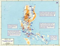
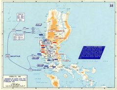
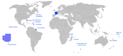
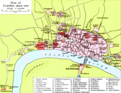
Maps
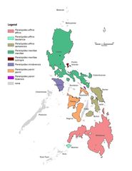
Genera Penelopides
1221 x 1581
- 115,245k -
jpg
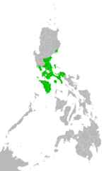
Katagalugan
2000 x 3120
- 61,677k -
png
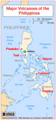
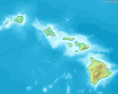
Majorvolcanoesofthephilippines Usgs
351 x 752
- 24,402k -
gif
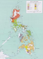
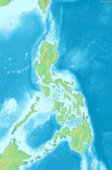
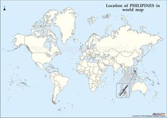
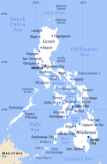
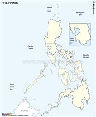
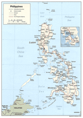
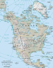
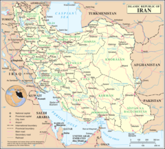
Map of Philippines
1800 x 2453
- 263,730k -
jpg
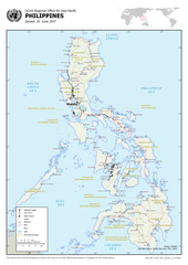
Map of Rrsea Philippines
2250 x 2775
- 405,651k -
jpg
Map of the Philippines Demis
814 x 1228
- 174,490k -
png
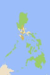
Map Philippines
1002 x 1426
- 243,105k -
jpg
Map Philippines 2005
328 x 716
- 20,616k -
gif
Philipines Location Map
1122 x 795
- 89,913k -
jpg
Philippines Country Map
1200 x 1696
- 945,210k -
png
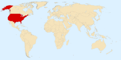
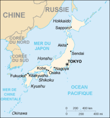
Philippines
976 x 1390
- 311,048k -
gif
Philippines 1
969 x 1384
- 155,361k -
jpg
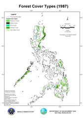
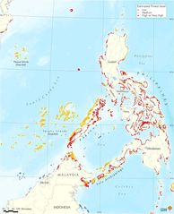
Philippines Forest Cover 1987
1123 x 1587
- 171,608k -
jpg
Philippines General Map
392 x 600
- 24,225k -
png
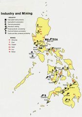
Philippines Industry And Mining
751 x 1067
- 101,400k -
jpg
Philippines Languages
600 x 900
- 44,547k -
jpg
Philippines Large
1000 x 1000
- 21,420k -
png
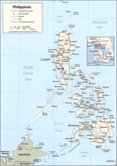
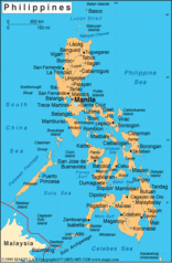
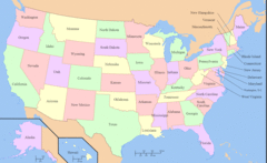
Philippines Map
800 x 1111
- 171,715k -
jpg
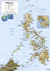
Philippines Physical Map
600 x 940
- 78,160k -
png
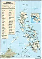
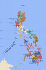
Philippines Regions And Provinces
600 x 900
- 54,137k -
png
Philippines Satalleti 1km
1150 x 1500
- 335,240k -
jpg
Philippines Tagalog
600 x 900
- 12,512k -
jpg
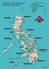
Philippine Airport Map
800 x 1127
- 93,182k -
jpg
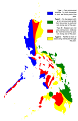
Philippine Climate Map
2000 x 3120
- 55,848k -
png
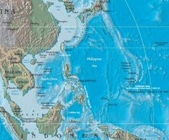
Philippine Sea Location
750 x 625
- 76,896k -
jpg
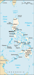
Phillippines Outline Map
820 x 992
- 60,291k -
jpg
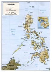
Physical Philippines Map
1048 x 1454
- 187,313k -
jpg
Political Map of Philippines
627 x 962
- 94,716k -
gif
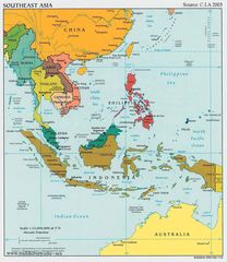
Se Asia Pol 95
1008 x 1240
- 167,941k -
jpg
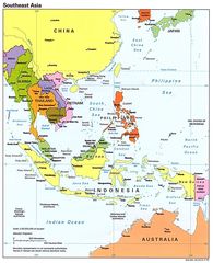
Southeast Asia Political Map Cia 2003
1098 x 1266
- 229,919k -
jpg
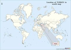
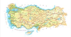
Location of Turkey Map
1121 x 794
- 88,842k -
jpg
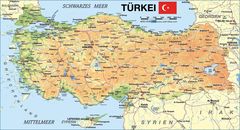
Map of Turkey
2531 x 1366
- 499,631k -
jpg
Map Turkey
1787 x 952
- 208,731k -
jpg
Turkeymap
2000 x 1446
- 255,593k -
jpg
Turkey Map
1800 x 1386
- 383,793k -
jpg
Turkey Map 2
2400 x 1245
- 263,158k -
jpg
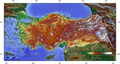
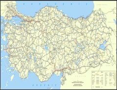
Turkey Topografical Map
1400 x 752
- 194,160k -
jpg
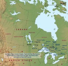
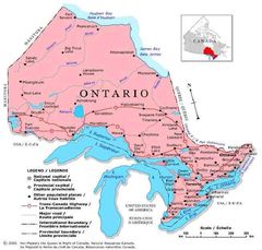
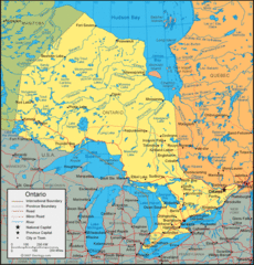
Map of Ontario
1800 x 1237
- 520,482k -
gif
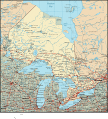
Ontario Canada
1800 x 1749
- 208,339k -
jpg
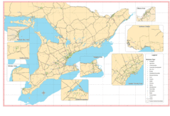
Ontario Map
1668 x 1848
- 543,203k -
gif
Ontario Map 1
654 x 625
- 56,291k -
jpg
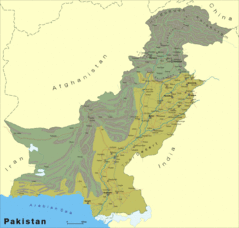
Pakistan L
1800 x 1715
- 310,125k -
gif
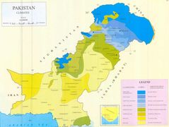
Pakistan Climate Map Jpg
1600 x 1206
- 92,362k -
JPG
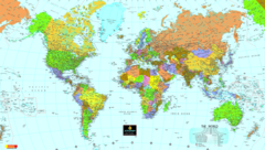
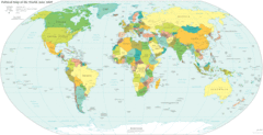
World Map
2130 x 1204
- 975,792k -
png
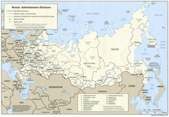
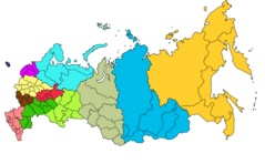
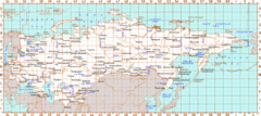
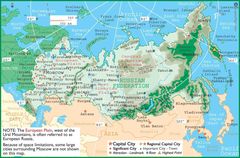
Administrative Divisions of Russia
1418 x 982
- 321,757k -
gif
Big Map of Russia
1800 x 1094
- 293,306k -
jpg
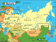
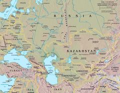
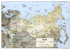
Map of Russia
1494 x 761
- 167,891k -
gif
Map of Russia 2
915 x 533
- 87,157k -
gif
Map of Russia Economic Regi
1680 x 1042
- 103,133k -
gif
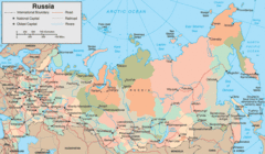
Map Russia
551 x 414
- 83,111k -
gif
Map Russia 1
2774 x 1654
- 457,651k -
jpg
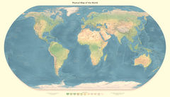
Physical Map of the World
3000 x 1522
- 593,230k -
jpg
Political World Map
4499 x 2440
- 801,554k -
gif
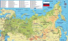
Russia
2204 x 986
- 564,693k -
gif
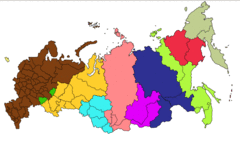
Russia Divisions
6269 x 2638
- 142,635k -
png
Russia Map
1628 x 1266
- 376,095k -
jpg
Russia Map 3
1396 x 920
- 227,669k -
jpg
Russia Map Physical
1460 x 1020
- 292,385k -
jpg
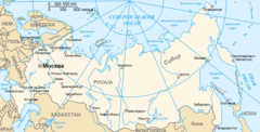
Russia Time Zones Map
1680 x 1050
- 110,417k -
gif
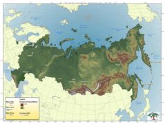
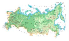
Topographic Map of Russia
2400 x 1805
- 336,208k -
jpg
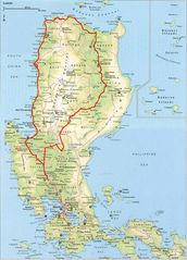
Luzon
1260 x 970
- 215,258k -
jpg
Luzon2
1260 x 970
- 191,029k -
jpg
Map of Luzon
1016 x 1438
- 317,951k -
gif
Map of Luzon 1
800 x 1113
- 127,623k -
jpg
Philippines Map 1
800 x 1111
- 171,715k -
jpg
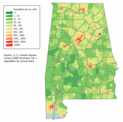
Alabama Population Map
592 x 590
- 25,603k -
png
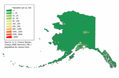
Alaska Population Map
700 x 460
- 15,302k -
png
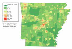
Arkansas Population Map
800 x 550
- 29,369k -
png
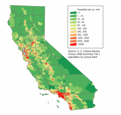
California Population Map
600 x 570
- 24,313k -
png
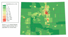
Colorado Population Map
700 x 380
- 16,537k -
png
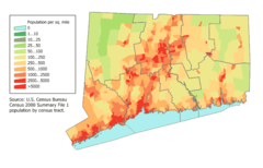
Connecticut Population Map
700 x 450
- 20,415k -
png
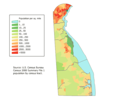
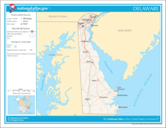
Delaware Population Map
600 x 500
- 13,060k -
png
Der Westen Der Vereinigten Staaten
1400 x 875
- 114,481k -
jpg
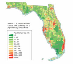
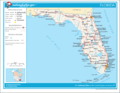
Florida Population Map
520 x 450
- 21,200k -
png
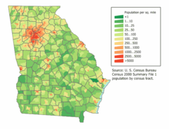
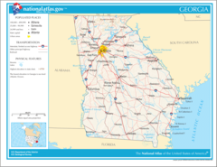
Georgia Population Map
600 x 460
- 25,450k -
png
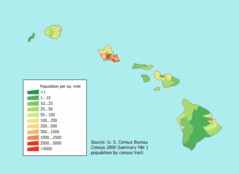
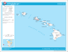
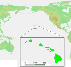
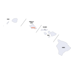
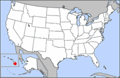
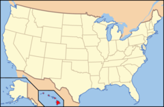
Hawaii Population Map
660 x 480
- 8,940k -
png
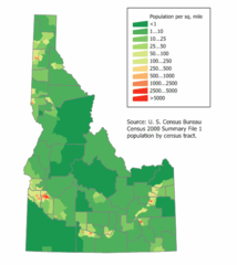
Idaho Population Map
500 x 560
- 14,171k -
png
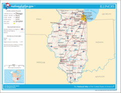
Illinois Population Map
592 x 640
- 21,801k -
png
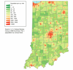
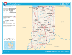
Indiana Population Map
600 x 580
- 21,347k -
png
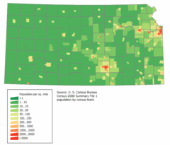
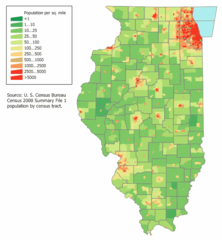
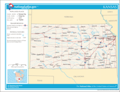
Kansas Population Map
664 x 568
- 14,513k -
png
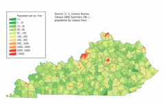
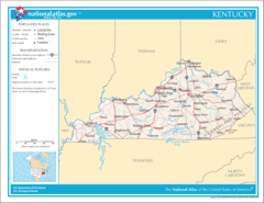
Kentucky Population Map
740 x 470
- 26,593k -
png
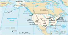
Location Uf Us
1519 x 754
- 97,698k -
gif
Location Usa
1427 x 628
- 16,989k -
png
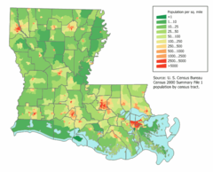
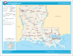
Louisiana Population Map
680 x 550
- 29,375k -
png
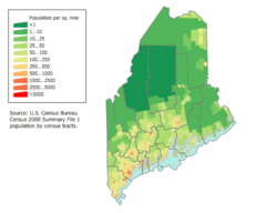
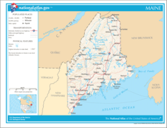
Maine Population Map
600 x 480
- 17,036k -
png
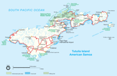
Mapoftutuila American Samoa
3033 x 1968
- 328,405k -
gif
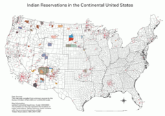
Map Indian Reservations Usa
3124 x 2200
- 379,767k -
png
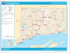
Map of Connecticut Na
1200 x 927
- 312,699k -
png
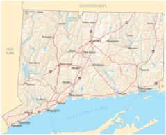
Map of Connecticut Na Cropp
1200 x 973
- 281,530k -
png
Map of Delaware Na
1200 x 927
- 93,692k -
png
Map of Florida Na
1200 x 927
- 123,328k -
png
Map of Georgia Na
1200 x 927
- 294,341k -
png
Map of Hawaii Na
1200 x 927
- 53,277k -
png
Map of Illinois Na
1200 x 927
- 142,473k -
png
Map of Indiana Na
1200 x 927
- 155,062k -
png
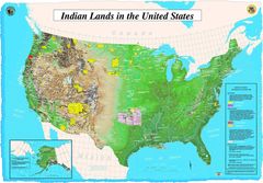
Map of Indian Lands In Us
2400 x 1673
- 486,614k -
jpg
Map of Kansas Na
1200 x 927
- 169,713k -
png
Map of Kentucky Na
1200 x 927
- 175,718k -
png
Map of Louisiana Na
1200 x 927
- 174,761k -
png
Map of Maine Na
1200 x 927
- 143,893k -
png
Map of Maryland Na
1200 x 927
- 128,453k -
png
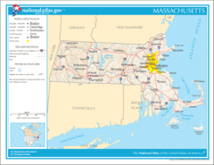
Map of Massachusetts Na
1200 x 927
- 146,141k -
png
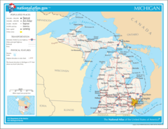
Map of Michigan Na
1200 x 927
- 124,940k -
png
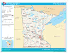
Map of Minnesota Na
1200 x 927
- 186,879k -
png
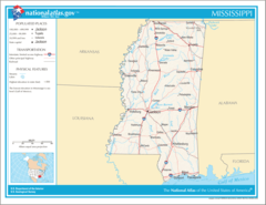
Map of Mississippi Na
1200 x 927
- 125,101k -
png
Map of Missouri Na
1200 x 927
- 337,720k -
png
Map of Montana Na
1200 x 927
- 182,323k -
png
Map of Nebraska Na
1200 x 927
- 163,205k -
png
Map of Nevada Na
1200 x 927
- 144,973k -
png
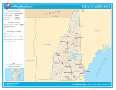
Map of New Hampshire Na
1200 x 927
- 120,520k -
png
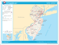
Map of New Jersey Na
1200 x 927
- 125,474k -
png
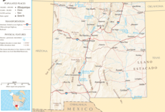
Map of New Mexico Na
1200 x 817
- 258,608k -
png
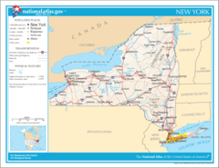
Map of New York Na
1200 x 927
- 156,479k -
png
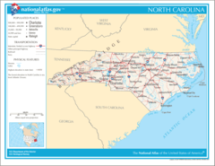
Map of North Carolina Na
1200 x 927
- 127,785k -
png
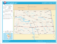
Map of North Dakota Na
1200 x 927
- 184,431k -
png

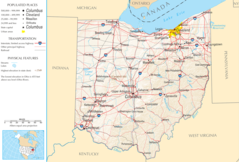
Map of Ohio
1200 x 813
- 325,670k -
png
Map of Ohio Na
1200 x 813
- 325,670k -
png
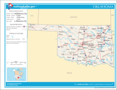
Map of Oklahoma Na
1200 x 927
- 177,621k -
png
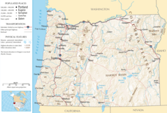
Map of Oregon Na
1200 x 812
- 436,107k -
png
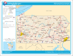
Map of Pennsylvania Na
1200 x 927
- 330,227k -
png

Map of Puerto Rico Na
1200 x 927
- 55,042k -
png
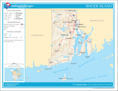
Map of Rhode Island Na
1200 x 927
- 174,790k -
png
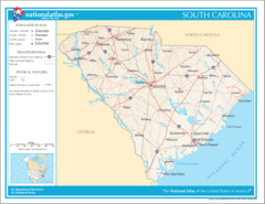
Map of South Carolina Na
1200 x 927
- 184,550k -
png
Map of South Dakota Na
1200 x 927
- 304,202k -
png
Map of Tennessee Na
1200 x 927
- 178,881k -
png
Map of Texas Na
1200 x 927
- 173,660k -
png
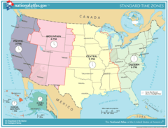
Map of Time Zones Usa
1187 x 915
- 80,792k -
png
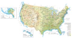
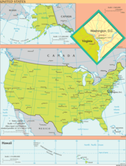
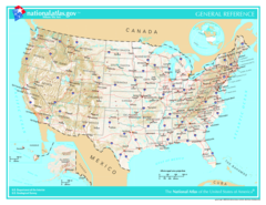
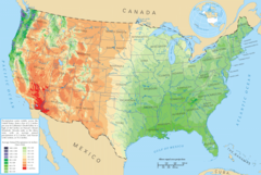
Map of United States
2896 x 1527
- 398,935k -
jpg
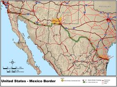
Map of Us Mexico Border
1152 x 862
- 178,716k -
jpg
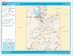
Map of Utah Na
1200 x 927
- 298,172k -
png
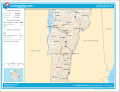
Map of Vermont Na
1200 x 927
- 142,952k -
png
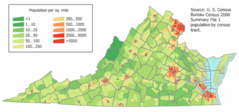
Map of Virginia Na
1200 x 927
- 135,432k -
png
Map of Virgin Islands Na
1200 x 927
- 55,042k -
png
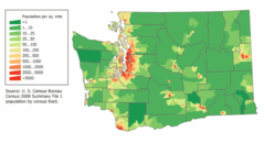
Map of Washington Na
1200 x 927
- 343,442k -
png
Map of Wisconsin Na
1200 x 927
- 307,533k -
png
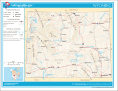
Map of Wyoming Na
1200 x 927
- 255,965k -
png
Map United States
1386 x 927
- 290,597k -
jpg
Map Usa 50 States
1140 x 990
- 89,567k -
png
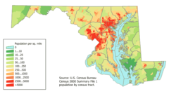
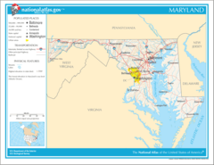
Maryland Population Map
700 x 400
- 24,612k -
png
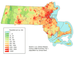
Massachusetts Population Map
600 x 480
- 22,626k -
png
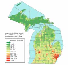
Michigan Population Map
592 x 565
- 23,443k -
png
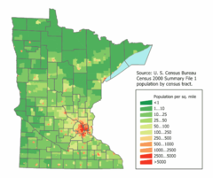
Minnesota Population Map
560 x 470
- 17,074k -
png
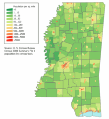
Mississippi Population Map
560 x 610
- 19,288k -
png
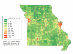
Missouri Population Map
660 x 490
- 20,968k -
png
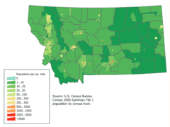
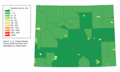
Montana Population Map
656 x 490
- 16,627k -
png
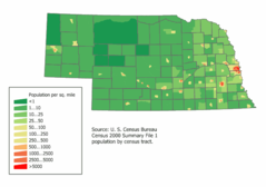
Nebraska Population Map
640 x 450
- 11,843k -
png
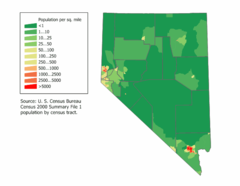
Nevada Population Map
620 x 480
- 10,945k -
png
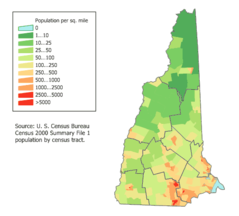
New Hampshire Population Map
504 x 455
- 11,804k -
png
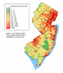
New Jersey Population Map
500 x 580
- 22,160k -
png
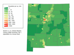
New Mexico Population Map
640 x 480
- 12,695k -
png
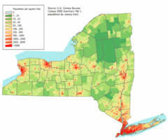
New York Population Map
792 x 660
- 31,514k -
png
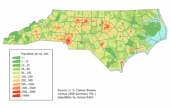
North Carolina Population Map
700 x 450
- 25,289k -
png
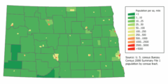
North Dakota Population Map
760 x 380
- 11,692k -
png
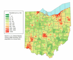
Ohio Population Map
672 x 550
- 26,283k -
png
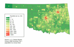
Oklahoma Population Map
672 x 430
- 17,243k -
png
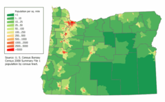
Oregon Population Map 2000
740 x 460
- 21,060k -
png
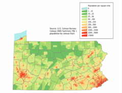
Pennsylvania Population Map
710 x 540
- 26,583k -
png
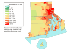
Rhode Island Population Map
620 x 450
- 14,776k -
png
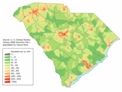
South Carolina Population Map
700 x 525
- 29,701k -
png
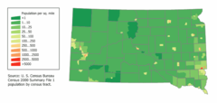
South Dakota Population Map
736 x 350
- 11,797k -
png
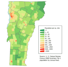
States
774 x 1017
- 155,211k -
gif
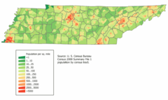
Tennessee Population Map
780 x 465
- 22,939k -
png
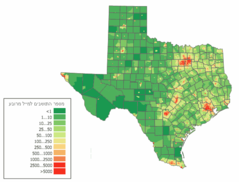
Texas Population Map
624 x 475
- 22,963k -
png
Timezonesusa
765 x 584
- 42,597k -
png
Unitedstatesmap
636 x 326
- 23,886k -
png
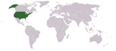
United States
2018 x 1365
- 863,919k -
gif
United States 1
1402 x 1853
- 158,444k -
png
United States 2
1471 x 904
- 129,142k -
gif
United States Wall Map Us
1800 x 1374
- 364,964k -
jpg
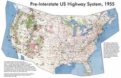
Us Highway Map
2400 x 1548
- 587,080k -
jpg
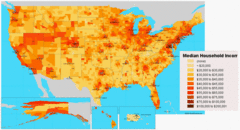
Us Income Map
4619 x 2506
- 671,158k -
gif
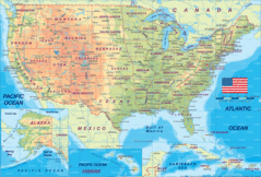
Us Map
883 x 1139
- 192,856k -
jpg
Us Map Geographic
1200 x 927
- 404,976k -
png
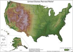
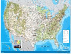
Us Painted Relief
2336 x 1689
- 351,661k -
jpg
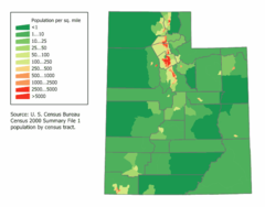
Utah Population Map
600 x 470
- 13,550k -
png
Vermont Population Map
510 x 500
- 14,541k -
png
Virginia Population Map
680 x 319
- 25,127k -
png
War On Terrorism Map
1434 x 736
- 160,572k -
jpg
Washington Population Map
740 x 400
- 22,793k -
png
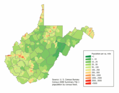
West Virginia Population Map
691 x 542
- 20,840k -
png
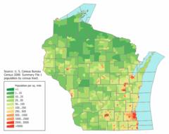
Wisconsin Population Map
720 x 570
- 22,158k -
png
Wyoming Population Map
760 x 460
- 11,500k -
png
Us Average Precipitation Map
1200 x 807
- 368,761k -
png
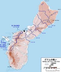
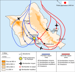
Battle of Guam Map Ja
760 x 900
- 70,017k -
jpg
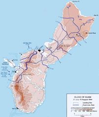
Battle of Guam Map
760 x 900
- 60,356k -
jpg
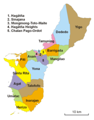
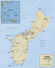
Guam Administracja
934 x 1190
- 30,290k -
png
Guam Cia Wfb Map
366 x 393
- 8,601k -
png
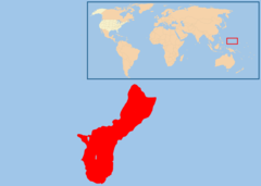
Guam Locator
489 x 602
- 17,639k -
png
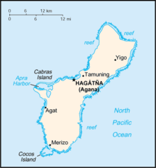
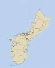
Guam Map
485 x 598
- 44,193k -
png
Location Map of Guam
2100 x 1500
- 34,467k -
png
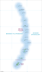
Mariany Map
950 x 1591
- 327,352k -
png
Map of Connecticut Na 1
1200 x 927
- 312,699k -
png
Map of Connecticut Na Cropp 1
1200 x 973
- 281,530k -
png
Map of Delaware Na 1
1200 x 927
- 93,692k -
png
Map of Florida Na 1
1200 x 927
- 123,328k -
png
Map of Georgia Na 1
1200 x 927
- 294,341k -
png
Map of Hawaii Na 1
1200 x 927
- 53,277k -
png
Map of Illinois Na 1
1200 x 927
- 142,473k -
png
Map of Indiana Na 1
1200 x 927
- 155,062k -
png
Map of Kansas Na 1
1200 x 927
- 169,713k -
png
Map of Kentucky Na 1
1200 x 927
- 175,718k -
png
Map of Louisiana Na 1
1200 x 927
- 174,761k -
png
Map of Maine Na 1
1200 x 927
- 143,893k -
png
Map of Maryland Na 1
1200 x 927
- 128,453k -
png
Map of Massachusetts Na 1
1200 x 927
- 146,141k -
png
Map of Michigan Na 1
1200 x 927
- 124,940k -
png
Map of Minnesota Na 1
1200 x 927
- 186,879k -
png
Map of Mississippi Na 1
1200 x 927
- 125,101k -
png
Map of Missouri Na 1
1200 x 927
- 337,720k -
png
Map of Montana Na 1
1200 x 927
- 182,323k -
png
Map of Nebraska Na 1
1200 x 927
- 163,205k -
png
Map of Nevada Na 1
1200 x 927
- 144,973k -
png
Map of New Hampshire Na 1
1200 x 927
- 120,520k -
png
Map of New Jersey Na 1
1200 x 927
- 125,474k -
png
Map of New Mexico Na 1
1200 x 817
- 258,608k -
png
Map of New York Na 1
1200 x 927
- 156,479k -
png
Map of North Carolina Na 1
1200 x 927
- 127,785k -
png
Map of North Dakota Na 1
1200 x 927
- 184,431k -
png
Map of Ohio 1
1200 x 813
- 325,670k -
png
Map of Ohio Na 1
1200 x 813
- 325,670k -
png
Map of Oklahoma Na 1
1200 x 927
- 177,621k -
png
Map of Oregon Na 1
1200 x 812
- 436,107k -
png
Map of Pennsylvania Na 1
1200 x 927
- 330,227k -
png
Map of Puerto Rico Na 1
1200 x 927
- 55,042k -
png
Map of Rhode Island Na 1
1200 x 927
- 174,790k -
png
Map of South Dakota Na 1
1200 x 927
- 304,202k -
png
Map of South Carolina Na 1
1200 x 927
- 184,550k -
png
Map of Tennessee Na 1
1200 x 927
- 178,881k -
png
Map of Texas Na 1
1200 x 927
- 173,660k -
png
Map of Utah Na 1
1200 x 927
- 298,172k -
png
Map of Vermont Na 1
1200 x 927
- 142,952k -
png
Map of Virgin Islands Na 1
1200 x 927
- 55,042k -
png
Map of Virginia Na 1
1200 x 927
- 135,432k -
png
Map of Washington Na 1
1200 x 927
- 343,442k -
png
Map of Wisconsin Na 1
1200 x 927
- 307,533k -
png
Map of Wyoming Na 1
1200 x 927
- 255,965k -
png
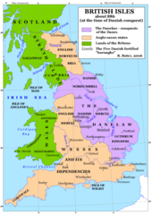
Britain 802
1241 x 1755
- 383,411k -
png
Britain 886
1241 x 1755
- 397,563k -
png
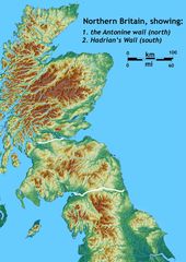
Britain Northern Walls
1484 x 2093
- 371,581k -
jpg
Britania 10dc
463 x 578
- 28,761k -
png
British Isles Isle of Man Svg
343 x 600
- 13,975k -
png
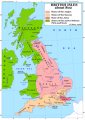
British Kingdoms C 800
718 x 1164
- 306,926k -
gif
British Seventh Century Kingdoms
526 x 880
- 169,492k -
gif
Counties In Uk
1042 x 1670
- 111,306k -
gif
England
2769 x 3553
- 936,365k -
jpg
England Large Map
1200 x 1540
- 620,120k -
png
England Map
760 x 1185
- 118,397k -
jpg
England Map 2
465 x 650
- 34,449k -
jpg
Europe Location England
1600 x 1200
- 121,832k -
png
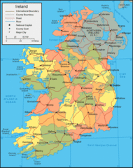
Ireland
684 x 788
- 44,987k -
gif
Ireland 1
1844 x 2450
- 256,211k -
jpg
Ireland 2
813 x 998
- 112,557k -
gif
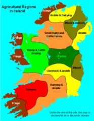
Ireland Maps Island Agriculture
429 x 553
- 14,313k -
gif
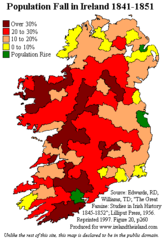
Ireland Population Change 1841 1851
358 x 531
- 11,234k -
png
Ireland Uk
1266 x 1167
- 641,699k -
gif
Isle of Man
1091 x 996
- 61,189k -
gif
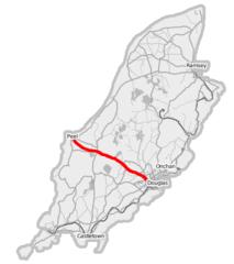
Isle of Man A1 Road
436 x 491
- 22,353k -
png
Isle of Man Cities Villages
690 x 815
- 7,661k -
png
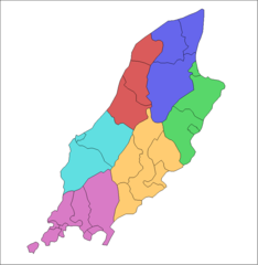
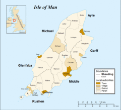
Isle of Man Parishes By Sheading
834 x 856
- 8,732k -
png
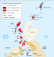
Kingdom of Mann And the Isl
914 x 966
- 93,000k -
gif
Map England
322 x 550
- 62,394k -
gif
Map of Faroe Islands In Europe
1433 x 1068
- 343,228k -
png
Map of Isle of Man
1564 x 1424
- 353,558k -
gif
Map of Isle of Man 2
1564 x 1436
- 310,005k -
gif
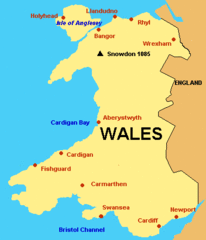
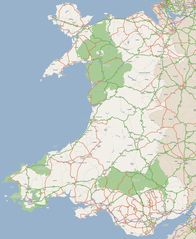
Map of Wales Gif
379 x 441
- 6,794k -
GIF
Map of Wales
760 x 1185
- 122,344k -
jpg
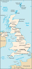
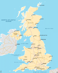
Map Uk
850 x 1013
- 95,745k -
gif
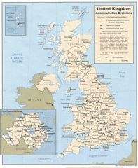
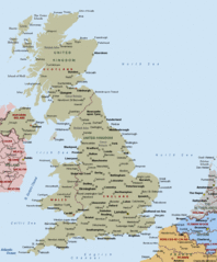
Map United Kingdom
1379 x 1956
- 234,736k -
jpg
Nireland
2012 x 1630
- 238,092k -
jpg
Northern Ireland
1252 x 1032
- 224,219k -
jpg
Northern Irland Religions 1991
685 x 585
- 43,542k -
png
River Trent
559 x 437
- 17,473k -
png
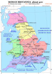
Roman Britain 410
1241 x 1755
- 457,815k -
png
Routes Irlandaises
594 x 750
- 86,884k -
gif
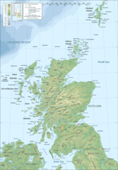
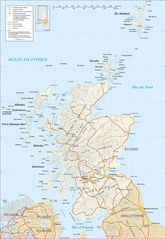
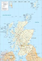
Scotland
1701 x 2684
- 416,599k -
jpg
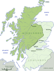
Scotland Highlands Lowlands
584 x 768
- 50,238k -
png
Scotland Land Use By Height
1597 x 2488
- 103,529k -
png

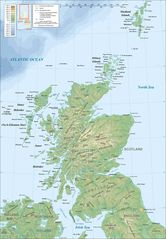
Scotland Map
1800 x 2588
- 506,693k -
jpg
Scotland Map 1
417 x 599
- 54,525k -
png
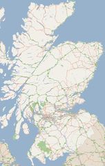
Scotland Rail Map
1024 x 1563
- 96,389k -
png
Scotland Topographic Map
1800 x 2588
- 378,570k -
jpg
Scotland Topographic Map 1
417 x 599
- 54,199k -
png
Topographic Map of the Uk
1750 x 2545
- 421,418k -
jpg
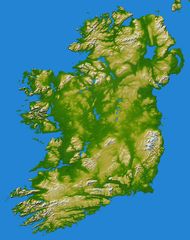
Topography Ireland
1800 x 2278
- 456,774k -
jpg
Uk
312 x 676
- 22,502k -
gif
Uk Ad
1000 x 1216
- 316,958k -
gif
Uk Europe Location
1600 x 1200
- 168,818k -
png
Uk Map
1200 x 1505
- 374,193k -
png
Uk Map England
643 x 1075
- 24,499k -
png
Uk Map Home Nation England
643 x 1075
- 24,506k -
png
Uk Map Home Nation Scotland
643 x 1075
- 24,407k -
png
Uk Map Northern Ireland
643 x 1075
- 24,436k -
png
Uk Outline Map
600 x 800
- 11,237k -
png
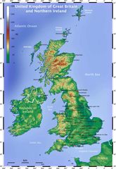
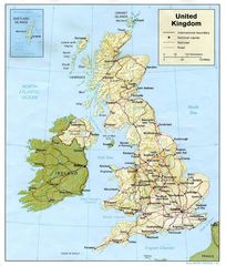
United Kingdom
910 x 1100
- 48,702k -
gif
United Kingdom 1
1032 x 1216
- 209,026k -
jpg
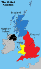
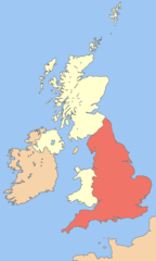
United Kingdom Labelled Map
643 x 1075
- 28,933k -
png
Wales
2052 x 2500
- 435,102k -
jpg
Uk Map Northern Ireland 1
643 x 1075
- 24,436k -
png
Nireland 1
2012 x 1630
- 238,092k -
jpg
Ireland Uk 1
1266 x 1167
- 641,699k -
gif
Ireland Maps Island Agriculture 1
429 x 553
- 14,313k -
gif
Ireland 2 3
813 x 998
- 112,557k -
gif
Ireland 4
1844 x 2450
- 256,211k -
jpg
Ireland 5
684 x 788
- 44,987k -
gif
Uk Map Home Nation Scotland 1
643 x 1075
- 24,407k -
png
Scotland Topographic Map 2
417 x 599
- 54,199k -
png
Scotland Topographic Map 3
1800 x 2588
- 378,570k -
jpg
Scotland Rail Map 1
1024 x 1563
- 96,389k -
png
Scotland Map 2
417 x 599
- 54,525k -
png
Scotland Map 3
1800 x 2588
- 506,693k -
jpg
Scotland Land Use By Height 1
1597 x 2488
- 103,529k -
png
Scotland Highlands Lowlands 1
584 x 768
- 50,238k -
png
Scotland 2
1701 x 2684
- 416,599k -
jpg
Map of Isle of Man 2 3
1564 x 1436
- 310,005k -
gif
Map of Isle of Man 4
1564 x 1424
- 353,558k -
gif
Isle of Man 1
1091 x 996
- 61,189k -
gif
Departements of France
624 x 600
- 126,478k -
png
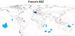
Eez France
2410 x 1178
- 80,688k -
png
Europe Location France
1245 x 1245
- 28,336k -
png
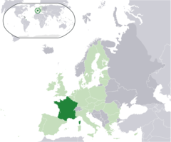
Europe Location of France
1600 x 1200
- 170,837k -
png
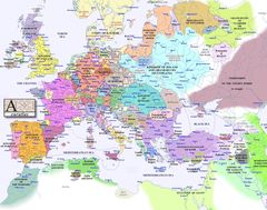
Europe Map 1000
1280 x 1009
- 188,744k -
jpg
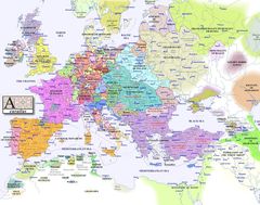
Europe Map 1100
1280 x 1009
- 198,190k -
jpg
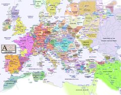
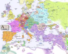
Europe Map 1200
1280 x 1009
- 204,009k -
jpg
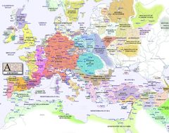
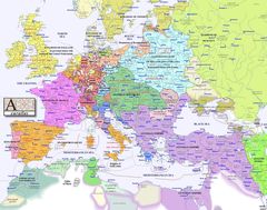
Europe Map 1300
1280 x 1009
- 216,494k -
jpg
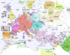
Europe Map 1400
1280 x 1009
- 212,898k -
jpg
Europe Map 1500
1280 x 1009
- 232,397k -
jpg
Europe Map 1600
1280 x 1009
- 220,718k -
jpg
Europe Map 1700
1280 x 1009
- 227,429k -
jpg
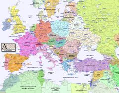
Europe Map 1800
1280 x 1009
- 230,310k -
jpg
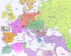
Europe Map 1900
1280 x 1009
- 235,457k -
jpg
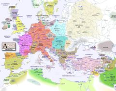
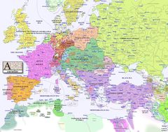
Europe Map 2000
1280 x 1009
- 258,037k -
jpg
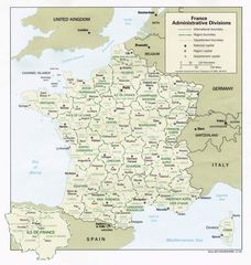
France Admin
1058 x 1114
- 171,549k -
jpg
France Cities
950 x 949
- 545,492k -
png
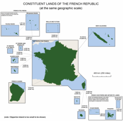
France Constituent Lands
3337 x 3300
- 127,917k -
png
France Map Jpg
996 x 1056
- 255,600k -
JPG
France Political Map
912 x 980
- 73,265k -
gif
France Shaded Relief Gif
996 x 1056
- 308,210k -
GIF
France Sites Unesco
950 x 948
- 541,768k -
png
French Network
1160 x 1349
- 95,761k -
gif
Location France Eu Europe
2056 x 1710
- 130,698k -
png
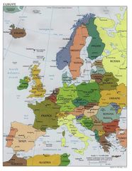
Map Europe
1120 x 1444
- 216,596k -
jpg
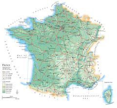
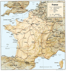
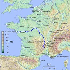
Map France
2218 x 2054
- 387,409k -
jpg
Map France Departments
1101 x 1221
- 223,106k -
jpg
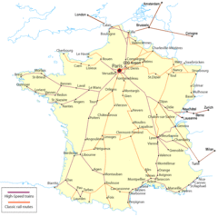
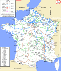
Map France Railroads
951 x 949
- 67,121k -
gif
Map Francophone World Png
1357 x 631
- 17,957k -
PNG
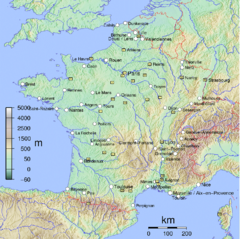
Map of France
1797 x 1796
- 488,511k -
jpg
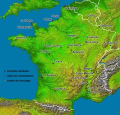
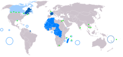
Nuclear Plants Map France
1200 x 1150
- 351,878k -
jpg
Nuclear Power Plants Map France De
1100 x 1100
- 79,718k -
png
Outre Mer En Sans Terre Adelie
1431 x 655
- 19,527k -
png
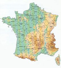
Physical Map of Europe
2300 x 1604
- 755,450k -
gif
Province Ecc France
630 x 644
- 62,174k -
jpg

West Europe
1266 x 1167
- 641,699k -
gif

Caribbean Map
2227 x 1536
- 327,833k -
jpg
Caribbean Map Large
1000 x 1138
- 199,030k -
gif
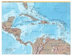
Central America And the Caribbean
1701 x 1318
- 309,050k -
jpg
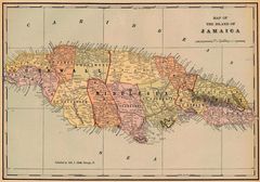
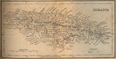
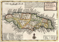
Historical Map Jamaica 1901
1800 x 1260
- 350,455k -
jpg
Jamaica
1343 x 849
- 34,862k -
gif
Jamaica 1
1426 x 552
- 148,982k -
jpg
Jamaica 1882
1446 x 741
- 230,616k -
jpg
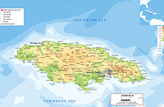
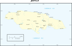
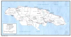
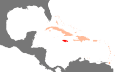
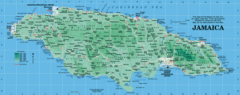
Jamaica Map
2136 x 1395
- 681,881k -
gif
Jamaica Map 1
1464 x 754
- 104,037k -
jpg
Jamaica Map 2
1440 x 1008
- 349,024k -
gif
Jamaica Roads
1474 x 780
- 122,366k -
jpg
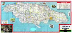
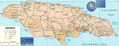
Jamaica Road Map
4868 x 2283
- 855,130k -
jpg
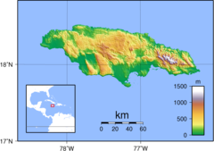
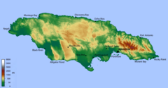
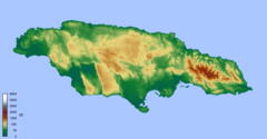
Jamaica Topography
2039 x 1439
- 404,479k -
png
Jm Map
673 x 344
- 8,573k -
png
Karibik Jamaika Position
1024 x 636
- 11,177k -
png
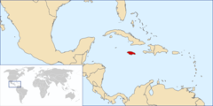
Location Jamaica
800 x 400
- 18,455k -
png
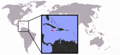
Location of Jamaica
1357 x 628
- 16,539k -
png

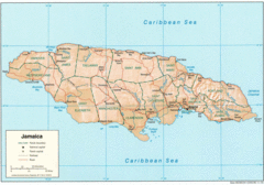
Map Jamaica
1600 x 802
- 71,536k -
jpg
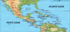
Map of Central America
2142 x 1000
- 443,372k -
gif
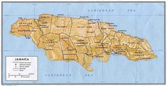
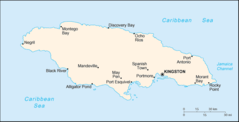
Map of Jamaica
1503 x 595
- 191,992k -
gif
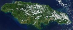
Satellite Image of Jamaica
949 x 387
- 56,212k -
jpg

Where Is Jamaica
1357 x 628
- 10,853k -
png
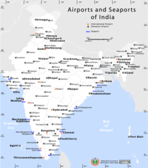
Airports And Seaports Map
1000 x 1138
- 71,764k -
png
Andhra Pradesh Map
842 x 777
- 121,219k -
jpg
Andhra Pradesh Topographic
842 x 777
- 357,687k -
png
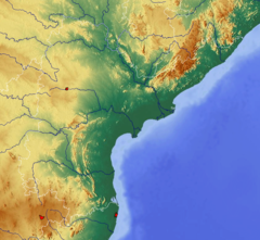
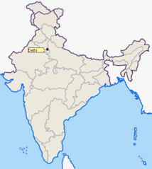
Delhi Area Locator Map
920 x 801
- 79,443k -
png
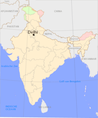
Delhi Location Png
1165 x 1415
- 64,984k -
PNG
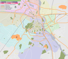
Delhi Map
428 x 429
- 33,844k -
jpg
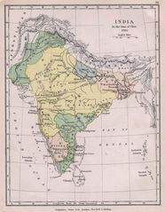
Historical Maps India In 1760
1154 x 1485
- 230,181k -
jpg
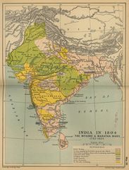
Historical Maps India In 18
1736 x 2276
- 502,231k -
jpg
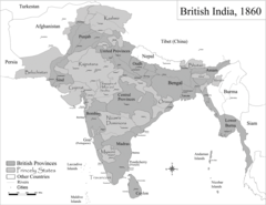
Historic Maps British India
1600 x 1235
- 191,527k -
png
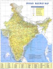
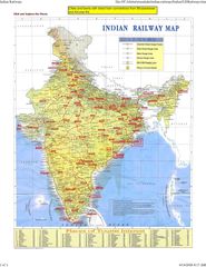
Indian Railways Map
1500 x 1935
- 488,116k -
jpg
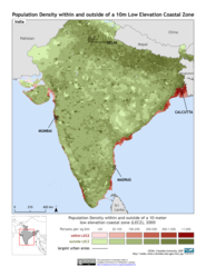
India 10m Lecz And Populati
1275 x 1650
- 334,105k -
png
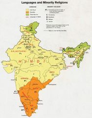
India Languages 1973
912 x 1162
- 138,922k -
jpg
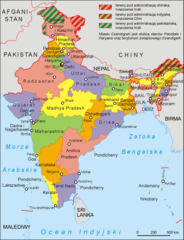
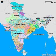
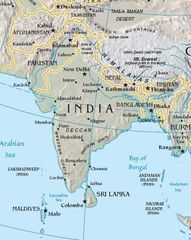
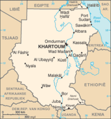
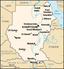
India Map
970 x 1166
- 207,913k -
jpg
India Map Bbsr Direct Train Full
1718 x 2223
- 515,318k -
jpg
India States By Rto Codes
2083 x 2371
- 234,548k -
png
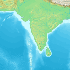
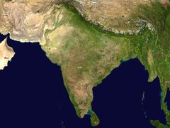
India Topographic
1200 x 1200
- 353,212k -
png
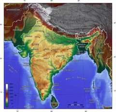
India Topographic Map
1800 x 1736
- 374,346k -
jpg
Indie 2006
1041 x 1360
- 88,907k -
png
Ind Tou
480 x 480
- 37,675k -
jpg
Location of Delhi Png
400 x 447
- 17,398k -
PNG
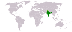
Location of India
1427 x 628
- 36,690k -
png
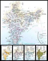
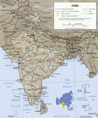
Map of India
1800 x 2275
- 442,369k -
jpg
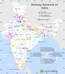
Railway Network Map
1000 x 1138
- 92,091k -
png
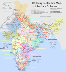
Railway Network Schematic M
2282 x 2500
- 457,683k -
png
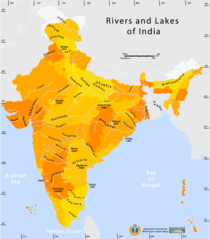
Rivers And Lakes Map of India
1000 x 1138
- 59,901k -
png
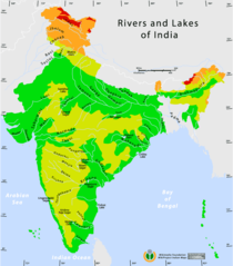
Rivers And Lakes Topo Map of India
1000 x 1138
- 62,861k -
png
South Asia
425 x 533
- 47,288k -
jpg
South Asia Satellite
1280 x 958
- 153,104k -
jpg
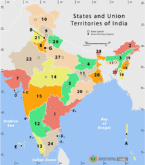
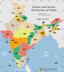
States And Union Territories of India Png
1000 x 1138
- 50,176k -
PNG
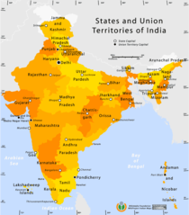
State And Union Territories Map
1000 x 1138
- 56,534k -
png
Location of Delhi Png 1
400 x 447
- 17,398k -
PNG
Delhi Map 1
428 x 429
- 33,844k -
jpg
Delhi Location Png 1
1165 x 1415
- 64,984k -
PNG
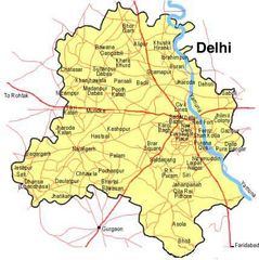
Delhi Area Locator Map 1
920 x 801
- 79,443k -
png
Ontario Map 2
718 x 750
- 174,465k -
gif
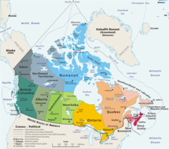
Map Canada Political
1280 x 1128
- 185,072k -
png
Map Canada Political 1
1280 x 1128
- 185,072k -
png
Map Canada Political 2
1280 x 1128
- 185,072k -
png
Map Canada Political 3
1280 x 1128
- 185,072k -
png
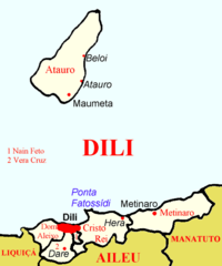
Dili Subdistricts
555 x 665
- 15,468k -
png
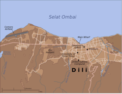
Map of Dili City Center
1488 x 1154
- 91,617k -
png
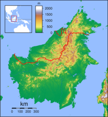
Borneo Locator Topography
950 x 1029
- 315,949k -
png
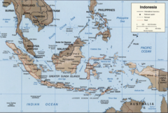
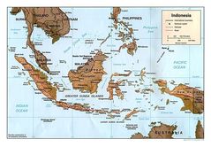
Indonesia 2002 Cia Map
1200 x 810
- 550,251k -
png
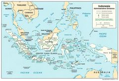
Indonesia Adminstrative Districts
1386 x 945
- 201,457k -
jpg
Indonesia License Plates Map
1667 x 757
- 69,837k -
png
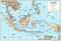
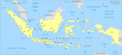
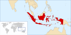
Indonesia Map
1377 x 926
- 212,626k -
jpg
Indonesia Map 1
636 x 326
- 25,164k -
png
Indonesia Map Physical
1450 x 1006
- 232,145k -
jpg
Indonesia Overview Map
400 x 446
- 41,604k -
gif
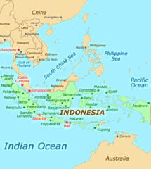
Location Indonesia
800 x 400
- 20,403k -
png
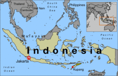
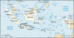
Map of Indonesia
617 x 400
- 36,760k -
gif
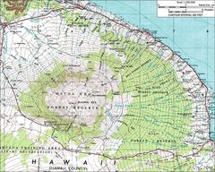
2003 3d Hawaiian Islands Usgs I2809
988 x 581
- 68,974k -
jpg
Ffs Map Lrg
600 x 549
- 16,211k -
png
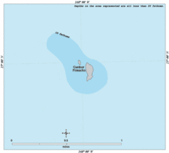
Gardner Map Lrg
600 x 542
- 9,066k -
gif
Haleakalamap
1000 x 800
- 187,059k -
jpg
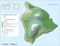
Hawaii Island Ecosystem Native Map Fr
920 x 711
- 113,305k -
png
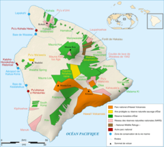
Hawaii Island Protected Areas Map Fr
920 x 825
- 153,115k -
png

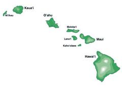
Hawaii Islands
436 x 414
- 14,613k -
png
Hawaii Islands2
287 x 273
- 11,046k -
png
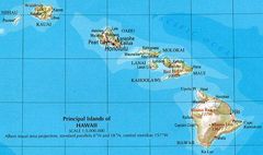
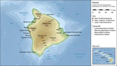
Hawaii Map
700 x 415
- 58,914k -
jpg
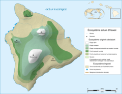
Hawaii Ecosystem Today
920 x 711
- 126,798k -
png
Hawaii Gmt De
1420 x 802
- 122,161k -
jpg
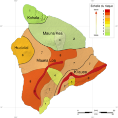
Hawaii Hazard Map Fr
920 x 920
- 160,965k -
png
Hawaii Islands 3
450 x 323
- 7,529k -
jpg
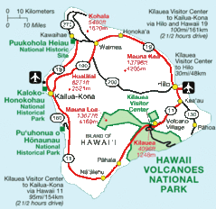
Hawaii National Parks Map
590 x 572
- 41,219k -
gif

Hawaii Population Map 1
660 x 480
- 8,940k -
png
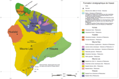
Hawaii Stratigraphic Map Fr
920 x 610
- 47,005k -
png
Hawaii Counties Map
660 x 692
- 7,319k -
gif
Hawaiianislandchain Usgs
571 x 292
- 7,770k -
png
Karte Des Hawaiarchipels
733 x 505
- 66,815k -
jpg
Kure Map Lrg
600 x 541
- 19,015k -
gif
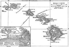
La2 Demis Hawaii
790 x 633
- 47,364k -
png
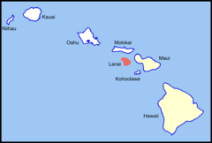
Lanai Island Location (southeastern Islands)
1024 x 692
- 16,061k -
png
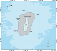
Laysan Map Lrg
600 x 546
- 17,453k -
gif
Lisianski Map Lrg
600 x 539
- 16,291k -
gif
Locmap Hawaii Volcanoes National Park
280 x 183
- 9,954k -
png
Map of Usa Hi Full
286 x 186
- 10,492k -
png
Map of Usa Hi
920 x 598
- 29,222k -
png

Map of Usa Highlighting Hawaii
280 x 183
- 9,682k -
png
Maro Map Lrg
600 x 547
- 17,225k -
gif
Maunakeamap
1000 x 800
- 250,700k -
jpg
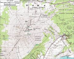
Maunaloamap
1000 x 800
- 236,291k -
jpg
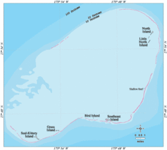
Nhinm
1200 x 725
- 140,727k -
png
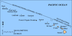
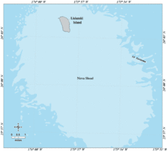
Nwhi Reserve
700 x 423
- 38,857k -
jpg
Necker Map Lrg
600 x 545
- 12,666k -
gif
Nihoa Map Lrg
600 x 545
- 14,372k -
gif
Oahu Blank Map
920 x 779
- 19,956k -
png
Oahu
920 x 779
- 28,696k -
png
Pearl Harbor 1941
920 x 889
- 47,944k -
png
Pearl Map Lrg
600 x 540
- 18,364k -
gif
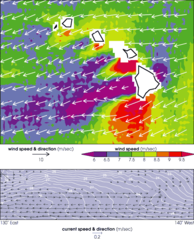
Tradewinds Hawaii Quikscat Aug99
540 x 667
- 41,011k -
png
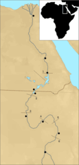
288px Nubia Blank
288 x 600
- 20,736k -
png
At1317 Map
761 x 795
- 5,422k -
png
Atbara River Map
1141 x 664
- 172,866k -
jpg
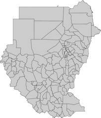
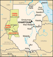
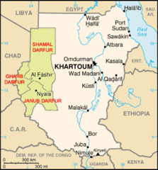
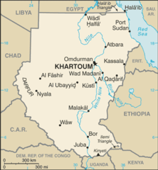
Blank Map of Sudan Administrative Areas
902 x 1058
- 52,434k -
png
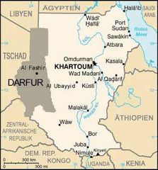
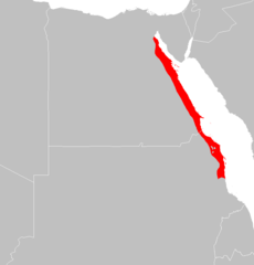
Dafur Map2
330 x 355
- 23,070k -
jpg
Darfur Map Es
330 x 355
- 14,395k -
png
Darfur Map Ja
330 x 355
- 10,734k -
png
Darfur Map
330 x 355
- 13,800k -
png
Darfur Mapfr
330 x 355
- 14,020k -
png

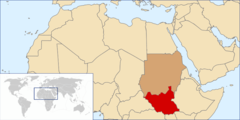
Flag Map of Sudan
900 x 1083
- 10,934k -
png
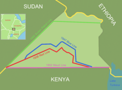
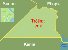
Ilemi Triangle Map
990 x 732
- 25,943k -
png
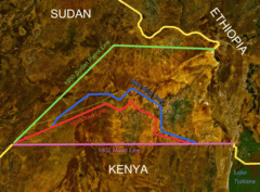
Ilemi Triangle Map 1
990 x 732
- 476,329k -
gif
Karte Sudans
330 x 353
- 14,119k -
png
Locationsouthernsudan
920 x 460
- 28,089k -
png
Locationsudan Africa
330 x 299
- 10,297k -
png
Mapa Sudanu
328 x 353
- 14,585k -
png
Nubia Spanish
288 x 600
- 28,481k -
png
Pa1327 Map
1339 x 819
- 18,779k -
png
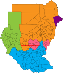
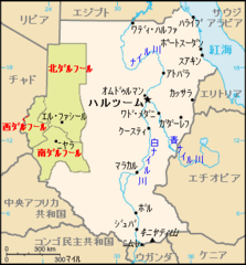
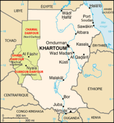
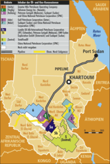
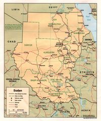
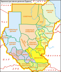
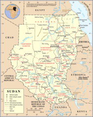
Political Regions of Sudan, July 2006
902 x 1058
- 42,692k -
png
Svg Koort Sudan
900 x 1080
- 10,652k -
png
Soedankaart
439 x 471
- 31,281k -
png
Soudan Carte
330 x 355
- 12,079k -
gif
Su Map
327 x 350
- 12,869k -
png
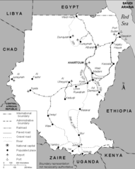
Sudan 1991 Transportation Map
827 x 1039
- 21,411k -
png
Sudan Map Oelgas
510 x 762
- 45,500k -
png
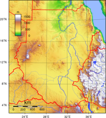
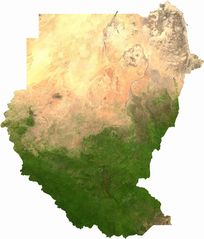
Sudan Topography
950 x 1052
- 481,713k -
png
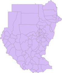
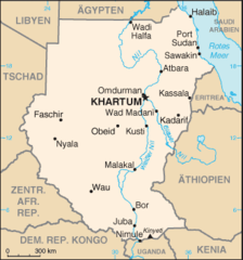
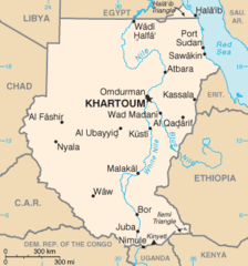
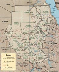
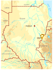
Sudan Admin
902 x 1060
- 45,778k -
png
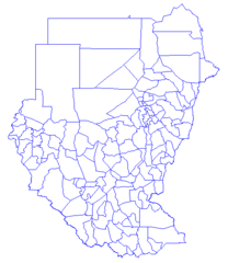
Sudan Districts1
502 x 579
- 8,739k -
png
Sudan Map Ja
330 x 355
- 10,241k -
png
Sudan Mapa
329 x 353
- 13,648k -
png
Sudan Political Map 1994
1066 x 1276
- 204,401k -
jpg
Sudan Political Map 2000
1626 x 2000
- 441,187k -
jpg
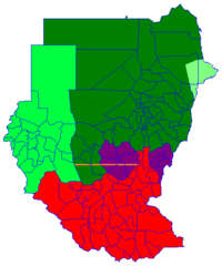
Sudan Political Regions July 2006
480 x 576
- 9,321k -
png
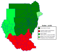
Sudan Politicaly Distrikt Map Jul2006
631 x 576
- 13,001k -
png
Sudan Sat
2015 x 2363
- 402,393k -
jpg
Sudan Cia Wfb Map
329 x 353
- 19,575k -
png
Sudan Adm Ru
1657 x 1969
- 66,031k -
png
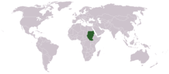
Sudanworldmap
1427 x 628
- 16,268k -
png
Trojkat Ilemi
990 x 732
- 24,779k -
png
Uebersicht Dinder Wiki
378 x 491
- 211,271k -
gif
Un Sudan
1200 x 1506
- 361,171k -
png

Flag Map of Jamaica
920 x 358
- 8,002k -
png
Jamaica 1528
424 x 242
- 19,258k -
png
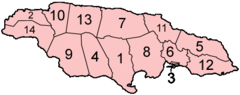
Jamaica Parishes Numbered
400 x 159
- 6,150k -
png
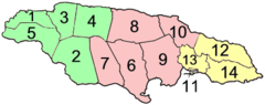
Jamaica Parishes Numbered2
400 x 159
- 7,565k -
png
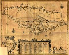
Jamaica1671ogilby
2400 x 1919
- 617,250k -
jpg
Jamaika Topo
1103 x 576
- 139,670k -
png
Jamaika
1103 x 576
- 135,238k -
png
Moll the Island of Jamaica
950 x 690
- 448,147k -
png
Portmore
920 x 444
- 8,275k -
png

Wimpelschwanz World
1357 x 628
- 10,853k -
png

Wimpelschwanz World2
1357 x 628
- 16,539k -
png

Wimpelschwanz World3
1357 x 628
- 11,837k -
png
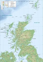
Scotland Map Fr
1600 x 2300
- 316,643k -
jpg
Scotland Map En
1800 x 2588
- 402,483k -
jpg
Scotland Topographic Map En
1800 x 2588
- 379,822k -
jpg
Scotland Topographic Map Fr
1800 x 2588
- 380,521k -
jpg
355px Lockerbie (location)
355 x 599
- 32,401k -
png
Archdioceseglasgow
567 x 456
- 15,016k -
png
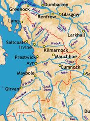
Ayrshire Rivers Some Towns
1400 x 1883
- 235,902k -
jpg
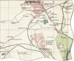
Bearsdenmap1923
808 x 677
- 75,612k -
jpg
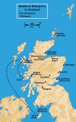
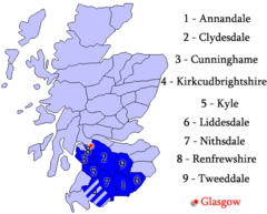
Bishoprics Scotland Medieval
1395 x 2253
- 316,864k -
jpg
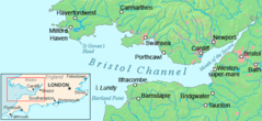
Bristol Channel Detailed Map
600 x 276
- 30,962k -
png
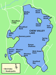
Chew Valley Lake Map
591 x 785
- 25,053k -
png
Chew Valley Map
950 x 1037
- 427,241k -
png
Coast 2 Coast
920 x 402
- 16,026k -
png
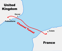
Course Channeltunnel En
472 x 387
- 5,649k -
png
Diocese of London Survey By John Harris 1714
712 x 539
- 58,554k -
jpg
England Uk
360 x 381
- 12,810k -
png
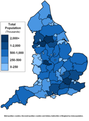
England Counties Population
1083 x 1458
- 51,983k -
png
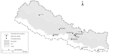
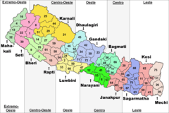
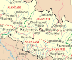
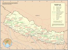
Mapa De Nepal
793 x 476
- 8,386k -
png
Carte Nepal
631 x 322
- 15,882k -
png

Map of Nepal (es)
632 x 323
- 15,335k -
png
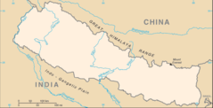
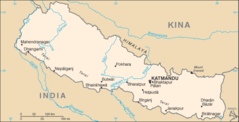
Map of Nepal
632 x 323
- 15,331k -
png
Nepal Districts
1281 x 880
- 16,896k -
png
Nepal Geographic Regions
1449 x 651
- 14,346k -
png
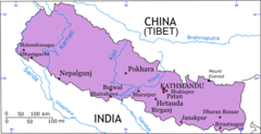
Nepal Map
634 x 325
- 20,226k -
png
Nepal Topo En Snp
228 x 150
- 8,865k -
jpg
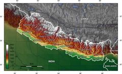
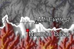
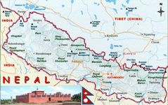
Nepal Topo En
1400 x 852
- 171,326k -
jpg
Nepal Zones Flood Hit Between July 3 And August 15 2007
792 x 482
- 5,646k -
png
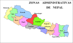
Nepal Zones
1600 x 1067
- 61,041k -
png
Nepal Cia Wfb Map
634 x 323
- 16,793k -
png
Nepal Divisions Blank
792 x 482
- 11,114k -
png
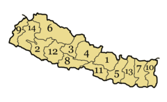
Nepal Divisions Numbered
792 x 482
- 12,942k -
png
Nepal Map Blank
634 x 323
- 13,311k -
png
Nepalmap1
797 x 500
- 89,250k -
jpg
Np Map No
634 x 323
- 15,909k -
png
Subdivisions of Nepal De
1600 x 1067
- 73,656k -
png
Subdivisions of Nepal En
1600 x 1067
- 71,824k -
png
Subdivisions of Nepal Hu
1600 x 1067
- 74,409k -
png
Subdivisions of Nepal No
1600 x 1067
- 73,915k -
png
Subdivisions of Nepal Pt
1600 x 1067
- 71,780k -
png
Un Nepal Kv
875 x 732
- 68,992k -
png
Un Nepal
1200 x 892
- 216,137k -
png
000 Irani Harta
332 x 353
- 8,936k -
png
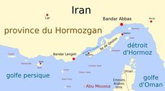
Abu Moussa Fr
894 x 497
- 34,932k -
jpg
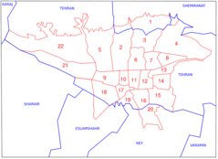
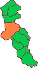
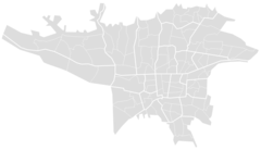
Administrative Map of Tehran
920 x 669
- 26,613k -
png
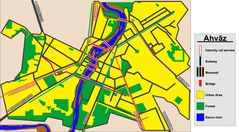
Ahvazmap
1843 x 1020
- 244,595k -
jpg
Amol Admin
616 x 709
- 10,882k -
png
Ardabil
400 x 703
- 20,801k -
jpg
Atomprogramm Des Iran
1024 x 768
- 37,256k -
png
Bandar E Anzali
1024 x 849
- 49,851k -
jpg
Blank Map Iran With Water Bodies
895 x 823
- 14,316k -
png
Caucasus Region Ovest
651 x 632
- 96,380k -
jpg
Chaharmahal
1034 x 921
- 23,791k -
png
Chaharmahalprovincemap
698 x 726
- 12,703k -
png
Damavand County
800 x 492
- 17,473k -
png
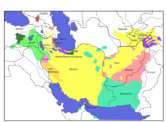
Distribution Ethnoreligieuse Iran 2004
950 x 940
- 476,851k -
png
East Azarbaijan Abb
852 x 901
- 30,117k -
png
East Azarbaijan
852 x 901
- 27,063k -
png
Eslamshahr County
800 x 492
- 17,370k -
png
Fars E
400 x 424
- 17,888k -
jpg
Fashapuyehrey
620 x 386
- 21,498k -
gif
Firuzkuh County
800 x 492
- 17,507k -
png
Gilan Abb
761 x 867
- 24,738k -
png
Golestan Abb
1016 x 841
- 24,254k -
png
Guney Azerbaycan
1024 x 849
- 50,278k -
png
Hamedan Admin
658 x 817
- 18,700k -
png
Hyrcania
483 x 461
- 7,612k -
png
Ilam Map Abb
941 x 910
- 49,010k -
jpg
Ilam Map
941 x 910
- 43,903k -
jpg
Ilam Map 1
941 x 910
- 25,475k -
png
Ilam
406 x 438
- 21,937k -
jpg
Iran 2001 Cia Map
1800 x 1801
- 425,262k -
jpg
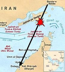
Iran Air 655 Strait of Hormuz 80
376 x 417
- 31,563k -
jpg
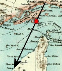
Iran Air 655 Strait of Hormuz
642 x 732
- 76,714k -
jpg
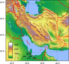
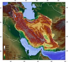
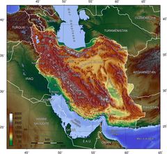
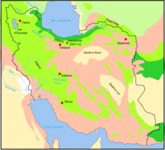
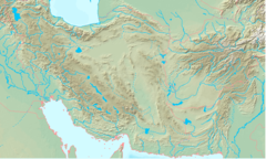
Iran Topography
950 x 887
- 416,129k -
png
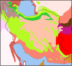
Iran Biotopes
1145 x 1041
- 35,029k -
png
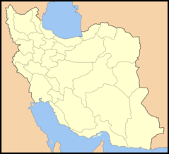
Iran Counties
1281 x 878
- 24,432k -
png
Iran Dunya Mirsi
426 x 247
- 39,819k -
gif
Iran Ethnoreligious Distribution 2004
980 x 970
- 162,519k -
jpg

Iran Locator
1024 x 849
- 49,831k -
png

Iran Locator1
1024 x 849
- 49,612k -
png

Iran Locator10
1024 x 849
- 49,624k -
png

Iran Locator11
1024 x 849
- 49,627k -
png

Iran Locator12
1024 x 849
- 49,589k -
png

Iran Locator13
1024 x 849
- 49,620k -
png

Iran Locator14
1024 x 849
- 49,639k -
png
Iran Locator15
1024 x 849
- 49,521k -
png

Iran Locator16
1024 x 849
- 49,676k -
png

Iran Locator17
1024 x 849
- 49,663k -
png

Iran Locator18
1024 x 849
- 49,605k -
png
Iran Locator19
1024 x 849
- 49,462k -
png

Iran Locator2
1024 x 849
- 49,687k -
png
Iran Locator20
1024 x 849
- 49,281k -
png
Iran Locator21
1024 x 849
- 49,268k -
png
Iran Locator22
1024 x 849
- 49,372k -
png
Iran Locator23
1024 x 849
- 49,406k -
png
Iran Locator24
1024 x 849
- 49,458k -
png
Iran Locator25
1024 x 849
- 49,587k -
png
Iran Locator26
1024 x 849
- 49,539k -
png

Iran Locator27
1024 x 849
- 49,646k -
png
Iran Locator28
1024 x 849
- 49,664k -
png
Iran Locator29
1024 x 849
- 49,408k -
png
Iran Locator3
1024 x 849
- 49,633k -
png

Iran Locator30
1024 x 849
- 49,508k -
png
Iran Locator4
1024 x 849
- 49,645k -
png

Iran Locator5
1024 x 849
- 49,677k -
png

Iran Locator6
1024 x 849
- 49,590k -
png

Iran Locator7
1024 x 849
- 49,614k -
png
Iran Locator8
1024 x 849
- 49,603k -
png

Iran Locator9
1024 x 849
- 49,416k -
png
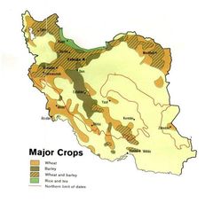
Iran Major Crops78
604 x 600
- 36,495k -
jpg
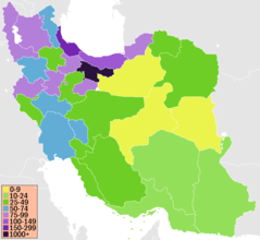
Iran Map Fa
328 x 355
- 12,558k -
png
Iran Map
328 x 355
- 13,638k -
png
Iran Nuclear Illustration
271 x 279
- 15,691k -
png
Iran Oil Map
1200 x 1200
- 57,533k -
png
Iran Peoples
1941 x 1385
- 402,428k -
jpg
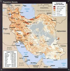
Iran Population Density 2004
1056 x 1067
- 250,656k -
jpg
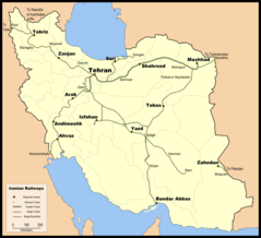
Iran Railway En
1142 x 1042
- 65,114k -
png
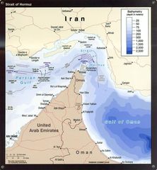
Iran Strait of Hormuz 2004
1052 x 1136
- 189,484k -
jpg
Iran Topo Blank
1400 x 1291
- 255,105k -
jpg
Iran Topo Fr
1400 x 1291
- 288,389k -
jpg
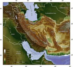
Iran And Neighbors Blank Map 1 770x770
770 x 770
- 23,051k -
png
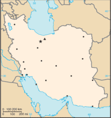
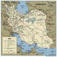
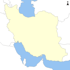
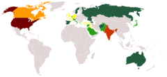
Iran
920 x 839
- 28,595k -
png
Iranlocator
1766 x 1549
- 105,746k -
png
Iranprovpopden
895 x 823
- 15,809k -
png
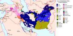
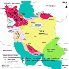
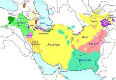
Iranian Languages Area
962 x 482
- 22,837k -
png
Iranian Tongues
920 x 680
- 33,363k -
png
Iranian Plateau
984 x 573
- 261,138k -
gif
Iranische Sprachen
800 x 551
- 64,599k -
jpg
Isfahan Iran 1942
1320 x 863
- 299,398k -
jpg
Karaj County
800 x 492
- 17,603k -
png
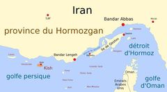
Kish Fr
894 x 497
- 34,440k -
jpg
Kohgiluye
1013 x 833
- 20,362k -
png
Kordestan Provinz
702 x 570
- 33,278k -
jpg
Kurdish 86
1190 x 954
- 295,258k -
jpg
Larak Fr
894 x 497
- 32,819k -
jpg
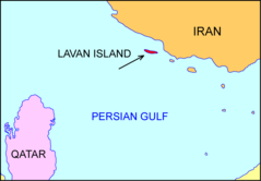
Lavanlocation
1170 x 814
- 13,434k -
png
Map Praying Mantis
517 x 378
- 31,238k -
png
Map Iran Biotopes Simplified Fr
1145 x 1041
- 52,527k -
png
Markazi Admin Map
653 x 789
- 27,568k -
png
Mazandaran County
800 x 293
- 16,659k -
gif
Mazandaran Road Map
1644 x 657
- 83,493k -
png
Mazandaranadminmapcolored
931 x 341
- 6,988k -
png
Mazandaranplainmap
931 x 341
- 6,113k -
png
Mazandaranplainmapcolored
931 x 341
- 6,240k -
png
Mazandarani Language Map
293 x 387
- 12,231k -
png

Nazarabad County
800 x 492
- 17,352k -
png

New Iran Locator
1024 x 849
- 49,888k -
png
Pg 1740
464 x 339
- 46,835k -
jpg
Pakdasht County
800 x 492
- 17,391k -
png
Persian Diaspora
1350 x 625
- 17,369k -
png
Persian Plateau
717 x 430
- 186,636k -
png
Persian Plateau Topo En
1000 x 923
- 137,367k -
jpg
Qeshm Fr
894 x 497
- 33,882k -
jpg
Qeshm Map Fr
669 x 399
- 24,891k -
jpg
Qom Admin Map
1009 x 712
- 17,159k -
png
Ray County
800 x 492
- 17,533k -
png
Robat Karim County
800 x 492
- 17,392k -
png
Savojbolagh
800 x 492
- 17,480k -
png
Semnan Admin Map
1138 x 809
- 28,552k -
png
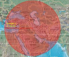
Shahab 3 Range
674 x 565
- 69,841k -
jpg
Shahriar County
800 x 492
- 17,399k -
png
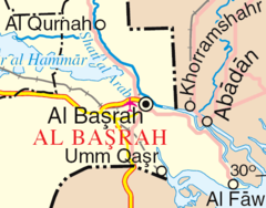
Shatt Al Arab
500 x 391
- 22,111k -
png
Shemiranat County
800 x 492
- 17,399k -
png

Sirri Fr
894 x 497
- 32,990k -
jpg
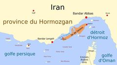
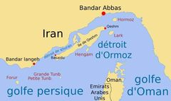
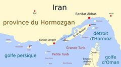
Strait of Hormuz
938 x 1360
- 182,347k -
jpg
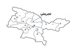
Tajrishmap
500 x 353
- 13,148k -
jpg
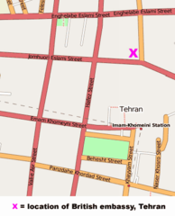
Tehran British Embassy Map
343 x 425
- 19,726k -
png
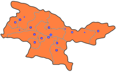
Tehran Province Blank Colored
953 x 589
- 18,327k -
png
Tehranblank
991 x 570
- 31,172k -
png
Tunb Fr
894 x 497
- 35,689k -
jpg
Un Iran
1600 x 1437
- 557,945k -
png
West Aserbaidschan
717 x 1066
- 63,516k -
jpg
Yadavaran
600 x 600
- 25,818k -
jpg
Bwfe Plan (cropped)
1707 x 1391
- 194,180k -
jpg
Bwfe Plan
1200 x 900
- 99,259k -
jpg
Bloomsbury Map 1
640 x 580
- 88,568k -
png
Central Kensington
787 x 512
- 39,823k -
png
City of London Map 01
4778 x 3708
- 344,432k -
jpg
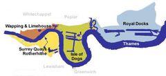
Docklands Map
490 x 224
- 13,576k -
jpg
Drury Lane Map
427 x 270
- 35,686k -
png
Enfield Town Map 1
350 x 350
- 35,248k -
png
Gower Street Map
273 x 346
- 21,714k -
png
Greater London Outline Map Bw
600 x 500
- 45,162k -
png
Greater London Outline Map
600 x 500
- 19,216k -
png
Hackney Districts
250 x 259
- 21,861k -
gif
Hampsteadkilburnconstituency
920 x 718
- 40,188k -
png
High Holborn Map 1
660 x 440
- 44,674k -
png
Kanal La Manche S Popisem
1800 x 935
- 163,507k -
jpg
London Postal District
561 x 439
- 38,141k -
png
London Boundaries Da
920 x 894
- 33,453k -
png
London Boundaries Fr
920 x 894
- 33,745k -
png
London Congestion Charge Zone
1513 x 1055
- 263,660k -
jpg
London Congestion Charge Zone 1
1400 x 1050
- 362,698k -
png
London North South Circulars
920 x 772
- 29,448k -
png
London1300 Marking the Spot of the Future Marshalsea
700 x 536
- 183,347k -
png
Londonse Map 1946 Nw Courner
1800 x 4208
- 1,004,522k -
jpg
Meyers B10 S0896a
1800 x 1401
- 478,070k -
jpg
Oxford Street London Map
770 x 331
- 11,865k -
png
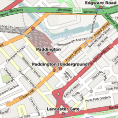
Paddington Station Location Map
350 x 350
- 24,629k -
png
Soho Map 1
626 x 525
- 58,552k -
png
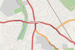
Whetstone, London Map 1
540 x 360
- 51,465k -
png
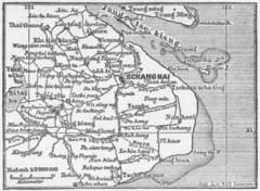
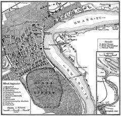
Karte Schanghai Mkl1888
369 x 270
- 40,632k -
png
Shanghai Ca 1910
1027 x 979
- 406,858k -
jpg
Shanghai 1933
800 x 1150
- 402,617k -
jpg

Shanghai Admin Cs
949 x 1200
- 46,116k -
png
Shanghai Administrative
380 x 480
- 18,920k -
png
Shanghai Chongming
949 x 1200
- 59,859k -
png
Shanghai Highlight
250 x 200
- 5,568k -
png
Shanghai Hongkou
949 x 1200
- 67,075k -
png

Shanghai Yangpu
949 x 1200
- 63,891k -
png
Chinashanghaipudong
400 x 356
- 8,643k -
png
Al Aaimmah Bridge Area
665 x 243
- 10,549k -
png
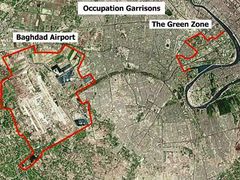
Baghdad Airport And Green Zone
496 x 371
- 58,810k -
jpg
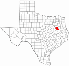
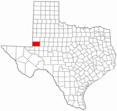
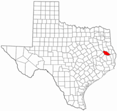
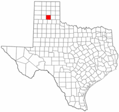
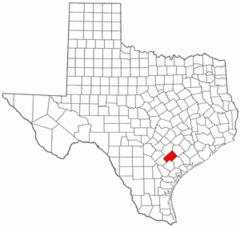
Anderson County Texas
300 x 284
- 13,880k -
png
Andrews County Texas
300 x 284
- 12,215k -
png
Angelina County Texas
300 x 284
- 11,906k -
png
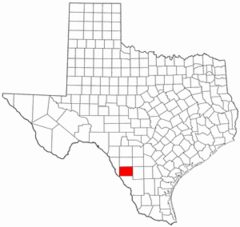
Aransas County Texas
300 x 284
- 13,664k -
png
Archer County Texas
300 x 284
- 13,163k -
png
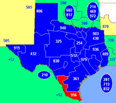
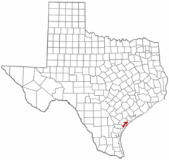
Area Code 956
400 x 355
- 7,426k -
png
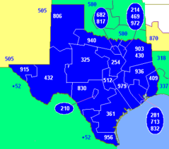
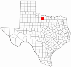
Area Codes Tx
400 x 355
- 7,448k -
png
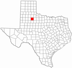
Armstrong County Texas
300 x 284
- 11,800k -
png
Atascosa County Texas
300 x 284
- 13,949k -
png
Austin County Texas
300 x 284
- 12,142k -
png
Austin Tx 1920 Map
690 x 562
- 98,092k -
jpg
Bailey County Texas
300 x 284
- 11,911k -
png
Bandera County Texas
300 x 284
- 13,069k -
png
Bastrop County Texas
300 x 284
- 13,147k -
png
Baylor County Texas
300 x 284
- 13,223k -
png
Bee County Texas
300 x 284
- 13,364k -
png
Bell County Texas
300 x 284
- 12,386k -
png
Bexar County Texas
300 x 284
- 13,673k -
png
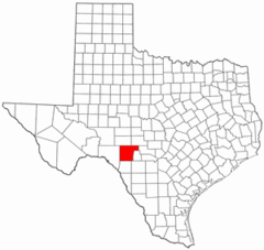
Blanco County Texas
300 x 284
- 12,271k -
png
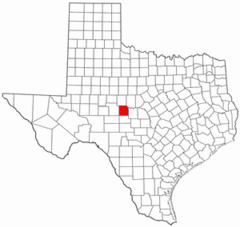
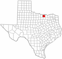
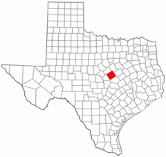
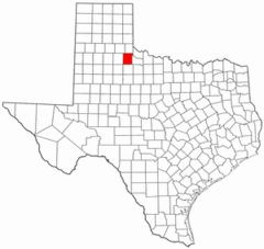
Blank Map of Texas
2308 x 1584
- 91,639k -
png
Borden County Texas
300 x 284
- 12,602k -
png
Bosque County Texas
300 x 284
- 13,894k -
png
Bowie County Texas
300 x 284
- 13,760k -
png
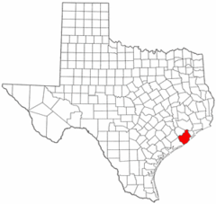
Brazoria County Texas
300 x 284
- 12,395k -
png
Brazos County Texas
300 x 284
- 12,655k -
png
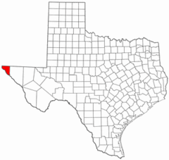
Brewster County Texas
300 x 284
- 12,626k -
png
Briscoe County Texas
300 x 284
- 13,369k -
png
Brooks County Texas
300 x 284
- 12,148k -
png
Brown County Texas
300 x 284
- 11,942k -
png
Burleson County Texas
300 x 284
- 12,234k -
png
Burnet County Texas
300 x 284
- 12,283k -
png
Caldwell County Texas
300 x 284
- 12,588k -
png
Calhoun County Texas
300 x 284
- 12,407k -
png
Callahan County Texas
300 x 284
- 11,803k -
png
Cameron County Texas
300 x 284
- 12,810k -
png
Camp County Texas
300 x 284
- 11,833k -
png
Carson County Texas
300 x 284
- 12,079k -
png
Cass County Texas
300 x 284
- 11,947k -
png
Castro County Texas
300 x 284
- 11,908k -
png
Chambers County Texas
300 x 284
- 11,693k -
png
Cherokee County Texas
300 x 284
- 12,484k -
png
Clay County Texas
300 x 284
- 13,015k -
png
Cochran County Texas
300 x 284
- 13,672k -
png
Coke County Texas
300 x 284
- 13,362k -
png
Coleman County Texas
300 x 284
- 12,557k -
png
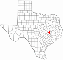
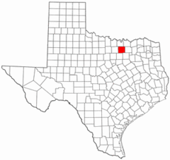
Collin County Texas Incorporated Areas
920 x 418
- 37,390k -
png
Collin County Texas
300 x 284
- 12,601k -
png
Collingsworth County Texas
300 x 284
- 11,945k -
png
Colorado County Texas
300 x 284
- 13,311k -
png
Comal County Texas
300 x 284
- 11,792k -
png
Comanche County Texas
300 x 284
- 12,683k -
png
Concho County Texas
300 x 284
- 12,099k -
png
Cooke County Texas
300 x 284
- 13,530k -
png
Coryell County Texas
300 x 284
- 12,032k -
png
Cottle County Texas
300 x 284
- 13,275k -
png
Crane County Texas
300 x 284
- 13,490k -
png
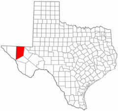
Crockett County Ozona
920 x 711
- 15,878k -
png
Crockett County Texas
300 x 284
- 12,327k -
png
Crosby County Texas
300 x 284
- 11,884k -
png
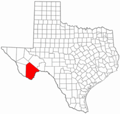
Culberson County Texas
300 x 284
- 12,314k -
png
Dallam County Texas
300 x 284
- 12,202k -
png
Dallas County Texas
300 x 284
- 11,764k -
png
Dawson County Texas
300 x 284
- 11,779k -
png
Deaf Smith County Texas
300 x 284
- 13,179k -
png
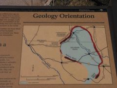
Delaware Basin Geology Exhibit
1400 x 1050
- 92,935k -
jpg
Delta County Texas
300 x 284
- 12,248k -
png
Denton County Texas Incorporated Areas
920 x 460
- 37,847k -
png
Denton County Texas
300 x 284
- 12,643k -
png
Dewitt County Texas
300 x 284
- 13,021k -
png
Dickens County Texas
300 x 284
- 11,993k -
png
Dimmit County Texas
300 x 284
- 12,271k -
png
Donley County Texas
300 x 284
- 12,334k -
png
Duval County Texas
300 x 284
- 12,059k -
png
East Texas Map
447 x 437
- 7,835k -
png

Eastland County Texas
300 x 284
- 11,868k -
png
Ector County Texas
300 x 284
- 12,329k -
png
Edwards County Texas
300 x 284
- 12,258k -
png
El Paso County Texas
300 x 284
- 12,962k -
png
Ellis County Texas
300 x 284
- 12,512k -
png
Erath County Texas
300 x 284
- 12,296k -
png
Falls County Texas
300 x 284
- 11,804k -
png
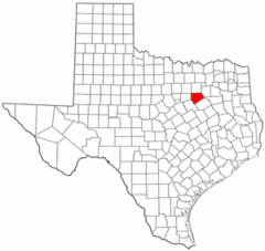
Fannin County Texas
300 x 284
- 12,210k -
png
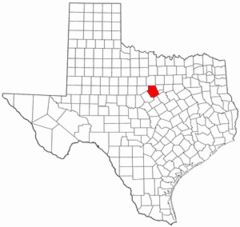
Fayette County Texas
300 x 284
- 12,081k -
png
Fisher County Texas
300 x 284
- 12,257k -
png
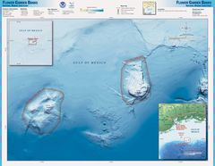
Flower Gardens Nms Map
2000 x 1550
- 222,144k -
jpg
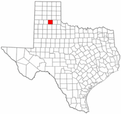
Floyd County Texas
300 x 284
- 12,191k -
png
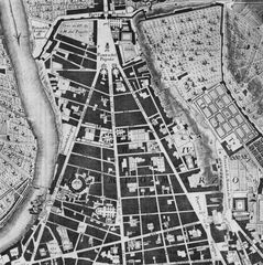
Map of Northern Rome, Piazza Del Popolo, By Nolli
1400 x 1403
- 318,191k -
jpg
Colinas Roma
570 x 488
- 21,028k -
png
Italyrome
624 x 710
- 101,231k -
png
Locationroma
731 x 840
- 106,786k -
jpg
Municipi Di Roma
906 x 1027
- 36,018k -
png
Roma Posizione 3
350 x 424
- 5,866k -
png
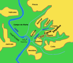
Roma Rioni Quartieri
1600 x 1600
- 214,980k -
jpg
Rome Muni 1 Campitelli
796 x 618
- 8,962k -
png
Rome Muni 1
796 x 618
- 18,168k -
png
Rome Muni 2
796 x 618
- 18,156k -
png
Rome Overview Numbered
796 x 618
- 18,138k -
png
Rome Openstreetmap 2008 05 23
991 x 753
- 171,362k -
jpg
Romekleinheuvels
200 x 206
- 5,320k -
png
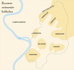
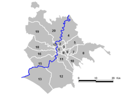
Rooman Kukkulat
628 x 599
- 18,406k -
png
Roma Rioni Mappa
1529 x 1409
- 89,083k -
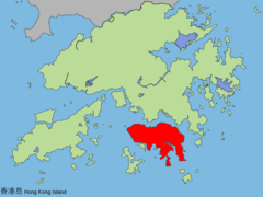
png
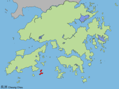
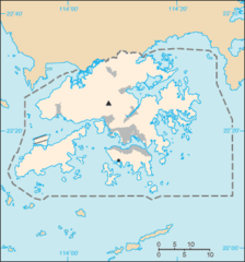
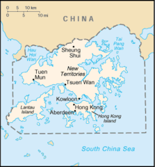
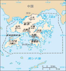
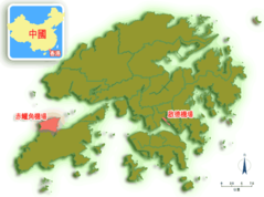
Cia Hongkong
1216 x 1150
- 209,083k -
jpg
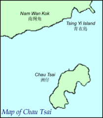
Chau Tsai
676 x 776
- 12,216k -
png
Cheklapkok
1024 x 768
- 52,238k -
png
Cheungchau
1024 x 768
- 51,807k -
png
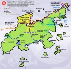
Concept Plan For Lantau
2048 x 1654
- 266,683k -
jpg
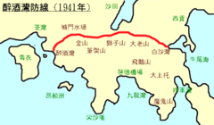
Gin Drinkers Line
600 x 350
- 15,486k -
png
Hk Map
329 x 353
- 11,899k -
png
Hk Lantau Map Zh
600 x 446
- 36,907k -
jpg
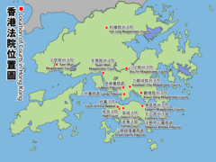
Hk Location of Courts
1024 x 768
- 127,632k -
png
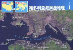
Hkvictoriaharbour Surroundinggeography
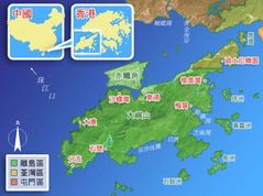
800 x 550
- 77,828k -
jpg
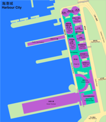
Harbour City
904 x 1040
- 40,338k -
png
Hk Map 18 Heb
1454 x 1083
- 68,735k -
png
Hk Map 18
1454 x 1083
- 78,961k -
png
Hk Map Uc Lc
1454 x 1083
- 60,231k -
png
Hk Map He
330 x 355
- 10,212k -
png
Hk Map Colonial
330 x 355
- 11,412k -
png
Hk Map Ja
329 x 353
- 15,448k -
png
Hkairports
600 x 446
- 28,451k -
png
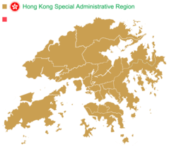
Hong Kong Base Map Urban
920 x 920
- 27,442k -
png
Hong Kong District Locator (template Map)
1344 x 1168
- 48,884k -
png
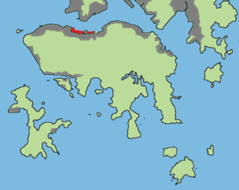
Hong Kong Districts
920 x 685
- 29,515k -
png
Hong Kong Island Land Reclamation
524 x 416
- 22,533k -
png
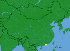
Hong Kong Location
400 x 202
- 12,016k -
png
Hong Kong Outline Map
1872 x 1404
- 217,687k -
png
Hong Kong Reclamation
1024 x 768
- 50,970k -
png
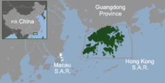
Hong Kong Within South Eastern China
800 x 600
- 32,705k -
png
Hongkong Asiapacificlatitude
778 x 412
- 57,713k -
jpg
Hongkongisland
1024 x 768
- 51,616k -
png
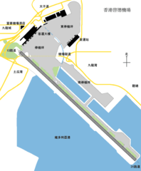
Kaitak Airport Plan
494 x 600
- 19,537k -
png
Kowloon Location
1804 x 1322
- 173,756k -
png
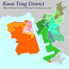
Kwai Tsing District Council Election 2003
1500 x 1500
- 47,561k -
png
Lammaisland
1024 x 768
- 51,575k -
png
Lantau Island Reclamation
800 x 560
- 25,368k -
png
Lantauisland
1024 x 768
- 50,587k -
png
Location of Hongkong By Guangdong (china)
770 x 640
- 38,980k -
png
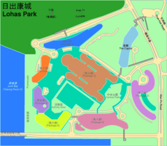
Lohas Park
920 x 807
- 40,600k -
png
Map Hk Lantau Closer
1560 x 1520
- 253,076k -
jpg
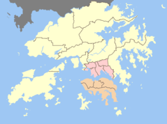
Map of Hong Kong 18districts En
920 x 685
- 39,226k -
png
Map of Hong Kong 18districts Zh
920 x 685
- 37,414k -
png
Map of Hong Kong Unpathed
920 x 623
- 49,993k -
png
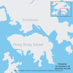
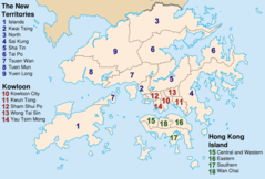
Map of Hong Kong
1101 x 865
- 182,051k -
png
Map Southchina Hongkong
721 x 405
- 72,088k -
jpg
Map Southchina
721 x 405
- 55,241k -
jpg
North Ninepin Island
1549 x 3184
- 95,974k -
png
Pearl River Delta Area
1000 x 800
- 40,704k -
png
Position of Yau Tsim Mong
690 x 600
- 36,921k -
png
Taikooplace
920 x 672
- 33,519k -
png
Taio
1024 x 768
- 51,702k -
png
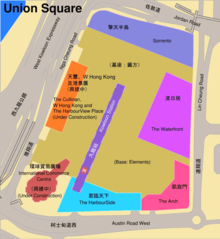
Union Square
910 x 990
- 46,112k -
png
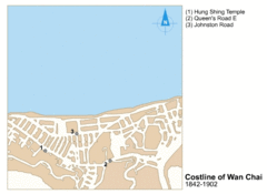
Wanchaireclamation
550 x 402
- 224,656k -
gif
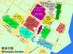
Whampoa Garden
920 x 686
- 53,309k -
png
2008 Iwate Earthquake Intensity
612 x 711
- 63,139k -
jpg
Ancient Japan Provinces Map Japanese
800 x 1129
- 250,094k -
gif
Ancient Japan Provinces Map
800 x 1129
- 113,630k -
jpg
Ariake Sea Coastline
180 x 200
- 12,251k -
png
Cartedujapon
351 x 377
- 19,608k -
png
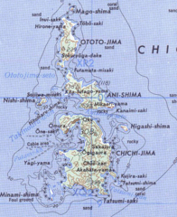
Chichijima Retto
457 x 559
- 223,933k -
png
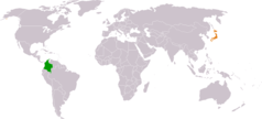
Colombia Japan Locator
1325 x 601
- 16,397k -
png
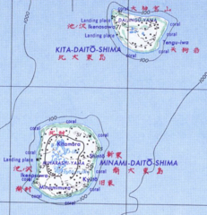
Daito Shoto
489 x 507
- 181,035k -
png
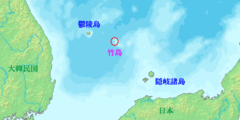
Dokdo Map
748 x 683
- 10,005k -
png
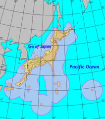
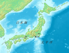
Eez of Japan
651 x 738
- 19,083k -
png
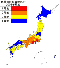
Earthquake Insurance Consultation of Japan 2005
1397 x 1593
- 28,095k -
png
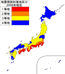
Earthquake Insurance Consultation of Japan 2006
1397 x 1593
- 28,125k -
png
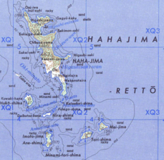
Hahajima Retto
619 x 605
- 295,854k -
png
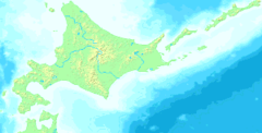
Hokkaido Map Small
300 x 152
- 9,090k -
png
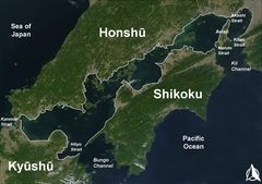
Inlandsea
1700 x 1200
- 193,555k -
jpg
Ja Map
912 x 979
- 171,597k -
png
Japan Administrative Zh Cn
1397 x 1593
- 173,172k -
jpg
Japan Administrative Zh Tw
1397 x 1593
- 174,702k -
jpg
Japan Chubu Region
453 x 408
- 8,388k -
png

Japan Chugoku Region Large
1397 x 1593
- 28,158k -
png
Japan Chugoku Region
369 x 261
- 5,821k -
png
Japan High School Rishumore Map 2006
1397 x 1593
- 32,533k -
png
Japan Hokkaido Large
1397 x 1593
- 28,102k -
png
Japan Honshu Large
1397 x 1593
- 28,114k -
png

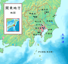
Japan Kansai Region Large
1397 x 1593
- 28,376k -
png
Japan Kanto Region Large
1397 x 1593
- 27,196k -
png
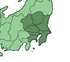
Japan Kanto Region
366 x 327
- 5,361k -
png
Japan Kinki Region Large
1397 x 1593
- 27,395k -
png
Japan Kinki Region
399 x 261
- 6,579k -
png
Japan Kosovo Locator
920 x 406
- 27,280k -
png
Japan Kyushu Region Large
1397 x 1593
- 27,117k -
png
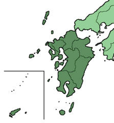
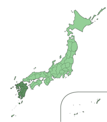
Japan Kyushu Region
399 x 429
- 6,924k -
png
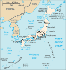
Japan Map Lincun
920 x 920
- 36,546k -
png
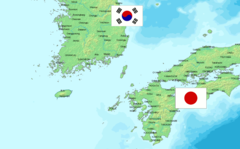
Japan North Korea South Korea Locator
1357 x 628
- 17,127k -
png
Japan Okinawa Large
1397 x 1593
- 27,964k -
png
Japan Shikoku Region Large
1397 x 1593
- 27,042k -
png
Japan Tohoku Region Large
1397 x 1593
- 27,541k -
png
Japan Tohoku Region
450 x 546
- 6,008k -
png
Japan Turkey Locator
920 x 406
- 25,697k -
png
Japan Admin Levels
920 x 920
- 45,273k -
png
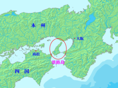
Japan Awaji Map Small
235 x 300
- 5,875k -
png
Japan Cities
983 x 1018
- 38,767k -
png
Japan Districts
908 x 1025
- 25,767k -
png
Japan El Utilities
570 x 755
- 17,427k -
png
Japan Equirectangular Projection
1200 x 904
- 99,025k -
png
Japan Hokkaido Map Small
235 x 300
- 5,781k -
png
Japan Honshu Map Small
235 x 300
- 5,782k -
png
Japan Icon Large
1397 x 1593
- 28,228k -
png

Japan Large
1397 x 1593
- 28,184k -
png
Japan Main Islands
235 x 300
- 5,693k -
png
Japan Prefectures
300 x 383
- 11,878k -
png
Japan Prov Map Awa1
235 x 300
- 6,500k -
png
Japan Prov Map Owari
235 x 300
- 6,412k -
png
Japan Satelliet
777 x 1002
- 170,978k -
jpg
Japan Sea Map German
330 x 355
- 12,956k -
png
Japan Sea Map
329 x 353
- 14,127k -
png

Japan Template Large
1397 x 1593
- 28,075k -
png
Japan Wards
1601 x 1025
- 29,682k -
png
Japan Location Zh
777 x 544
- 65,518k -
jpg
Japan2
1397 x 1593
- 24,827k -
png
Japanese Three Major Great Image of Buddha
300 x 300
- 10,176k -
jpg
Japanmap
353 x 377
- 19,467k -
jpg
Japonmarinterior
3341 x 2029
- 57,544k -
png
Japonmarinterior1
3341 x 2029
- 63,971k -
png
Justjapan
1251 x 941
- 296,858k -
png
Kantomap Jp
585 x 554
- 66,242k -
png
Karafuto Map
514 x 747
- 8,149k -
png
Keisei Bus Katsushikagyoda Line5
404 x 556
- 15,336k -
png
Kinki En
642 x 463
- 73,256k -
png
Kinki Jp
642 x 463
- 72,471k -
png
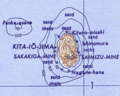
Kitaiojima
305 x 243
- 35,191k -
png
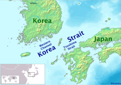
Korea Strait
681 x 479
- 44,143k -
png
Koreastrasse Without Labels
1149 x 715
- 92,140k -
png
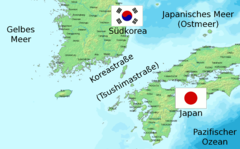
Koreastrasse
1149 x 715
- 96,986k -
png
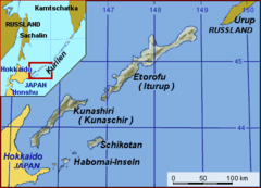
Kurilenkonflikt
430 x 310
- 11,722k -
png
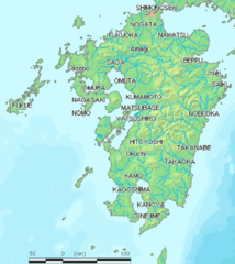
Kyushu Map
598 x 672
- 65,451k -
png

Kyushu Jp
631 x 1120
- 156,024k -
png
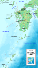
Kyushumap En
631 x 1120
- 157,244k -
png
Location Atsumipeninsulajp
647 x 702
- 47,432k -
jpg
Location Bosopeninsulajp
647 x 702
- 47,715k -
jpg

Location Chitapeninsulajp
647 x 702
- 47,368k -
jpg

Location Chuoexpwayjp
647 x 702
- 47,505k -
jpg
Location Izuilands
639 x 698
- 48,142k -
jpg
Location Izupeninsula
639 x 698
- 47,387k -
jpg

Location Kyotojapan
647 x 702
- 48,130k -
jpg

Location Meishinexpwayjp
647 x 702
- 47,362k -
jpg
Location Miurapeninsulajp
647 x 702
- 47,276k -
jpg

Location Nagasakipeninjp
647 x 702
- 47,478k -
jpg
Location Nemuropeninjp
647 x 702
- 47,526k -
jpg

Location Nishisonogipeninjp
647 x 702
- 47,419k -
jpg

Location Notopeninsulajp
647 x 702
- 47,651k -
jpg
Location Notsukepeninsulajp
647 x 702
- 47,335k -
jpg
Location Ogapeninsulajp
647 x 702
- 47,454k -
jpg
Location Osakajapan
647 x 702
- 48,141k -
jpg
Location Ryukyu Islands
482 x 377
- 31,226k -
png
Location Satsumapeninsulajp
647 x 702
- 47,424k -
jpg
Location Shimabarapeninjp
647 x 702
- 47,184k -
jpg
Location Shimokitapeninjp
647 x 702
- 47,758k -
jpg
Location Shiretokopeninjp
647 x 702
- 47,496k -
jpg
Location Tohokuexpwayjp
647 x 702
- 47,393k -
jpg

Location Tomeiexpway
647 x 702
- 47,380k -
jpg
Location Tsugarupeninsulajp
647 x 702
- 47,716k -
jpg
Location of Fujiyama In Chinese
900 x 690
- 250,855k -
png
Location of Japanese Alps
420 x 401
- 29,273k -
png
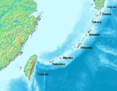
Location of the Ryukyu Islands
482 x 377
- 26,854k -
jpg
Location of Awaji Island Ja
640 x 480
- 64,802k -
png
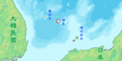
Location of Liancourt Rocks Ja
640 x 320
- 34,052k -
png
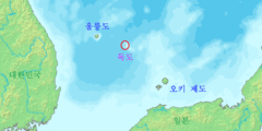
Location of Liancourt Rocks Ko
640 x 320
- 33,885k -
png
Location of Liancourt Rocks Zh Classical
640 x 320
- 32,422k -
png
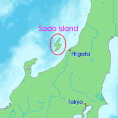
Location of Sadogashima Island En
400 x 400
- 11,252k -
png
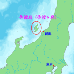
Location of Sadogashima Island Ja
400 x 400
- 11,074k -
png
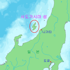
Location of Sadogashima Island Ko
400 x 400
- 10,336k -
png
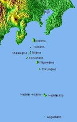
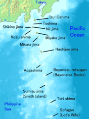
Map Izuislandsshuttle
331 x 523
- 23,427k -
jpg
Map of Izu Islands
300 x 400
- 20,924k -
png
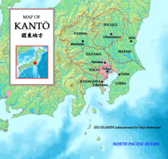
Mapofkanto
585 x 554
- 66,822k -
png
Mengjiang Map 1939
920 x 562
- 46,010k -
png
Minami Torishima Map
1240 x 904
- 65,569k -
jpg