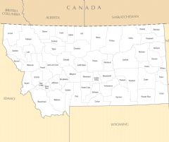
Montana, US
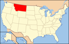
Montana: Located in the Western United States, it is bordered by Canada to the north and Idaho, Wyoming, and the Dakotas to the west, south, and east.
Montana became the 41st state admitted to the Union on November 8, 1889. Its name comes from the Spanish word for mountain.
Geography and Climate
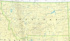
Montana is the 4th largest U.S. state covering 147,039 square miles. It shares borders with North Dakota, South Dakota, Wyoming, Idaho, and Canada. The varied terrain includes the Rocky Mountains and eastern rolling plains. Major rivers are the Missouri and Yellowstone.
The continental climate produces cold winters and hot summers. The west is drier than the east.
Economy and Industries
Montana's economy relies on agriculture, energy, and tourism. Cattle ranching and wheat farming drive the agricultural sector. Coal, oil, and natural gas are important energy resources. Attractions like Glacier and Yellowstone National Parks draw tourists.
The service industry is growing in cities while high-tech firms are building data centers and creating jobs.
Culture and Demographics
Montana has just over 1 million residents. The population is predominantly white with significant Native American heritage. The culture reflects rugged individualism and outdoor lifestyles. Larger cities offer amenities with access to nature.
Government and Politics
The capital is Helena while the largest city is Billings. The current governor is Greg Gianforte, Republican. Montana leans conservative and has voted Republican in recent presidential elections.
Montana offers majestic natural beauty through soaring mountains and wide-open plains. Ranching, farming, energy, and tourism underpin the economy. Hardy, self-reliant residents enjoy the state's pristine wilderness and small town communities.

State Snapshot
Montana at a glance
Montana currently has 67 quality-checked populated place pages and 56 county pages linked on MapSof.
Mapped cities & towns
67
These counts use a stricter populated-place filter so the main lists stay focused on real city and town pages.
County pages
56
Open related pagesLargest city
BillingsPopulation 117,445
Top linked places
Quick Facts about Montana
| Population | 1,080,577 |
| Country | United States of America |
| Area | 381154 km2 |
| Water as percent of area | 1.02% |
| Land as percent of area | 98.98% |
| Northernmost point | Point(-107.366666666 49.0) |
| Latitude & Longitude | 47.0003,-109.7510 |
| Legislative body | Montana Legislature |
| Named for | mountain |
| Official language | English |
| Altitude | 3,396 feet / 1035 meters |
| Capital | Helena |
| Establishment | November 08, 1889 (136 years ago) |
| Time Zone | UTC−07:00, America/Denver |
| Local time | 03:57:27 (23rd September 2026) |
| Weather | 47℉ Partly Cloudy 7-days weather |

Geography
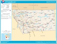
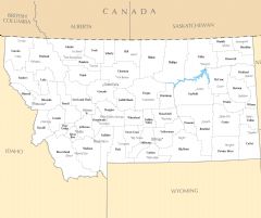
Montana is located at 47°0'1"N 109°45'4"W (47.0002500, -109.7510200). It has 8 neighbors: Idaho, North Dakota, South Dakota, Wyoming, Alberta, British Columbia, Northwest Territories and Saskatchewan.
Montana map
 icon to open full mode. View satellite images
The largest city of Montana is Billings with a population of 117,445. Other cities include, Missoula population 76,848, Great Falls population 58,353, Bozeman population 50,970 and Helena population 33,737. See all Montana cities & populated places.
Largest Cities in Montana (more)
Cities, Towns, Villages, Neighborhoods & Other Populated Places in Montana.
| City Name | County | Population |
|---|---|---|
| Billings | Yellowstone | 117,445 |
| Missoula | Missoula | 76,848 |
| Great Falls | Cascade | 58,353 |
| Bozeman | Gallatin | 50,970 |
| Butte | Silver Bow | 34,190 |
| Helena | Lewis and Clark | 33,737 |
| Kalispell | Flathead | 25,329 |
| Belgrade | Gallatin | 10,390 |
| Havre | Hill | 9,706 |
| Whitefish | Flathead | 8,713 |
| Miles City | Custer | 8,264 |
| Livingston | Park | 7,898 |
| Lockwood | Yellowstone | 6,797 |
| Laurel | Yellowstone | 6,715 |
| Sidney | Richland | 6,297 |
| Columbia Falls | Flathead | 6,209 |
Show more Montana cities and populated places
Weather
Partly cloudy, with a low around 47.
7-Day ForecastOfficial website of Montana
Official Website- Missoula County
- Ravalli County
- Cascade County
- Silver Bow County
- Hill County
- Stillwater County
- Yellowstone County
- Chouteau County
- Broadwater County
- Petroleum County
- Beaverhead County
- Garfield County
- Flathead County
- Wibaux County
- Mineral County
- Custer County
- Toole County
- Treasure County
- Teton County
- Powder River County
- Judith Basin County
- Blaine County
- Daniels County
- Jefferson County
- Fallon County
- Glacier County
- Granite County
- Roosevelt County
- Lake County
- Sheridan County
- Fergus County
- Lincoln County
- Sweet Grass County
- Carbon County
- Rosebud County
- Big Horn County
- Pondera County
- Valley County
- Liberty County
- Richland County
- Gallatin County
- Wheatland County
- Dawson County
- Carter County
- McCone County
- Meagher County
- Madison County
- Golden Valley County
- Musselshell County
- Phillips County
- Sanders County
- Lewis and Clark County
- Prairie County
- Powell County
- Park County
- Deer Lodge County
Demographics
| Year | Population | % Change | Method |
|---|---|---|---|
| 1910 | 376,053 | - | census |
| 1920 | 548,889 | 45.96% | census |
| 1930 | 537,606 | -2.06% | census |
| 1940 | 559,456 | 4.06% | census |
| 1950 | 591,024 | 5.64% | census |
| 1960 | 674,767 | 14.17% | census |
| 1970 | 694,409 | 2.91% | census |
| 1980 | 786,690 | 13.29% | census |
| 1990 | 799,065 | 1.57% | census |
| 2000 | 902,195 | 12.91% | census |
| 2010 | 989,415 | 9.67% | census |
| 2011 | 997,316 | 0.8% | estimation process |
| 2012 | 1,003,783 | 0.65% | estimation process |
| 2013 | 1,013,569 | 0.97% | estimation process |
| 2014 | 1,021,869 | 0.82% | estimation process |
| 2015 | 1,030,475 | 0.84% | estimation process |
| 2016 | 1,040,859 | 1.01% | estimation process |
| 2017 | 1,052,482 | 1.12% | estimation process |
| 2018 | 1,060,665 | 0.78% | estimation process |
| 2019 | 1,068,778 | 0.76% | estimation process |
| 2020 | 1,080,577 | 1.1% | estimation process |
People born in Montana (94)
People born in Montana, including costume designer Irene Lentz, film director Erle C. Kenton, diplomat Spruille Braden, .
More notable people
- Bill Bowers (American actor) he was born in 16/04/1959
- Brandon Eggum (American amateur wrestler) he was born in 04/08/1976
- Brent Weeks (American fiction writer) he was born in 07/03/1977
- George Montgomery (American actor and artist) he was born in 29/08/1916
- Dennis Meadows (American scientist and Emeritus Professor of Systems Management, widely known as a coauthor of The Limits to Growth) he was born in 07/06/1942
- William McPherson Allen (American businessperson) he was born in 01/09/1900
- Joe Rickson (actor (1880-1958)) he was born in 06/09/1880
- Julia Heron (set decorator) she was born in 21/11/1897
- Kendall Cross (Olympic wrestler) he was born in 24/02/1968
- Marvin Camel (American boxer) he was born in 24/12/1951
- Jeanne DuPrau (American writer) she was born in 09/06/1944
- Will Roscoe (American scholar) he was born in 01/01/1964
- Looking Glass (Nez Percé War leader) he was born in 01/01/1823
- Morning Star (great chief of the Northern Cheyenne people) he was born in 01/01/1810
- George Theodore Boileau (American priest) he was born in 10/09/1912
- George Flynn (American composer (b. 1937)) he was born in 21/01/1937
- Jack A. Marta (American cinematographer) he was born in 05/03/1903
- Jack Aeby (American mechanical engineer and photographer) he was born in 16/08/1923
Montana Counties (more)
Yellowstone County

county in Montana, United States of America.
Missoula County

county in Montana, United States.
Gallatin County

county in Montana, United States.
| County Name | Population |
|---|---|
| Yellowstone County | 162,990 |
| Missoula County | 121,630 |
| Gallatin County | 116,806 |
| Flathead County | 105,851 |
| Cascade County | 81,346 |
| Lewis and Clark County | 70,229 |
| Ravalli County | 45,002 |
| Silver Bow County | 35,180 |
| Lake County | 30,986 |
| Lincoln County | 20,343 |
| Park County | 16,760 |
| Hill County | 16,358 |
| Glacier County | 13,594 |
| Big Horn County | 13,063 |
| Jefferson County | 12,360 |
| Sanders County | 12,157 |
Show more Montana counties
Map & Images (more maps)
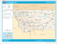
Map of Montana Na 1
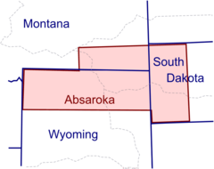
Absaroka Outline
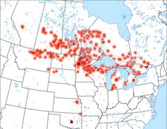
Anishinaabewaki 2
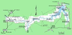
Charles M Russell National Wildlife Refuge Map
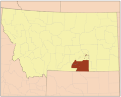
Crowirmap
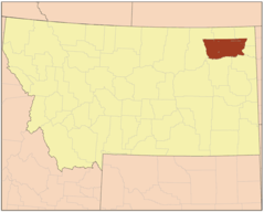
Fortpeckirmap
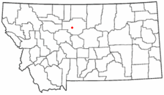
Mtmap Doton Fortbenton
Map of Usa Mt
Montana 1990
Montana Locator Map With Us
Montana Locator Map
Montana Map
Wpdms Washington Territory 1863 Legend 3
Yellowstone Caldera Map2
Usa Montana Location Map
Montana Flag Map
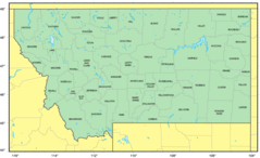
Counties Map of Montana
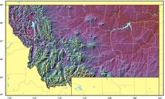
Montana Relief Map
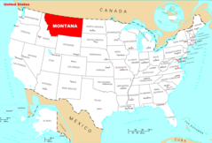
Where Is Montana Located
Montana Cities And Towns