British Columbia, CA
British Columbia: province of Canada
About
State Snapshot
British Columbia at a glance
British Columbia currently has 2 quality-checked populated place pages and 0 county pages linked on MapSof.
Mapped cities & towns
2
These counts use a stricter populated-place filter so the main lists stay focused on real city and town pages.
County pages
0
Open related pagesLargest city
AbbotsfordPopulation 151,683
Top linked places
Quick Facts about British Columbia
| Population | 4,841,078 |
| Country | Canada |
| Postal code | V |
| Phone Area Codes | 778, 604, 236, 250 |
| Area | 944735 km2 |
| Official name | Colombie-Britannique, British Columbia |
| Continent | North America |
| Easternmost point | Point(-114.068180555 48.998858333) |
| Northernmost point | Point(-130.0 60.0) |
| Latitude & Longitude | 53.9998,-125.0032 |
| Legislative body | Parliament of British Columbia |
| Named for | Christopher Columbus, British Isles |
| Official language | English |
| Capital | Victoria |
| Establishment | January 01, 1871 (155 years ago) |
| Time Zone | Pacific Time Zone, America/Vancouver |
| Local time | 01:08:53 (15th July 2026) |
Geography
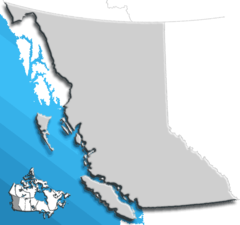
British Columbia is located at 53°59'59"N 125°0'12"W (53.999827295, -125.003201924). It has 7 neighbors: Idaho, Montana, Washington, Alaska, Alberta, Northwest Territories and Yukon.
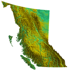
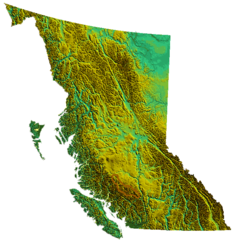
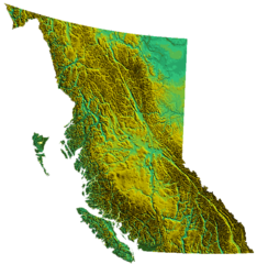
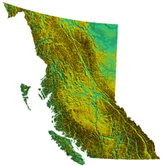
British Columbia map
The largest city of British Columbia is Abbotsford with a population of 151,683. . See all British Columbia cities & populated places.
Largest Cities in British Columbia
Cities, Towns, Villages, Neighborhoods & Other Populated Places in British Columbia.
| City Name | County | Population |
|---|---|---|
| Abbotsford | Fraser Valley Regional District | 151,683 |
| Agassiz | Fraser Valley Regional District | 4,738 |
Official website of British Columbia
Official WebsiteDemographics
| Year | Population | % Change | Method |
|---|---|---|---|
| 1851 | 55,000 | - | census |
| 1871 | 36,247 | -51.74% | census |
| 1881 | 49,459 | 26.71% | census |
| 1891 | 98,173 | 49.62% | census |
| 1901 | 178,657 | 45.05% | census |
| 1911 | 392,480 | 54.48% | census |
| 1921 | 524,582 | 25.18% | census |
| 1931 | 694,263 | 24.44% | census |
| 1941 | 817,861 | 15.11% | census |
| 1956 | 1,398,464 | 41.52% | census |
| 1961 | 1,629,082 | 14.16% | census |
| 1966 | 1,873,674 | 13.05% | census |
| 1971 | 2,184,621 | 14.23% | census |
| 1974 | 51,524 | -4140.01% | 1861-01-01T00:00:00Z |
| 1976 | 2,466,608 | 97.91% | census |
| 2011 | 4,400,057 | 43.94% | census |
| 2015 | 4,659,272 | 5.56% | estimation process |
| 2016 | 4,648,055 | -0.24% | census |
| 2017 | 4,841,078 | 3.99% | estimation process |
British Columbia Counties
| County Name | Population |
|---|
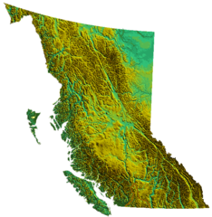
Map & Images (more maps)
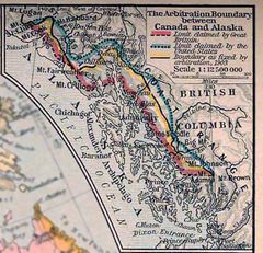
1926 Canada Alaska 1903 Boundary Map
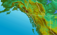
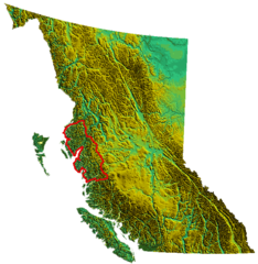
Alaska Panhandle Relief
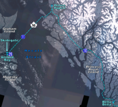
Bc Ferries Zone Five
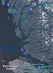
Bc Ferries Zone Four
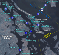
Bc Ferries Zone One
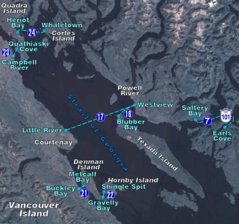
Bc Ferries Zone Three
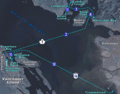
Bc Ferries Zone Two
Bc Blank 3
Bc Blank
Bc Canada Province
Bc Outline

Bc Relief Camelsfootrange
Bc Relief Canadiancascades

Bc Relief Cariboomtns
Bc Relief Cayooshrange
Bc Relief Chilcotinranges
Bc Relief Clearrange
Bc Relief Garibaldiranges
Bc Relief Kitimatranges

Bc Relief Lillooetranges
