Yukon, Yukon
Yukon: territory of Canada
About
State Snapshot
Yukon at a glance
Yukon currently has 2 quality-checked populated place pages and 0 county pages linked on MapSof.
Mapped cities & towns
2
These counts use a stricter populated-place filter so the main lists stay focused on real city and town pages.
County pages
0
Open related pagesLargest city
WhitehorsePopulation 25,085
Top linked places
Quick Facts about Yukon
| Population | 42,052 |
| Country | Canada |
| State | Yukon (Canada) |
| Postal code | Y |
| Area | 482443 km2 |
| Official name | Yukon Territory, Yukon, Yukon |
| Water as percent of area | 1.7% |
| Land as percent of area | 98.3% |
| Continent | North America |
| Easternmost point | Point(-123.81 60.0) |
| Northernmost point | Point(-139.076388888 69.585833333) |
| Latitude & Longitude | 62.9996,-135.0040 |
| Legislative body | Legislature of Yukon |
| Named for | Yukon River |
| Official language | Gwich’in, English |
| Capital | Whitehorse |
| Establishment | January 01, 1898 (128 years ago) |
| Time Zone | Pacific Time Zone |
| Local time | 09:18:54 (30th June 2026) |
Geography
Yukon is located at 62°59'59"N 135°0'15"W (62.99961549, -135.004040644). It has 7 neighbors: North Slope Borough, Southeast Fairbanks Census Area, Valdez Cordova Census Area, Yukon Koyukuk Census Area, Alaska, British Columbia and Northwest Territories.
Yukon map
Click "full screen"  icon to open full mode. View satellite images
Largest Cities in Yukon
Cities, Towns, Villages, Neighborhoods & Other Populated Places in Yukon.
| City Name | County | Population |
|---|---|---|
| Whitehorse | 25,085 | |
| Haines Junction | 1,148 |
Official website of Yukon
Official WebsiteDemographics
| Year | Population | % Change | Method |
|---|---|---|---|
| 1901 | 27,219 | - | census |
| 1911 | 8,512 | -219.77% | census |
| 1921 | 4,157 | -104.76% | census |
| 1931 | 4,230 | 1.73% | census |
| 1941 | 4,914 | 13.92% | census |
| 1951 | 9,096 | 45.98% | census |
| 1956 | 12,190 | 25.38% | census |
| 1961 | 14,628 | 16.67% | census |
| 1966 | 14,382 | -1.71% | census |
| 1971 | 18,388 | 21.79% | census |
| 1976 | 21,836 | 15.79% | census |
| 2011 | 33,897 | 35.58% | census |
| 2015 | 36,589 | 7.36% | estimation process |
| 2016 | 35,874 | -1.99% | census |
| 2017 | 38,669 | 7.23% | estimation process |
| 2020 | 42,052 | 8.04% | estimation process |
Yukon Territory
Yukon Counties
| County Name | Population |
|---|
Map & Images (more maps)

Loacation Map of Yukon
1291 x 1631
- 129,194k -
png
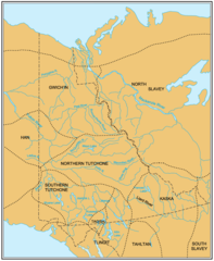
Nation Languages Map of Yukon
814 x 991
- 72,503k -
png

Physical Land Map of Yukon
1061 x 1294
- 107,955k -
png

Vegetation Map of Yukon
1245 x 1522
- 125,381k -
png