Phoenician Trade Routes and Colonies in the Mediterranean (1500-300 BC)
The Masters of the Mediterranean
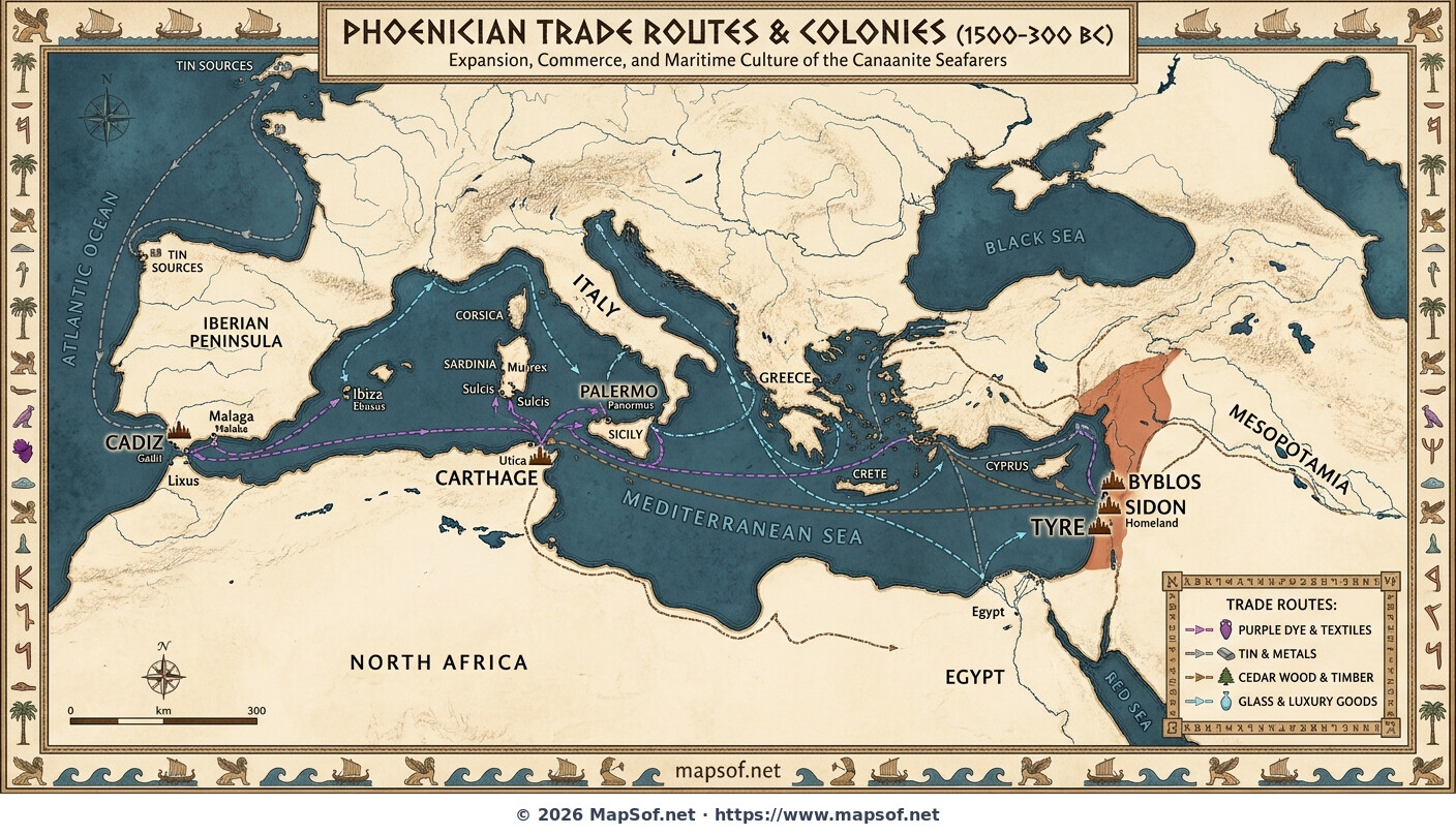
This historical map illustrates the extensive maritime network established by the Phoenicians between 1500 and 300 BC. Originating from the Levantine coast, the map highlights their ancestral homeland cities of Tyre, Sidon, and Byblos. These powerful city-states became the epicenter of ancient navigation, driving an era of unprecedented commercial expansion across the "Great Sea," rendered here with ancient-style coastlines and decorative Phoenician script elements.
Colonial Expansion Westward
Driven by the search for resources and markets, Phoenician mariners established strategic settlements far from home. The map marks major colonies that grew into dominant powers, most notably the mighty city of Carthage in North Africa. It also shows crucial outposts like Cadiz (Gadir) beyond the Pillars of Hercules in Iberia, and Palermo in Sicily, demonstrating the vast reach of their influence across the Mediterranean basin.
A Network of Commodities
The distinct trade routes depicted visualize the flow of highly valued goods that fueled ancient economies. The map traces long-distance commerce for precious tin from the Atlantic, the famous Tyrian purple dye derived from sea snails, prized Lebanese cedar wood used for shipbuilding and temples, and intricate glass wares. This complex web of commerce connected diverse cultures and solidified the Phoenicians' legacy as the premier merchants of antiquity.
More World Static Maps

Ottoman Empire Map: Imperial Height & Decline (1683)

US State Name Origins: An Etymological Map

World GDP by Country 2025 Map: Top Economies and Global Economic Scale

Projected 2025 World Map: International Tourist Arrivals

Hours of Work for a Pizza: Global Minimum Wage vs Big Mac (2024)

Projected World Population Density 2025 Heat Map

Mongol Empire 1279 Map: The Four Khanates at Their Peak

Caffeine Wars: Coffee vs. Tea Consumption by Country (Per Capita)

Where Sheep and Cattle Outnumber People (Global Ratios)

World Map: Distribution of Major Language Families

Map of Alexander the Great's Conquests (334–323 BC)

Most Common First Names in Europe – Country-by-Country Map

World Map: Coffee Production by Country & The Coffee Belt

Where the UK Has Resident Embassies and High Commissions (2026)

Global Internet Connectivity Map: 2025 Projected Penetration Rates

World Map of Major Tectonic Plates, Boundaries, and Geohazards

World Map: Projected Proven Oil Reserves by Country, 2025

Dominant Electricity Sources Worldwide 2025 Forecast Map

2025 Global Happiness Index Map: Country Rankings & Scores

Global Ocean Currents Map: Warm, Cold, and Thermohaline Circulation

World Map: Deforestation Rates and Forest Cover (Last Decade)

Cold War Map 1980: NATO vs Warsaw Pact & Iron Curtain

Achaemenid Persian Empire Map 500 BC: Satrapies Under Darius I

Projected 2025 World Map: Renewable Electricity Percentage by Country

World Adult Literacy Rates Map 2025 Forecast

Global Seismic Activity Map: Major Earthquake Zones & The Ring of Fire

Projected World Migration Flows 2025 Map

Projected World CO2 Emissions Per Capita Map 2025

Age of Discovery: Voyages of Columbus, da Gama, Magellan & Drake
