Global Ocean Currents Map: Warm, Cold, and Thermohaline Circulation
Mapping Earth's Circulatory System
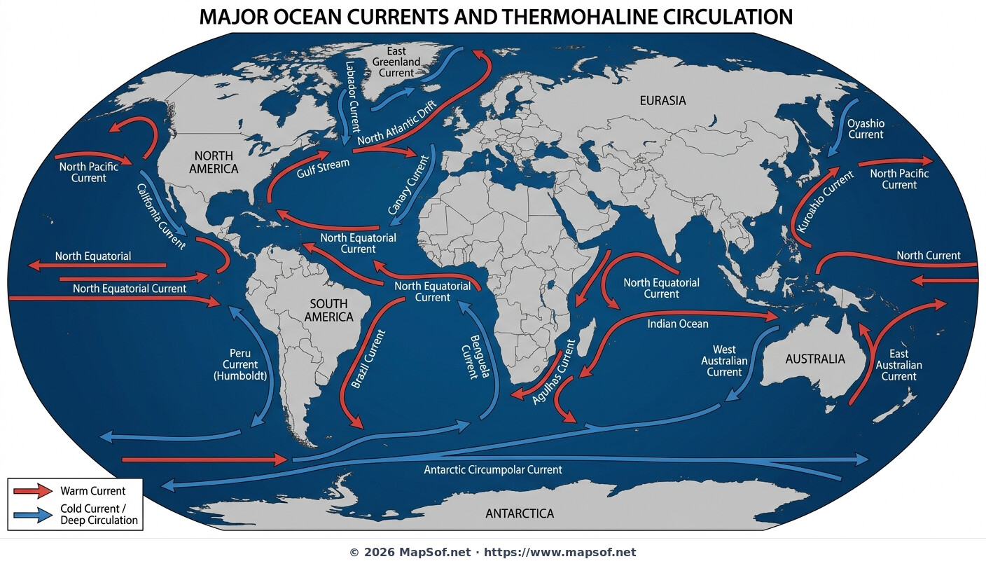
This world map provides a comprehensive visualization of major ocean currents, acting as the Earth's global circulatory system. Against a deep blue ocean background, surface currents are explicitly labeled and color-coded for temperature. Red arrows indicate warm currents originating near the equator and moving poleward, while blue arrows signify cold currents flowing from high latitudes towards the tropics. A clear legend assists in distinguishing between these thermal flows.
Climate Regulators and Global Flow
These currents play a pivotal role in regulating global climate and weather patterns by redistributing massive amounts of heat around the planet. The map highlights crucial warm flows like the Gulf Stream in the Atlantic and the Kuroshio Current in the Pacific, which moderate temperatures in adjacent landmasses. Conversely, cold currents like the Labrador and Benguela bring cooler conditions and usually nutrient-rich waters to different coastal regions.
The Global Conveyor Belt
Beyond surface flows, this map illustrates the complex thermohaline circulation, often referred to as the "global conveyor belt." This slow, deep-ocean circulation is driven by differences in water density, which are controlled by temperature (thermo) and salinity (haline). Understanding these interconnected surface and deep-water systems is essential for grasping how oceans influence everything from marine ecosystems to long-term climate trends.
More World Static Maps

Ottoman Empire Map: Imperial Height & Decline (1683)

US State Name Origins: An Etymological Map

World GDP by Country 2025 Map: Top Economies and Global Economic Scale

Projected 2025 World Map: International Tourist Arrivals

Hours of Work for a Pizza: Global Minimum Wage vs Big Mac (2024)

Projected World Population Density 2025 Heat Map

Mongol Empire 1279 Map: The Four Khanates at Their Peak

Caffeine Wars: Coffee vs. Tea Consumption by Country (Per Capita)

Where Sheep and Cattle Outnumber People (Global Ratios)

World Map: Distribution of Major Language Families

Map of Alexander the Great's Conquests (334–323 BC)

Most Common First Names in Europe – Country-by-Country Map

World Map: Coffee Production by Country & The Coffee Belt

Where the UK Has Resident Embassies and High Commissions (2026)

Global Internet Connectivity Map: 2025 Projected Penetration Rates

World Map of Major Tectonic Plates, Boundaries, and Geohazards

World Map: Projected Proven Oil Reserves by Country, 2025

Dominant Electricity Sources Worldwide 2025 Forecast Map

2025 Global Happiness Index Map: Country Rankings & Scores

Global Ocean Currents Map: Warm, Cold, and Thermohaline Circulation

World Map: Deforestation Rates and Forest Cover (Last Decade)

Cold War Map 1980: NATO vs Warsaw Pact & Iron Curtain

Achaemenid Persian Empire Map 500 BC: Satrapies Under Darius I

Projected 2025 World Map: Renewable Electricity Percentage by Country

World Adult Literacy Rates Map 2025 Forecast

Global Seismic Activity Map: Major Earthquake Zones & The Ring of Fire

Projected World Migration Flows 2025 Map

Projected World CO2 Emissions Per Capita Map 2025

Age of Discovery: Voyages of Columbus, da Gama, Magellan & Drake
