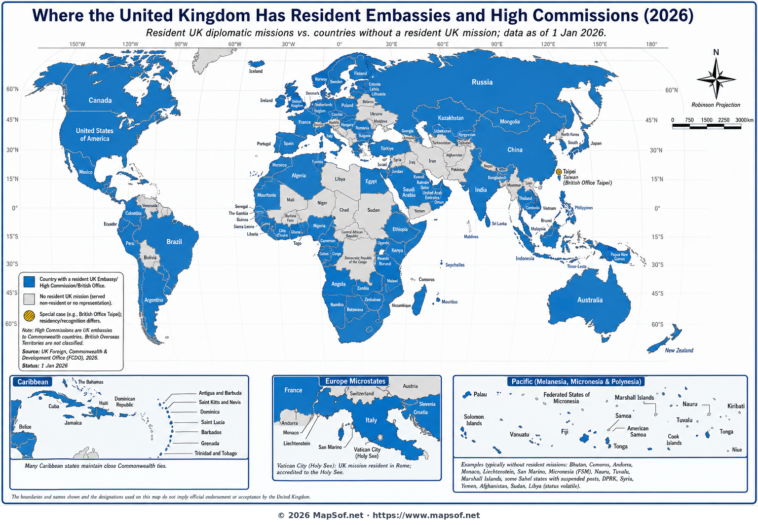
Where the UK Has Resident Embassies and High Commissions (2026)
This world map highlights, as of 2026, where the United Kingdom maintains a resident diplomatic presence—either an embassy or a high commission—and distinguishes them from countries served non-residently or without a resident UK mission. Using a clear two-color scheme, the visualization offers a fast, authoritative overview of the UK’s on-the-ground diplomatic network across every region.
High Commissions (used in Commonwealth countries) are treated as equivalent to embassies, reflecting the UK’s practice, while consulates alone do not qualify unless they function as the resident primary mission. Special care is taken with microstates and unique cases: the Holy See is shown as represented despite all foreign embassies being physically located in Rome, and Taipei is annotated to indicate the UK’s British Office Taipei, a de facto mission in a non-recognized state. Insets for the Caribbean and Pacific ensure small states are legible, and notes flag countries where missions have been suspended or are handled from nearby capitals due to security or political conditions.
Why this map matters
Resident embassies and high commissions signal deeper bilateral engagement, consular availability, and sustained diplomatic capacity. By distinguishing resident from non-resident coverage, this map helps researchers, travelers, and policy analysts quickly understand where the UK is physically present, and where diplomatic ties are maintained from afar. It also clarifies common misconceptions—embassies represent the United Kingdom, not England—and underscores the fluidity of representation in conflict-affected states.
More World Static Maps

Ottoman Empire Map: Imperial Height & Decline (1683)

US State Name Origins: An Etymological Map

World GDP by Country 2025 Map: Top Economies and Global Economic Scale

Projected 2025 World Map: International Tourist Arrivals

Hours of Work for a Pizza: Global Minimum Wage vs Big Mac (2024)

Projected World Population Density 2025 Heat Map

Mongol Empire 1279 Map: The Four Khanates at Their Peak

Caffeine Wars: Coffee vs. Tea Consumption by Country (Per Capita)

Where Sheep and Cattle Outnumber People (Global Ratios)

World Map: Distribution of Major Language Families

Map of Alexander the Great's Conquests (334–323 BC)

Most Common First Names in Europe – Country-by-Country Map

World Map: Coffee Production by Country & The Coffee Belt

Where the UK Has Resident Embassies and High Commissions (2026)

Global Internet Connectivity Map: 2025 Projected Penetration Rates

World Map of Major Tectonic Plates, Boundaries, and Geohazards

World Map: Projected Proven Oil Reserves by Country, 2025

Dominant Electricity Sources Worldwide 2025 Forecast Map

2025 Global Happiness Index Map: Country Rankings & Scores

Global Ocean Currents Map: Warm, Cold, and Thermohaline Circulation

World Map: Deforestation Rates and Forest Cover (Last Decade)

Cold War Map 1980: NATO vs Warsaw Pact & Iron Curtain

Achaemenid Persian Empire Map 500 BC: Satrapies Under Darius I

Projected 2025 World Map: Renewable Electricity Percentage by Country

World Adult Literacy Rates Map 2025 Forecast

Global Seismic Activity Map: Major Earthquake Zones & The Ring of Fire

Projected World Migration Flows 2025 Map

Projected World CO2 Emissions Per Capita Map 2025

Age of Discovery: Voyages of Columbus, da Gama, Magellan & Drake
