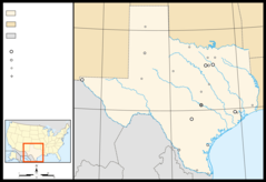
Texas, US
Texas: This southern US state shares a border with Mexico, and its major cities include Houston, San Antonio, Dallas, and the capital, Austin.
About
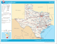
Texas is the second largest U.S. state, located in the South Central region. It borders Mexico, New Mexico, Oklahoma, Arkansas and Louisiana. Texas is known for its cowboy culture, oil industry, vast landscape, and independent spirit.
Some key facts about Texas:
- Capital: Austin
- Population: Around 29 million (second most populous state)
- Area: 268,597 square miles (second largest state)
- Nickname: The Lone Star State
Texas features diverse geography including forested hills and mountains, fertile plains, rugged deserts, swamps and coastline along the Gulf of Mexico. Iconic sites include the Alamo, Big Bend National Park and South Padre Island.
Major cities include Houston, San Antonio, Dallas and El Paso. The economy revolves around oil/gas, ranching, tech and aerospace industries. Texans have a reputation for stubborn pride in their state’s size and heritage.
Texas culture blends Southern, cowboy and Mexican influences. Festivals celebrate barbeque, cowboy life and Latin American traditions. Sports are also a major passion, especially football.
The climate varies from arid deserts to humid, subtropical coastline. Summers are blistering hot while winters range from mild to freezing depending on region.
In summary, Texas represents rugged individualism through its expansive lands, iconic cowboy legacy, Southern hospitality, and bold confidence. Everything’s bigger in Texas, from its personality to its landscape.

State Snapshot
Texas at a glance
Texas currently has 1,357 quality-checked populated place pages and 254 county pages linked on MapSof.
Mapped cities & towns
1,357
These counts use a stricter populated-place filter so the main lists stay focused on real city and town pages.
County pages
254
Open related pagesLargest city
HoustonPopulation 2,316,120
Top linked places
Quick Facts about Texas
| Population | 29,360,759 |
| Country | United States of America |
| Area | 696241 km2 |
| Water as percent of area | 2.74% |
| Land as percent of area | 97.26% |
| Continent | North America |
| Easternmost point | Point(-93.507969 31.031078) |
| Northernmost point | Point(-103.00228 36.5004) |
| Latitude & Longitude | 31.2504,-99.2506 |
| Legislative body | Texas Legislature |
| Named for | friend |
| Altitude | 1,706 feet / 520 meters |
| Capital | Austin |
| Establishment | December 29, 1845 (180 years ago) |
| Time Zone | America/Chicago, UTC−06:00, Central Time Zone |
| Local time | 08:19:25 (24th July 2026) |
| Weather | 94℉ Sunny 7-days weather |

Geography
Texas is located at 31°15'2"N 99°15'2"W (31.2504400, -99.2506100). It has 8 neighbors: Estado de Tamaulipas, Estado de Nuevo Leon, Estado de Coahuila de Zaragoza, Estado de Chihuahua, Arkansas, Louisiana, Oklahoma and New Mexico.
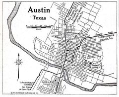
Texas map
The largest city of Texas is Houston with a population of 2,316,120. Other cities include, San Antonio population 1,567,118, Dallas population 1,343,266, Austin population 995,484 and Fort Worth population 927,720. See all Texas cities & populated places.
Largest Cities in Texas (more)
Cities, Towns, Villages, Neighborhoods & Other Populated Places in Texas.
| City Name | County | Population |
|---|---|---|
| Houston | Harris | 2,316,120 |
| San Antonio | Bexar | 1,567,118 |
| Dallas | Dallas | 1,343,266 |
| Austin | Travis | 995,484 |
| Fort Worth | Tarrant | 927,720 |
| Montopolis | Travis | 912,791 |
| El Paso | El Paso | 681,534 |
| Arlington | Tarrant | 398,864 |
| Corpus Christi | Nueces | 327,248 |
| Plano | Collin | 291,296 |
| Laredo | Webb | 263,640 |
| Lubbock | Lubbock | 262,611 |
| Irving | Dallas | 240,916 |
| Frisco | Collin | 209,980 |
| McKinney | Collin | 208,272 |
| Grand Prairie | Dallas | 195,272 |
Show more Texas cities and populated places
Weather
Sunny, with a high near 94. South southeast wind around 10 mph.
7-Day ForecastOfficial website of Texas
Official Website- Hockley County
- Armstrong County
- Nolan County
- Knox County
- Lavaca County
- Upshur County
- Anderson County
- Terry County
- Cooke County
- Collingsworth County
- Stonewall County
- Garza County
- Sutton County
- Ellis County
- Motley County
- San Patricio County
- Bandera County
- Maverick County
- Deaf Smith County
- Duval County
- Cass County
- Bowie County
- Hudspeth County
- Medina County
- Karnes County
- Guadalupe County
- Wilson County
- Coleman County
- Fayette County
- Madison County
- Navarro County
- Live Oak County
- Montague County
- Dimmit County
- Aransas County
- Rains County
- Calhoun County
- Henderson County
- Kenedy County
- Trinity County
- Cameron County
- Austin County
- Foard County
- Scurry County
- Palo Pinto County
- Presidio County
- Kendall County
- Kent County
- King County
- Brazos County
- Williamson County
- Washington County
- Menard County
- Cherokee County
- Tarrant County
- Coke County
- Uvalde County
- Upton County
- Wharton County
- Jasper County
- Oldham County
- Jack County
- Comal County
- Burnet County
- Fannin County
- Sherman County
- Rusk County
- Jackson County
- Marion County
- Angelina County
- Burleson County
- Falls County
- Kaufman County
- Zapata County
- Starr County
- DeWitt County
- Hardeman County
- San Saba County
- Ward County
- Midland County
- Comanche County
- Crane County
- Throckmorton County
- Haskell County
- Galveston County
- Kimble County
- Swisher County
- Mitchell County
- Hidalgo County
- Floyd County
- Liberty County
- El Paso County
- Lipscomb County
- Lamb County
- Rockwall County
- Winkler County
- Borden County
- Jones County
- Crockett County
- Young County
- Archer County
- Terrell County
- Val Verde County
- Mills County
- Randall County
- Donley County
- Baylor County
- McLennan County
- Delta County
- Howard County
- Kinney County
- Lampasas County
- Stephens County
- Hardin County
- Hunt County
- Titus County
- Newton County
- Coryell County
- Kleberg County
- Blanco County
- Concho County
- Hopkins County
- Irion County
- Waller County
- Jeff Davis County
- Willacy County
- Chambers County
- Refugio County
- Sabine County
- Hood County
- Shackelford County
- Dallas County
- San Jacinto County
- Matagorda County
- Shelby County
- Glasscock County
- Jim Hogg County
- Parmer County
- Caldwell County
- La Salle County
- Wheeler County
- Brewster County
- Fisher County
- Wood County
- Gray County
- Lamar County
- Andrews County
- Milam County
- Wichita County
- Yoakum County
- Brooks County
- Hale County
- Johnson County
- Tyler County
- Carson County
- Llano County
- Hall County
- Hill County
- Roberts County
- Harrison County
- Tom Green County
- Taylor County
- Ochiltree County
- Hutchinson County
- Pecos County
- Loving County
- Walker County
- Robertson County
- Erath County
- Culberson County
- Bastrop County
- Reagan County
- Runnels County
- Bosque County
- Franklin County
- Gonzales County
- Freestone County
- Schleicher County
- Orange County
- Grimes County
- Hamilton County
- Victoria County
- Colorado County
- Cochran County
- Red River County
- Travis County
- Lynn County
- Leon County
- Reeves County
- Bell County
- Real County
- Briscoe County
- Somervell County
- Edwards County
- Nueces County
- Brazoria County
- Atascosa County
- Houston County
- Mason County
- Gregg County
- Crosby County
- Bailey County
- Gaines County
- Panola County
- McMullen County
- Jefferson County
- Moore County
- Martin County
- Childress County
- Morris County
- Limestone County
- Eastland County
- Potter County
- Gillespie County
- Parker County
- Hays County
- Clay County
- Hartley County
- Zavala County
- Wise County
- Nacogdoches County
- Grayson County
- Frio County
- Ector County
- McCulloch County
- Sterling County
- Hemphill County
- Harris County
- San Augustine County
- Lubbock County
- Goliad County
- Dawson County
- Hansford County
- Webb County
- Dallam County
- Cottle County
- Wilbarger County
- Brown County
- Bee County
- Callahan County
- Kerr County
- Denton County
- Jim Wells County
- Camp County
- Lee County
- Castro County
- Bexar County
- Smith County
- Dickens County
- Van Zandt County
- Fort Bend County
- Polk County
- Montgomery County
- Collin County
Demographics
| Year | Population | % Change | Method |
|---|---|---|---|
| 1910 | 3,896,542 | - | census |
| 1920 | 4,663,228 | 16.44% | census |
| 1930 | 5,824,715 | 19.94% | census |
| 1940 | 6,414,824 | 9.2% | census |
| 1950 | 7,711,194 | 16.81% | census |
| 1960 | 9,579,677 | 19.5% | census |
| 1970 | 11,196,730 | 14.44% | census |
| 1980 | 14,229,191 | 21.31% | census |
| 1990 | 16,986,510 | 16.23% | census |
| 2000 | 20,851,820 | 18.54% | census |
| 2010 | 25,145,561 | 17.08% | census |
| 2011 | 25,645,629 | 1.95% | estimation process |
| 2012 | 26,084,481 | 1.68% | estimation process |
| 2013 | 26,480,266 | 1.49% | estimation process |
| 2014 | 26,964,333 | 1.8% | estimation process |
| 2015 | 27,470,056 | 1.84% | estimation process |
| 2016 | 27,914,410 | 1.59% | estimation process |
| 2017 | 28,295,273 | 1.35% | estimation process |
| 2018 | 28,628,666 | 1.16% | estimation process |
| 2019 | 28,995,881 | 1.27% | estimation process |
| 2020 | 29,360,759 | 1.24% | estimation process |
People born in Texas (200)
People born in Texas, including murderer Stagger Lee Shelton, musician Camila Grey, bass player and music producer Dennis Ward, .
More notable people
- Charles Forgy (American computer scientist) he was born in 12/12/1949
- Scott Joplin (American composer, musician, and pianist) he was born in 24/11/1868
- Tom Tall (American singer) he was born in 27/12/1937
- Ed Sprinkle (American football player (1923-2014)) he was born in 03/09/1923
- Katie Featherston (American actress) she was born in 20/10/1982
- Lori Singer (American actress) she was born in 06/11/1957
- Cindy Walker (American singer-songwriter) she was born in 20/07/1918
- Lon L. Fuller (American philosopher of law) he was born in 15/06/1902
- McKaley Miller (actress) she was born in 14/05/1996
- Aaron Vale he was born in 06/11/1968
- Robert McFarlane (United States Marine Corps officer) he was born in 12/07/1937
- Washington Phillips (American musician) he was born in 11/01/1880
- Akira Rabelais (American musician) he was born in 28/03/1966
- Robert Bass (American businessman) he was born in 01/01/1948
- Thomas Ambrose Tschoepe (Bishop of San Angelo, Bishop of Dallas) he was born in 17/12/1915
- Helen Donath (American soprano) she was born in 10/07/1940
- Libba Bray (American teen writer) she was born in 11/03/1964
- John Hemphill (American politician (1803-1862)) he was born in 18/12/1803
Other places with the same name (2)
- Texas, Pennsylvania township in Wayne County, Pennsylvania with a population of 2,417 people.
- Texas, Ohio city in United States of America with a population of 366 people.
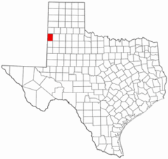
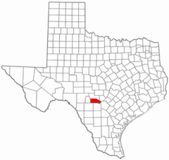
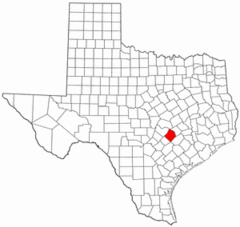
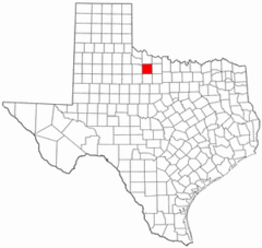
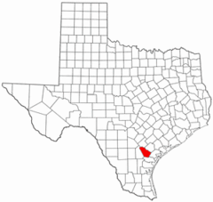
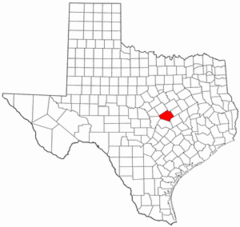
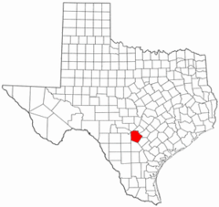
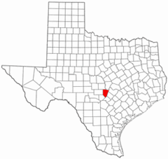
Texas Counties (more)
Harris County

county in Texas, United States
Dallas County

county in Texas, United States
Tarrant County

county in Texas, United States
| County Name | Population |
|---|---|
| Harris County | 4,738,253 |
| Dallas County | 2,635,888 |
| Tarrant County | 2,123,347 |
| Bexar County | 2,026,823 |
| Travis County | 1,300,503 |
| Collin County | 1,072,069 |
| Denton County | 919,324 |
| Hidalgo County | 875,200 |
| El Paso County | 841,286 |
| Fort Bend County | 839,706 |
| Montgomery County | 626,351 |
| Williamson County | 617,855 |
| Cameron County | 424,180 |
| Brazoria County | 380,518 |
| Bell County | 369,927 |
| Nueces County | 363,148 |
Show more Texas counties
Map & Images (more maps)
Map of Texas Na 1
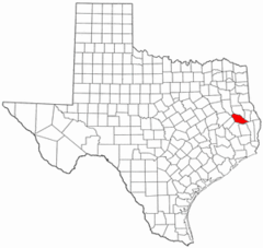
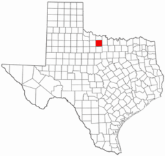
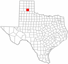
Anderson County Texas
Andrews County Texas
Angelina County Texas
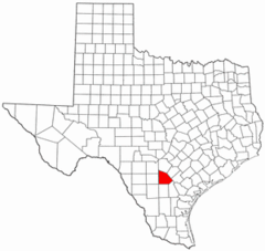
Aransas County Texas
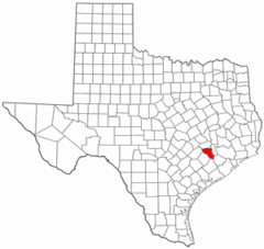
Archer County Texas
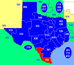
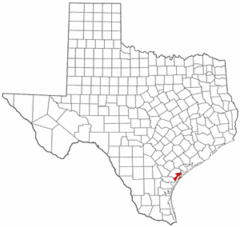
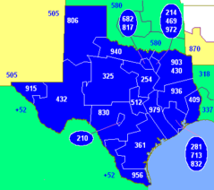
Area Code 956
Area Codes Tx
Armstrong County Texas
Atascosa County Texas
Austin County Texas
Austin Tx 1920 Map
Bailey County Texas
Bandera County Texas
Bastrop County Texas
Baylor County Texas
Bee County Texas
Bell County Texas
Bexar County Texas
Blanco County Texas