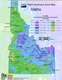
Idaho, US
Idaho: This northwestern U.S. state shares borders with six other states and Canada.
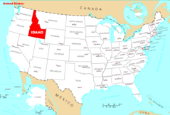
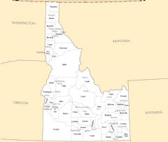
Idaho covers 83,570 square miles of varied terrain including the Rocky Mountains, Snake River Plain and Columbia River Plateau. It shares borders with Washington, Oregon, Nevada, Utah, Wyoming and Montana.
The climate is generally dry with cold winters and warm summers in southern Idaho and cooler temps in the north.
Economy and Industry
Major industries important to Idaho's economy include agriculture, food processing, lumber, tourism and technology. Key agricultural products are cattle, dairy, potatoes and wheat. Idaho's lush forests support lumber and wood industries. Popular tourist destinations include Sun Valley ski resort and Lake Coeur d’Alene.
High tech firms are growing in cities like Boise. Micron Technology, a semiconductor company, is a leading employer. The Idaho National Laboratory conducts nuclear energy research.
Culture and Demographics
Idaho has about 1.8 million residents. The population is predominantly white with Hispanic/Latino being the largest minority group. Mormon cultural influences can be seen in eastern Idaho.
Government and Politics
The capital and largest city is Boise. The current governor is Brad Little, a Republican. Idaho generally favors conservative policies and votes Republican in national elections.
In summary, Idaho offers great natural beauty through mountains, rivers and forests. Agriculture and lumber thrive thanks to the climate and land. A burgeoning high-tech sector balances Idaho's traditional farming and mining roots.

State Snapshot
Idaho at a glance
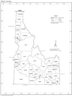
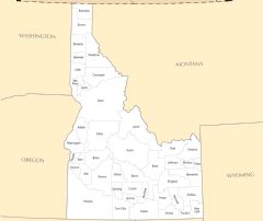
Idaho currently has 80 quality-checked populated place pages and 44 county pages linked on MapSof.
Mapped cities & towns
80
These counts use a stricter populated-place filter so the main lists stay focused on real city and town pages.
County pages
44
Open related pagesLargest city
BoisePopulation 228,959
Top linked places
Quick Facts about Idaho
| Population | 1,787,065 |
| Country | United States of America |
| Phone Area Codes | 208 |
| Area | 216699 km2 |
| Water as percent of area | 1.11% |
| Land as percent of area | 98.89% |
| Latitude & Longitude | 44.5002,-114.2512 |
| Legislative body | Idaho Legislature |
| Official language | English |
| Altitude | 5,000 feet / 1524 meters |
| Capital | Boise |
| Establishment | July 03, 1890 (136 years ago) |
| Time Zone | UTC−08:00, America/Denver, UTC−07:00 |
| Local time | 03:57:23 (23rd September 2026) |
| Weather | 39℉ Chance Rain Showers then Mostly Cloudy 7-days weather |

Geography
Idaho is located at 44°30'1"N 114°15'4"W (44.5002000, -114.2511800). It has 7 neighbors: Nevada, Utah, Montana, Oregon, Washington, Wyoming and British Columbia.
Idaho map
 icon to open full mode. View satellite images
The largest city of Idaho is Boise with a population of 228,959. Other cities include, Meridian population 114,161, Nampa population 99,277, Idaho Falls population 62,888 and Caldwell population 58,481. See all Idaho cities & populated places.
Largest Cities in Idaho (more)
Cities, Towns, Villages, Neighborhoods & Other Populated Places in Idaho.
| City Name | County | Population |
|---|---|---|
| Boise | Ada | 228,959 |
| Meridian | Ada | 114,161 |
| Nampa | Canyon | 99,277 |
| Idaho Falls | Bonneville | 62,888 |
| Caldwell | Canyon | 58,481 |
| Pocatello | Bannock | 56,637 |
| Coeur d'Alene | Kootenai | 52,414 |
| Twin Falls | Twin Falls | 50,197 |
| Post Falls | Kootenai | 36,250 |
| Lewiston | Nez Perce | 32,788 |
| Eagle | Ada | 29,796 |
| Rexburg | Madison | 29,400 |
| Moscow | Latah | 25,702 |
| Kuna | Ada | 22,257 |
| Ammon | Bonneville | 17,115 |
| Chubbuck | Bannock | 15,588 |
Show more Idaho cities and populated places
Weather
A chance of rain showers before midnight. Mostly cloudy, with a low around 39. Southwest wind 3 to 7 mph. Chance of precipitation is 30%.
7-Day ForecastOfficial website of Idaho
Official Website- Franklin County
- Latah County
- Gem County
- Boundary County
- Jefferson County
- Benewah County
- Bonner County
- Idaho County
- Custer County
- Camas County
- Butte County
- Teton County
- Twin Falls County
- Minidoka County
- Bingham County
- Caribou County
- Clearwater County
- Payette County
- Bannock County
- Lincoln County
- Adams County
- Oneida County
- Ada County
- Fremont County
- Bear Lake County
- Kootenai County
- Lewis County
- Jerome County
- Gooding County
- Shoshone County
- Power County
- Madison County
- Clark County
- Cassia County
- Nez Perce County
- Boise County
- Washington County
- Blaine County
- Canyon County
- Lemhi County
- Valley County
- Bonneville County
- Elmore County
- Owyhee County
Demographics
| Year | Population | % Change | Method |
|---|---|---|---|
| 1910 | 325,594 | - | census |
| 1920 | 431,866 | 32.64% | census |
| 1930 | 445,032 | 3.05% | census |
| 1940 | 524,873 | 17.94% | census |
| 1950 | 588,637 | 12.15% | census |
| 1960 | 667,191 | 13.35% | census |
| 1970 | 712,567 | 6.8% | census |
| 1980 | 943,935 | 32.47% | census |
| 1990 | 1,006,749 | 6.65% | census |
| 2000 | 1,293,953 | 28.53% | census |
| 2010 | 1,567,582 | 21.15% | census |
| 2011 | 1,583,910 | 1.04% | estimation process |
| 2012 | 1,595,324 | 0.72% | estimation process |
| 2013 | 1,611,206 | 1% | estimation process |
| 2014 | 1,631,112 | 1.24% | estimation process |
| 2015 | 1,651,059 | 1.22% | estimation process |
| 2016 | 1,682,380 | 1.9% | estimation process |
| 2017 | 1,717,715 | 2.1% | estimation process |
| 2018 | 1,750,536 | 1.91% | estimation process |
| 2019 | 1,787,065 | 2.09% | estimation process |
People born in Idaho (63)
People born in Idaho, including politician Phil Batt, paleontologist Donald E. Russell, artist and philanthropist Lillian Disney, .
More notable people
- Christina Dodd (American writer) she was born in 14/07/1957
- Steven E. Jones (physicist) he was born in 25/03/1949
- J. D. Cannon (American actor) he was born in 24/04/1922
- Carl Eldon Bond (American ichthyologist) he was born in 11/09/1920
- Glen Robinson (American special and visual effects artist) he was born in 20/09/1914
- Ezra Taft Benson (President of The Church of Jesus Christ of Latter-day Saints (1899-1994)) he was born in 04/08/1899
- Jack E. McLaughlin (American mathematician) he was born in 17/08/1923
- Vardis Fisher (Novelist, essayist) he was born in 31/03/1895
- Douglas Crimp (American art critic) he was born in 18/08/1944
- Doseone (American rapper, producer, poet and artist) he was born in 21/04/1977
- Francis Anthony Dahlen he was born in 05/12/1942
- Amanda Moore (American model) she was born in 10/09/1979
- Jake Pitts (American musician and record producer) he was born in 21/08/1985
- Robert J. Lamphere (FBI agent) he was born in 14/02/1918
- Laurel Thatcher Ulrich (American historian) she was born in 11/07/1938
- Brian Kibler (American player of Magic: The Gathering) he was born in 07/09/1980
- Christopher Farnsworth (American writer) he was born in 01/01/1971
- David R. Hogg (United States Army general) he was born in 01/12/1958
Idaho Counties (more)
Ada County

county in Idaho, United States.
Canyon County

county in Idaho, United States.
Kootenai County

county in Idaho, United States.
| County Name | Population |
|---|---|
| Ada County | 481,587 |
| Canyon County | 229,849 |
| Kootenai County | 165,697 |
| Bonneville County | 119,062 |
| Bannock County | 87,808 |
| Twin Falls County | 86,878 |
| Bingham County | 46,811 |
| Bonner County | 45,739 |
| Nez Perce County | 40,408 |
| Latah County | 40,108 |
| Madison County | 39,907 |
| Jefferson County | 29,871 |
| Elmore County | 27,511 |
| Jerome County | 24,412 |
| Cassia County | 24,030 |
| Payette County | 23,951 |
Show more Idaho counties
Map & Images (more maps)
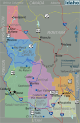
Idaho Regions Map
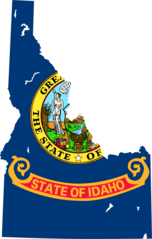
Idaho Flag Map
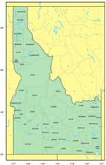
Counties Map of Idaho

Idaho Relief Map
Where Is Idaho Located
Idaho Counties Map
Idaho Cities And Towns
Idaho County Map
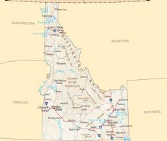
Idaho Reference Map
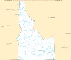
Idaho Rivers And Lakes