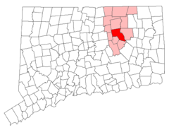
Connecticut, US
Connecticut: Located in the New England region of the northeastern United States, this state is home to cities such as Hartford, its capital, and New Haven.
Connecticut is a small New England state located in the northeastern United States. It is bordered by Rhode Island, Massachusetts, New York, and Long Island Sound.
Some key facts about Connecticut:
- Capital: Hartford
- Population: Around 3.6 million
- Area: 5,543 square miles (48th largest state)
- Nickname: The Constitution State
Connecticut has a landscape of forests, rivers, coastline and rural countryside. Major rivers include the Connecticut and Housatonic. The state has four distinct seasons, with warm humid summers and winters with some snowfall.
Connecticut played an influential role in colonial America and the founding of the country. It was one of the 13 original colonies. Today, major industries include finance, insurance, manufacturing, and defense like helicopter production.
Connecticut is home to affluent commuter cities and suburban towns outside NYC like Greenwich and Stamford as well as rural countryside and coastal villages. New Haven and Yale University are cultural hubs.
Popular attractions include the U.S.S. Nautilus nuclear submarine, Mystic Seaport, Foxwoods Casino, wineries, museums, and seaside getaways. Connecticut also has an eclectic dining scene and many ethnic traditions.
In summary, Connecticut balances cosmopolitan cities, quaint villages, maritime heritage, and modern culture. Its coastal beauty, history, and proximity to New York City make it a prosperous place to live and visit.

State Snapshot
Connecticut at a glance
Connecticut currently has 187 quality-checked populated place pages and 8 county pages linked on MapSof.
Mapped cities & towns
187
These counts use a stricter populated-place filter so the main lists stay focused on real city and town pages.
County pages
8
Open related pagesLargest city
BridgeportPopulation 143,525
Top linked places
Quick Facts about Connecticut
| Population | 3,557,006 |
| Country | United States of America |
| Area | 14357 km2 |
| Water as percent of area | 12.65% |
| Land as percent of area | 87.35% |
| Continent | North America |
| Northernmost point | Point(-73.4325 42.0506) |
| Latitude & Longitude | 41.6670,-72.6665 |
| Legislative body | Connecticut General Assembly |
| Named for | Connecticut River |
| Altitude | 499 feet / 152 meters |
| Capital | Hartford |
| Establishment | January 09, 1788 (238 years ago) |
| Time Zone | Eastern Time Zone, America/New_York |
| Local time | 04:49:16 (19th September 2026) |

Geography
Connecticut is located at 41°40'1"N 72°39'59"W (41.6670400, -72.6664800). It has 3 neighbors: New York, Rhode Island and Massachusetts.
Connecticut map
 icon to open full mode. View satellite images
The largest city of Connecticut is Bridgeport with a population of 143,525. Other cities include, Stamford population 131,397, New Haven population 130,801, North Stamford population 128,278 and Hartford population 121,535. See all Connecticut cities & populated places.
Largest Cities in Connecticut (more)
Cities, Towns, Villages, Neighborhoods & Other Populated Places in Connecticut.
| City Name | County | Population |
|---|---|---|
| Bridgeport | Fairfield | 143,525 |
| Stamford | Fairfield | 131,397 |
| New Haven | New Haven | 130,801 |
| North Stamford | Fairfield | 128,278 |
| Hartford | Hartford | 121,535 |
| Waterbury | New Haven | 106,826 |
| Norwalk | Fairfield | 88,655 |
| East Norwalk | Fairfield | 84,530 |
| Danbury | Fairfield | 84,317 |
| New Britain | Hartford | 72,198 |
| West Hartford | Hartford | 62,868 |
| Greenwich | Fairfield | 62,769 |
| Fairfield | Fairfield | 62,215 |
| Hamden | New Haven | 60,294 |
| Bristol | Hartford | 59,734 |
| Meriden | New Haven | 58,981 |
Show more Connecticut cities and populated places
Official website of Connecticut
Official Website- Tolland County
- Hartford County
- Fairfield County
- New Haven County
- Litchfield County
- Windham County
- Middlesex County
- New London County
Demographics
| Year | Population | % Change | Method |
|---|---|---|---|
| 1910 | 1,114,756 | - | census |
| 1920 | 1,380,631 | 23.85% | census |
| 1930 | 1,606,903 | 16.39% | census |
| 1940 | 1,709,242 | 6.37% | census |
| 1950 | 2,007,280 | 17.44% | census |
| 1960 | 2,535,234 | 26.3% | census |
| 1970 | 3,031,709 | 19.58% | census |
| 1980 | 3,107,576 | 2.5% | census |
| 1990 | 3,287,116 | 5.78% | census |
| 2000 | 3,405,565 | 3.6% | census |
| 2010 | 3,574,097 | 4.95% | census |
| 2011 | 3,588,283 | 0.4% | estimation process |
| 2012 | 3,594,547 | 0.17% | estimation process |
| 2013 | 3,594,841 | 0.01% | estimation process |
| 2014 | 3,594,524 | -0.01% | estimation process |
| 2015 | 3,587,122 | -0.21% | estimation process |
| 2016 | 3,578,141 | -0.25% | estimation process |
| 2017 | 3,573,297 | -0.14% | estimation process |
| 2018 | 3,571,520 | -0.05% | estimation process |
| 2019 | 3,565,287 | -0.17% | estimation process |
| 2020 | 3,557,006 | -0.23% | estimation process |
People born in Connecticut (200)
People born in Connecticut, including economist Franklin Henry Giddings, Augustine Sackett, inventor David Bushnell, .
More notable people
- Tommy Godwin (English racing cyclist) he was born in 05/11/1920
- Aarti Mann (American actress) she was born in 03/03/1978
- Henry Chandler Cowles (American botanist (1869-1939)) he was born in 27/02/1869
- Jason Garfield (Juggler and Entertainer) he was born in 09/08/1974
- Chris Landreth (American animator) he was born in 04/08/1961
- David Dudley Field II (American politician (1805-1894)) he was born in 13/02/1805
- Bob Clearmountain (American record producer) he was born in 16/01/1953
- Leslie I. Carey (Sound engineer) he was born in 03/08/1895
- Julie Umerle (artist) she was born in 01/01/1950
- Mysterious Dave Mather (American sheriff) he was born in 10/08/1851
- Nancy McKinstry (American businesswoman) she was born in 04/01/1959
- Chris Impellitteri (American musician) he was born in 25/09/1964
- Neil Burger (American screenwriter) he was born in 01/01/1963
- Lorne Lanning (American art director) he was born in 20/03/1964
- William Williams (Signer of the US declaration of Independence (1731-1811)) he was born in 23/04/1731
- Asahel Nettleton (American theologian) he was born in 21/04/1783
- David Brainerd (Missionary in colonial North America) he was born in 20/04/1718
- Daniel Rose (American politician (1772-1833)) he was born in 31/07/1772
Connecticut Counties
Fairfield County

county in Connecticut, United States.
Hartford County

county in Connecticut, United States.
New Haven County

county in Connecticut, United States.
| County Name | Population |
|---|---|
| Fairfield County | 942,426 |
| Hartford County | 889,226 |
| New Haven County | 851,948 |
| New London County | 264,999 |
| Litchfield County | 179,610 |
| Middlesex County | 161,657 |
| Tolland County | 150,600 |
| Windham County | 116,540 |
Show more Connecticut counties
Map & Images (more maps)
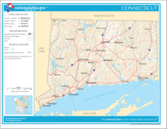
Map of Connecticut Na 1
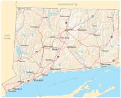
Map of Connecticut Na Cropp 1
Andover Ct Highlight
Ansoniactlocatormap
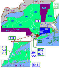
Area Codes Ct
Beconfallsctlocatormap
Bethanyctlocatormap
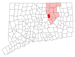
Bolton Ct Highlight
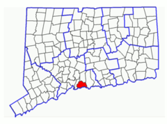
Branfordctlocatormap
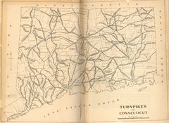
Ct Pikes
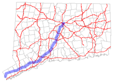
Ct 15 Map
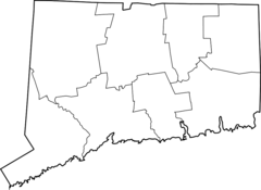
Ctmap County Boundaries
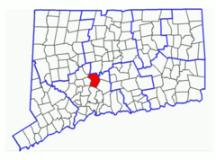
Chechirectlocatormap
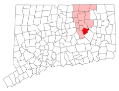
Columbia Ct Highlight
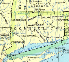
Connecticut 90
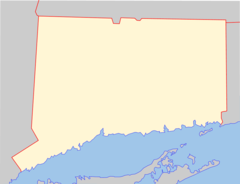
Connecticut Blank
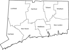
Connecticut Counties

Connecticut Population Map 1
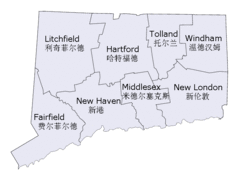
Connecticut Counties En Zh
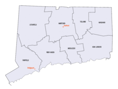
Connecticut Counties Map