Maryland, US
Maryland: Located in the Mid-Atlantic region, this state is home to the capital city of Annapolis and the largest city of Baltimore.
About
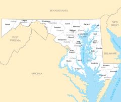
Maryland is a state located in the Mid-Atlantic region of the eastern United States. It shares borders with Virginia, West Virginia, Pennsylvania, Delaware, and Washington D.C.
Some key facts about Maryland:
- Capital: Annapolis
- Population: Around 6 million
- Area: 12,407 square miles
- Nicknames: Old Line State, Free State
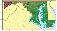
Maryland has diverse geography spanning the Appalachian Mountains, forested hills, dense urban centers, and the Atlantic Coast. The Chesapeake Bay separates the state's Eastern Shore region from the rest of Maryland. Major cities include Baltimore and the capital Annapolis.
Maryland has historically played a central role in early American history and the founding of the country. It was one of the 13 original colonies. Key events like the writing of the Star Spangled Banner took place in Maryland.
Today, Maryland has a dynamic, prosperous economy anchored by the technology and defense industries surrounding Washington D.C. The state is among the wealthiest and most educated in the nation. Other major industries include healthcare, biotech, and tourism.
Maryland is known for its vibrant seafood scene, especially crabs, oysters, and rockfish. It also has a rich tradition of colonial history, amusement parks like Ocean City, and natural assets including the Assateague beaches. The climate is mild.
In summary, Maryland's strategic location, thriving metro areas, and blend of history and modernity make it a diverse state and important contributor to American business, culture and politics.

State Snapshot
Maryland at a glance
Maryland currently has 301 quality-checked populated place pages and 24 county pages linked on MapSof.
Mapped cities & towns
301
These counts use a stricter populated-place filter so the main lists stay focused on real city and town pages.
County pages
24
Open related pagesLargest city
BaltimorePopulation 586,131
Top linked places
Quick Facts about Maryland
| Population | 6,055,802 |
| Country | United States of America |
| Different from | Maryland |
| Phone Area Codes | 240, 667, 443, 410, 301 |
| Official name | Maryland |
| Continent | North America |
| Northernmost point | Point(-78.7258 39.723) |
| Latitude & Longitude | 39.0004,-76.7500 |
| Legislative body | Maryland General Assembly |
| Named for | Henrietta Maria of France |
| Altitude | 344 feet / 105, 350 meters |
| Capital | Annapolis |
| Establishment | April 28, 1788 (238 years ago) |
| Time Zone | America/New_York, Eastern Time Zone, UTC−05:00, UTC−04:00 |
| Local time | 02:41:24 (17th July 2026) |
| Weather | 96℉ Mostly Sunny 7-days weather |

Geography
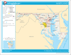
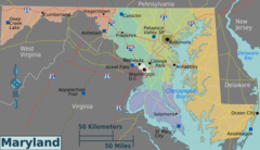
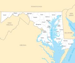
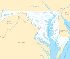
Maryland is located at 39°0'1"N 76°44'60"W (39.0003900, -76.7499700). It has 4 neighbors: Delaware, West Virginia, Pennsylvania and Virginia.
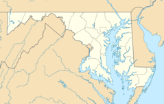
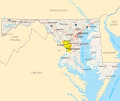
Maryland map
The largest city of Maryland is Baltimore with a population of 586,131. Other cities include, Frederick population 73,308, Silver Spring population 71,452, Rockville population 69,512 and Gaithersburg population 67,741. See all Maryland cities & populated places.
Largest Cities in Maryland (more)
Cities, Towns, Villages, Neighborhoods & Other Populated Places in Maryland.
| City Name | County | Population |
|---|---|---|
| Baltimore | City of Baltimore | 586,131 |
| Germantown | Montgomery | 86,395 |
| Frederick | Frederick | 73,308 |
| Silver Spring | Montgomery | 71,452 |
| Rockville | Montgomery | 69,512 |
| Waldorf | Charles | 67,752 |
| Gaithersburg | Montgomery | 67,741 |
| Glen Burnie | Anne Arundel | 67,639 |
| Ellicott City | Howard | 65,834 |
| Dundalk | Baltimore | 63,597 |
| Bethesda | Montgomery | 62,448 |
| Bowie | Prince George's | 58,212 |
| Towson | Baltimore | 55,197 |
| Aspen Hill | Montgomery | 48,759 |
| Gwynn Oak | City of Baltimore | 47,092 |
| Potomac | Montgomery | 44,965 |
Show more Maryland cities and populated places
Official website of Maryland
Official Website- Somerset County
- Wicomico County
- Queen Anne's County
- Harford County
- Montgomery County
- Caroline County
- St. Mary's County
- Worcester County
- Baltimore County
- Carroll County
- Prince George's County
- Cecil County
- Talbot County
- Anne Arundel County
- Washington County
- Charles County
- Dorchester County
- Baltimore
- Frederick County
- Kent County
- Howard County
- Allegany County
- Calvert County
- Garrett County
Demographics
| Year | Population | % Change | Method |
|---|---|---|---|
| 1910 | 1,295,346 | - | 1910 United States Census |
| 1920 | 1,449,661 | 10.64% | 1920 United States Census |
| 1930 | 1,631,526 | 11.15% | 1930 United States Census |
| 1940 | 1,821,244 | 10.42% | 1940 United States Census |
| 1950 | 2,343,001 | 22.27% | 1950 United States Census |
| 1960 | 3,100,689 | 24.44% | 1960 United States Census |
| 1970 | 3,922,399 | 20.95% | 1970 United States Census |
| 1980 | 4,216,975 | 6.99% | 1980 United States Census |
| 1990 | 4,781,468 | 11.81% | 1990 United States Census |
| 2000 | 5,296,486 | 9.72% | 2000 United States Census |
| 2010 | 5,773,552 | 8.26% | census |
| 2011 | 5,839,419 | 1.13% | estimation process |
| 2012 | 5,886,992 | 0.81% | estimation process |
| 2013 | 5,923,188 | 0.61% | estimation process |
| 2014 | 5,957,283 | 0.57% | estimation process |
| 2015 | 5,985,562 | 0.47% | estimation process |
| 2016 | 6,003,323 | 0.3% | estimation process |
| 2017 | 6,023,868 | 0.34% | estimation process |
| 2018 | 6,035,802 | 0.2% | estimation process |
| 2019 | 6,045,680 | 0.16% | estimation process |
| 2020 | 6,055,802 | 0.17% | estimation process |
People born in Maryland (196)
People born in Maryland, including politician, died 1859 John Dennis, chemist William O. Baker, businessman Samuel Sachs, .
More notable people
- Amit Bhattacharya (American cinematographer) he was born in 01/01/1961
- David Herold (accomplice of John Wilkes Booth in Lincoln's assassination (1842-1865)) he was born in 16/06/1842
- Barton W. Stone (American leader in the Restoration Movement) he was born in 24/12/1772
- James Jones (American politician and lawyer from the state of Georgia (1769-1801)) he was born in 01/01/1769
- William Few (American politician (1748-1828)) he was born in 08/06/1748
- William Bowie (American engineer) he was born in 06/05/1872
- Edwin Booth (19th-century American actor) he was born in 13/11/1833
- Bert Muhly (American mayor and academic (1923-2011)) he was born in 18/06/1923
- George Kerr (athlete) he was born in 16/10/1937
- James Wray Williams (American politician (1792-1842)) he was born in 08/10/1792
- Eric Brittingham (American musician) he was born in 08/05/1960
- David Bentley Hart (American theologian) he was born in 01/01/1965
- Mark Johnson (American film producer) he was born in 27/12/1945
- Edwin C. Hahn (Sound engineer) he was born in 02/08/1888
- Nathan Larson (American guitarist, singer, songwriter, and author (born 1970)) he was born in 12/09/1970
- George Washington Parke Custis (adopted son of George Washington (1781-1857)) he was born in 30/04/1781
- Thomas P. Carnes (American politician (1762-1822)) he was born in 01/01/1762
- Rolando Martín (Argentine rugby union footballer and coach) he was born in 23/09/1968
Other places with the same name (2)
- Maryland, New York town in Otsego County, New York, United States with a population of 1,785 people.
- Maryland, Illinois township of Illinois with a population of 500 people.
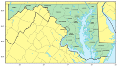
Maryland Counties (more)
Montgomery County

county in Maryland, United States
Prince George's County

county in Maryland, United States
Baltimore County

county in Maryland, United States
| County Name | Population |
|---|---|
| Montgomery County | 1,051,816 |
| Prince George's County | 909,612 |
| Baltimore County | 826,017 |
| City of Baltimore | 621,849 |
| Anne Arundel County | 582,777 |
| Howard County | 328,200 |
| Frederick County | 265,161 |
| Harford County | 256,805 |
| Carroll County | 169,092 |
| Charles County | 164,436 |
| Washington County | 151,146 |
| Saint Mary's County | 114,687 |
| Wicomico County | 103,990 |
| Cecil County | 103,419 |
| Calvert County | 93,072 |
| Allegany County | 70,057 |
Show more Maryland counties
Map & Images (more maps)
Map of Maryland Na 1
Maryland Regions Map
Usa Maryland Location Map

Maryland Flag Map
Counties Map of Maryland
Maryland Relief Map
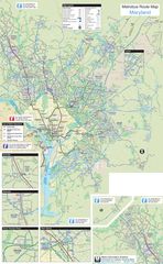
Maryland Metrobus Map
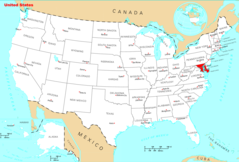
Where Is Maryland Located
Maryland Cities And Towns
Maryland County Map
Maryland Reference Map
Maryland Rivers And Lakes
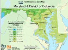
District Of Columbia Plant Hardiness Zone Map
