Whittier, California
Whittier: A city in Los Angeles County, California.
About
Whittier is a city located in the county of Los Angeles in the U.S. state of California. Its population at the 2010 census was 85,331. After 10 years in 2020 city had an estimated population of 83,194 inhabitants.
The city was created 128 years ago in 1898.

Quick Facts about Whittier
| Population | 83,194 (2020) |
| Country | United States of America |
| State | California (United States) |
| County | Los Angeles County |
| Postal code | 90601–90610 |
| Phone Area Codes | 562 |
| Water as percent of area | 0.11% |
| Land as percent of area | 99.89% |
| Latitude & Longitude | 33.9792,-118.0328 |
| Named for | John Greenleaf Whittier |
| Altitude | 1,204 feet / 367 meters |
| Establishment | February 25, 1898 (128 years ago) |
| Time Zone | Pacific Time Zone |
| Local time | 14:15:17 (18th July 2026) |
| Population growth | -2.57% (2010-2020) |
| Weather | 69℉ Mostly Cloudy then Patchy Fog 7-days weather |

Geography
Whittier is located at 33°58'45"N 118°1'58"W (33.9791800, -118.0328400).
Whittier map
Weather
Patchy fog after 5am. Mostly cloudy, with a low around 69. South wind 5 to 10 mph.
7-Day ForecastOfficial website of Whittier
Official Website- Changshu
- Suzhou
- Whittier
Demographics
According to census records, the population of Whittier decreased by 2.57% in 10 years.
| Year | Population | % Change | Method |
|---|---|---|---|
| 2010 | 85,331 | - | census |
| 2011 | 85,633 | 0.35% | estimation process |
| 2012 | 85,968 | 0.39% | estimation process |
| 2013 | 86,326 | 0.41% | estimation process |
| 2014 | 86,482 | 0.18% | estimation process |
| 2015 | 86,705 | 0.26% | estimation process |
| 2016 | 86,600 | -0.12% | estimation process |
| 2017 | 86,326 | -0.32% | estimation process |
| 2018 | 85,791 | -0.62% | estimation process |
| 2019 | 85,098 | -0.81% | estimation process |
| 2020 | 83,194 | -2.29% | estimation process |
Where to Stay in Whittier
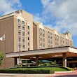
1DoubleTree by Hilton
7320 Greenleaf Ave, Whittier, CA 90602, United States View details
Phone: +15629458511 | Website available
2Days Inn by Wyndham Whittier Los Angeles
14330 Telegraph Rd, Whittier, CA 90604, United States View details
Phone: +15629444760 | Website available
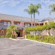
3Vagabond Inn - Whittier
14125 Whittier Blvd, Whittier, CA 90605, United States View details
Phone: +15626989701 | Website available
4Lambert Inn
13318 Lambert Rd, Whittier, CA 90602, United States View details
Phone: +15626931099 | Website available

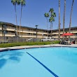
5Travelodge by Wyndham Whittier
11530 Whittier Blvd, Whittier, CA 90601, United States View details
Phone: +15622051835 | Website available

Services and Civic Places in Whittier
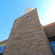
1Whittier City Hall
13230 Penn St, Whittier, CA 90602, United States View details
Phone: +15625679999 | Website available
2Whittier City Building Department
13230 Penn St, Whittier, CA 90602, United States View details
Phone: +15625679320 | Website available
3IPS
11612 Washington Blvd f, Whittier, CA 90606 View details
Phone: +15627588051
People born in Whittier (143)
People born in Whittier, including singer Fergie, sport shooter Kim Rhode, American-Canadian science fiction author Robert Charles Wilson, .
More notable people
- Martika (American singer-songwriter, record producer and actress) she was born in 18/05/1969
- Shirley Babashoff (American swimmer, Olympic gold medalist, world champion, former world record-holder) she was born in 31/01/1957
- Kathy Hilton (American actress) she was born in 13/03/1959
- Tina Yothers (actress, singer) she was born in 05/05/1973
- Eric Stoltz (actor) he was born in 30/09/1961
- Shaun Cody (All-American college football player, professional football player, defensive lineman) he was born in 22/01/1983
- Kherington Payne (American dance musician and actress) she was born in 26/01/1990
- George Allen (U.S. politician) he was born in 08/03/1952
- Ante Razov (American soccer player) he was born in 02/03/1974
- Tracy G (American musician) he was born in 03/01/1959
- Tony DiTerlizzi (American artist, writer and producer) he was born in 06/09/1969
- Brendon Baerg (American actor and voice actor) he was born in 25/02/1998
- Greg Hancock (American speedway rider) he was born in 03/06/1970
- David Ingram (American philosopher) he was born in 27/01/1952
- Nomar Garciaparra (American baseball player) he was born in 23/07/1973
- Diane Wakoski (American poet) she was born in 03/08/1937
- Nick D'Virgilio (American musician) he was born in 12/11/1968
- Jack Babashoff (American swimmer, Olympic silver medalist, world champion, world record-holder) he was born in 13/07/1955
Nearby Schools and Colleges
Schools and campuses linked to Whittier, CA. Select a name to open its map and contact details.
| Code | Name | City | ZIP |
|---|---|---|---|
| 125763 | Whittier College | Whittier (CA) | 90601 |
| 444325 | ATI College-Norwalk | Whitter (CA) | 90603-0000 |
| 121886 | Rio Hondo College | Whittier (CA) | 90601-1616 |
| 443207 | NTMA Training Centers of Southern California | Santa Fe Springs (CA) | 90670 |
| 457253 | Beyond 21st Century Beauty Academy | Santa Fe Springs (CA) | 90670 |
Nearby Transit Stations (46)
Rail and bus stations connected to Whittier, CA. Select a station to open its map and address details.
| Code | Name | Address | Type |
|---|---|---|---|
| FUL | Fullerton Transportation Center | 120 East Santa Fe Avenue | RAIL |
| LAX | Los Angeles Union Station | 800 North Alameda Street | RAIL |
| PAS | Pasadena, California | 150 South Los Robles Ave. | BUS |
| ANA | Anaheim Regional Transportation Intermodal Center | 2150 East Katella Avenue | RAIL |
| GDL | Glendale Transportation Center | 400 West Cerritos Avenue | RAIL |
Closest post offices linked to Whittier.
| Post Office Name | City | ZIP |
|---|---|---|
| Bailey Post Office | Whittier (CA) | 90601 |
| Whittier Post Office | Whittier (CA) | 90605 |
| Los N Post Office | Whittier (CA) | 90606 |
| Santa Fe Plaza Post Office | Whittier (CA) | 90605 |
| Pico Rivera Post Office | Pico Rivera (CA) | 90660 |
Other places with the same name (1)
- Whittier, Alaska city in Alaska, USA with a population of 203 people.
Other cities in Los Angeles County
Cities, towns, neighborhoods & other populated places in Los Angeles County , CA. (more)
| City Name | Population | Title |
|---|---|---|
| Los Angeles | 3,970,219 | The second most populous city in the United States and the center of the Los Angeles metropolitan area. |
| Long Beach | 454,681 | The second most populous city in California, Long Beach is a major center for business, manufacturing, and tourism. |
| Santa Clarita | 209,990 | The second most populous city in Los Angeles County, California. |
| Glendale | 197,747 | The second most populous city in Los Angeles County, California. |
| Lancaster | 155,822 | The most populous city in Los Angeles County, California. |
| Palmdale | 150,498 | The most populous city in Los Angeles County, California. |
| Pomona | 149,212 | The sixth most populous city in Los Angeles County, California. |
| Torrance | 141,553 | The third most populous city in Los Angeles County, California. |
| Pasadena | 141,045 | The second most populous city in Los Angeles County, California. |
| East Los Angeles | 126,496 | Census-designated place in Los Angeles County, California, United States |
| El Monte | 112,344 | The most populous city in Los Angeles County, California. |
| Downey | 109,202 | The most populous city in Los Angeles County, California. |
| Inglewood | 107,203 | The most populous city in Los Angeles County, California. |
| Santa Maria | 105,851 | The third most populous city in Santa Barbara County, California. |
| West Covina | 103,656 | The most populous city in Los Angeles County, California. |
| Norwalk | 102,635 | The most populous city in Los Angeles County, California. |
Distance to Other Cities
Whittier distances to largest California cities