Rowland Heights, California
Rowland Heights: census-designated place in California, United States
About
Rowland Heights is a CDP located in the county of Los Angeles in the U.S. state of California.

Quick Facts about Rowland Heights
| Population | 48,993 |
| Country | United States of America |
| State | California (United States) |
| County | Los Angeles County |
| Postal code | 91748 |
| Water as percent of area | 0.04% |
| Land as percent of area | 99.96% |
| Latitude & Longitude | 33.9761,-117.9053 |
| Altitude | 1,722 feet / 525 meters |
| Time Zone | Pacific Time Zone |
| Local time | 06:14:33 (14th July 2026) |
| Weather | 69℉ Partly Cloudy 7-days weather |

Geography
Rowland Heights is located at 33°58'34"N 117°54'19"W (33.9761200, -117.9053400).
Rowland Heights map
Weather
Partly cloudy, with a low around 69. Southwest wind 0 to 10 mph.
7-Day ForecastOfficial website of Rowland Heights
Official WebsiteWhere to Stay in Rowland Heights
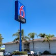
1Motel 6 Rowland Heights, CA - Los Angeles - Pomona
18970 Labin Ct, Rowland Heights, CA 91748, United States View details
Phone: +16269645333 | Website available
2Best Western Plus Executive Inn
18880 Gale Ave, Rowland Heights, CA 91748, United States View details
Phone: +16268101818 | Website available

3Deep in the city Homestay
1940 Tiburon Ct, Rowland Heights, CA 91748, United States View details
Phone: +19095256800
People born in Rowland Heights (4)
People born in Rowland Heights, including boxer Alexander Flores, baseball player Bill Fleming, political consultant and columnist Lanhee Chen, .
More notable people
- Larry Tieu (American-Vietnamese basketball player) he was born in 13/07/1986
Nearby Schools and Colleges
Schools and campuses linked to Rowland Heights, CA. Select a name to open its map and contact details.
| Code | Name | City | ZIP |
|---|---|---|---|
| 117672 | Southern California University of Health Sciences | Whittier (CA) | 90604 |
| 119164 | Mt San Antonio College | Walnut (CA) | 91789-1399 |
| 123943 | Marshall B Ketchum University | Fullerton (CA) | 92831-1699 |
| 383084 | Hacienda La Puente Adult Education | La Puente (CA) | 91746-0002 |
| 444325 | ATI College-Norwalk | Whitter (CA) | 90603-0000 |
Nearby Transit Stations (46)
Rail and bus stations connected to Rowland Heights, CA. Select a station to open its map and address details.
| Code | Name | Address | Type |
|---|---|---|---|
| FUL | Fullerton Transportation Center | 120 East Santa Fe Avenue | RAIL |
| POS | Pomona station | 100 West Commercial Street | RAIL |
| ANA | Anaheim Regional Transportation Intermodal Center | 2150 East Katella Avenue | RAIL |
| CLM | Claremont, California | 200 West First St. | BUS |
| SNA | Santa Ana Regional Transportation Center | 1000 East Santa Ana Boulevard | RAIL |
Closest post offices linked to Rowland Heights.
| Post Office Name | City | ZIP |
|---|---|---|
| Rowland Heigh Post Office | Rowland Heights (CA) | 91748 |
| Hacienda Heigh Post Office | Hacienda Heights (CA) | 91745 |
| Civic Center La Habra Post Office | La Habra (CA) | 90631 |
| Walnu Post Office | Walnut (CA) | 91788 |
| Brea Post Office | Brea (CA) | 92822 |
Other cities in Los Angeles County
Cities, towns, neighborhoods & other populated places in Los Angeles County , CA. (more)
| City Name | Population | Title |
|---|---|---|
| Los Angeles | 3,970,219 | The second most populous city in the United States and the center of the Los Angeles metropolitan area. |
| Long Beach | 454,681 | The second most populous city in California, Long Beach is a major center for business, manufacturing, and tourism. |
| Santa Clarita | 209,990 | The second most populous city in Los Angeles County, California. |
| Glendale | 197,747 | The second most populous city in Los Angeles County, California. |
| Lancaster | 155,822 | The most populous city in Los Angeles County, California. |
| Palmdale | 150,498 | The most populous city in Los Angeles County, California. |
| Pomona | 149,212 | The sixth most populous city in Los Angeles County, California. |
| Torrance | 141,553 | The third most populous city in Los Angeles County, California. |
| Pasadena | 141,045 | The second most populous city in Los Angeles County, California. |
| East Los Angeles | 126,496 | Census-designated place in Los Angeles County, California, United States |
| El Monte | 112,344 | The most populous city in Los Angeles County, California. |
| Downey | 109,202 | The most populous city in Los Angeles County, California. |
| Inglewood | 107,203 | The most populous city in Los Angeles County, California. |
| Santa Maria | 105,851 | The third most populous city in Santa Barbara County, California. |
| West Covina | 103,656 | The most populous city in Los Angeles County, California. |
| Norwalk | 102,635 | The most populous city in Los Angeles County, California. |
Distance to Other Cities
Rowland Heights distances to largest California cities