Oklahoma, US
Oklahoma: Located in the South Central region of the United States, this state is known for its diverse geography, including plains, mountains, and forests.
About
Oklahoma is a south-central U.S. state situated between the Great Plains and the Rocky Mountains. It is bordered by Texas, New Mexico, Colorado, Kansas, Missouri, and Arkansas.
Some key facts about Oklahoma:
- Capital: Oklahoma City
- Population: Around 4 million
- Area: 69,899 square miles
- Nickname: The Sooner State
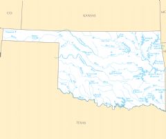
Oklahoma has a diverse landscape including prairie, plains, forests, and foothills. The state also has over 200 lakes and many rivers like the Arkansas River and Red River. Eastern Oklahoma is green and hilly while the western half is highly arid.
Oklahoma City and Tulsa are the two major metropolitan hubs. The state economy relies on the energy industry, aviation, telecommunications, and agriculture. Cattle ranching is a top industry.
Oklahoma has a rich Native American heritage and was once called Indian Territory. It has 39 tribal headquarters and one of the largest populations of Native American people. Oil was discovered here in the 1920s.
Oklahoma experiences extreme weather from tornadoes and severe storms to droughts, flooding, and icy winters. Popular outdoor destinations include the Wichita Mountains, Lake Texoma, and Red Rock Canyon.
In summary, Oklahoma is a uniquely diverse state with prairie landscapes, a Native American legacy, oil industry ties, and located at the crossroads of the Great Plains and American Southwest.

State Snapshot
Oklahoma at a glance
Oklahoma currently has 594 quality-checked populated place pages and 77 county pages linked on MapSof.
Mapped cities & towns
594
These counts use a stricter populated-place filter so the main lists stay focused on real city and town pages.
County pages
77
Open related pagesLargest city
Oklahoma CityPopulation 655,057
Top linked places
Quick Facts about Oklahoma
| Population | 3,980,783 |
| Country | United States of America |
| Area | 181195 km2 |
| Water as percent of area | 1.87% |
| Land as percent of area | 98.13% |
| Easternmost point | Point(-94.431111111 35.394166666) |
| Northernmost point | Point(-103.0 37.0) |
| Latitude & Longitude | 35.4921,-97.5033 |
| Legislative body | Oklahoma Legislature |
| Named for | Oklahoma Territory |
| Official language | English |
| Altitude | 1,211 feet / 369 meters |
| Capital | Oklahoma City |
| Establishment | November 16, 1907 (118 years ago) |
| Time Zone | America/Chicago, UTC−06:00 |
| Local time | 08:19:21 (24th July 2026) |
| Weather | 99℉ Slight Chance Showers And Thunderstorms 7-days weather |

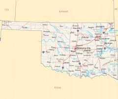
Geography
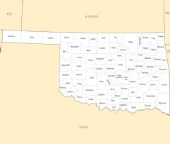
Oklahoma is located at 35°29'32"N 97°30'12"W (35.4920900, -97.5032800). It has 6 neighbors: Arkansas, Kansas, Missouri, Texas, Colorado and New Mexico.
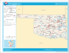
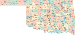
Oklahoma map
The largest city of Oklahoma is Oklahoma City with a population of 655,057. Other cities include, Tulsa population 403,166, Norman population 125,762, Broken Arrow population 111,648 and Edmond population 95,346. See all Oklahoma cities & populated places.
Largest Cities in Oklahoma (more)
Cities, Towns, Villages, Neighborhoods & Other Populated Places in Oklahoma.
| City Name | County | Population |
|---|---|---|
| Oklahoma City | Oklahoma | 655,057 |
| Tulsa | Tulsa | 403,166 |
| Norman | Cleveland | 125,762 |
| Broken Arrow | Tulsa | 111,648 |
| Edmond | Oklahoma | 95,346 |
| Lawton | Comanche | 93,164 |
| Moore | Cleveland | 63,102 |
| Midwest City | Oklahoma | 57,407 |
| Stillwater | Payne | 50,306 |
| Enid | Garfield | 49,542 |
| Owasso | Tulsa | 37,241 |
| Muskogee | Muskogee | 36,831 |
| Bartlesville | Washington | 36,605 |
| Shawnee | Pottawatomie | 31,555 |
| Yukon | Canadian | 28,793 |
| Bixby | Tulsa | 28,453 |
Show more Oklahoma cities and populated places
Weather
A slight chance of showers and thunderstorms between 7am and 1pm. Mostly sunny, with a high near 99.
7-Day ForecastOfficial website of Oklahoma
Official Website- Rogers County
- Johnston County
- Nowata County
- Payne County
- McIntosh County
- Atoka County
- Logan County
- Tulsa County
- Kiowa County
- Jefferson County
- Texas County
- Wagoner County
- Creek County
- Sequoyah County
- Okmulgee County
- Greer County
- Murray County
- Washita County
- Carter County
- Roger Mills County
- Grant County
- Cotton County
- Alfalfa County
- Pittsburg County
- Washington County
- Custer County
- Beaver County
- McClain County
- Adair County
- Ellis County
- Blaine County
- Love County
- Caddo County
- Cherokee County
- Latimer County
- Kay County
- Bryan County
- Cleveland County
- Grady County
- Major County
- Garvin County
- Pushmataha County
- Beckham County
- Woods County
- Pottawatomie County
- Okfuskee County
- Cimarron County
- McCurtain County
- Ottawa County
- Kingfisher County
- Delaware County
- Harmon County
- Oklahoma County
- Mayes County
- Tillman County
- Canadian County
- Pawnee County
- Pontotoc County
- Stephens County
- Garfield County
- Marshall County
- Seminole County
- Osage County
- Haskell County
- Jackson County
- Comanche County
- Woodward County
- Choctaw County
- Craig County
- Dewey County
- Noble County
- Harper County
- Lincoln County
- Hughes County
- Coal County
- Le Flore County
- Muskogee County
Demographics
| Year | Population | % Change | Method |
|---|---|---|---|
| 1910 | 1,657,155 | - | census |
| 1920 | 2,028,283 | 18.3% | census |
| 1930 | 2,396,040 | 15.35% | census |
| 1940 | 2,336,434 | -2.55% | census |
| 1950 | 2,233,351 | -4.62% | census |
| 1960 | 2,328,284 | 4.08% | census |
| 1970 | 2,559,229 | 9.02% | census |
| 1980 | 3,025,290 | 15.41% | census |
| 1990 | 3,145,585 | 3.82% | census |
| 2000 | 3,450,654 | 8.84% | census |
| 2010 | 3,751,351 | 8.02% | census |
| 2011 | 3,788,379 | 0.98% | estimation process |
| 2012 | 3,818,814 | 0.8% | estimation process |
| 2013 | 3,853,214 | 0.89% | estimation process |
| 2014 | 3,878,187 | 0.64% | estimation process |
| 2015 | 3,909,500 | 0.8% | estimation process |
| 2016 | 3,926,331 | 0.43% | estimation process |
| 2017 | 3,931,316 | 0.13% | estimation process |
| 2018 | 3,940,235 | 0.23% | estimation process |
| 2019 | 3,956,971 | 0.42% | estimation process |
| 2020 | 3,980,783 | 0.6% | estimation process |
People born in Oklahoma (199)
People born in Oklahoma, including Comanche-Kiowa sculptor and painter Blackbear Bosin, racing driver Troy Ruttman, musician Aaron Bell, .
More notable people
- Elizabeth Crewson Paris (American judge) she was born in 01/01/2000
- Sidney Graham (American mathematician) he was born in 29/08/1950
- Blake Griffin (American professional basketball player) he was born in 16/03/1989
- Roy Milton (American R&B and jump blues singer, drummer and bandleader) he was born in 31/07/1907
- Mark Dinning (American male singer) he was born in 17/08/1933
- Lucien Ballard (American cinematographer) he was born in 06/05/1908
- Dick Lowry (American director and film producer) he was born in 15/09/1944
- Lee Hazlewood (American singer, songwriter, record producer (1929-2007)) he was born in 09/07/1929
- Spade Cooley (Big band leader, Actor, Television personality (1910-1969)) he was born in 17/12/1910
- Bruce Timm (animator) he was born in 08/02/1961
- Clonie Gowen (American poker player) she was born in 06/11/1971
- Kirsten Nelson (American actress and director) she was born in 03/10/1970
- Glen Sherley (American musician) he was born in 09/03/1936
- Hadley Caliman (American saxophonist) he was born in 12/01/1932
- Jenteal (American movie actress) she was born in 26/06/1976
- Jack Parker (American decathlete) he was born in 27/09/1915
- Meg Gardiner (American writer) she was born in 15/05/1957
- Bonnie Owens (American singer) she was born in 01/10/1932
Other places with the same name (1)
- Oklahoma, Pennsylvania borough in Westmoreland County, Pennsylvania, United States with a population of 739 people.
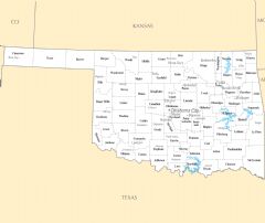
Oklahoma Counties (more)
Oklahoma County

county in Oklahoma, United States
Tulsa County

county in Oklahoma, United States of America
Cleveland County

county in North Carolina, United States
| County Name | Population |
|---|---|
| Oklahoma County | 804,041 |
| Tulsa County | 657,589 |
| Cleveland County | 287,066 |
| Canadian County | 153,192 |
| Comanche County | 121,099 |
| Rogers County | 93,155 |
| Wagoner County | 82,925 |
| Payne County | 81,755 |
| Pottawatomie County | 72,998 |
| Creek County | 71,485 |
| Muskogee County | 67,610 |
| Garfield County | 60,869 |
| Grady County | 55,906 |
| Washington County | 52,222 |
| Le Flore County | 49,935 |
| Cherokee County | 49,019 |
Show more Oklahoma counties
Map & Images (more maps)
Map of Oklahoma Na 1
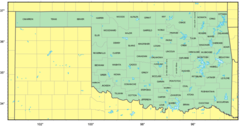
Map of Cities Counties In Oklahoma
Usa Oklahoma Location Map
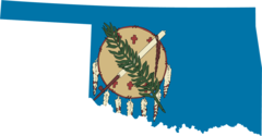
Oklahoma Flag Map
Counties Map of Oklahoma
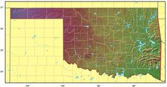
Oklahoma Relief Map
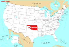
Where Is Oklahoma Located
Oklahoma Cities And Towns
Oklahoma County Map
Oklahoma Reference Map
Oklahoma Rivers And Lakes