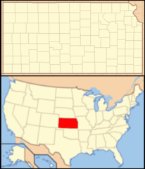
Kansas, US
Kansas: This Midwestern U.
About
Kansas is a midwestern state nicknamed “the Wheat State” for its immense crop production. It is bordered by Nebraska, Missouri, Oklahoma, and Colorado.
Some key facts about Kansas:
- Capital: Topeka
- Population: Around 2.9 million
- Area: 82,278 square miles (15th largest state)
- Nickname: The Wheat State
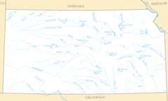
Kansas lies in the heart of Tornado Alley and has a temperate climate with hot summers and cold winters. Geographic landscapes include fertile plains, rolling hills, and wooded areas. Major rivers are the Kansas and Arkansas Rivers.
Wichita, Overland Park, Kansas City, and Topeka are the largest metro areas. The economy relies heavily on agriculture and livestock like cattle ranching. Aviation and transportation are also important industries in Kansas.
Culturally, Kansas mixes its rural, farming traditions with modern city amenities. The state has many museums, memorials, and cultural sites that celebrate its history and heritage. Historical figures like Amelia Earhart and Dwight D. Eisenhower came from Kansas.
Outdoor attractions range from hiking the Flint Hills Trail to exploring underground caves. Popular sports include auto racing, fishing, and hunting. The state is known for its barbecue cuisine.
In summary, Kansas represents the quintessential Great Plains state with sprawling wheat fields, agrarian roots, family farms, and close ties to American expansion and plains culture.

State Snapshot
Kansas at a glance
Kansas currently has 790 quality-checked populated place pages and 105 county pages linked on MapSof.
Mapped cities & towns
790
These counts use a stricter populated-place filter so the main lists stay focused on real city and town pages.
County pages
105
Open related pagesLargest city
WichitaPopulation 391,731
Top linked places
Quick Facts about Kansas
| Population | 2,913,805 |
| Country | United States of America |
| Area | 213100 km2 |
| Water as percent of area | 0.63% |
| Land as percent of area | 99.37% |
| Easternmost point | Point(-94.589518055 39.146873055) |
| Northernmost point | Point(-102.05175 40.003083333) |
| Latitude & Longitude | 38.5003,-98.5006 |
| Legislative body | Kansas Legislature |
| Named for | Kansas River |
| Official language | English |
| Altitude | 1,969 feet / 600 meters |
| Capital | Topeka |
| Establishment | January 29, 1861 (165 years ago) |
| Time Zone | Central Time Zone, UTC−06:00, America/Chicago |
| Local time | 06:02:03 (12th July 2026) |
| Weather | 93℉ Sunny 7-days weather |

Geography
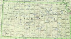
Kansas is located at 38°30'1"N 98°30'2"W (38.5002900, -98.5006300). It has 4 neighbors: Missouri, Oklahoma, Nebraska and Colorado.
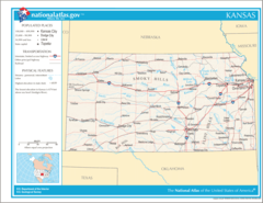
Kansas map
The largest city of Kansas is Wichita with a population of 391,731. Other cities include, Overland Park population 197,381, Kansas City population 152,960, Shawnee population 66,298 and Lenexa population 56,156. See all Kansas cities & populated places.
Largest Cities in Kansas (more)
Cities, Towns, Villages, Neighborhoods & Other Populated Places in Kansas.
| City Name | County | Population |
|---|---|---|
| Wichita | Sedgwick | 391,731 |
| Overland Park | Johnson | 197,381 |
| Kansas City | Wyandotte | 152,960 |
| Shawnee | Johnson | 66,298 |
| Lenexa | Johnson | 56,156 |
| Salina | Saline | 46,274 |
| Hutchinson | Reno | 40,209 |
| Leavenworth | Leavenworth | 35,934 |
| Leawood | Johnson | 34,669 |
| Fort Dodge | Ford | 28,075 |
| Dodge City | Ford | 27,104 |
| Derby | Sedgwick | 25,145 |
| Prairie Village | Butler | 22,315 |
| Prairie Village | Johnson | 21,877 |
| Junction City | Geary | 21,482 |
| Hays | Ellis | 20,829 |
Show more Kansas cities and populated places
Official website of Kansas
Official Website- Thomas County
- Wallace County
- Ford County
- Jewell County
- Washington County
- Wilson County
- Cowley County
- Hamilton County
- Douglas County
- Greenwood County
- Brown County
- Sumner County
- Cheyenne County
- Sherman County
- Hodgeman County
- Meade County
- Saline County
- Greeley County
- Montgomery County
- Russell County
- Jefferson County
- Smith County
- Shawnee County
- Cloud County
- Linn County
- Harvey County
- Mitchell County
- Ellis County
- Republic County
- Leavenworth County
- Marshall County
- Haskell County
- McPherson County
- Wyandotte County
- Chase County
- Rice County
- Ottawa County
- Neosho County
- Jackson County
- Wichita County
- Anderson County
- Nemaha County
- Stevens County
- Reno County
- Decatur County
- Gray County
- Allen County
- Phillips County
- Johnson County
- Trego County
- Coffey County
- Riley County
- Woodson County
- Dickinson County
- Lyon County
- Lane County
- Rawlins County
- Doniphan County
- Kiowa County
- Rush County
- Norton County
- Labette County
- Kearny County
- Stanton County
- Morton County
- Atchison County
- Pawnee County
- Clark County
- Pottawatomie County
- Geary County
- Edwards County
- Harper County
- Marion County
- Sheridan County
- Graham County
- Barton County
- Cherokee County
- Finney County
- Stafford County
- Pratt County
- Chautauqua County
- Morris County
- Rooks County
- Barber County
- Lincoln County
- Crawford County
- Ness County
- Sedgwick County
- Grant County
- Logan County
- Bourbon County
- Scott County
- Franklin County
- Gove County
- Clay County
- Wabaunsee County
- Osborne County
- Elk County
- Miami County
- Osage County
- Butler County
- Ellsworth County
- Kingman County
- Seward County
- Comanche County
Demographics
| Year | Population | % Change | Method |
|---|---|---|---|
| 1910 | 1,690,949 | - | census |
| 1920 | 1,769,257 | 4.43% | census |
| 1930 | 1,880,999 | 5.94% | census |
| 1940 | 1,801,028 | -4.44% | census |
| 1950 | 1,905,299 | 5.47% | census |
| 1960 | 2,178,611 | 12.55% | census |
| 1970 | 2,246,578 | 3.03% | census |
| 1980 | 2,363,679 | 4.95% | census |
| 1990 | 2,477,574 | 4.6% | census |
| 2000 | 2,688,418 | 7.84% | census |
| 2010 | 2,853,118 | 5.77% | census |
| 2011 | 2,869,225 | 0.56% | estimation process |
| 2012 | 2,885,257 | 0.56% | estimation process |
| 2013 | 2,893,212 | 0.27% | estimation process |
| 2014 | 2,900,475 | 0.25% | estimation process |
| 2015 | 2,909,011 | 0.29% | estimation process |
| 2016 | 2,910,844 | 0.06% | estimation process |
| 2017 | 2,908,718 | -0.07% | estimation process |
| 2018 | 2,911,359 | 0.09% | estimation process |
| 2019 | 2,913,314 | 0.07% | estimation process |
| 2020 | 2,913,805 | 0.02% | estimation process |
People born in Kansas (197)
People born in Kansas, including actress ZaSu Pitts, football player Tiny Feather, actor Rudy Bowman, .
More notable people
- Robert McAlmon (American writer) he was born in 09/03/1895
- Walter Chrysler (American automotive industry executive) he was born in 02/04/1875
- Oran McPherson (Canadian politician (1886-1949)) he was born in 12/04/1886
- Charles Hatfield (American cloud seeder) he was born in 01/01/1875
- John L. Kelley (American mathematician) he was born in 06/12/1916
- Dorothy DeLay (American musician and violin instructor) she was born in 31/03/1917
- Edgar Lee Masters (American writer) he was born in 23/08/1868
- Jess Willard (boxer) he was born in 29/12/1881
- Mary Howard de Liagre (American actress) she was born in 24/08/1914
- Hollis Dow Hedberg (American academic) he was born in 29/05/1903
- Katherine R. Whitmore (American academic) she was born in 01/01/1897
- Olive Ann Beech (American businesswoman) she was born in 25/09/1904
- Betty Glamann (American musician) she was born in 21/05/1923
- George Sawley (Set decorator, Art director) he was born in 18/06/1904
- Arthur Johns (Sound engineer) he was born in 30/10/1889
- Samantha Ryan (Ex American movie actress) she was born in 03/03/1978
- Billy Devore (American racecar driver) he was born in 12/09/1910
- Dwight Frye (actor (1899-1943)) he was born in 22/02/1899
Other places with the same name (3)
- Kansas, Oklahoma city in Delaware County, Oklahoma, United States of America with a population of 803 people.
- Kansas, Illinois village in Illinois with a population of 707 people.
- Kansas, Alabama town in Walker County, Aabama with a population of 214 people.
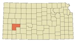
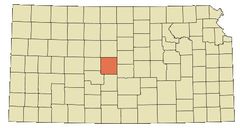
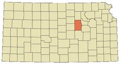
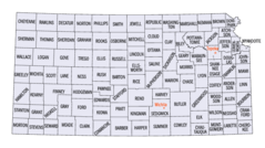
Kansas Counties (more)
Johnson County

county in Wyoming, United States
Sedgwick County

county in Kansas, United States
Shawnee County

county in Kansas, United States
| County Name | Population |
|---|---|
| Johnson County | 607,220 |
| Sedgwick County | 519,907 |
| Shawnee County | 175,999 |
| Wyandotte County | 165,265 |
| Douglas County | 122,530 |
| Leavenworth County | 82,246 |
| Riley County | 73,202 |
| Butler County | 66,992 |
| Reno County | 61,793 |
| Saline County | 53,926 |
| Crawford County | 38,730 |
| Finney County | 35,917 |
| Cowley County | 34,628 |
| Miami County | 34,334 |
| Harvey County | 34,291 |
| Ford County | 33,094 |
Show more Kansas counties
Map & Images (more maps)
Map of Kansas Na 1
Anishinaabewaki 3
Coffeyville Dotmap
Gardencity Dotmap
Greatbend Dotmap
Herington Dotmap
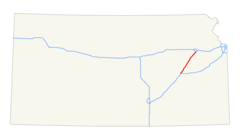
I 29 Kansas City
I 335 (ks) Map

I 435 (ks Mo) Map
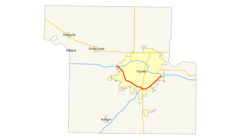
I 470 (ks) Map

I 635 (ks Mo) Map

I 670 (ks Mo) Map
Independence Dotmap
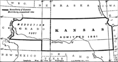
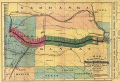
Ks Territory Change
Kansas 90
Kansas Locator Map With Us
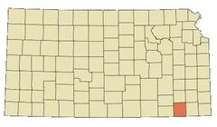
Kansas Counties Map
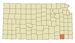
Kansas Counties
Kansas Rivers And Lakes
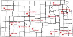
Kansas Airfields 2