Suriname (Republic of Suriname), SR
Suriname: Located on the northeastern coast of South America, this country is characterized by its dense rainforests, diverse culture, and a population of approximately 616, 500.
About

Country Snapshot
Republic of Suriname at a glance
Republic of Suriname currently has 8 quality-checked populated place pages and 10 state or regional pages linked on MapSof.
Mapped cities & towns
8
These counts use a stricter populated-place filter so the main lists stay focused on real city and town pages.
States & regions
10
Open related pagesLargest city
ParamariboPopulation 223,757
Top linked places
Quick Facts about Republic of Suriname
| Population | 616,500 |
| Country | Suriname |
| Plate code | SME |
| Area | 163270 km2 |
| Official name | la République du Suriname, Suriname |
| Continent | South America |
| Northernmost point | Point(-55.0 5.99) |
| Latitude & Longitude | 4.0000,-56.0000 |
| Legislative body | National Assembly |
| Official language | Dutch |
| Capital | Paramaribo |
| Establishment | November 25, 1975 (50 years ago) |
| Time Zone | UTC−03:00 |
| Local time | 19:57:03 (26th June 2026) |

Geography
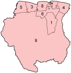
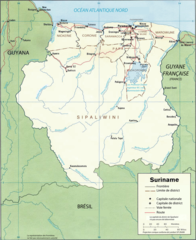
Republic of Suriname is located at 4°0'0"N 56°0'0"W (4.0000000, -56.0000000). It has 5 neighbors: France, Guyana, French Guiana, Brazil and Union.
Suriname map
The largest city of Republic of Suriname is Paramaribo with a population of 223,757. . See all Republic of Suriname cities & populated places.
Official website of Republic of Suriname
Official WebsiteCompare Republic of Suriname with
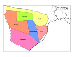
- Para District
- Brokopondo District
- Nickerie District
- Wanica District
- Sipaliwini District
- Marowijne District
- Saramacca District
- Coronie District
- Paramaribo District
- Commewijne District
Demographics
| Year | Population | % Change | Method |
|---|---|---|---|
| 1960 | 290,137 | - | census |
| 1961 | 298,411 | 2.77% | census |
| 1962 | 306,613 | 2.68% | census |
| 1963 | 314,883 | 2.63% | census |
| 1964 | 323,428 | 2.64% | census |
| 1965 | 332,315 | 2.67% | census |
| 1966 | 341,745 | 2.76% | census |
| 1967 | 351,463 | 2.77% | census |
| 1968 | 360,548 | 2.52% | census |
| 1969 | 367,772 | 1.96% | census |
| 1970 | 372,311 | 1.22% | census |
| 1971 | 373,785 | 0.39% | census |
| 1972 | 372,614 | -0.31% | census |
| 1973 | 369,777 | -0.77% | census |
| 1974 | 366,690 | -0.84% | census |
| 1975 | 364,402 | -0.63% | census |
| 1976 | 363,278 | -0.31% | census |
| 1977 | 363,108 | -0.05% | census |
| 1978 | 363,692 | 0.16% | census |
| 1979 | 364,619 | 0.25% | census |
| 1980 | 365,616 | 0.27% | census |
| 1981 | 366,637 | 0.28% | census |
| 1982 | 367,895 | 0.34% | census |
| 1983 | 369,654 | 0.48% | census |
| 1984 | 372,272 | 0.7% | census |
| 1985 | 375,979 | 0.99% | census |
| 1986 | 380,890 | 1.29% | census |
| 1987 | 386,852 | 1.54% | census |
| 1988 | 393,483 | 1.69% | census |
| 1989 | 400,251 | 1.69% | census |
| 1990 | 406,764 | 1.6% | census |
| 1991 | 412,884 | 1.48% | census |
| 1992 | 418,700 | 1.39% | census |
| 1993 | 424,326 | 1.33% | census |
| 1994 | 429,968 | 1.31% | census |
| 1995 | 435,776 | 1.33% | census |
| 1996 | 441,734 | 1.35% | census |
| 1997 | 447,771 | 1.35% | census |
| 1998 | 453,920 | 1.35% | census |
| 1999 | 460,215 | 1.37% | census |
| 2000 | 466,668 | 1.38% | census |
| 2001 | 473,312 | 1.4% | census |
| 2002 | 480,099 | 1.41% | census |
| 2003 | 486,867 | 1.39% | census |
| 2004 | 493,394 | 1.32% | census |
| 2005 | 499,523 | 1.23% | census |
| 2006 | 505,186 | 1.12% | census |
| 2007 | 510,433 | 1.03% | census |
| 2008 | 515,372 | 0.96% | census |
| 2009 | 520,173 | 0.92% | census |
| 2010 | 524,960 | 0.91% | census |
| 2011 | 529,761 | 0.91% | census |
| 2012 | 534,541 | 0.89% | census |
| 2013 | 539,276 | 0.88% | census |
| 2014 | 553,278 | 2.53% | (Worldbank) |
| 2015 | 559,136 | 1.05% | (Worldbank) |
| 2016 | 564,883 | 1.02% | (Worldbank) |
| 2017 | 563,402 | -0.26% | census |
| 2018 | 575,987 | 2.18% | (Worldbank) |
| 2019 | 581,363 | 0.92% | (Worldbank) |
| 2026 | 616,500 | 5.7% |
Map & Images (more maps)
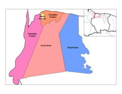
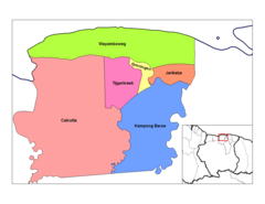
Brokopondo Resorts
Commewijne Resorts
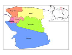
Coronie Resorts
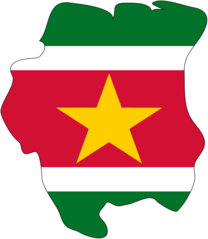
Flag Map of Suriname
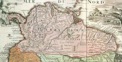
Map New Kingdom of Granada 1
Map of Surinam Demis
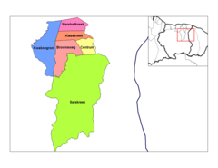
Marowijne Resorts
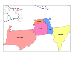
Nickerie Resorts
Para Resorts
Paramaibo Resorts
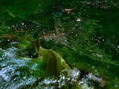
Paramaribo 55 20082w 5 85569n
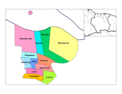
Saramacca Resorts

Selection of Map Lavaux 1737 Location Oranibo
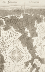
Selection of Map Lavaux 1737
Sipaliwini Resorts
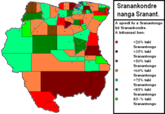
Sranantongo
Surinam Map Fr
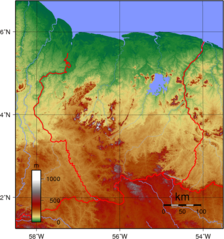
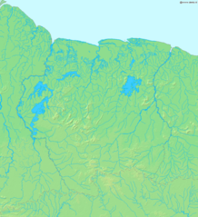
Suriname Topography
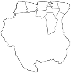
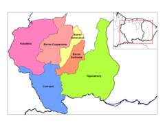
Suriname Districts Blank
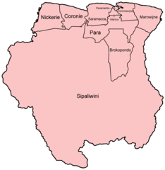
Suriname Districts Named