France (Republic of France), FR
France: Located in Western Europe, the Republic of France is the largest country in the European Union by area, sharing borders with numerous nations.
About

Country Snapshot
Republic of France at a glance
Republic of France currently has 6,781 quality-checked populated place pages and 6 state or regional pages linked on MapSof.
Mapped cities & towns
6,781
These counts use a stricter populated-place filter so the main lists stay focused on real city and town pages.
States & regions
6
Open related pagesLargest city
ParisPopulation 2,187,526
Top linked places
Quick Facts about Republic of France
| Population | 66,351,959 |
| Country | France |
| Plate code | F |
| Area | 643801 km2 |
| Official name | Република Француска, France, Francouzská republika, République française, Republica Franceză, República Francesa, la République française, ߝߊ߬ߙߊ߲߬ߛߌ߬, ߝߊ߬ߙߊ߲߬ߛߌ߬ ߞߊ߲ߓߍ߲ |
| Has part | Loire Valley |
| Water as percent of area | 0.3% |
| Land as percent of area | 99.7% |
| Speed limit | 90, 30, 110, 130, 70, 50 |
| Continent | Europe, Africa, Antarctica, Oceania, Americas |
| Annual number of weddings | 251478, 245930, 305234, 236826, 251654, 283984, 286169, 241000, 238592, 273914, 249069, 319900, 273669, 265404, 283036, 516900, 279087, 282756, 295720, 278439 |
| Easternmost point | Point(9.56 42.282222222), Point(55.783333333 -21.1) |
| Northernmost point | Point(2.528333333 51.071666666) |
| Latitude & Longitude | 46.0000,2.0000 |
| Legislative body | French National Assembly, Senate, Congress of the French Parliament, French Parliament |
| Named for | Franks |
| Official language | French |
| Capital | Tours, Paris, Bayeux, London, Brazzaville, Bordeaux, Versailles, Versailles, Algiers, Vichy |
| Time Zone | UTC+11:00, Central European Summer Time, UTC+03:00, UTC−03:00, UTC−02:00, UTC+02:00, UTC+04:00, UTC−03:00, UTC+01:00, UTC−03:00, UTC−10:00, UTC−04:00, UTC+12:00, Central European Time, Europe/Paris |
| Local time | 22:20:06 (20th July 2026) |
Geography
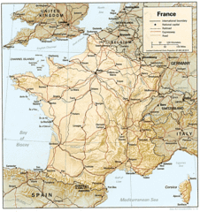
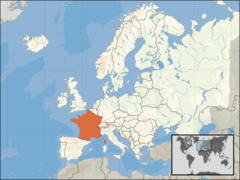
Republic of France is located at 46°0'0"N 2°0'0"E (46.0000000, 2.0000000). It has 16 neighbors: Spain, United Kingdom, Switzerland, Netherlands, Belgium, Germany, Luxembourg, Monaco, Andorra, Navarra, Italy, Suriname, Brazil, Netherlands Antilles, Saint Martin and Venezuela.
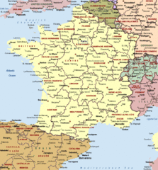
France map
The largest city of Republic of France is Paris with a population of 2,187,526. Other cities include, Nice population 340,017, Nantes population 309,346, Montpellier population 285,121 and Reims population 182,460. See all Republic of France cities & populated places.
Compare Republic of France with
- Burgundy
- Wallis and Futuna
- Lorraine
- Saint Barthélemy
- Champagne-Ardenne
- Rhône
- Occitania
- Picardy
- French Polynesia
- Aquitaine
- Mayotte
- Réunion
- Pays de la Loire
- Normandy
- Midi-Pyrénées
- New Caledonia
- Île-de-France
- Hauts-de-France
- French Southern and Antarctic Lands
- Martinique
- Limousin
- Rhône-Alpes
- Auvergne-Rhône-Alpes
- Nord-Pas-de-Calais
- Guadeloupe
- Lower Normandy
- Poitou-Charentes
- Brittany
- Upper Normandy
- Bourgogne-Franche-Comté
- Saint Pierre and Miquelon
- Corsica
- Clipperton Island
- Provence-Alpes-Côte d'Azur
- Grand Est
- Nouvelle-Aquitaine
- Alsace
- Languedoc-Roussillon
- Centre-Val de Loire
- Saint Martin (French part)
- Auvergne
- Alpes
- Franche-Comté
- French Guiana
Demographics
| Year | Population | % Change | Method |
|---|---|---|---|
| 1901 | 40,681,000 | - | 2016-01-01T00:00:00Z |
| 1906 | 41,067,000 | 0.94% | 2016-01-01T00:00:00Z |
| 1911 | 41,415,000 | 0.84% | 2016-01-01T00:00:00Z |
| 1960 | 46,647,521 | 11.22% | 2016-01-01T00:00:00Z |
| 1961 | 47,293,811 | 1.37% | 2016-01-01T00:00:00Z |
| 1962 | 47,990,159 | 1.45% | 2016-01-01T00:00:00Z |
| 1963 | 48,697,015 | 1.45% | census |
| 1964 | 49,361,165 | 1.35% | 2016-01-01T00:00:00Z |
| 1965 | 49,945,471 | 1.17% | 2016-01-01T00:00:00Z |
| 1966 | 50,430,631 | 0.96% | 2016-01-01T00:00:00Z |
| 1967 | 50,829,214 | 0.78% | 2016-01-01T00:00:00Z |
| 1968 | 51,175,036 | 0.68% | 2016-01-01T00:00:00Z |
| 1969 | 51,518,731 | 0.67% | 2016-01-01T00:00:00Z |
| 1970 | 51,895,793 | 0.73% | 2016-01-01T00:00:00Z |
| 1971 | 52,320,049 | 0.81% | 2016-01-01T00:00:00Z |
| 1972 | 52,776,806 | 0.87% | 2016-01-01T00:00:00Z |
| 1973 | 53,239,101 | 0.87% | 2016-01-01T00:00:00Z |
| 1974 | 53,666,947 | 0.8% | 2016-01-01T00:00:00Z |
| 1975 | 54,033,095 | 0.68% | 2016-01-01T00:00:00Z |
| 1976 | 54,328,016 | 0.54% | 2016-01-01T00:00:00Z |
| 1977 | 54,565,943 | 0.44% | 2016-01-01T00:00:00Z |
| 1978 | 54,772,084 | 0.38% | 2016-01-01T00:00:00Z |
| 1979 | 54,982,879 | 0.38% | 2016-01-01T00:00:00Z |
| 1980 | 55,224,670 | 0.44% | 2016-01-01T00:00:00Z |
| 1981 | 55,505,282 | 0.51% | 2016-01-01T00:00:00Z |
| 1982 | 55,816,654 | 0.56% | 2016-01-01T00:00:00Z |
| 1983 | 56,149,874 | 0.59% | 2016-01-01T00:00:00Z |
| 1984 | 56,489,874 | 0.6% | 2016-01-01T00:00:00Z |
| 1985 | 56,825,158 | 0.59% | 2016-01-01T00:00:00Z |
| 1986 | 57,155,165 | 0.58% | 2016-01-01T00:00:00Z |
| 1987 | 57,482,783 | 0.57% | 2016-01-01T00:00:00Z |
| 1988 | 57,803,824 | 0.56% | 2016-01-01T00:00:00Z |
| 1989 | 58,113,622 | 0.53% | 2016-01-01T00:00:00Z |
| 1990 | 58,409,202 | 0.51% | 2016-01-01T00:00:00Z |
| 1991 | 58,557,072 | 0.25% | 2016-01-01T00:00:00Z |
| 1992 | 58,849,212 | 0.5% | 2016-01-01T00:00:00Z |
| 1993 | 59,105,073 | 0.43% | 2016-01-01T00:00:00Z |
| 1994 | 59,325,793 | 0.37% | 2016-01-01T00:00:00Z |
| 1995 | 59,540,711 | 0.36% | 2016-01-01T00:00:00Z |
| 1996 | 59,752,020 | 0.35% | 2016-01-01T00:00:00Z |
| 1997 | 59,963,792 | 0.35% | 2016-01-01T00:00:00Z |
| 1998 | 60,185,178 | 0.37% | 2016-01-01T00:00:00Z |
| 1999 | 60,495,470 | 0.51% | 2016-01-01T00:00:00Z |
| 2000 | 60,911,057 | 0.68% | 2016-01-01T00:00:00Z |
| 2001 | 61,355,725 | 0.72% | census |
| 2002 | 61,803,229 | 0.72% | 2016-01-01T00:00:00Z |
| 2003 | 62,242,474 | 0.71% | census |
| 2004 | 62,702,121 | 0.73% | 2016-01-01T00:00:00Z |
| 2005 | 63,176,246 | 0.75% | census |
| 2006 | 63,617,975 | 0.69% | 2016-01-01T00:00:00Z |
| 2007 | 64,012,572 | 0.62% | 2016-01-01T00:00:00Z |
| 2008 | 64,371,099 | 0.56% | 2016-01-01T00:00:00Z |
| 2009 | 64,702,921 | 0.51% | 2016-01-01T00:00:00Z |
| 2010 | 65,023,142 | 0.49% | 2016-01-01T00:00:00Z |
| 2011 | 65,343,588 | 0.49% | 2016-01-01T00:00:00Z |
| 2012 | 65,649,570 | 0.47% | 2016-01-01T00:00:00Z |
| 2013 | 65,939,866 | 0.44% | 2016-01-01T00:00:00Z |
| 2014 | 66,312,067 | 0.56% | (Worldbank) |
| 2015 | 66,380,602 | 0.1% | 2016-01-01T00:00:00Z |
| 2016 | 66,632,870 | 0.38% | 2016-01-01T00:00:00Z |
| 2017 | 67,118,648 | 0.72% | 2016-01-01T00:00:00Z |
| 2018 | 66,965,912 | -0.23% | (Worldbank) |
| 2019 | 67,059,887 | 0.14% | (Worldbank) |
| 2026 | 66,351,959 | -1.07% |
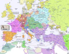
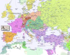
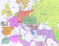
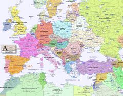
Map & Images (more maps)
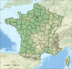
Departements of France
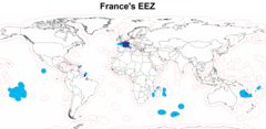
Eez France
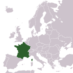
Europe Location France
Europe Location of France
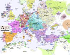
Europe Map 1000
Europe Map 1100
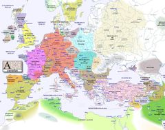
Europe Map 1200
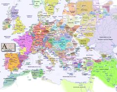
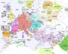
Europe Map 1300
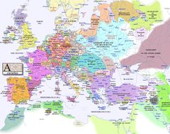
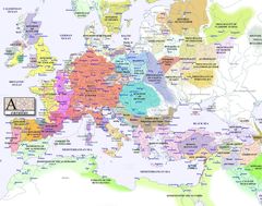
Europe Map 1400
Europe Map 1500
Europe Map 1600
Europe Map 1700
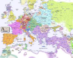
Europe Map 1800
Europe Map 1900
Europe Map 2000
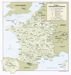
France Admin
France Cities
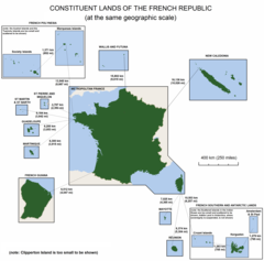
France Constituent Lands
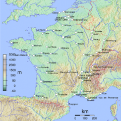
France Map Jpg
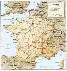
France Political Map