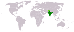
India (Republic of India), IN
India: Located in South Asia, this vast country is the world's most populous democracy.
About

Country Snapshot
Republic of India at a glance
Republic of India currently has 2,078 quality-checked populated place pages and 33 state or regional pages linked on MapSof.
Mapped cities & towns
2,078
These counts use a stricter populated-place filter so the main lists stay focused on real city and town pages.
States & regions
33
Open related pagesLargest city
DelhiPopulation 26,495,000
Top linked places
Quick Facts about Republic of India
| Population | 1,417,492,000 |
| Country | India |
| Plate code | IND |
| Area | 3287263 km2 |
| Official name | بھارت, भारत, भारत, India, भारत गणराज्य, Republic of India, la République de l’Inde |
| Water as percent of area | 9.5% |
| Land as percent of area | 90.5% |
| Continent | Asia |
| Easternmost point | Point(97.39535585 28.01174361) |
| Northernmost point | Point(76.78 35.62) |
| Latitude & Longitude | 22.0000,79.0000 |
| Legislative body | Parliament of India |
| Named for | Indus River, Bharata |
| Official language | Hindi, English |
| Capital | New Delhi |
| Establishment | August 15, 1947 (78 years ago) |
| Time Zone | Indian Standard Time |
| Local time | 11:05:37 (17th July 2026) |

Geography
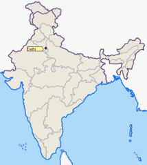
Republic of India is located at 22°0'0"N 79°0'0"E (22.0000000, 79.0000000). It has 8 neighbors: Pakistan, Bangladesh, Sri Lanka, Bhutan, Nepal, Myanmar, Indonesia and China.
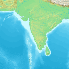
India map
The largest city of Republic of India is Bengaluru with a population of 11,250,000. Other cities include, Hyderabad population 9,305,000, Ahmedabad population 7,645,000, Surat population 5,935,000 and Kanpur population 2,823,249. See all Republic of India cities & populated places.
Official website of Republic of India
Official WebsiteCompare Republic of India with
- Assam
- Uttar Pradesh
- Andaman and Nicobar Islands
- Bihar
- Puducherry
- Dadra and Nagar Haveli
- Ladakh
- Jammu and Kashmir
- Kerala
- Sikkim
- Jharkhand
- Andhra Pradesh
- Arunachal Pradesh
- Maharashtra
- Goa
- Meghalaya
- Chhattisgarh
- Jammu and Kashmir
- Daman and Diu
- Haryana
- Manipur
- Uttarakhand
- Himachal Pradesh
- Telangana
- Mizoram
- Tamil Nadu
- Rajasthan
- Nagaland
- Tripura
- Gujarat
- Karnataka
- Punjab
- Madhya Pradesh
- Lakshadweep
- Delhi
- Odisha
- West Bengal
- Chandigarh
Demographics
| Year | Population | % Change | Method |
|---|---|---|---|
| 1960 | 449,595,489 | - | estimation process |
| 1961 | 458,626,687 | 1.97% | estimation process |
| 1962 | 467,962,144 | 1.99% | estimation process |
| 1963 | 477,615,992 | 2.02% | estimation process |
| 1964 | 487,607,406 | 2.05% | estimation process |
| 1965 | 497,952,332 | 2.08% | estimation process |
| 1966 | 508,656,247 | 2.1% | estimation process |
| 1967 | 519,722,246 | 2.13% | estimation process |
| 1968 | 531,160,986 | 2.15% | estimation process |
| 1969 | 542,983,934 | 2.18% | estimation process |
| 1970 | 555,199,768 | 2.2% | estimation process |
| 1971 | 567,805,061 | 2.22% | estimation process |
| 1972 | 580,798,773 | 2.24% | estimation process |
| 1973 | 594,192,969 | 2.25% | estimation process |
| 1974 | 608,002,572 | 2.27% | estimation process |
| 1975 | 622,232,355 | 2.29% | estimation process |
| 1976 | 636,883,717 | 2.3% | estimation process |
| 1977 | 651,935,141 | 2.31% | estimation process |
| 1978 | 667,339,022 | 2.31% | estimation process |
| 1979 | 683,032,539 | 2.3% | estimation process |
| 1980 | 698,965,575 | 2.28% | estimation process |
| 1981 | 715,105,168 | 2.26% | estimation process |
| 1982 | 731,443,752 | 2.23% | estimation process |
| 1983 | 747,986,284 | 2.21% | estimation process |
| 1984 | 764,749,394 | 2.19% | estimation process |
| 1985 | 781,736,502 | 2.17% | estimation process |
| 1986 | 798,941,802 | 2.15% | estimation process |
| 1987 | 816,328,792 | 2.13% | estimation process |
| 1988 | 833,833,510 | 2.1% | estimation process |
| 1989 | 851,374,699 | 2.06% | estimation process |
| 1990 | 868,890,700 | 2.02% | estimation process |
| 1991 | 886,348,712 | 1.97% | estimation process |
| 1992 | 903,749,636 | 1.93% | estimation process |
| 1993 | 921,107,534 | 1.88% | estimation process |
| 1994 | 938,452,550 | 1.85% | estimation process |
| 1995 | 955,804,355 | 1.82% | estimation process |
| 1996 | 973,147,577 | 1.78% | estimation process |
| 1997 | 990,460,131 | 1.75% | estimation process |
| 1998 | 1,007,746,556 | 1.72% | estimation process |
| 1999 | 1,025,014,711 | 1.68% | estimation process |
| 2000 | 1,042,261,758 | 1.65% | estimation process |
| 2001 | 1,059,500,888 | 1.63% | estimation process |
| 2002 | 1,076,705,723 | 1.6% | estimation process |
| 2003 | 1,093,786,762 | 1.56% | estimation process |
| 2004 | 1,110,626,108 | 1.52% | estimation process |
| 2005 | 1,127,143,548 | 1.47% | estimation process |
| 2006 | 1,143,289,350 | 1.41% | estimation process |
| 2007 | 1,159,095,250 | 1.36% | estimation process |
| 2008 | 1,174,662,334 | 1.33% | estimation process |
| 2009 | 1,190,138,069 | 1.3% | estimation process |
| 2010 | 1,205,624,648 | 1.28% | estimation process |
| 2011 | 1,221,156,319 | 1.27% | estimation process |
| 2012 | 1,236,686,732 | 1.26% | estimation process |
| 2013 | 1,252,139,596 | 1.23% | estimation process |
| 2014 | 1,263,200,000 | 0.88% | estimation process |
| 2015 | 1,309,053,980 | 3.5% | estimation process |
| 2016 | 1,324,171,354 | 1.14% | estimation process |
| 2017 | 1,339,180,127 | 1.12% | estimation process |
| 2018 | 1,349,217,956 | 0.74% | estimation process |
| 2019 | 1,366,417,754 | 1.26% | (Worldbank) |
| 2020 | 1,326,093,247 | -3.04% | estimation process |
| 2026 | 1,417,492,000 | 6.45% |
Map & Images (more maps)
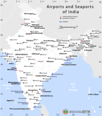
Airports And Seaports Map
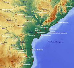
Andhra Pradesh Map
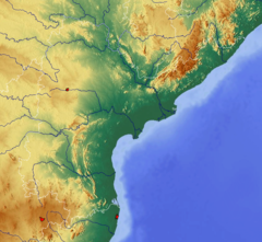
Andhra Pradesh Topographic
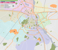
Delhi Area Locator Map
Delhi Location Png
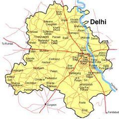
Delhi Map
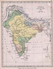
Historical Maps India In 1760
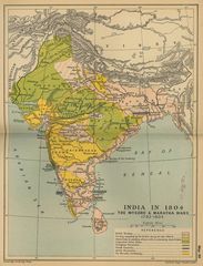
Historical Maps India In 18
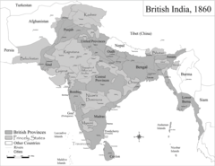
Historic Maps British India
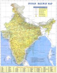
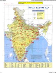
Indian Railways Map
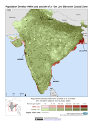
India 10m Lecz And Populati
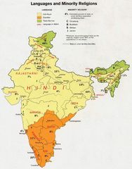
India Languages 1973
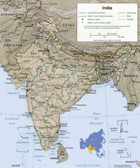
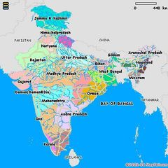
India Map
India Map Bbsr Direct Train Full
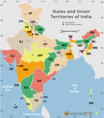
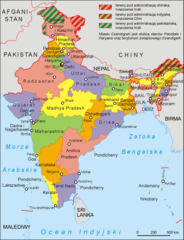
India States By Rto Codes
India Topographic
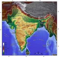
India Topographic Map
Indie 2006
Ind Tou
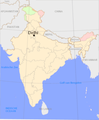
Location of Delhi Png