
Map & Images
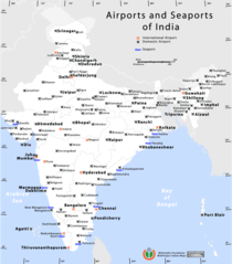
Airports And Seaports Map
1000 x 1138 - 71,764k -
png
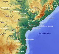
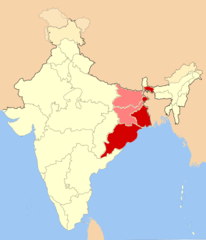
Andhra Pradesh Map
842 x 777 - 121,219k -
jpg
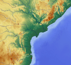
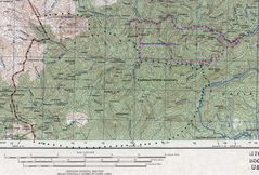
Andhra Pradesh Topographic
842 x 777 - 357,687k -
png
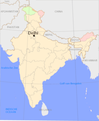
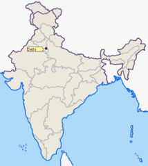
Delhi Area Locator Map
920 x 801 - 79,443k -
png
Delhi Location Png
1165 x 1415 - 64,984k -
PNG
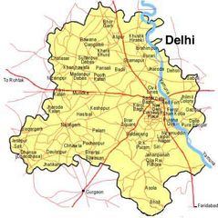
Delhi Map
428 x 429 - 33,844k -
jpg
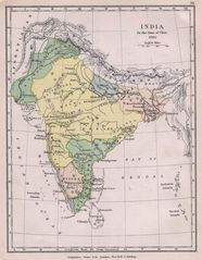
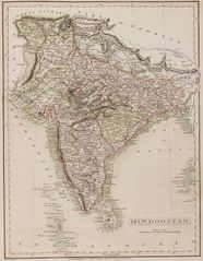
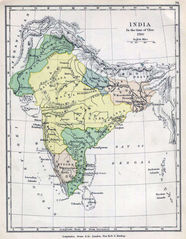
Historical Maps India In 1760
1154 x 1485 - 230,181k -
jpg
Historical Maps India In 18
1736 x 2276 - 502,231k -
jpg
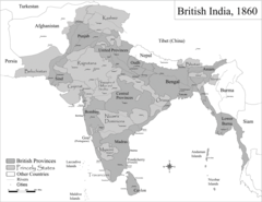
Historic Maps British India
1600 x 1235 - 191,527k -
png
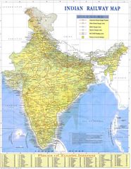
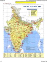
Indian Railways Map
1500 x 1935 - 488,116k -
jpg
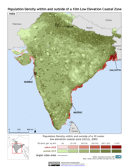
India 10m Lecz And Populati
1275 x 1650 - 334,105k -
png
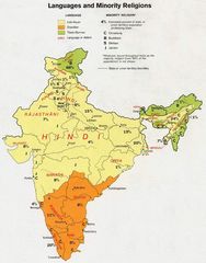
India Languages 1973
912 x 1162 - 138,922k -
jpg
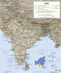
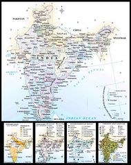
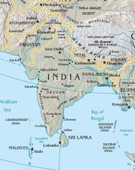
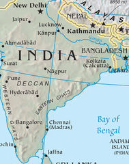
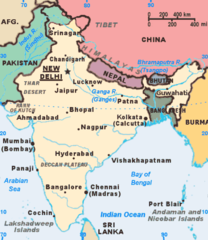
India Map
970 x 1166 - 207,913k -
jpg
India Map Bbsr Direct Train Full
1718 x 2223 - 515,318k -
jpg

India States By Rto Codes
2083 x 2371 - 234,548k -
png
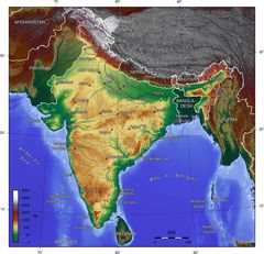
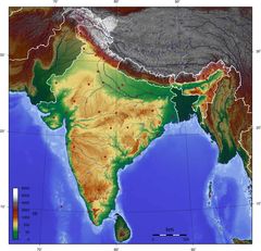
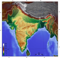
India Topographic
1200 x 1200 - 353,212k -
png
India Topographic Map
1800 x 1736 - 374,346k -
jpg
Indie 2006
1041 x 1360 - 88,907k -
png
Ind Tou
480 x 480 - 37,675k -
jpg
Location of Delhi Png
400 x 447 - 17,398k -
PNG

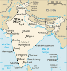
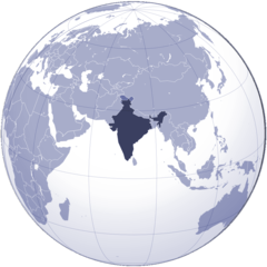
Location of India
1427 x 628 - 36,690k -
png
Map of India
1800 x 2275 - 442,369k -
jpg
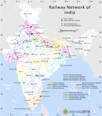
Railway Network Map
1000 x 1138 - 92,091k -
png
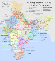
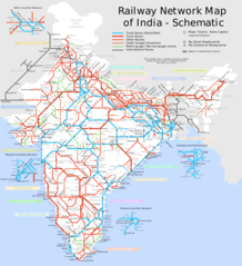
Railway Network Schematic M
2282 x 2500 - 457,683k -
png
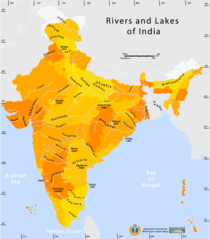
Rivers And Lakes Map of India
1000 x 1138 - 59,901k -
png
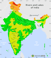
Rivers And Lakes Topo Map of India
1000 x 1138 - 62,861k -
png
South Asia
425 x 533 - 47,288k -
jpg
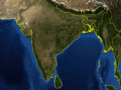
South Asia Satellite
1280 x 958 - 153,104k -
jpg
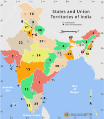
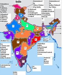
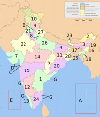
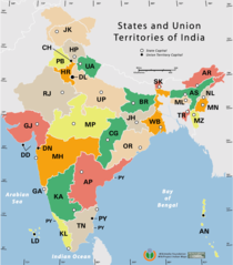
States And Union Territories of India Png
1000 x 1138 - 50,176k -
PNG
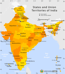
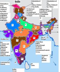
State And Union Territories Map
1000 x 1138 - 56,534k -
png
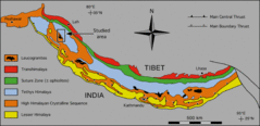
2 2 Himal Tecto Units
768 x 373 - 36,844k -
gif
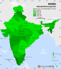
Alphabetisierungsrate
527 x 600 - 21,191k -
png
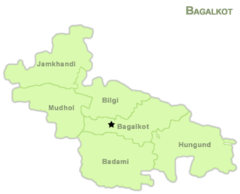
Bagakot Map
383 x 310 - 7,551k -
png
Bangalore 77 58328e 12 98331n
1280 x 958 - 284,299k -
jpg
Bombay 72 86065e 19 07915n
1280 x 958 - 171,216k -
jpg
Calcutta
604 x 765 - 118,559k -
jpg
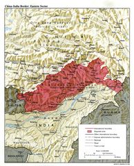
China India Eastern Border 1
1048 x 1294 - 367,645k -
jpg
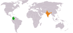
Colombia India Locator 1
1325 x 601 - 16,445k -
png
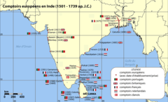
Comptoirsinde
1140 x 700 - 52,901k -
png
Cooch Behar Enclaves Systematisch 1
950 x 1855 - 226,973k -
png
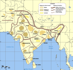
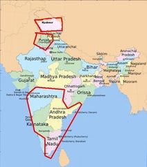
Cultural Regional Areas of India
1199 x 1153 - 86,674k -
png
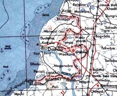
Daman 1956
459 x 378 - 177,976k -
jpg
Dehradun Indien
200 x 144 - 8,146k -
jpg
Demoindien 2
290 x 269 - 15,356k -
jpg
Dharamsala Indien
196 x 201 - 10,710k -
jpg
Distribution of Christians In Indian States
906 x 1053 - 69,509k -
jpg
Eaglenest Topo
2164 x 1467 - 737,023k -
jpg
East India Locator
514 x 600 - 16,669k -
png
Eastern Ghats
896 x 1300 - 129,494k -
png
Eastindiamap
624 x 704 - 20,824k -
png
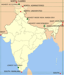
Extreme Points of India En
903 x 1054 - 44,464k -
png
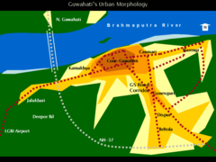
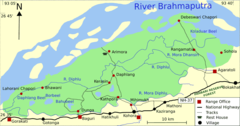
Guwahati Urban Morphology
800 x 600 - 23,886k -
png
Hindi Belt
624 x 704 - 22,875k -
gif
Hinterland of Kolkata Port
530 x 599 - 29,369k -
jpg
Hyderabad 78 49154e 17 40593n
1280 x 958 - 322,322k -
jpg
Ist Cia Tz
429 x 459 - 22,665k -
png
In Ahmedabad
327 x 352 - 11,726k -
png
In Ar Kaart
460 x 482 - 29,342k -
jpg
In Hr Kaart
460 x 482 - 29,627k -
jpg
Inde Fleuves
350 x 402 - 16,400k -
png

India 78 40398e 20 74980n
1280 x 958 - 171,043k -
jpg
India Bangladesh Border Us Army Map Service 1
680 x 788 - 294,868k -
jpg
India China Locator 1
1357 x 628 - 16,464k -
png
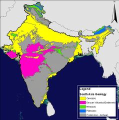
India Geology Zones
582 x 586 - 193,397k -
jpg
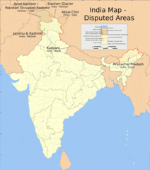
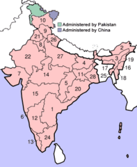
India Disputed Areas Map
906 x 1024 - 86,865k -
png
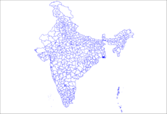
India Districts
1281 x 878 - 27,745k -
png
India Railway Schematic Map
909 x 998 - 154,547k -
png
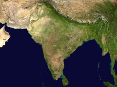
India Satellite Image
950 x 703 - 321,884k -
png
India Ter
512 x 608 - 79,128k -
jpg
India Ter1
512 x 608 - 79,415k -
jpg
India Topo Blank
1800 x 1736 - 261,914k -
jpg
India Topo Blank 1
950 x 916 - 371,868k -
png
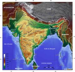
India Topogaphy Fr
1600 x 1543 - 270,308k -
jpg
India Wine Regions
530 x 599 - 48,453k -
jpg
India Cia Wfb Map
329 x 353 - 23,889k -
png
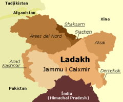
India Ladakh
903 x 1054 - 34,324k -
png
India Geology Map Fr
300 x 352 - 9,664k -
png
India Geology Map
300 x 352 - 9,647k -
png
India Locator Map Blank
903 x 1054 - 34,015k -
png
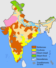
India Naturalhazards Map Fr
350 x 427 - 12,256k -
png
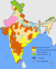
India Naturalhazards Map
350 x 427 - 12,237k -
png
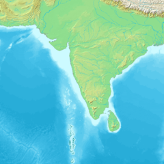
India Physical Map
300 x 262 - 7,158k -
png
India State Elections 2006
903 x 1054 - 33,376k -
png
India States Numbered
902 x 1057 - 51,897k -
png

Indiaflagindoors
784 x 465 - 11,967k -
png
Indiamap
474 x 547 - 33,248k -
png
Indianumbered
300 x 365 - 12,092k -
png
Indianumbered3
300 x 360 - 11,992k -
png
Indiastatesbyrtocodes
2083 x 2371 - 234,548k -
png
Indiahills
609 x 700 - 30,754k -
png
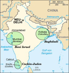
Indian Jews Communities Map De
328 x 352 - 14,697k -
png
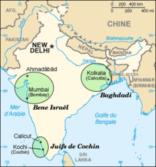
Indian Jews Communities Map Fr
328 x 352 - 15,014k -
png

Indian Jews Communities Map
328 x 352 - 14,695k -
png
Indie 2006 7
1041 x 1360 - 88,907k -
png
Indien Haryana
200 x 231 - 5,779k -
png
Indien Verwaltungsgliederung
2083 x 2371 - 222,832k -
png
Indien Karta Andaman Nicobar
290 x 277 - 10,663k -
jpg
Indien Karta Dadra Nagar Haveli
169 x 179 - 8,124k -
jpg
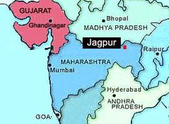
Indien Karta Jagpur
270 x 199 - 11,961k -
jpg
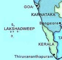
Indien Karta Lakshadweep
168 x 162 - 6,308k -
jpg
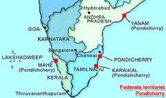
Indien Karta Pondicherry
290 x 173 - 10,711k -
jpg
Indogangeticplain Map 1
433 x 290 - 21,308k -
png
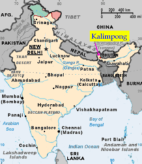
Kalimponglocation
474 x 547 - 36,086k -
png
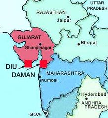
Karta Diu Daman
238 x 261 - 15,278k -
jpg
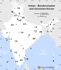
Karte Indien Bundesstaaten Unionsterritorien
800 x 910 - 38,848k -
png
Kashmir Map Big 1
985 x 1131 - 280,898k -
jpg
Kaziranga National Park Map En Mod
920 x 483 - 33,962k -
png
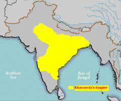
Kharavela Kingdom
400 x 337 - 10,971k -
gif
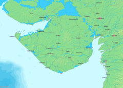
Khatiawar
1143 x 819 - 118,985k -
png
Ladakhmapa
400 x 333 - 6,846k -
gif
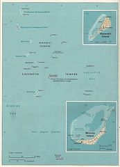
Lakshadweep Map
882 x 1222 - 174,964k -
jpg
Language Travel From India 1
919 x 765 - 54,172k -
png
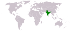
Locationindia
1427 x 628 - 36,690k -
png
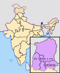
Locationgangtok
300 x 365 - 13,126k -
png
Lucknow 80 92169e 26 85143n
1280 x 958 - 194,834k -
jpg
Madurai 78 11654e 9 93331n
1280 x 958 - 270,356k -
jpg
Map Guj Gir Natpark Sanctuary
1210 x 826 - 50,374k -
png
Map India
330 x 355 - 17,302k -
png
Northindiamap
624 x 704 - 22,658k -
gif
Penjab Carte 1
300 x 214 - 21,141k -
jpg
Primary School With Wall Writing And Map
800 x 600 - 123,312k -
jpg
Ranchi Indien
206 x 194 - 11,992k -
jpg
Relief Inde
522 x 600 - 29,572k -
png

River Ganges And Tributaries
863 x 586 - 131,709k -
png
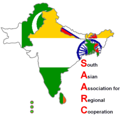
Saarc 1
556 x 536 - 14,725k -
png
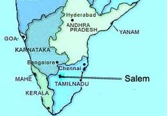
Salem I Indien
290 x 202 - 9,700k -
jpg
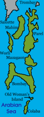
Sevenislandsofbombay
150 x 397 - 6,364k -
png
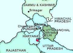
Shimla Indien
241 x 175 - 10,295k -
jpg
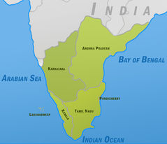
South India Polmap,
529 x 456 - 60,423k -
jpg
South Asia Local Lang
725 x 622 - 29,551k -
png
South Asia Local
725 x 622 - 27,643k -
png
Southindiaregionsweb
790 x 794 - 60,094k -
png
Topografic Map of Himalaya 1
1200 x 644 - 533,707k -
png

Topographic30deg N0e60
1200 x 1200 - 353,366k -
png
Vishakhapatnam 83 32513e 17 72616n
1280 x 958 - 180,241k -
jpg
Western Ghats
552 x 1458 - 65,991k -
png
Westindiamap
624 x 704 - 20,723k -
png
Wikipedia Oldmysore
1200 x 840 - 273,047k -
jpg
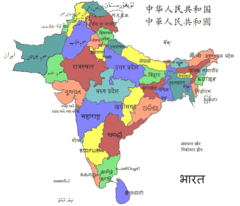
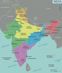
Political Map of India 1996
720 x 855 - 400,448k -
gif
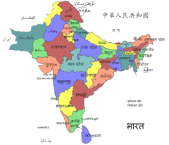
Political Map of India 2001
720 x 867 - 419,965k -
gif
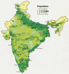
Population Map of India 1973
720 x 764 - 335,349k -
gif
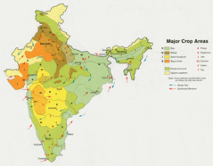
Crop Areas Map of India 1973
720 x 560 - 203,954k -
gif
Shared Relief Map of India 1996
720 x 882 - 432,376k -
gif
Shared Releif Map of India 1979
720 x 838 - 201,766k -
gif
Religions Map of India 1987
720 x 854 - 364,713k -
gif

Languages And Religions Map of India 1973
720 x 917 - 378,903k -
gif
Small Map of India 2005
327 x 351 - 18,959k -
gif
India Airports And Seaports Map
1000 x 1138 - 91,349k -
png
India Flag Map
2048 x 2048 - 104,667k -
png
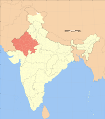
India Rajasthan Locator Map
1024 x 1157 - 113,649k -
png
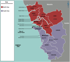
Map India Goa
1255 x 1104 - 76,387k -
png
Map of India 1
996 x 1186 - 84,395k -
png
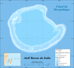
Bassas Da India Atoll Map Fr
1555 x 1435 - 119,716k -
png
India Climatic Zone Map
2000 x 2260 - 253,152k -
png
Indian Railways Map 1
1500 x 1935 - 488,116k -
jpg
India Physical
550 x 664 - 98,519k -
png
India National Roads Map
2000 x 2260 - 424,137k -
png
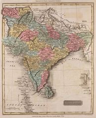
Historical Map India
1400 x 1141 - 328,777k -
jpg
Historical Map India (1808)
932 x 1200 - 205,300k -
jpg
Historical Map of India (1809)
984 x 1214 - 249,858k -
jpg

India Historical Map
932 x 1200 - 205,300k -
jpg
India Pakistan Physical Map
785 x 852 - 181,641k -
jpg
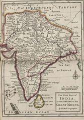
India Historical Map (mogul)
732 x 1050 - 183,902k -
jpg
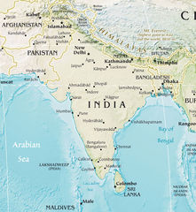
Where Is India Located
1000 x 1000 - 124,032k -
png
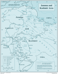
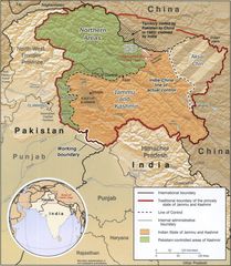
Jammu Kashmir
1963 x 2507 - 332,385k -
png
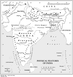
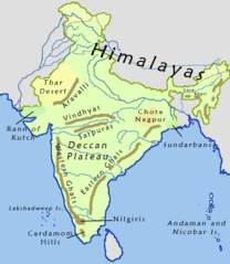
Physical Features of India
2117 x 2224 - 379,707k -
png
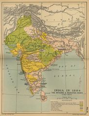
India Map 1760
1154 x 1485 - 342,822k -
jpg
Map of the Mughal Empire at its Greatest Extent 1700 under Aurangzeb
1408 x 808 - 478,322k -
jpg