Hyderabad, Telangana
Hyderabad: Located in south-central India on the Deccan Plateau, this major city is the capital of Telangana state.
About
Quick Facts about Hyderabad
| Population | 9,305,000 |
| Country | Hyderabad State, Mughal Empire, Qutb Shahi dynasty, India |
| State | Telangana (India) |
| County | Hyderābād |
| Postal code | 500001 |
| Plate code | AP10, AP09, AP12, AP28, AP29, AP11, AP13 |
| Phone Area Codes | 040 |
| Official name | حیدر آباد, హైదరాబాదు |
| Latitude & Longitude | 17.3841,78.4564 |
| Male population | 1901271 |
| Official language | English, Urdu, Telugu |
| Female population | 1817380 |
| Altitude | 1,657 feet / 505 meters |
| Capital city | Hyderabad is capital of Hyderabad State, Ranga Reddy district, Hyderabad State, Hyderabad district, Andhra Pradesh, Telangana |
| Establishment | January 01, 1592 (434 years ago) |
| Time Zone | UTC+05:30 |
| Local time | 12:11:22 (17th July 2026) |
Geography
Hyderabad is located at 17°23'3"N 78°27'23"E (17.3840500, 78.4563600).
Hyderabad map
Click "full screen"  icon to open full mode. View satellite images
Official website of Hyderabad
Official Website- Indianapolis (2010 )
- Isfahan
- Kazan
- Mantua
- Medellín
- Montgomery County (2014 )
- Riverside
- Suwon
- Taipei (2000 )
Demographics
| Year | Population | % Change | Method |
|---|---|---|---|
| 2011 | 6,731,790 | - | estimation process |
| 2016 | 9,305,000 | 27.65% | estimation process |
Map of countries with a smaller population than Hyderabad
Bhaganagar, HYD, Haidarabadas, Haiderabad, Hajdarabad, Hajdarábád, Hyderabad-Deccan, Hyderābād, Khajdarabad, Khajderabad, hai de la ba, haidarabada, haidarabadu, haiderabado, haitarapat, hayadarabada ema. karporesana, hayadrabada, hydr abad, hydr abad dkn, hydrabad, Хайдарабад, Хајдерабад, حیدر آباد, حیدر آباد دکن, حیدرآباد, हैदराबाद, হায়দরাবাদ এম. কর্পোরেশন, হায়দ্রাবাদ, ஹைதராபாத், హైదరాబాదు, ハイデラバード, 海得拉巴
Map & Images (more maps)
City Map of Delhi
600 x 519
- 35,252k -
jpg
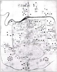
Historical Map of Ahmedabad
951 x 1200
- 143,993k -
jpg
History Map of Uttar Pradesh
700 x 525
- 119,119k -
jpg
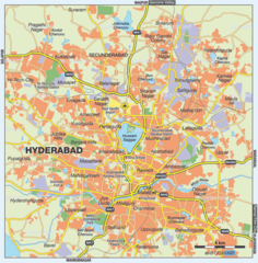
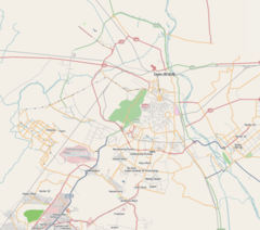
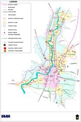
Hyderabad City Map
1000 x 1018
- 185,116k -
png
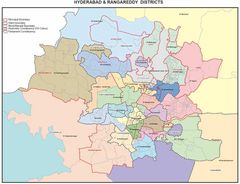
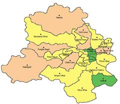
Hyderabad Districts Map
1100 x 845
- 93,425k -
jpg
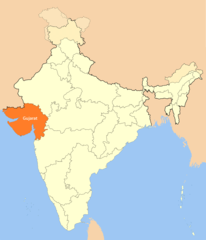
Location Map of Gujarat
1714 x 2000
- 100,984k -
png
Map of Delhi 1
1050 x 927
- 126,698k -
png
Physical Map of Gujarat
600 x 470
- 66,935k -
png
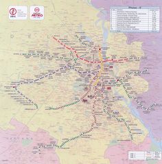
Subway (metro) Map Delhi
1400 x 1420
- 311,900k -
jpg
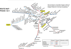
Subway Map of Delhi
1400 x 954
- 154,419k -
png
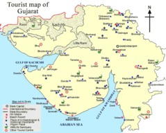
Tourist Map of Gujarat
720 x 578
- 82,428k -
png
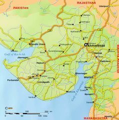
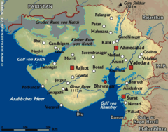
Transport Map of Gujarat
700 x 706
- 79,603k -
jpg
Transport Map of West Bengal
1199 x 1800
- 226,459k -
jpg