Minnesota, US
Minnesota: Located in the upper Midwest region of the United States, this state is home to the major cities of Minneapolis and Saint Paul.
About
Minnesota is a state located in the Upper Midwest region of the United States. It borders North Dakota, South Dakota, Iowa, Wisconsin, and the Canadian provinces of Ontario and Manitoba. Minnesota is known as the "Land of 10,000 Lakes."
Some key facts about Minnesota:
- Capital: St. Paul
- Population: Around 5.6 million (21st most populous state)
- Area: 86,940 square miles (12th largest state)
- Nickname: The North Star State
Minnesota has a diverse geography ranging from prairie to forests and wetlands. The state's most iconic natural feature is the Mississippi River, which begins in Minnesota and flows southwards. Major lakes include Lake Superior, Lake of the Woods, and the Lake Minnetonka chain.
Culturally, Minnesota has been shaped by Native American tribes as well as European immigrants. Logging, farming, and flour milling drove the early economy. Today, major industries include technology, healthcare, retail, manufacturing, and tourism.
The Twin Cities metropolitan area, centered on Minneapolis and St. Paul, is home to over half the state's population. Other major cities include Duluth and Rochester. The University of Minnesota is a major educational institution.
Minnesota is known for its dramatic seasons, from warm humid summers to cold snowy winters. Outdoor recreation like fishing, boating, and skiing are popular pastimes. Sports, arts, food, and shopping are all part of Minnesota's vibrant urban scenes.
In summary, Minnesota is an iconic Upper Midwestern state with thousands of lakes, strong cultural traditions, a robust economy, and a quintessential four-season climate. The state's friendly residents and dynamic cities make it a great place to live, work, and explore.

State Snapshot
Minnesota at a glance
Minnesota currently has 1,198 quality-checked populated place pages and 87 county pages linked on MapSof.
Mapped cities & towns
1,198
These counts use a stricter populated-place filter so the main lists stay focused on real city and town pages.
County pages
87
Open related pagesLargest city
MinneapolisPopulation 433,111
Top linked places
Quick Facts about Minnesota
| Population | 5,657,342 |
| Country | United States of America |
| Area | 225163 km2 |
| Water as percent of area | 8.41% |
| Land as percent of area | 91.59% |
| Easternmost point | Point(-89.483316666 48.014241666) |
| Northernmost point | Point(-95.153388888 49.384472222) |
| Latitude & Longitude | 46.2502,-94.2506 |
| Legislative body | Minnesota Legislature |
| Named for | Minnesota River |
| Altitude | 1,198 feet / 365 meters |
| Capital | Saint Paul |
| Establishment | May 11, 1858 (168 years ago) |
| Time Zone | America/Chicago, Central Time Zone, UTC−06:00 |
| Local time | 08:19:41 (24th July 2026) |
| Weather | 83℉ Mostly Sunny 7-days weather |

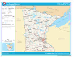
Geography
Minnesota is located at 46°15'1"N 94°15'2"W (46.2502400, -94.2505500). It has 8 neighbors: Iowa, Michigan, Wisconsin, North Dakota, South Dakota, Manitoba, Northwest Territories and Ontario.
Minnesota map
The largest city of Minnesota is Minneapolis with a population of 433,111. Other cities include, Saint Paul population 306,717, Bloomington population 84,583, Plymouth population 79,635 and Brooklyn Park population 79,574. See all Minnesota cities & populated places.
Largest Cities in Minnesota (more)
Cities, Towns, Villages, Neighborhoods & Other Populated Places in Minnesota.
| City Name | County | Population |
|---|---|---|
| Minneapolis | Hennepin | 433,111 |
| Saint Paul | Ramsey | 306,717 |
| Bloomington | Hennepin | 84,583 |
| Plymouth | Hennepin | 79,635 |
| Brooklyn Park | Hennepin | 79,574 |
| Maple Grove | Hennepin | 72,881 |
| Lakeville | Dakota | 69,583 |
| Saint Cloud | Stearns | 68,510 |
| Blaine | Anoka | 66,697 |
| Eagan | Dakota | 65,975 |
| Eden Prairie | Hennepin | 64,894 |
| Co on Rapids | Anoka | 62,935 |
| West Co on Rapids | Hennepin | 62,528 |
| Burnsville | Dakota | 62,170 |
| Minnetonka | Hennepin | 55,370 |
| Apple Valley | Dakota | 54,847 |
Show more Minnesota cities and populated places
Weather
Mostly sunny, with a high near 83. South wind 5 to 15 mph, with gusts as high as 25 mph.
7-Day ForecastOfficial website of Minnesota
Official Website- Benton County
- Waseca County
- Winona County
- Becker County
- Dakota County
- Pipestone County
- Scott County
- Chippewa County
- Murray County
- Mower County
- Aitkin County
- Fillmore County
- Pennington County
- Clay County
- Kandiyohi County
- Lake of the Woods County
- Ramsey County
- Martin County
- Jackson County
- Le Sueur County
- Pope County
- Itasca County
- Otter Tail County
- Big Stone County
- Norman County
- Kittson County
- Hennepin County
- Lac qui Parle County
- Chisago County
- Meeker County
- Crow Wing County
- Sibley County
- Houston County
- Wright County
- Marshall County
- Stevens County
- Watonwan County
- Rock County
- Lake County
- Morrison County
- Wilkin County
- Lyon County
- Sherburne County
- Yellow Medicine County
- Isanti County
- Rice County
- Cook County
- Goodhue County
- Nicollet County
- Faribault County
- Wabasha County
- Pine County
- Steele County
- Swift County
- Redwood County
- Anoka County
- Carlton County
- Stearns County
- Clearwater County
- Nobles County
- Mille Lacs County
- Cottonwood County
- Lincoln County
- Polk County
- Renville County
- McLeod County
- Blue Earth County
- Carver County
- Wadena County
- Freeborn County
- Brown County
- Beltrami County
- Dodge County
- Cass County
- Red Lake County
- Kanabec County
- Mahnomen County
- Washington County
- Roseau County
- Hubbard County
- Douglas County
- Olmsted County
- St. Louis County
- Koochiching County
- Grant County
- Traverse County
- Todd County
Demographics
| Year | Population | % Change | Method |
|---|---|---|---|
| 1910 | 2,075,708 | - | census |
| 1920 | 2,387,125 | 13.05% | census |
| 1930 | 2,563,953 | 6.9% | census |
| 1940 | 2,792,300 | 8.18% | census |
| 1950 | 2,982,483 | 6.38% | census |
| 1960 | 3,413,864 | 12.64% | census |
| 1970 | 3,804,971 | 10.28% | census |
| 1980 | 4,075,970 | 6.65% | census |
| 1990 | 4,375,099 | 6.84% | census |
| 2000 | 4,919,479 | 11.07% | census |
| 2010 | 5,303,925 | 7.25% | census |
| 2011 | 5,346,143 | 0.79% | estimation process |
| 2012 | 5,376,643 | 0.57% | estimation process |
| 2013 | 5,413,479 | 0.68% | estimation process |
| 2014 | 5,451,079 | 0.69% | estimation process |
| 2015 | 5,482,032 | 0.56% | estimation process |
| 2016 | 5,522,744 | 0.74% | estimation process |
| 2017 | 5,566,230 | 0.78% | estimation process |
| 2018 | 5,606,249 | 0.71% | estimation process |
| 2019 | 5,639,632 | 0.59% | estimation process |
| 2020 | 5,657,342 | 0.31% | estimation process |
People born in Minnesota (199)
People born in Minnesota, including actress Adele Watson, actress Teal Redmann, actor Reverend Billy and the Church of Life After Shopping, .
More notable people
- Theodore Marston (American film director) he was born in 10/08/1868
- Edward Kitsis (American screenwriter) he was born in 04/02/1971
- Scott William Carter (American writer)
- Frankie Thorn (American actress) she was born in 27/08/1964
- Raymond C. Bushland (US entomologist) he was born in 05/10/1910
- Terre Thaemlitz (American musician) was born in 01/01/1968
- Erik Jensen (actor and playwright) he was born in 20/07/1970
- Blaine Hogan (American actor) he was born in 29/01/1980
- Reid Anderson (Bassist/composer) he was born in 15/10/1970
- Wayne Boring (comic artist) he was born in 05/06/1905
- John Berg (American catholic priest) he was born in 01/01/1970
- Bill Haglund he was born in 01/01/1943
- Brock Pierce (Entrepreneur, former child actor) he was born in 14/11/1980
- Clark Comstock (American actor (1862-1934)) he was born in 07/01/1862
- Curt Perkins he was born in 25/04/1916
- Douglas Crockford (American computer programmer) he was born in 01/01/1955
- Henry Edward Helseth he was born in 01/01/1912
- Lars Martinson (cartoonist) he was born in 01/01/1977
Minnesota Counties (more)
Hennepin County

county in Minnesota, United States
Ramsey County

county in Minnesota, United States
Dakota County

county in Minnesota, United States
| County Name | Population |
|---|---|
| Hennepin County | 1,268,408 |
| Ramsey County | 547,903 |
| Dakota County | 431,807 |
| Anoka County | 359,921 |
| Washington County | 265,476 |
| Saint Louis County | 198,538 |
| Stearns County | 162,038 |
| Olmsted County | 159,298 |
| Scott County | 150,689 |
| Wright County | 140,249 |
| Carver County | 106,565 |
| Sherburne County | 98,811 |
| Blue Earth County | 68,241 |
| Rice County | 67,084 |
| Crow Wing County | 65,644 |
| Clay County | 64,690 |
Show more Minnesota counties
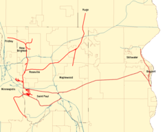
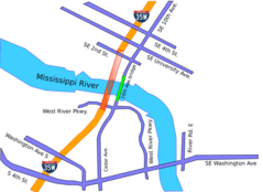
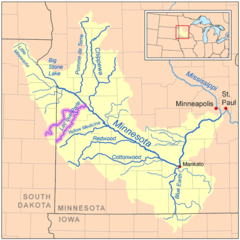
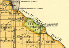
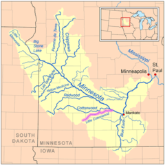
Map & Images (more maps)
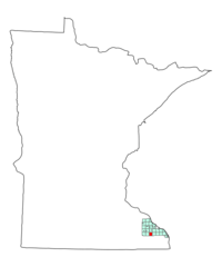
Map of Minnesota Na 1
10th Ave Bridge (minneapolis)
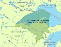
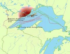
1842treatyoflapointe 1
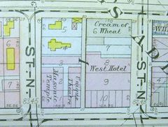
500 Block Minneapolis Plat
Anishinaabewaki 1
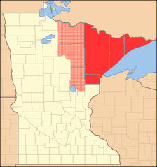
Arrowhead Region, Minnesota
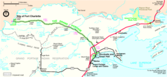
Ctrr Map
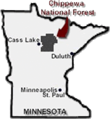
Chippewa National Forest
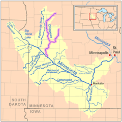
Chippewamnrivermap
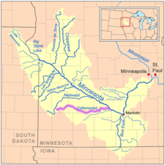
Cottonwoodmnrivermap
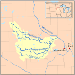
Crow Mnrivermap
Fremont Township, Minnesota Map
Grpo Map
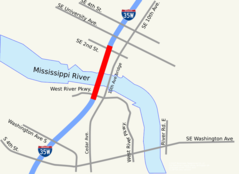
I 35w Bridge
Isleroyaleagreement 1
Lacqueparlerivermap
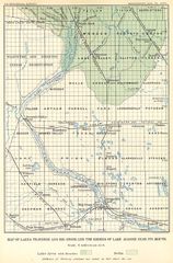
Lake Agassiz, Southern Outlet
Lake Pepin Half Breed
Lcottonwoodmnrivermap
Mnmap Doton Saint Paul