Wisconsin, US
Wisconsin: Located in the upper Midwest of the United States, this state is bordered by Lake Michigan to the east and Lake Superior to the north.
About
Wisconsin is a midwestern state bordered by Lake Michigan, Lake Superior, Minnesota, Iowa, Illinois, and Michigan. Known as "America's Dairyland," it is renowned for its dairy and cheese production.
Some key facts about Wisconsin:
- Capital: Madison
- Population: Around 5.8 million
- Area: 65,496 square miles
- Nickname: The Badger State
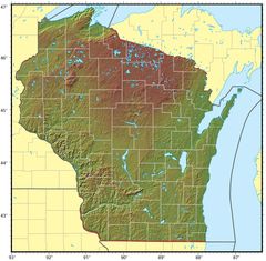
Wisconsin's landscape consists of forests, rolling hills, lakes, and farmland. Major rivers include the Wisconsin River and Mississippi River. The state has thousands of natural lakes, including Lake Winnebago. Seasonal weather ranges from warm, humid summers to frigid, snowy winters.
Agriculture, especially dairy farming, is central to Wisconsin's economy and culture. The state is an epicenter of cheesemaking, producing famous varieties like cheddar and colby. Other major industries include manufacturing, health care, biotech, and tourism.
Wisconsin's largest city is Milwaukee, located on Lake Michigan. The capital Madison is home to the University of Wisconsin. Green Bay, Racine, and Kenosha are other notable cities. The state is passionate about sports like football, basketball, and baseball.
Popular attractions include the Wisconsin Dells, waterparks, lakeside towns, breweries, supper clubs, and historical sites. Cultural festivals celebrate the state's German, Scandinavian, and other immigrant heritage.
In summary, Wisconsin's scenic landscapes, dairy traditions, Midwestern charm, and sports fandom make it a distinctive heartland destination. Its natural beauty and cultural flavour truly make it "America's Dairyland."

State Snapshot
Wisconsin at a glance
Wisconsin currently has 1,015 quality-checked populated place pages and 72 county pages linked on MapSof.
Mapped cities & towns
1,015
These counts use a stricter populated-place filter so the main lists stay focused on real city and town pages.
County pages
72
Open related pagesLargest city
MilwaukeePopulation 589,067
Top linked places
Quick Facts about Wisconsin
| Population | 5,832,655 |
| Country | United States of America |
| Area | 169640 km2 |
| Water as percent of area | 17.31% |
| Land as percent of area | 82.69% |
| Easternmost point | Point(-86.249722222 45.236388888) |
| Northernmost point | Point(-90.654444444 47.31) |
| Latitude & Longitude | 44.5002,-90.0004 |
| Legislative body | Wisconsin Legislature |
| Named for | Wisconsin River |
| Altitude | 1,050 feet / 320 meters |
| Capital | Madison |
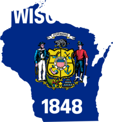
| Establishment | May 29, 1848 (178 years ago) |
| Time Zone | America/Chicago, UTC−06:00, Central Time Zone |
| Local time | 02:06:23 (19th July 2026) |
| Weather | 86℉ Sunny 7-days weather |

Geography
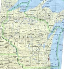
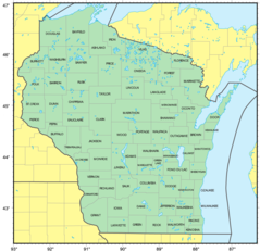
Wisconsin is located at 44°30'1"N 90°0'1"W (44.5002368, -90.0004077). It has 5 neighbors: Iowa, Illinois, Michigan, Minnesota and Ontario.
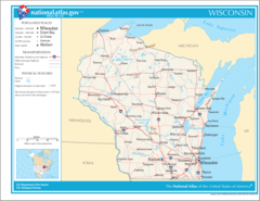
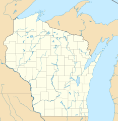
Wisconsin map
The largest city of Wisconsin is Milwaukee with a population of 589,067. Other cities include, Kenosha population 99,570, Racine population 76,237, Eau Claire population 67,065 and West Allis population 59,748. See all Wisconsin cities & populated places.
Largest Cities in Wisconsin (more)
Cities, Towns, Villages, Neighborhoods & Other Populated Places in Wisconsin.
| City Name | County | Population |
|---|---|---|
| Milwaukee | Milwaukee | 589,067 |
| Kenosha | Kenosha | 99,570 |
| Racine | Racine | 76,237 |
| Eau Claire | Eau Claire | 67,065 |
| West Allis | Milwaukee | 59,748 |
| La Crosse | La Crosse | 51,163 |
| North La Crosse | La Crosse | 50,470 |
| Wauwatosa | Milwaukee | 48,084 |
| New Berlin | Waukesha | 39,812 |
| Menomonee Falls | Waukesha | 38,243 |
| Oak Creek | Milwaukee | 36,469 |
| Franklin | Milwaukee | 36,222 |
| Fitchburg | Dane | 30,866 |
| Stevens Point | Portage | 25,949 |
| Muskego | Waukesha | 25,317 |
| De Pere | Brown | 25,014 |
Show more Wisconsin cities and populated places
Weather
Sunny, with a high near 86. South southeast wind 2 to 6 mph.
7-Day ForecastOfficial website of Wisconsin
Official Website- St. Croix County
- Barron County
- Richland County
- Marathon County
- Racine County
- Winnebago County
- Outagamie County
- Adams County
- Taylor County
- Dunn County
- Grant County
- Waushara County
- Vilas County
- Sawyer County
- Portage County
- Pepin County
- Juneau County
- Florence County
- Waukesha County
- Oneida County
- Green Lake County
- Shawano County
- Pierce County
- Ozaukee County
- Vernon County
- Ashland County
- Marquette County
- Lafayette County
- Rusk County
- Door County
- Burnett County
- Sheboygan County
- Menominee County
- Milwaukee County
- Trempealeau County
- Walworth County
- Calumet County
- Buffalo County
- Kenosha County
- Lincoln County
- Manitowoc County
- Eau Claire County
- Polk County
- Clark County
- Columbia County
- Kewaunee County
- Fond du Lac County
- Wood County
- Brown County
- Green County
- Rock County
- Monroe County
- Dane County
- Marinette County
- Washington County
- Washburn County
- Jackson County
- Langlade County
- La Crosse County
- Iowa County
- Chippewa County
- Dodge County
- Crawford County
- Price County
- Sauk County
- Douglas County
- Forest County
- Jefferson County
- Oconto County
- Iron County
- Bayfield County
- Waupaca County
Demographics
| Year | Population | % Change | Method |
|---|---|---|---|
| 1820 | 1,444 | - | census |
| 1830 | 3,635 | 60.28% | census |
| 1840 | 30,945 | 88.25% | demographic balance |
| 1850 | 305,391 | 89.87% | census |
| 1860 | 775,881 | 60.64% | census |
| 1870 | 1,054,670 | 26.43% | demographic balance |
| 1880 | 1,315,457 | 19.82% | census |
| 1890 | 1,693,330 | 22.32% | census |
| 1910 | 2,333,860 | 27.45% | census |
| 1920 | 2,632,067 | 11.33% | census |
| 1930 | 2,939,006 | 10.44% | census |
| 1940 | 3,137,587 | 6.33% | census |
| 1950 | 3,434,575 | 8.65% | census |
| 1960 | 3,951,777 | 13.09% | census |
| 1970 | 4,417,731 | 10.55% | census |
| 1980 | 4,705,767 | 6.12% | census |
| 1990 | 4,891,769 | 3.8% | census |
| 2000 | 5,363,675 | 8.8% | census |
| 2010 | 5,686,986 | 5.69% | census |
| 2011 | 5,705,288 | 0.32% | estimation process |
| 2012 | 5,719,960 | 0.26% | estimation process |
| 2013 | 5,736,754 | 0.29% | estimation process |
| 2014 | 5,751,525 | 0.26% | estimation process |
| 2015 | 5,760,940 | 0.16% | estimation process |
| 2016 | 5,772,628 | 0.2% | estimation process |
| 2017 | 5,790,186 | 0.3% | estimation process |
| 2018 | 5,807,406 | 0.3% | estimation process |
| 2019 | 5,822,434 | 0.26% | estimation process |
| 2020 | 5,832,655 | 0.18% | estimation process |
People born in Wisconsin (200)
People born in Wisconsin, including artist Arthur Frank Mathews, stage and screen actor Dominic Fumusa, activist in global trade issues Lori Wallach, .
More notable people
- Laura Ingalls Wilder (American children's writer, diarist, and journalist) she was born in 07/02/1867
- Dominick Fernow (musician) he was born in 13/03/1981
- Ben Peterson (Olympic wrestler) he was born in 27/06/1950
- John Peterson (Olympic wrestler) he was born in 22/10/1948
- Jon Morton Aase (American physician) he was born in 01/01/1936
- David Filo (American businessman) he was born in 20/04/1966
- Kevin Gage (American actor) he was born in 26/05/1959
- Howard Wales (American musician) he was born in 08/02/1943
- Mary Ingalls (elder sister of author Laura Ingalls Wilder) she was born in 10/01/1865
- Eugenie Scott (anthropologist) she was born in 24/10/1945
- Walter Bradford Cannon (American physiologist) he was born in 19/10/1871
- Francis J. Pettijohn (geologist) he was born in 20/06/1904
- Earnest Hooton (American anthropologist) he was born in 20/11/1887
- Lucian Pulvermacher (pope) he was born in 20/04/1918
- Andrés Waissbluth (Chilean film director) he was born in 10/03/1973
- Evelyn Frechette (American singer, waitress, convict, and lecturer) she was born in 15/09/1907
- Marc Mitscher (United States admiral) he was born in 26/01/1887
- Hildegarde (American singer) she was born in 01/02/1906
Wisconsin Counties (more)
Milwaukee County

county in Wisconsin, United States
Dane County

county in Wisconsin, United States
Waukesha County

county in Wisconsin, United States
| County Name | Population |
|---|---|
| Milwaukee County | 945,016 |
| Dane County | 552,536 |
| Waukesha County | 406,172 |
| Brown County | 264,610 |
| Racine County | 195,802 |
| Outagamie County | 188,766 |
| Winnebago County | 171,631 |
| Kenosha County | 169,671 |
| Rock County | 163,084 |
| Washington County | 136,445 |
| Marathon County | 135,593 |
| La Crosse County | 118,502 |
| Sheboygan County | 115,240 |
| Eau Claire County | 105,260 |
| Walworth County | 103,953 |
| Fond du Lac County | 102,902 |
Show more Wisconsin counties
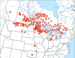
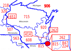
Map & Images (more maps)
Map of Wisconsin Na 1
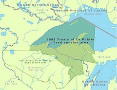
1842treatyoflapointe 2
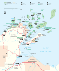
Apismap1
Anishinaabewaki 4
Area Code Map Wi
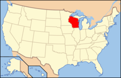
Map of Usa Wi
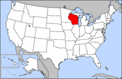
Map of Usa Highlighting Wisconsin
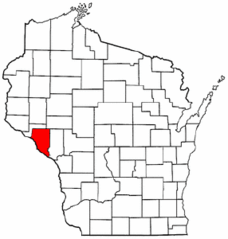
Map of Wisconsin Highlighting Buffalo County
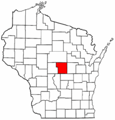
Map of Wisconsin Highlighting Portage County
Us Metro Areas Minneapolis Stpaul Bloomington 1
Wimap Doton Lincoln H
Wisconsin 90
Wisconsin Locator Map With Us
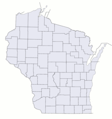
Wisconsin Counties Blank Map
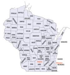
Wisconsin Counties Map
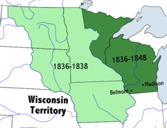
Wisconsinterritory
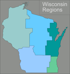
Wisconsin Regions Map
Usa Wisconsin Location Map
Wisconsin Flag Map
Counties Map of Wisconsin