Zambia (Republic of Zambia), ZM
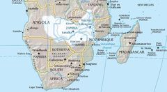
Zambia: A landlocked country in Southern Africa, it is known for its diverse wildlife, rugged terrain, and waterfalls, including Victoria Falls.
About

Country Snapshot
Republic of Zambia at a glance
Republic of Zambia currently has 42 quality-checked populated place pages and 9 state or regional pages linked on MapSof.
Mapped cities & towns
42
These counts use a stricter populated-place filter so the main lists stay focused on real city and town pages.
States & regions
9
Open related pagesLargest city
LusakaPopulation 2,467,563
Top linked places
Quick Facts about Republic of Zambia
| Population | 19,693,423 |
| Country | Zambia |
| Plate code | Z |
| Area | 752618 km2 |
| Official name | Zambia, la République de Zambie |
| Continent | Africa |
| Northernmost point | Point(30.78 -8.23) |
| Latitude & Longitude | -14.3333,28.5000 |
| Legislative body | National Assembly |
| Official language | English |
| Capital | Lusaka |
| Establishment | October 24, 1964 (61 years ago) |
| Time Zone | UTC+02:00 |
| Local time | 04:59:18 (21st July 2026) |

Geography
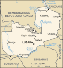
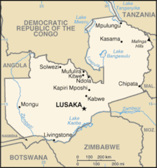
Republic of Zambia is located at 14°19'60"S 28°30'0"E (-14.3333300, 28.5000000). It has 8 neighbors: Tanzania, Congo Kinshasa, Zimbabwe, Malawi, Botswana, Mozambique, Angola and Namibia.
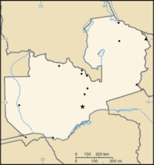
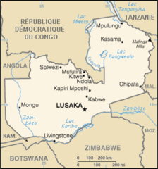
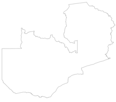
Zambia map
The largest city of Republic of Zambia is Lusaka with a population of 2,467,563. Other cities include, Ndola population 528,330, Kitwe population 504,194, Kabwe population 188,979 and Chingola population 148,564. See all Republic of Zambia cities & populated places.
Official website of Republic of Zambia
Official WebsiteCompare Republic of Zambia with
- Muchinga Province
- Northwestern Province
- Southern Province
- Northern Province
- Lusaka Province
- Eastern Province
- Luapula Province
- Central Province
- Copperbelt Province
- Western Province
Demographics
| Year | Population | % Change | Method |
|---|---|---|---|
| 1960 | 3,082,627 | - | census |
| 1961 | 3,173,662 | 2.87% | census |
| 1962 | 3,269,151 | 2.92% | census |
| 1963 | 3,368,961 | 2.96% | census |
| 1964 | 3,472,843 | 2.99% | census |
| 1965 | 3,580,708 | 3.01% | census |
| 1966 | 3,692,409 | 3.03% | census |
| 1967 | 3,808,277 | 3.04% | census |
| 1968 | 3,929,254 | 3.08% | census |
| 1969 | 4,056,584 | 3.14% | census |
| 1970 | 4,191,114 | 3.21% | census |
| 1971 | 4,333,234 | 3.28% | census |
| 1972 | 4,482,567 | 3.33% | census |
| 1973 | 4,638,227 | 3.36% | census |
| 1974 | 4,798,913 | 3.35% | census |
| 1975 | 4,963,655 | 3.32% | census |
| 1976 | 5,131,916 | 3.28% | census |
| 1977 | 5,303,836 | 3.24% | census |
| 1978 | 5,479,897 | 3.21% | census |
| 1979 | 5,660,893 | 3.2% | census |
| 1980 | 5,847,241 | 3.19% | census |
| 1981 | 6,038,971 | 3.17% | census |
| 1982 | 6,235,352 | 3.15% | census |
| 1983 | 6,435,110 | 3.1% | census |
| 1984 | 6,636,560 | 3.04% | census |
| 1985 | 6,838,392 | 2.95% | census |
| 1986 | 7,040,796 | 2.87% | census |
| 1987 | 7,243,918 | 2.8% | census |
| 1988 | 7,446,478 | 2.72% | census |
| 1989 | 7,646,911 | 2.62% | census |
| 1990 | 7,844,516 | 2.52% | census |
| 1991 | 8,038,236 | 2.41% | census |
| 1992 | 8,229,480 | 2.32% | census |
| 1993 | 8,423,058 | 2.3% | census |
| 1994 | 8,625,477 | 2.35% | census |
| 1995 | 8,841,338 | 2.44% | census |
| 1996 | 9,073,311 | 2.56% | census |
| 1997 | 9,320,089 | 2.65% | census |
| 1998 | 9,577,483 | 2.69% | census |
| 1999 | 9,839,179 | 2.66% | census |
| 2000 | 10,100,981 | 2.59% | census |
| 2001 | 10,362,137 | 2.52% | census |
| 2002 | 10,625,423 | 2.48% | census |
| 2003 | 10,894,519 | 2.47% | census |
| 2004 | 11,174,650 | 2.51% | census |
| 2005 | 11,470,022 | 2.58% | census |
| 2006 | 11,781,612 | 2.64% | census |
| 2007 | 12,109,620 | 2.71% | census |
| 2008 | 12,456,527 | 2.78% | census |
| 2009 | 12,825,031 | 2.87% | census |
| 2010 | 13,216,985 | 2.97% | census |
| 2011 | 13,633,796 | 3.06% | census |
| 2012 | 14,075,099 | 3.14% | census |
| 2013 | 14,538,640 | 3.19% | census |
| 2014 | 15,399,753 | 5.59% | (Worldbank) |
| 2015 | 15,879,361 | 3.02% | (Worldbank) |
| 2016 | 16,363,507 | 2.96% | (Worldbank) |
| 2017 | 17,094,130 | 4.27% | census |
| 2018 | 17,351,822 | 1.49% | (Worldbank) |
| 2019 | 17,861,030 | 2.85% | (Worldbank) |
| 2026 | 19,693,423 | 9.3% |
Map & Images (more maps)
000 Zambia Harta

At0704 Map

At0719 Map 1
Carte De La Zambie Fr
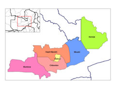
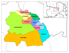
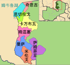
Central Zambia Districts
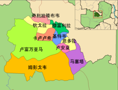
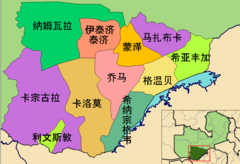
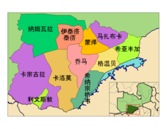
Copperbelt Province Districts Zh
Copperbelt Districts
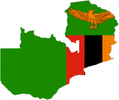
Flag Map of Zambia
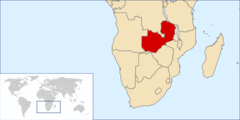
Locationzambia
Luapula Districts Zh
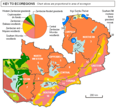
Map of Ecoregions of Zambia
Mapa Zambie
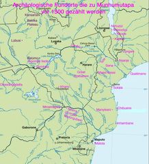
Munhumutapa 1
Svg Koort Sambia
Southern Province Zambia Districts Zh
Southern Zambia Districts Zh
Za Map
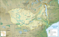
Zambezi River Basin De
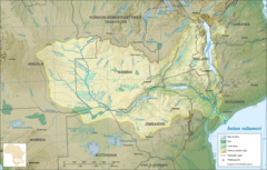
Zambezi River Basin Fi

Zambezi River Basin Fr