Mozambique (Republic of Mozambique), MZ
Mozambique: Located in Southeast Africa, it is known for its extensive coastline along the Indian Ocean, rich natural resources, and diverse cultural heritage.

Country Snapshot
Republic of Mozambique at a glance
Republic of Mozambique currently has 11 quality-checked populated place pages and 11 state or regional pages linked on MapSof.
Mapped cities & towns
11
These counts use a stricter populated-place filter so the main lists stay focused on real city and town pages.
States & regions
11
Open related pagesLargest city
MaputoPopulation 1,191,613
Top linked places
Quick Facts about Republic of Mozambique
| Population | 34,090,466 |
| Country | Mozambique, Portuguese Empire |
| Plate code | MOC |
| Area | 801590 km2 |
| Official name | la République du Mozambique, Moçambique, República Popular de Moçambique, Colónia de Moçambique, Província de Moçambique, República de Moçambique, Província de Moçambique, Estado de Moçambique |
| Continent | Africa |
| Easternmost point | Point(40.8028693 -14.4145128) |
| Northernmost point | Point(40.45 -10.47) |
| Latitude & Longitude | -18.2500,35.0000 |
| Legislative body | Assembly of the Republic |
| Named for | Island of Mozambique |
| Official language | Portuguese |
| Capital | Maputo |
| Establishment | June 25, 1975 (51 years ago) |
| Time Zone | UTC+02:00 |
| Local time | 08:35:56 (20th October 2026) |

Geography
Republic of Mozambique is located at 18°15'0"S 35°0'0"E (-18.2500000, 35.0000000). It has 7 neighbors: Tanzania, Zimbabwe, Zambia, Comoros, Malawi, Swaziland and South Africa.
Mozambique map
 icon to open full mode. View satellite images
The largest city of Republic of Mozambique is Maputo with a population of 1,191,613. Other cities include, Matola population 675,422, Beira population 439,264, Nampula population 388,526 and Quelimane population 188,964. See all Republic of Mozambique cities & populated places.
Official website of Republic of Mozambique
Official WebsiteCompare Republic of Mozambique with
- Cabo Delgado Province
- Tete Province
- Gaza Province
- Maputo
- Sofala
- Inhambane Province
- Nampula Province
- Maputo Province
- Niassa Province
- Manica Province
- Zambezia Province
Demographics
| Year | Population | % Change | Method |
|---|---|---|---|
| 1960 | 7,647,284 | - | census |
| 1961 | 7,800,474 | 2% | census |
| 1962 | 7,959,881 | 2.04% | census |
| 1963 | 8,125,367 | 2.08% | census |
| 1964 | 8,296,721 | 2.11% | census |
| 1965 | 8,473,847 | 2.13% | census |
| 1966 | 8,657,157 | 2.16% | census |
| 1967 | 8,846,984 | 2.19% | census |
| 1968 | 9,043,116 | 2.22% | census |
| 1969 | 9,245,227 | 2.23% | census |
| 1970 | 9,453,375 | 2.25% | census |
| 1971 | 9,665,673 | 2.25% | census |
| 1972 | 9,882,718 | 2.25% | census |
| 1973 | 10,109,853 | 2.3% | census |
| 1974 | 10,354,300 | 2.42% | census |
| 1975 | 10,620,260 | 2.57% | census |
| 1976 | 10,908,161 | 2.71% | census |
| 1977 | 11,213,159 | 2.8% | census |
| 1978 | 11,527,369 | 2.8% | census |
| 1979 | 11,840,048 | 2.71% | census |
| 1980 | 12,142,014 | 2.55% | census |
| 1981 | 12,438,624 | 2.44% | census |
| 1982 | 12,729,259 | 2.34% | census |
| 1983 | 12,992,559 | 2.07% | census |
| 1984 | 13,200,833 | 1.6% | census |
| 1985 | 13,338,850 | 1.05% | census |
| 1986 | 13,390,888 | 0.39% | census |
| 1987 | 13,374,618 | -0.12% | census |
| 1988 | 13,348,965 | -0.19% | census |
| 1989 | 13,394,656 | 0.34% | census |
| 1990 | 13,567,959 | 1.29% | census |
| 1991 | 13,893,546 | 2.4% | census |
| 1992 | 14,350,459 | 3.29% | census |
| 1993 | 14,893,218 | 3.78% | census |
| 1994 | 15,453,464 | 3.76% | census |
| 1995 | 15,981,571 | 3.42% | census |
| 1996 | 16,463,426 | 3.02% | census |
| 1997 | 16,914,628 | 2.74% | census |
| 1998 | 17,350,739 | 2.58% | census |
| 1999 | 17,798,102 | 2.58% | census |
| 2000 | 18,275,618 | 2.68% | census |
| 2001 | 18,785,719 | 2.79% | census |
| 2002 | 19,319,894 | 2.84% | census |
| 2003 | 19,873,460 | 2.87% | census |
| 2004 | 20,438,827 | 2.84% | census |
| 2005 | 21,010,376 | 2.8% | census |
| 2006 | 21,587,317 | 2.75% | census |
| 2007 | 22,171,404 | 2.71% | census |
| 2008 | 22,762,525 | 2.67% | census |
| 2009 | 23,361,025 | 2.63% | census |
| 2010 | 23,967,265 | 2.6% | census |
| 2011 | 24,581,367 | 2.56% | census |
| 2012 | 25,203,395 | 2.53% | census |
| 2013 | 25,833,752 | 2.5% | census |
| 2014 | 26,286,163 | 1.75% | (Worldbank) |
| 2015 | 27,042,002 | 2.88% | (Worldbank) |
| 2016 | 27,829,942 | 2.91% | (Worldbank) |
| 2017 | 29,668,834 | 6.61% | census |
| 2018 | 29,495,962 | -0.58% | (Worldbank) |
| 2019 | 30,366,036 | 2.95% | (Worldbank) |
| 2026 | 34,090,466 | 12.27% |
Map & Images (more maps)

Baia Map Port

Kaart Mosambiek

Kaart Mozambique Blank

Map Nampula

Mapa Mosambiku

Mozambique Gaza Destaque

Mozambique Locator

Mozambique Provinces Gaza 250px

Mozambique Provinces Tete 250px

Mozambique Provinces Numbered 300px

Mozambique Topography

Mozambique Carte

Mozambique Districts

Mozambique Map Cities

Mozambique Cia Wfb Map
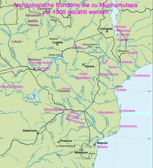
Munhumutapa

Mz Etnies

Mz Niassa

Un Mozambique

000 Mozambiku Harta
