Serbia, RS
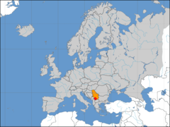
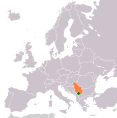
Serbia: Located in Southeast Europe, it is a landlocked country known for its rich history, diverse culture, and natural landscapes.
About
Country Snapshot
Serbia at a glance
Serbia currently has 95 quality-checked populated place pages and 2 state or regional pages linked on MapSof.
Mapped cities & towns
95
These counts use a stricter populated-place filter so the main lists stay focused on real city and town pages.
States & regions
2
Open related pagesLargest city
BelgradePopulation 1,378,682
Top linked places
Quick Facts about Serbia
| Population | 6,567,783 |
| Country | Serbia |
| Different from | Republika Srpska |
| Plate code | SRB |
| Area | 88361 km2 |
| Official name | la République de Serbie, Србија |
| Continent | Europe |
| Easternmost point | Point(23.00629511 43.18729985) |
| Northernmost point | Point(19.67 46.18) |
| Latitude & Longitude | 44.8189,20.4600 |
| Legislative body | National Assembly of Serbia |
| Official language | Serbian |
| Capital | Belgrade |
| Time Zone | Europe/Belgrade, Central European Time, UTC+02:00, UTC+01:00 |
| Local time | 04:19:27 (17th July 2026) |
Geography
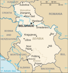
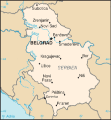
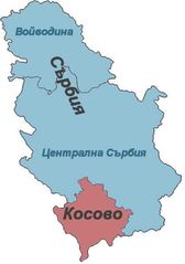
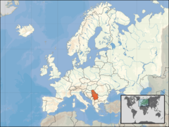
Serbia is located at 44°49'8"N 20°27'36"E (44.818924690689, 20.4599761962891). It has 10 neighbors: North Macedonia, Bulgaria, Albania, Romania, Hun, Croatia, Bosnia and Herzegovina, Montenegro, Union and Kosovo.
Serbia map
The largest city of Serbia is Belgrade with a population of 1,378,682. Other cities include, Pristina population 550,000, Novi Pazar population 85,996, Kruševac population 75,256 and Suva Reka population 72,229. See all Serbia cities & populated places.
Official website of Serbia
Official WebsiteCompare Serbia with
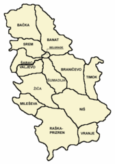
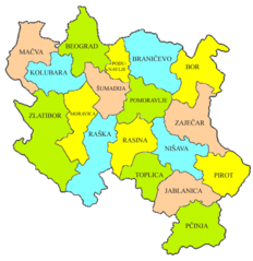
- West Bačka District
- Podunavlje District
- Central Banat District
- Mačva District
- Peć District
- Zaječar District
- Kosovska Mitrovica District
- Prizren District
- Kolubara District
- Kosovo-Pomoravlje District
- Srem District
- Braničevo District
- South Bačka District
- Toplica District
- Rasina District
- North Bačka District
- Bor District
- Zlatibor District
- Belgrade District
- Kosovo District
- Pirot District
- Pomoravlje District
- Pčinja District
- North Banat District
- Raška District
- Moravica District
- Nišava District
- Jablanica District
- Šumadija District
- South Banat District
Demographics
| Year | Population | % Change | Method |
|---|---|---|---|
| 1990 | 7,586,000 | - | (Worldbank) |
| 1991 | 7,595,636 | 0.13% | (Worldbank) |
| 1992 | 7,646,424 | 0.66% | (Worldbank) |
| 1993 | 7,699,307 | 0.69% | (Worldbank) |
| 1994 | 7,734,639 | 0.46% | (Worldbank) |
| 1995 | 7,625,357 | -1.43% | (Worldbank) |
| 1996 | 7,617,794 | -0.1% | (Worldbank) |
| 1997 | 7,596,501 | -0.28% | (Worldbank) |
| 1998 | 7,567,745 | -0.38% | (Worldbank) |
| 1999 | 7,540,401 | -0.36% | (Worldbank) |
| 2000 | 7,516,346 | -0.32% | (Worldbank) |
| 2001 | 7,503,433 | -0.17% | (Worldbank) |
| 2002 | 7,496,522 | -0.09% | (Worldbank) |
| 2003 | 7,480,591 | -0.21% | (Worldbank) |
| 2004 | 7,463,157 | -0.23% | (Worldbank) |
| 2005 | 7,440,769 | -0.3% | (Worldbank) |
| 2006 | 7,411,569 | -0.39% | (Worldbank) |
| 2007 | 7,381,579 | -0.41% | (Worldbank) |
| 2008 | 7,350,222 | -0.43% | (Worldbank) |
| 2009 | 7,320,807 | -0.4% | (Worldbank) |
| 2010 | 7,291,436 | -0.4% | (Worldbank) |
| 2011 | 7,234,099 | -0.79% | (Worldbank) |
| 2012 | 7,199,077 | -0.49% | (Worldbank) |
| 2013 | 7,164,132 | -0.49% | (Worldbank) |
| 2014 | 7,130,576 | -0.47% | (Worldbank) |
| 2015 | 7,095,383 | -0.5% | (Worldbank) |
| 2016 | 7,041,599 | -0.76% | estimation process |
| 2017 | 7,022,268 | -0.28% | estimation process |
| 2018 | 6,982,604 | -0.57% | (Worldbank) |
| 2019 | 6,944,975 | -0.54% | (Worldbank) |
| 2026 | 6,567,783 | -5.74% |
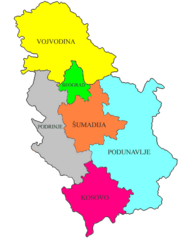
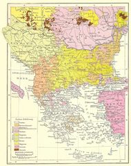
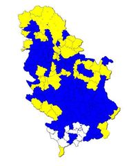
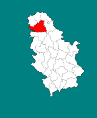
Map & Images (more maps)
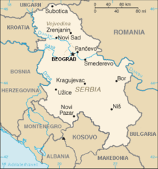
2006 Serbia Cia Wfb Map No
2006 Serbia Cia Wfb Map
Andree64 1
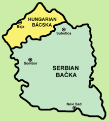
Backa
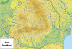
Bega 1
Blank Map of Serbia (in Serbian)
Catholic Church Serbia
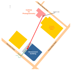
Djindjic Assassination Map
Eparhije
Europe Location Serbia Kosovo Marked

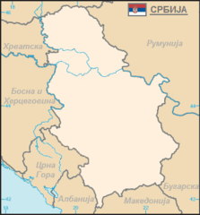
Europe Location Serbia
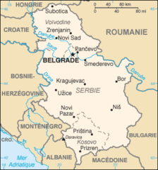
Image Serbia Cia Wfb Map Fr
Izbori2008preds
Juzna Backa
Karte Serbien2
Kosovo Serbia Locator 1
Kosovoandserbianew2105 6
Kovacicamunicipality
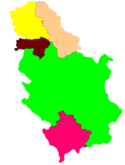
Location of Serbia In Europe, Kosovo Included
M Central Serbia02