Malaysia, MY
Malaysia: This Southeast Asian nation, comprising Peninsular Malaysia and East Malaysia on Borneo, is known for its diverse culture and rich biodiversity.
About

Country Snapshot
Malaysia at a glance
Malaysia currently has 112 quality-checked populated place pages and 16 state or regional pages linked on MapSof.
Mapped cities & towns
112
These counts use a stricter populated-place filter so the main lists stay focused on real city and town pages.
States & regions
16
Open related pagesLargest city
Kuala LumpurPopulation 7,590,000
Top linked places
Quick Facts about Malaysia
| Population | 34,231,700 |
| Country | Malaysia |
| Different from | My, Malesia |
| Twitter username | TourismMalaysia |
| Plate code | MAL |
| Area | 330290 km2 |
| Official name | Malaisie, Malaysia |
| Continent | Asia |
| Easternmost point | Point(119.2691 5.2329) |
| Northernmost point | Point(117.23 7.37) |
| Latitude & Longitude | 2.5000,112.5000 |
| Legislative body | Parliament of Malaysia |
| Associated foods | nasi lemak |
| Official language | Malay |
| Capital | Kuala Lumpur |
| Establishment | January 01, 1957 (69 years ago) |
| Time Zone | UTC+08:00 |
| Local time | 13:26:49 (19th July 2026) |

Geography
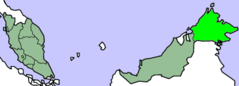
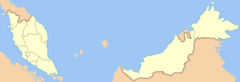
Malaysia is located at 2°30'0"N 112°30'0"E (2.5000000, 112.5000000). It has 5 neighbors: Thailand, Indonesia, Philippines, Brunei and Singapore.
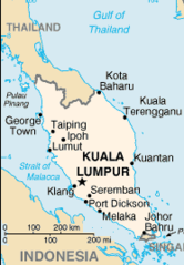
Malaysia map
The largest city of Malaysia is Kuala Lumpur with a population of 7,590,000. Other cities include, Johor Bahru population 802,489, Petaling Jaya population 520,698, Sandakan population 392,288 and George Town population 300,000. See all Malaysia cities & populated places.
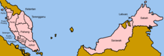
Compare Malaysia with
- Kedah
- Selangor
- Johor
- Negeri Sembilan
- Sabah
- Perlis
- Sarawak
- Melaka
- Kelantan
- Perak
- Pahang
- Penang
- Terengganu
- Kuala Lumpur
- Labuan
- Putrajaya
Demographics
| Year | Population | % Change | Method |
|---|---|---|---|
| 1960 | 8,160,975 | - | census |
| 1961 | 8,429,369 | 3.18% | 11676830 |
| 1962 | 8,710,678 | 3.23% | estimation process |
| 1963 | 8,999,247 | 3.21% | 11676830 |
| 1964 | 9,287,442 | 3.1% | estimation process |
| 1965 | 9,569,784 | 2.95% | census |
| 1966 | 9,844,116 | 2.79% | estimation process |
| 1967 | 10,111,920 | 2.65% | 11676830 |
| 1968 | 10,375,877 | 2.54% | 11676830 |
| 1969 | 10,640,347 | 2.49% | estimation process |
| 1970 | 10,908,634 | 2.46% | census |
| 1971 | 11,182,078 | 2.45% | census |
| 1972 | 11,460,080 | 2.43% | estimation process |
| 1973 | 11,741,849 | 2.4% | census |
| 1974 | 12,025,930 | 2.36% | estimation process |
| 1975 | 12,311,782 | 2.32% | estimation process |
| 1976 | 12,599,655 | 2.28% | census |
| 1977 | 12,891,715 | 2.27% | estimation process |
| 1978 | 13,191,699 | 2.27% | estimation process |
| 1979 | 13,504,433 | 2.32% | estimation process |
| 1980 | 13,833,739 | 2.38% | estimation process |
| 1981 | 14,180,093 | 2.44% | census |
| 1982 | 14,543,585 | 2.5% | census |
| 1983 | 14,926,976 | 2.57% | estimation process |
| 1984 | 15,333,369 | 2.65% | census |
| 1985 | 15,764,340 | 2.73% | estimation process |
| 1986 | 16,221,767 | 2.82% | census |
| 1987 | 16,703,500 | 2.88% | 11676830 |
| 1988 | 17,202,032 | 2.9% | estimation process |
| 1989 | 17,707,064 | 2.85% | 11676830 |
| 1990 | 18,211,097 | 2.77% | estimation process |
| 1991 | 18,709,963 | 2.67% | census |
| 1992 | 19,205,112 | 2.58% | estimation process |
| 1993 | 19,701,410 | 2.52% | estimation process |
| 1994 | 20,206,546 | 2.5% | 11676830 |
| 1995 | 20,725,374 | 2.5% | 11676830 |
| 1996 | 21,259,831 | 2.51% | 11676830 |
| 1997 | 21,805,835 | 2.5% | 11676830 |
| 1998 | 22,355,057 | 2.46% | 11676830 |
| 1999 | 22,896,048 | 2.36% | census |
| 2000 | 23,420,751 | 2.24% | census |
| 2001 | 23,925,742 | 2.11% | 11676830 |
| 2002 | 24,413,795 | 2% | estimation process |
| 2003 | 24,890,654 | 1.92% | 11676830 |
| 2004 | 25,365,089 | 1.87% | estimation process |
| 2005 | 25,843,466 | 1.85% | estimation process |
| 2006 | 26,327,098 | 1.84% | estimation process |
| 2007 | 26,813,819 | 1.82% | 11676830 |
| 2008 | 27,302,348 | 1.79% | census |
| 2009 | 27,790,324 | 1.76% | estimation process |
| 2010 | 28,334,135 | 1.92% | census |
| 2011 | 28,758,968 | 1.48% | census |
| 2012 | 29,239,927 | 1.64% | 11676830 |
| 2013 | 29,716,965 | 1.61% | census |
| 2014 | 30,018,242 | 1% | estimation process |
| 2015 | 30,331,007 | 1.03% | 11676830 |
| 2016 | 30,684,804 | 1.15% | (Worldbank) |
| 2017 | 31,624,264 | 2.97% | estimation process |
| 2018 | 31,528,585 | -0.3% | (Worldbank) |
| 2019 | 31,949,777 | 1.32% | (Worldbank) |
| 2026 | 34,231,700 | 6.67% |
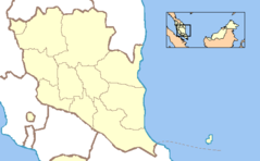
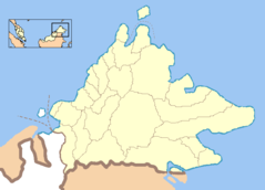
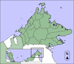
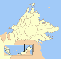
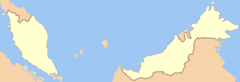
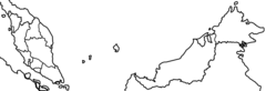
Map & Images (more maps)
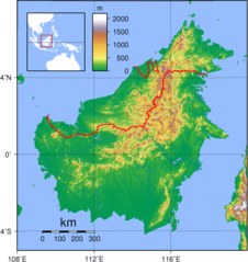
Borneo Topography
District Borders of Perak
Dynamicpahang
Dynamicpahang2
Dynamicsabah2
Dynamicsabahblank3
Dynamicsabahblankcolorscheme
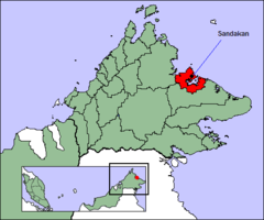
Dynamicsandakan
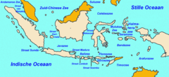
Indozee
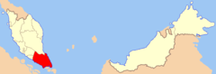
Johor State Locator

Kl Ft Locator
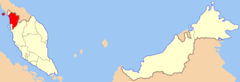
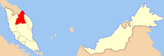
Kedah State Locator
Kelantan State Locator
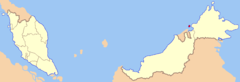
Labuan Ft Locator
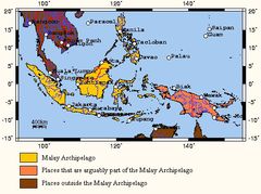
Malayarch
Malaysia Map Worldfactbook
Malaysia States Blank (color Scheme)
Malaysia States Blank No Borders
Malaysia States Blank
Malaysia States Named