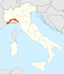
Liguria, Liguria
Liguria: Italian region
About
State Snapshot
Liguria at a glance
Liguria currently has 110 quality-checked populated place pages and 4 county pages linked on MapSof.
Mapped cities & towns
110
These counts use a stricter populated-place filter so the main lists stay focused on real city and town pages.
County pages
4
Open related pagesLargest city
GenoaPopulation 580,097
Top linked places
Quick Facts about Liguria
| Country | Italy |
| State | Liguria (Italy) |
| Area | 5422 km2 |
| Latitude & Longitude | 44.5000,8.8333 |
| Legislative body | Regional Council of Liguria |
| Altitude | 820 feet / 250 meters |
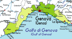
| Capital | Genoa |
| Time Zone | UTC+01:00, UTC+02:00 |
| Local time | 04:41:04 (9th June 2026) |
Geography
Liguria is located at 44°30'0"N 8°49'60"E (44.5000000, 8.8333300). It has 3 neighbors: Region Auvergne, Tuscany and Regione Piemonte.
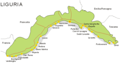
Liguria map
Click "full screen"  icon to open full mode. View satellite images
The largest city of Liguria is Ventimiglia with a population of 24,065. . See all Liguria cities & populated places.
Official website of Liguria
Official Website- Province of Imperia
- Province of Savona
- Province of La Spezia
- Metropolitan City of Genoa
- Province of Genoa
Li-ku-li-a, Ligouria, Ligueria, Liguerje, Liguri, Ligurie, Ligurien, Ligurija, Ligurio, Ligurië, Ligurya, Liguryja, Liguuria, Liguurien, Ligúria, Ligüria, Ligūrija, Liquriya, Lígúría, Region de Liguria, Regione Liguria, Región de Liguria, ilikuriya, li gu li ya, lie gu li ya, ligulia ju, liguri'a, liguriya, lyghwrya, lygwrya, lygwryh, riguria zhou, Łiguria, Λιγουρία, Лигури, Лигурия, Лигурија, Лігурыя, Лігурія, Լիգուրիա, ליגוריה, صوبہ لیگوریا, ليغوريا, لیگوریا, लिगुरिया, ਲਿਗੂਰੀਆ, இலிகுரியா, แคว้นลิกูเรีย, ლიგურია, ሊጉርያ, リグーリア州, 列古利亞, 利古里亞, 리구리아 주
Map & Images (more maps)
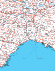
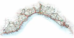
Liguria Map
1363 x 1764
- 452,763k -
png
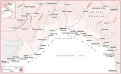
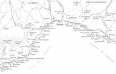
Liguria Map Provice
592 x 325
- 30,165k -
png
Location of Liguria Map
1338 x 1548
- 100,283k -
png
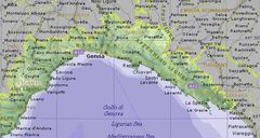
Map Liguria
700 x 368
- 31,867k -
png
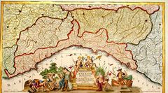
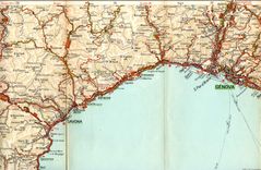
Historical Map Liguria
1156 x 641
- 194,052k -
jpg
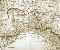
Historical Map of Liguria
838 x 699
- 175,091k -
jpg
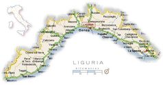
Liguria Political Map
700 x 373
- 64,143k -
jpg
Political Liguria Map
900 x 552
- 59,681k -
jpg
Political Map Liguria
830 x 532
- 41,267k -
jpg
Political Map of Liguria
3679 x 1892
- 682,604k -
jpg
Political Map of Liguria (1964)
1800 x 1176
- 445,173k -
jpg
Weather Map of Liguria
740 x 385
- 40,527k -
jpg