How far is Winston-Salem, NC from Brogden, NC?
The driving distance from Winston-Salem, NC to Brogden, NC is about 158.7 miles (255.4 km), with a travel time of about 03h 17m by car.
- The straight-line flight distance is about 136 miles (218.8 km).
- For a round trip, plan for roughly 06h 35m of driving time before adding stops, traffic, or weather delays.
- A comfortable departure window is usually 6:00 AM to 8:00 AM EDT.
Reverse, save, or send this route
This drive is better planned with a longer stop or an overnight stay. Copy the route link, send it to another device, or print a clean version before you head out.
This drive is better planned with a longer stop or an overnight stay.
Flight Distance
Driving Distance
Gas Cost Calculator
Leave and Arrive Planner
Pick a departure time to see your estimated arrival and same-day return window.
Drive time stays fixed at 03h 17m.
An early departure helps you fit a real stop into the day without turning the return into a late-night drive.
You are leaving earlier than the recommended window, which gives you extra margin for breaks and traffic.
Halfway Point
A useful midpoint for breaks, coffee, or meeting in the middle.
Township in Chatham County, North Carolina
Route Weather Snapshot
Check the forecast at both ends before you head out.
Mostly Cloudy
Driving Route Map
The map below follows the saved road route between Winston-Salem and Brogden.
Turn-by-Turn Driving Directions
Step-by-step road directions between Winston-Salem and Brogden.
-
1
Start on North Main Street
2610 ft · 59 sec · North Main Street
-
2
Take the ramp sharp left toward US 158 East, US 421 South, NC 150 East
917 ft · 22 sec
-
3
Merge slight left onto Salem Parkway
2.5 mi · 3 min · Salem Parkway
-
4
Keep slight left to continue on Salem Parkway
16 mi · 19 min · Salem Parkway
-
5
Keep slight left to continue on I 73 South, US 421 South: Asheboro, Durham
12.2 mi · 13 min
-
6
Take the exit slight right toward US 421: Sanford
1133 ft · 28 sec
-
7
Keep slight right to continue on US 421 South: Sanford
26.3 mi · 32 min
-
8
Take the exit slight right toward US 64: Siler City, Pittsboro
1413 ft · 42 sec
-
9
Turn left
10.9 mi · 15 min
-
10
Keep slight left
21 mi · 27 min
-
11
Take the exit slight right toward NC 540 Toll South
2827 ft · 1 min
-
12
Merge slight left onto Triangle Expressway
22 mi · 24 min · Triangle Expressway
-
13
Keep slight left
1648 ft · 40 sec
-
14
Keep slight right to continue on I 42 East: Smithfield
2526 ft · 1 min
-
15
Merge slight left onto Clayton Bypass Scenic Byway
8.7 mi · 9 min · Clayton Bypass Scenic Byway
-
16
Continue straight
7.6 mi · 10 min
-
17
Keep slight left
14.3 mi · 19 min
-
18
Continue straight
2 mi · 3 min
-
19
Turn slight right
3.6 mi · 5 min
-
20
Continue straight
1.4 km · 1 min
-
21
Take the ramp slight right
1749 ft · 43 sec
-
22
Merge slight left
3.3 mi · 4 min
-
23
Continue straight
1.4 km · 1 min
-
24
Turn left onto Old Mount Olive Highway
3.6 mi · 6 min · Old Mount Olive Highway
-
25
Turn left onto Royall Drive
24 m · 4 sec · Royall Drive
-
26
Arrive at your destination
0 m · 1 sec · Royall Drive
Car Route Details
A richer read on the saved driving route between Winston-Salem and Brogden.
Highway-focused drive
Most of the mileage stays on named highways, so the important moments are ramps, exits, merges, and the final local approach.
US 421 South
Keep slight right to continue on US 421 South: Sanford
26.3 mi · 00h 32m
Route Summary
A quick read on whether this route feels easy, ambitious, or worth planning around.
A longer out-and-back drive
This is still possible in one day, but it becomes a long driving day. Leaving early and planning your stop window matters more here.
Cloudy leaving Winston-Salem and Mostly Cloudy near Brogden.
Trip Questions
Direct answers travelers usually want before committing to the drive.
How long does it take to drive from Winston-Salem to Brogden?
The road trip is about 158.7 miles (255.4 km) and usually takes 03h 17m in normal driving conditions.
Is this a same-day trip or an overnight route?
This is still possible in one day, but it becomes a long driving day. Leaving early and planning your stop window matters more here.
What is the halfway point on this route?
Fearrington Village is a useful midpoint, sitting about 79.3 miles from Winston-Salem and 79.4 miles from Brogden.
How much longer is the road route than the straight-line distance?
The direct path is about 136 miles (218.8 km), while the road route adds roughly 22.7 extra miles because roads do not follow the straight air line.
When is the best time to leave for this route?
A good departure window is usually 6:00 AM to 8:00 AM EDT. If you want a more comfortable same-day return, try to leave by 10:24 AM EDT.
How much will gas cost for this route?
Using about 28.3 MPG, regular gas is estimated at $22.18 one way or $44.36 round trip. Estimated CO2 is about 49.8 kg one way.
What should you check before leaving?
Before you leave, expect Cloudy around Winston-Salem and Mostly Cloudy near Brogden.
Stop Ideas Near Fearrington Village
Useful break, food, and waypoint ideas within about 15 miles of the route midpoint.

Town Hall Burger & Beer Durham
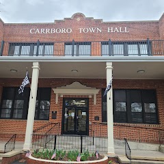
Carrboro Town Hall

The Town Hall Grill
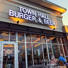
Town Hall Burger and Beer
Transit and Meeting Points
Useful pickup, handoff, or rendezvous points close to Fearrington Village.
Durham
Cary
North Carolina State Fair station
Raleigh Union Station
Flight Path Map
This map shows the direct air route between Winston-Salem and Brogden. Straight-line distance: 135.96 mi (218.8 km).

#1 Winston-Salem
The fifth most populous city in North Carolina.
| Population | 248,112 |
| Coordinates | 36.0998600, -80.2442200 |
| Altitude | 293 |
| Country | United States |
#2 Brogden
Census designated place
| Population | 2,633 |
| Coordinates | 35.2926600, -78.0344300 |
| Altitude | 53 |
| Country | United States |
End: Brogden (-78.03443, 35.29266)
Estimated Travel Time
Distance: 255 km by road
| Speed | Time |
|---|---|
| 30 mph (48.3 km/h) | 05h 17m |
| 40 mph (64.37 km/h) | 03h 58m |
| 50 mph (80.47 km/h) | 03h 10m |
| 60 mph (96.56 km/h) | 02h 38m |
| 70 mph (112.65 km/h) | 02h 16m |
| 80 mph (129 km/h) | 01h 58m |
Fuel, Round Trip and CO2
Estimated fuel cost and emissions for this route.
| Fuel | $/gal | One way | Round trip |
|---|---|---|---|
| Regular gas | $3.96 | $22.18 | $44.36 |
| Mid-grade | $4.43 | $24.80 | $49.60 |
| Premium | $4.78 | $26.76 | $53.51 |
| Diesel | $5.62 | $31.49 | $62.99 |
Assumes 8.3 L/100 km (about 28.3 MPG). CO2 is an estimate and varies by vehicle, fuel blend, traffic, and terrain.
Prices in North Carolina · Jun 10, 2026
Distance to Other Cities
Planning a road trip? See the full trip guide on Trip.ovh — stops, fuel costs, weather, and departure timing.