Westfield, New Jersey
Westfield: town in Union County, New Jersey
About
Westfield is a town located in the county of Union in the U.S. state of New Jersey. Its population at the 2010 census was 30,316 and a population density of 1,736 people per km². After 10 years in 2020 city had an estimated population of 29,238 inhabitants.
The town was created 232 years ago in 1794.

Quick Facts about Westfield
| Population | 29,238 (2020) |
| Country | United States of America |
| State | New Jersey (United States) |
| County | Union County |
| Postal code | 07090–07091 |
| Phone Area Codes | 908 |
| Area | 17.47 km2 |
| Latitude & Longitude | 40.6590,-74.3474 |
| Altitude | 118 feet / 36 meters |
| Establishment | January 27, 1794 (232 years ago) |
| Time Zone | Eastern Time Zone |
| Local time | 20:06:27 (16th July 2026) |
| Density | 1,674 Pop. per km² as of 2020 |
| Population growth | -3.69% (2010-2020) |

Geography
Westfield is located at 40°39'32"N 74°20'51"W (40.6589900, -74.3473700). It has 6 neighbors: Clark, Cranford, Garwood, Mountainside, Scotch Plains and Springfield.
Westfield map
Official website of Westfield
Official WebsiteDemographics
According to census records, the population of Westfield decreased by 3.69% in 10 years.
| Year | Population | % Change | Method |
|---|---|---|---|
| 1810 | 2,152 | - | 1810 United States Census |
| 2010 | 30,316 | 92.9% | census |
| 2011 | 30,384 | 0.22% | estimation process |
| 2012 | 30,408 | 0.08% | estimation process |
| 2013 | 30,464 | 0.18% | estimation process |
| 2014 | 30,351 | -0.37% | estimation process |
| 2015 | 30,209 | -0.47% | estimation process |
| 2016 | 30,035 | -0.58% | estimation process |
| 2017 | 29,899 | -0.45% | estimation process |
| 2018 | 29,780 | -0.4% | estimation process |
| 2019 | 29,512 | -0.91% | estimation process |
| 2020 | 29,238 | -0.94% | estimation process |
Demographic Facts
| Estimated population as of July 1, 2019 : | 25,661 |
| Based on demographic estimates as of April 1, 2010 : | 24,086 |
| Based on demographic estimates as of 1 April 2010 : | 6.5% |
| April 1, 2020 Population : | 27,747 |
| April 1, 2010 Population : | 24,149 |
| People under 5 years old, percentage : | 6.6% |
| People under 18 years old, percentage : | 27.7% |
| People over 65 (%) : | 13.7% |
| Female persons, % : | 52.3% |
| White only, percent : | 82.5% |
| Black or African American alone, percent : | 10.7% |
| American Indian and Alaska Native only, % : | 0.3% |
| Asians alone % : | 5.0% |
| Only Native Hawaiians and Other Pacific Islanders, % : | 0.0% |
| % of people who have participated in two or more races : | 1.0% |
| % of Hispanic or Latino : | 1.7% |
| White people, not Hispanic or Latino people, make up the majority of the population. : | 81.0% |
| 2015-2019 Veterans : | 1,333 |
| Percentage of foreign-born people, 2015-2019 : | 6.1% |
| Rate of owner-occupied housing units, 2015-2019 : | 93.2% |
Economic Facts
| Rate of owner-occupied housing units, 2015-2019 : | 93.2% |
| Owner-occupied housing unit median value, 2015-2019 : | $261,900 |
| From 2015 to 2019, the median selected monthly owner costs - with a mortgage : | $1,752 |
| Monthly owner costs, without a mortgage, at the median, 2015-2019 : | $504 |
| 2015-2019 median gross rent : | $1,549 |
| 2015-2019 Households : | 8,972 |
| Population per household, 2015-2019 : | 2.82 |
| Living in the same house a year ago, percentage of people aged one year and up, 2015-2019 : | 92.3% |
| Languages other than English spoken at home, as a percentage of people aged 5 and up, 2015-2019 : | 8.7% |
| Households with computers, %, 2015-2019 : | 97.5% |
| Percentage of households with a broadband Internet subscription, 2015-2019 : | 94.2% |
| Percentage of people aged 25 and up with a high school diploma or higher, 2015-2019 : | 97.8% |
| Bachelor's degree or higher, proportion of people aged 25 and up, 2015-2019 : | 68.5% |
| Percentage of people under the age of 65 who have a disability, 2015-2019 : | 3.4% |
| Persons under the age of 65 who do not have health insurance, as a percentage : | 2.3% |
| Total civilian labor force, percent of population aged 16 and up, 2015-2019 : | 68.6% |
| Female labor force participation in the civilian labor force, as a percentage of the population aged 16 and up, 2015-2019 : | 62.4% |
| Total receipts/revenue for health care and social assistance in 2012 ($1,000) : | 93,153 |
| 2012 total retail sales ($1,000) : | 409,310 |
| 2012 total retail sales per capita : | $16,477 |
| Mean commute time to work (in minutes), workers aged 16 and up, 2015-2019 : | 22.6 |
| 2015-2019 median household income (in 2019 dollars) : | $114,521 |
| Income per capita in the previous 12 months (in 2019 dollars), 2015-2019 : | $49,224 |
| Percentage of people living in poverty : | 3.3% |
| Total number of businesses in 2012 : | 3,838 |
| Men-owned businesses in 2012 : | 2,197 |
| Women-owned businesses in 2012 : | 1,131 |
| Minority-owned businesses in 2012 : | 372 |
| Non-minority-owned businesses in 2012 : | 3,293 |
| Veteran-owned businesses in 2012 : | 276 |
| Nonveteran-owned businesses in 2012 : | 3,280 |
| 2010 population per square mile : | 957.4 |
| 2010 land area in square miles : | 25.22 |
Best Things to Do in Westfield
1Mindowaskin Park
385 E Broad St, Westfield, NJ 07090, United States View details
Phone: +19082330028 | Website available

2Gumbert Park
S Chestnut St, Westfield, NJ 07090, United States View details
Phone: +19087894040

3Miller-Cory House Museum
614 Mountain Ave, Westfield, NJ 07090, United States View details
Phone: +19082321776 | Website available

Where to Stay in Westfield
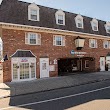
1Best Western Westfield Inn
435 N Ave W, Westfield, NJ 07090, United States View details
Phone: +19086545600 | Website available
Services and Civic Places in Westfield
1Westfield Town Hall
425 E Broad St, Westfield, NJ 07090 View details
Phone: +19087894040 | Website available

People born in Westfield (30)
People born in Westfield, including racecar driver Walt Hansgen, cartoonist Charles Addams, scientist Robert S. Dietz, .
More notable people
- Roger Welch (American artist, sculptor and photographer) he was born in 10/02/1946
- Chris Campbell (Olympic wrestler) he was born in 01/01/1954
- Geoffrey Edwards (American actor and screenwriter) he was born in 29/10/1959
- Christian J. Lambertsen (Diving engineering pioneer, inventor of first scuba device) he was born in 15/05/1917
- Alexander Wilson Drake (American artist) he was born in 01/01/1843
- Benny Reid (American musician) he was born in 07/10/1980
- Marilyn Lange (American Playboy model) she was born in 14/11/1946
- Colleen Patrick-Goudreau (American writer and activist) she was born in 08/03/1970
- Dan Soucek (American politician) he was born in 22/04/1969
- Geoff Edwards (game show host) he was born in 13/02/1931
- Harry Lonsdale (Businessman, scientist, politician) he was born in 19/01/1932
- Jessica St. Clair (American actress and comedian) she was born in 21/09/1976
- Judith St. George (American children's writer) she was born in 26/02/1931
- Mary Jo Keenen (American actress)
- P. Roy Vagelos (American businessman) he was born in 08/10/1929
- Sara Driver (American actress and film director) she was born in 15/12/1955
- Steve Cheek (American coach of American football) he was born in 18/04/1977
- William Chapman Foster (American government official) he was born in 27/04/1897
Nearby Schools and Colleges
Schools and campuses linked to Westfield, NJ. Select a name to open its map and contact details.
| Code | Name | City | ZIP |
|---|---|---|---|
| 187198 | Union County College | Cranford (NJ) | 07016-1528 |
Nearby Transit Stations (21)
Rail and bus stations connected to Westfield, NJ. Select a station to open its map and address details.
| Code | Name | Address | Type |
|---|---|---|---|
| MET | Metropark station | 100 Middlesex-Essex Turnpike | RAIL |
| EWR | Newark Liberty International Airport | Newark Liberty International Airport | RAIL |
| NWK | Pennsylvania Station | 1 Raymond Plaza West | RAIL |
| NBK | New Brunswick station | French and Albany Streets | RAIL |
| NYP | Pennsylvania Station | 8th Ave 31st Street / 8th Ave 33rd Street | RAIL |
Closest post offices linked to Westfield.
| Post Office Name | City | ZIP |
|---|---|---|
| Mountainsid Post Office | Mountainside (NJ) | 07092 |
Other places with the same name (11)
- Westfield, Indiana The most populous city in Hamilton County, Indiana. with a population of 46,145 people.
- Westfield, Massachusetts A city in Hampden County, Massachusetts. with a population of 41,063 people.
- Westfield, New York town in Chautauqua County, New York with a population of 2,962 people.
- Westfield, Ohio unincorporated community in Morrow County, Ohio with a population of 1,255 people.
- Westfield, Pennsylvania borough of Pennsylvania with a population of 1,027 people.
- Westfield, Wisconsin town in Marquette County, Wisconsin with a population of 607 people.
- Westfield, Illinois village in Westfield Township, Clark County, Illinois with a population of 552 people.
- Westfield, Maine town in Aroostook County, Maine with a population of 505 people.
- Westfield, Vermont town in Vermont, USA with a population of 491 people.
- Westfield, Iowa city in Iowa, USA with a population of 126 people.
- Westfield, North Dakota township in Steele County, North Dakota with a population of 56 people.
Other cities in Union County
Cities, towns, neighborhoods & other populated places in Union County , NJ. (more)
| City Name | Population | Title |
|---|---|---|
| Elizabeth | 128,382 | The second most populous city in Union County, New Jersey. |
| Elizabethport | 124,969 | A city in Union County, New Jersey. |
| Union | 67,137 | A city in Union County, New Jersey. |
| Plainfield | 50,011 | A city in Union County, New Jersey. |
| Linden | 42,076 | A city in Union County, New Jersey. |
| Rahway | 29,832 | City in Union County, New Jersey |
| Scotch Plains | 24,138 | Township in Union County, New Jersey, United States |
| Cranford | 24,028 | Township of New Jersey |
| Hillside | 21,841 | Township of New Jersey |
| Summit | 21,812 | City in Union County, New Jersey, United States |
| Roselle | 21,689 | Borough in New Jersey, USA |
| Clark | 15,837 | Township in southern Union County, New Jersey, United States |
| New Providence | 13,994 | Town in New Jersey, United States |
| Roselle Park | 13,510 | Borough in Union County, New Jersey |
| Berkeley Heights | 13,313 | Township in Union County, New Jersey |
| Kenilworth | 8,153 | Town in New Jersey |
Distance to Other Cities
Westfield distances to largest New Jersey cities