Garwood, New Jersey
Garwood: town
About
Garwood is a town located in the county of Union in the U.S. state of New Jersey. Its population at the 2010 census was 4,226 and a population density of 2,509 people per km². After 10 years in 2020 city had an estimated population of 4,325 inhabitants.
The town was created 123 years ago in 1903.

Quick Facts about Garwood
| Population | 4,325 (2020) |
| Country | United States of America |
| State | New Jersey (United States) |
| County | Union County |
| Postal code | 07027 |
| Phone Area Codes | 908 |
| Area | 1.68 km2 |
| Latitude & Longitude | 40.6518,-74.3229 |
| Altitude | 82 feet / 25 meters |
| Establishment | March 19, 1903 (123 years ago) |
| Time Zone | Eastern Time Zone |
| Local time | 20:05:45 (16th July 2026) |
| Density | 2,568 Pop. per km² as of 2020 |
| Population growth | 2.29% (2010-2020) |

Geography
Garwood is located at 40°39'6"N 74°19'23"W (40.6517700, -74.3229300). It has 2 neighbors: Cranford and Westfield.
Garwood map
Official website of Garwood
Official WebsiteDemographics
The population of Garwood increased by 2.29% in 10 years.
| Year | Population | % Change | Method |
|---|---|---|---|
| 2010 | 4,226 | - | census |
| 2011 | 4,260 | 0.8% | estimation process |
| 2012 | 4,276 | 0.37% | estimation process |
| 2013 | 4,299 | 0.54% | estimation process |
| 2014 | 4,306 | 0.16% | estimation process |
| 2015 | 4,310 | 0.09% | estimation process |
| 2016 | 4,330 | 0.46% | estimation process |
| 2017 | 4,342 | 0.28% | estimation process |
| 2018 | 4,354 | 0.28% | estimation process |
| 2019 | 4,352 | -0.05% | estimation process |
| 2020 | 4,325 | -0.62% | estimation process |
Best Things to Do in Garwood
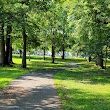
1Unami Park
Garwood, NJ 07027, United States View details
Phone: +19085274744 | Website available
People born in Garwood (1)
American novelist and screenwriter Tom Perrotta was born in Garwood
Nearby Schools and Colleges
Schools and campuses linked to Garwood, NJ. Select a name to open its map and contact details.
| Code | Name | City | ZIP |
|---|---|---|---|
| 187198 | Union County College | Cranford (NJ) | 07016-1528 |
Nearby Transit Stations (21)
Rail and bus stations connected to Garwood, NJ. Select a station to open its map and address details.
| Code | Name | Address | Type |
|---|---|---|---|
| MET | Metropark station | 100 Middlesex-Essex Turnpike | RAIL |
| EWR | Newark Liberty International Airport | Newark Liberty International Airport | RAIL |
| NWK | Pennsylvania Station | 1 Raymond Plaza West | RAIL |
| NBK | New Brunswick station | French and Albany Streets | RAIL |
| NYP | Pennsylvania Station | 8th Ave 31st Street / 8th Ave 33rd Street | RAIL |
Closest post offices linked to Garwood.
| Post Office Name | City | ZIP |
|---|---|---|
| Garwood Post Office | Garwood (NJ) | 07027 |
Other cities in Union County
Cities, towns, neighborhoods & other populated places in Union County , NJ. (more)
| City Name | Population | Title |
|---|---|---|
| Elizabeth | 128,382 | The second most populous city in Union County, New Jersey. |
| Elizabethport | 124,969 | A city in Union County, New Jersey. |
| Union | 67,137 | A city in Union County, New Jersey. |
| Plainfield | 50,011 | A city in Union County, New Jersey. |
| Linden | 42,076 | A city in Union County, New Jersey. |
| Rahway | 29,832 | City in Union County, New Jersey |
| Westfield | 29,238 | Town in Union County, New Jersey |
| Scotch Plains | 24,138 | Township in Union County, New Jersey, United States |
| Cranford | 24,028 | Township of New Jersey |
| Hillside | 21,841 | Township of New Jersey |
| Summit | 21,812 | City in Union County, New Jersey, United States |
| Roselle | 21,689 | Borough in New Jersey, USA |
| Clark | 15,837 | Township in southern Union County, New Jersey, United States |
| New Providence | 13,994 | Town in New Jersey, United States |
| Roselle Park | 13,510 | Borough in Union County, New Jersey |
| Berkeley Heights | 13,313 | Township in Union County, New Jersey |
Distance to Other Cities
Garwood distances to largest New Jersey cities