Gaza Strip, Gaza Strip
Gaza Strip: region on the eastern coast of the Mediterranean Sea
About
State Snapshot
Gaza Strip at a glance
Gaza Strip currently has 11 quality-checked populated place pages and 0 county pages linked on MapSof.
Mapped cities & towns
11
These counts use a stricter populated-place filter so the main lists stay focused on real city and town pages.
County pages
0
Open related pagesLargest city
Khān YūnisPopulation 173,183
Top linked places
Quick Facts about Gaza Strip
| Population | 0 |
| Country | State of Palestine |
| State | Gaza Strip (Palestinian Territory) |
| Different from | Gaza |
| Speed limit | 80 |
| Latitude & Longitude | 31.4167,34.3333 |
| Capital | Gaza City |
| Establishment | January 01, 2007 (19 years ago) |
| Time Zone | UTC+02:00 |
| Local time | 06:11:50 (10th June 2026) |
Geography
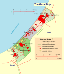
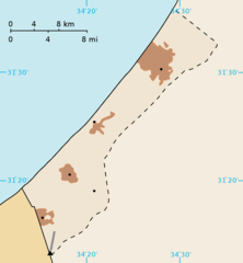
Gaza Strip is located at 31°25'0"N 34°19'60"E (31.4166700, 34.3333300). It has 2 neighbors: Israel and Egypt.
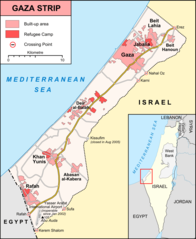
Gaza Strip map
The largest city of Gaza Strip is Khān Yūnis with a population of 173,183. Other cities include, Rafaḩ population 164,000 and Dayr al Balaḩ population 59,504. See all Gaza Strip cities & populated places.
Demographics
| Year | Population | % Change | Method |
|---|---|---|---|
| 2026 | 5,483,450 | - |
Map & Images (more maps)
Gaza Strip Cities Map
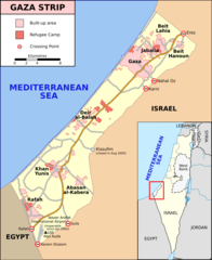
Gaza Strip Map
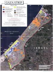
Gaza Strip Map 1999
Gaza Strip Map Blank