Belford, New Jersey
Belford: census designated place
About
Belford is a CDP located in the county of Monmouth in the U.S. state of New Jersey.

Quick Facts about Belford
| Population | 1,768 |
| Country | United States of America |
| State | New Jersey (United States) |
| County | Monmouth County |
| Area | 3.4 km2 |
| Latitude & Longitude | 40.4259,-74.0868 |
| Altitude | 10 feet / 3 meters |
| Time Zone | Eastern Time Zone |
| Local time | 10:50:04 (24th July 2026) |
| Postal code | 07718 |
| Weather | 83℉ Sunny 7-days weather |

Geography
Belford is located at 40°25'33"N 74°5'13"W (40.4259400, -74.0868100).
Belford map
Weather
Sunny, with a high near 83. Northeast wind 5 to 10 mph.
7-Day ForecastBest Things to Do in Belford
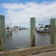
1Bayshore Waterfront County Park
600 Main St, Belford, NJ 07718, United States View details
People born in Belford (1)
film director and producer John Barnes was born in Belford
Nearby Schools and Colleges
Schools and campuses linked to Belford, NJ. Select a name to open its map and contact details.
| Code | Name | City | ZIP |
|---|---|---|---|
| 183859 | Brookdale Community College | Lincroft (NJ) | 07738-1597 |
| 491710 | Yeshiva Gedolah of Cliffwood | Keyport (NJ) | 07735-5105 |
| 457855 | Academy of Cosmetology and Esthetics NYC | Staten Island (NY) | 10306 |
| 490896 | Advantage Career Institute | Eatontown (NJ) | 07724 |
| 185572 | Monmouth University | West Long Branch (NJ) | 07764-1898 |
Nearby Transit Stations (23)
Rail and bus stations connected to Belford, NJ. Select a station to open its map and address details.
| Code | Name | Address | Type |
|---|---|---|---|
| MET | Metropark station | 100 Middlesex-Essex Turnpike | RAIL |
| EWR | Newark Liberty International Airport | Newark Liberty International Airport | RAIL |
| NBK | New Brunswick station | French and Albany Streets | RAIL |
| NWK | Pennsylvania Station | 1 Raymond Plaza West | RAIL |
| NYP | Pennsylvania Station | 8th Ave 31st Street / 8th Ave 33rd Street | RAIL |
Closest post offices linked to Belford.
| Post Office Name | City | ZIP |
|---|---|---|
| Belford Post Office | Belford (NJ) | 07718 |
| Port Monmouth Post Office | Port Monmouth (NJ) | 07758 |
| New Monmouth Post Office | Middletown (NJ) | 07748 |
| Leonard Post Office | Leonardo (NJ) | 07737 |
| Keansburg Post Office | Keansburg (NJ) | 07734 |
Other cities in Monmouth County
Cities, towns, neighborhoods & other populated places in Monmouth County , NJ. (more)
| City Name | Population | Title |
|---|---|---|
| Hamilton | 86,722 | Township in Mercer County, New Jersey, United States |
| Manalapan | 39,225 | Township in Monmouth County, New Jersey |
| Long Branch | 30,210 | City in New Jersey, United States |
| Hazlet | 19,641 | Township in Monmouth County, New Jersey |
| Tinton Falls | 17,406 | Borough in Monmouth County, New Jersey, United States |
| Holmdel | 16,670 | Township of New Jersey |
| Asbury Park | 15,377 | City in New Jersey, United States |
| West Freehold | 13,613 | Census designated place |
| Eatontown | 12,132 | Borough in Monmouth County, New Jersey, United States |
| Freehold | 11,658 | Borough in Monmouth County, New Jersey, United States |
| Colts Neck | 9,841 | Township in Monmouth County, New Jersey |
| Keansburg | 9,614 | Borough in New Jersey, United States |
| Matawan | 8,607 | Borough in New Jersey, United States |
| West Long Branch | 7,875 | Borough in Monmouth County, New Jersey |
| Keyport | 6,951 | Town in Monmouth County, New Jersey |
| Rumson | 6,671 | Borough in Monmouth County, New Jersey, United States |
Distance to Other Cities
Belford distances to largest New Jersey cities