How far is Palm Beach Gardens, FL from Tallahassee, FL?
The driving distance from Palm Beach Gardens, FL to Tallahassee, FL is about 408.7 miles (657.7 km), with a travel time of about 05h 58m by car.
- The straight-line flight distance is about 354.2 miles (570 km).
- For a round trip, plan for roughly 11h 56m of driving time before adding stops, traffic, or weather delays.
- A comfortable departure window is usually 6:00 AM to 8:00 AM EDT.
Reverse, save, or send this route
This drive is better planned with a longer stop or an overnight stay. Copy the route link, send it to another device, or print a clean version before you head out.
This drive is better planned with a longer stop or an overnight stay.
Flight Distance
Driving Distance
Gas Cost Calculator
Leave and Arrive Planner
Pick a departure time to see your estimated arrival and same-day return window.
Drive time stays fixed at 05h 58m.
An early departure helps you fit a real stop into the day without turning the return into a late-night drive.
You are leaving earlier than the recommended window, which gives you extra margin for breaks and traffic.
Halfway Point
A useful midpoint for breaks, coffee, or meeting in the middle.
Human settlement in Sumter County, Florida, United States of America
Route Weather Snapshot
Check the forecast at both ends before you head out.
Mostly Sunny then Chance Showers And Thunderstorms
Showers And Thunderstorms Likely
Driving Route Map
The map below follows the saved road route between Palm Beach Gardens and Tallahassee.
Turn-by-Turn Driving Directions
Step-by-step road directions between Palm Beach Gardens and Tallahassee.
-
1
Start on Diamond Head Way
155 m · 23 sec · Diamond Head Way
-
2
Turn left onto General Drive
2239 ft · 2 min · General Drive
-
3
At the end of the road, turn left onto Avenue of the Masters
1.1 mi · 2 min · Avenue of the Masters
-
4
Turn right onto Avenue of the Champions
822 ft · 36 sec · Avenue of the Champions
-
5
Enter the roundabout and take exit 2 toward Avenue of the Champions
122 m · 18 sec · Avenue of the Champions
-
6
Exit the roundabout onto Avenue of the Champions
628 ft · 32 sec · Avenue of the Champions
-
7
Turn right onto PGA Boulevard
1285 ft · 29 sec · PGA Boulevard
-
8
Take the ramp left toward Florida's Turnpike Toll, Orlando, Miami
914 ft · 33 sec
-
9
Continue on Florida's Turnpike
534 ft · 13 sec
-
10
Keep slight left to continue on Florida's Turnpike North: Orlando
2577 ft · 1 min
-
11
Merge slight left onto Florida's Turnpike
198.8 mi · 3 hr 33 min · Florida's Turnpike
-
12
Keep slight left to continue on Florida's Turnpike
1281 ft · 16 sec · Florida's Turnpike
-
13
Merge slight left
106.9 mi · 1 hr 55 min
-
14
Take the exit slight right toward I 10: Jacksonville, Tallahassee
820 ft · 16 sec
-
15
Keep slight left to continue on I 10 West: Tallahassee
1569 ft · 30 sec
-
16
Merge slight right
87.7 mi · 1 hr 34 min
-
17
Turn left onto Mahan Drive
6.7 mi · 12 min · Mahan Drive
-
18
Continue on East Tennessee Street
3252 ft · 1 min · East Tennessee Street
-
19
Turn left onto North Franklin Boulevard
2568 ft · 1 min · North Franklin Boulevard
-
20
Turn right onto East Pensacola Street
1087 ft · 40 sec · East Pensacola Street
-
21
Turn left onto South Calhoun Street
64 m · 10 sec · South Calhoun Street
-
22
Turn right onto Apalachee Parkway
103 m · 12 sec · Apalachee Parkway
-
23
Turn right onto South Monroe Street
9 m · 1 sec · South Monroe Street
-
24
Arrive at your destination
0 m · 1 sec · South Monroe Street
Car Route Details
A richer read on the saved driving route between Palm Beach Gardens and Tallahassee.
Long-distance drive
This route is long enough that fuel, rest stops, weather, and timing matter more than any single maneuver.
Florida's Turnpike
Merge slight left onto Florida's Turnpike
199 mi · 03h 33m
Route Summary
A quick read on whether this route feels easy, ambitious, or worth planning around.
A longer out-and-back drive
This is still possible in one day, but it becomes a long driving day. Leaving early and planning your stop window matters more here.
Mostly Sunny then Chance Showers And Thunderstorms leaving Palm Beach Gardens and Showers And Thunderstorms Likely near Tallahassee.
Trip Questions
Direct answers travelers usually want before committing to the drive.
How long does it take to drive from Palm Beach Gardens to Tallahassee?
The road trip is about 408.7 miles (657.7 km) and usually takes 05h 58m in normal driving conditions.
Is this a same-day trip or an overnight route?
This is still possible in one day, but it becomes a long driving day. Leaving early and planning your stop window matters more here.
What is the halfway point on this route?
Wildwood is a useful midpoint, sitting about 202.8 miles from Palm Beach Gardens and 205.9 miles from Tallahassee.
How much longer is the road route than the straight-line distance?
The direct path is about 354.2 miles (570 km), while the road route adds roughly 54.5 extra miles because roads do not follow the straight air line.
When is the best time to leave for this route?
A good departure window is usually 6:00 AM to 8:00 AM EDT. If you want a more comfortable same-day return, try to leave by 5:04 AM EDT.
How much will gas cost for this route?
Using about 28.3 MPG, regular gas is estimated at $59.81 one way or $119.63 round trip. Estimated CO2 is about 128.2 kg one way.
What should you check before leaving?
Before you leave, expect Mostly Sunny then Chance Showers And Thunderstorms around Palm Beach Gardens and Showers And Thunderstorms Likely near Tallahassee.
Stop Ideas Near Wildwood
Useful break, food, and waypoint ideas within about 15 miles of the route midpoint.
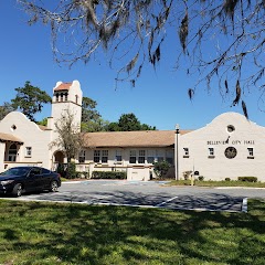
Belleview City Hall Park

Inverness Government Center
City of Belleview
Transit and Meeting Points
Useful pickup, handoff, or rendezvous points close to Wildwood.
Wildwood, Florida
The Villages-Lady Lake, FL
Ocala, Florida
Dade City, Florida
Flight Path Map
This map shows the direct air route between Palm Beach Gardens and Tallahassee. Straight-line distance: 354.17 mi (569.98 km).

#1 Palm Beach Gardens
A city in Palm Beach County, Florida.
| Population | 58,210 |
| Coordinates | 26.8233900, -80.1386500 |
| Altitude | 5 |
| Country | United States |

#2 Tallahassee
The capital of Florida.
| Population | 196,326 |
| Coordinates | 30.4382600, -84.2807300 |
| Altitude | 62 |
| Country | United States |
End: South Monroe Street (-84.280628, 30.438261)
Estimated Travel Time
Distance: 658 km by road
| Speed | Time |
|---|---|
| 30 mph (48.3 km/h) | 13h 37m |
| 40 mph (64.37 km/h) | 10h 13m |
| 50 mph (80.47 km/h) | 08h 10m |
| 60 mph (96.56 km/h) | 06h 48m |
| 70 mph (112.65 km/h) | 05h 50m |
| 80 mph (129 km/h) | 05h 05m |
Fuel, Round Trip and CO2
Estimated fuel cost and emissions for this route.
| Fuel | $/gal | One way | Round trip |
|---|---|---|---|
| Regular gas | $4.15 | $59.81 | $119.63 |
| Mid-grade | $4.60 | $66.27 | $132.55 |
| Premium | $4.90 | $70.60 | $141.20 |
| Diesel | $4.35 | $62.73 | $125.45 |
Assumes 8.3 L/100 km (about 28.3 MPG). CO2 is an estimate and varies by vehicle, fuel blend, traffic, and terrain.
Prices in Florida · Jul 18, 2026
Distance to Other Cities
Planning a road trip? See the full trip guide on Trip.ovh — stops, fuel costs, weather, and departure timing.