How far is Laredo, TX from Giddings, TX?
The driving distance from Laredo, TX to Giddings, TX is about 280.9 miles (452.1 km), with a travel time of about 04h 57m by car.
- The straight-line flight distance is about 241.7 miles (388.9 km).
- For a round trip, plan for roughly 09h 55m of driving time before adding stops, traffic, or weather delays.
- A comfortable departure window is usually 6:00 AM to 8:00 AM CDT.
Reverse, save, or send this route
This drive is better planned with a longer stop or an overnight stay. Copy the route link, send it to another device, or print a clean version before you head out.
This drive is better planned with a longer stop or an overnight stay.
Flight Distance
Driving Distance
Gas Cost Calculator
Leave and Arrive Planner
Pick a departure time to see your estimated arrival and same-day return window.
Drive time stays fixed at 04h 57m.
An early departure helps you fit a real stop into the day without turning the return into a late-night drive.
You are leaving earlier than the recommended window, which gives you extra margin for breaks and traffic.
Halfway Point
A useful midpoint for breaks, coffee, or meeting in the middle.
City in Bexar County, Texas, United States
Route Weather Snapshot
Check the forecast at both ends before you head out.
Mostly Sunny
Mostly Sunny then Slight Chance Showers And Thunderstorms
Driving Route Map
The map below follows the saved road route between Laredo and Giddings.
Turn-by-Turn Driving Directions
Step-by-step road directions between Laredo and Giddings.
-
1
Start on Matamoros Street
1544 ft · 46 sec · Matamoros Street
-
2
Turn left onto San Dario Avenue
553 ft · 11 sec · San Dario Avenue
-
3
Continue on Purple Heart Trail
144.4 mi · 2 hr 27 min · Purple Heart Trail
-
4
Continue on South Pan Am Expressway
8.4 mi · 10 min · South Pan Am Expressway
-
5
Take the exit slight right toward I 10 East, US 90 West, US 90 East, US 87 South: Houston, Del Rio
616 ft · 15 sec
-
6
Keep slight right to continue on I 10 East, US 90 East, US 87 South: Houston
2146 ft · 52 sec
-
7
Merge slight left onto Jose Lopez Freeway
8 mi · 9 min · Jose Lopez Freeway
-
8
Continue on 90th Infantry Division Highway
22.2 mi · 23 min · 90th Infantry Division Highway
-
9
Continue on I 10 East: Houston, Austin, Waco
10.9 mi · 11 min
-
10
Take the exit slight right toward TX 130 Toll North: Austin, Waco
1.5 km · 2 min
-
11
Continue on Pickle Parkway
34 mi · 30 min · Pickle Parkway
-
12
Take the exit slight right toward TX 21: Old Lockhart Road, Laws Road
1274 ft · 31 sec
-
13
Turn straight
2939 ft · 39 sec
-
14
Turn slight right onto TX 21
1465 ft · 1 min
-
15
Turn right onto Camino Real
17.6 mi · 21 min · Camino Real
-
16
Take the ramp slight right
5.5 mi · 7 min
-
17
Take the exit slight right
1067 ft · 26 sec
-
18
Turn straight onto College Street
1.4 km · 2 min · College Street
-
19
Turn left onto State Highway 95
1945 ft · 35 sec · State Highway 95
-
20
Turn right onto Chestnut Street
1.3 km · 1 min · Chestnut Street
-
21
Continue on State Highway 21 East
11.6 mi · 14 min · State Highway 21 East
-
22
Take the exit slight right
1830 ft · 51 sec
-
23
Merge slight left onto US Highway 290
12.1 mi · 14 min · US Highway 290
-
24
Continue on West Austin Street
3255 ft · 1 min · West Austin Street
-
25
Arrive at your destination
0 m · 1 sec · East Austin Street
Car Route Details
A richer read on the saved driving route between Laredo and Giddings.
Interchange-aware route
The drive includes several ramps, exits, or merges, so checking the next few maneuvers before busy interchanges is useful.
Purple Heart Trail
Continue on Purple Heart Trail
144 mi · 02h 27m
Route Summary
A quick read on whether this route feels easy, ambitious, or worth planning around.
A longer out-and-back drive
This is still possible in one day, but it becomes a long driving day. Leaving early and planning your stop window matters more here.
Mostly Sunny leaving Laredo and Mostly Sunny then Slight Chance Showers And Thunderstorms near Giddings.
Trip Questions
Direct answers travelers usually want before committing to the drive.
How long does it take to drive from Laredo to Giddings?
The road trip is about 280.9 miles (452.1 km) and usually takes 04h 57m in normal driving conditions.
Is this a same-day trip or an overnight route?
This is still possible in one day, but it becomes a long driving day. Leaving early and planning your stop window matters more here.
What is the halfway point on this route?
Von Ormy is a useful midpoint, sitting about 140.6 miles from Laredo and 140.3 miles from Giddings.
How much longer is the road route than the straight-line distance?
The direct path is about 241.7 miles (388.9 km), while the road route adds roughly 39.2 extra miles because roads do not follow the straight air line.
When is the best time to leave for this route?
A good departure window is usually 6:00 AM to 8:00 AM CDT. If you want a more comfortable same-day return, try to leave by 7:04 AM CDT.
How much will gas cost for this route?
Using about 28.3 MPG, regular gas is estimated at $37.45 one way or $74.90 round trip. Estimated CO2 is about 88.1 kg one way.
What should you check before leaving?
Before you leave, expect Mostly Sunny around Laredo and Mostly Sunny then Slight Chance Showers And Thunderstorms near Giddings.
Stop Ideas Near Von Ormy
Useful break, food, and waypoint ideas within about 15 miles of the route midpoint.
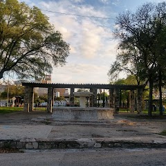
Piazza Italia Park

City Hall San Antonio

Municipal Plaza
Transit and Meeting Points
Useful pickup, handoff, or rendezvous points close to Von Ormy.
San Antonio Station
San Marcos Station
Flight Path Map
This map shows the direct air route between Laredo and Giddings. Straight-line distance: 241.66 mi (388.91 km).

#1 Laredo
The third most populous city in Texas and the center of the Laredo metropolitan area.
| Population | 263,640 |
| Coordinates | 27.5064100, -99.5075400 |
| Altitude | 126 |
| Country | United States |

#2 Giddings
City in Texas
| Population | 5,148 |
| Coordinates | 30.1827200, -96.9363700 |
| Altitude | 154 |
| Country | United States |
End: Giddings (-96.93637, 30.18272)
Estimated Travel Time
Distance: 452 km by road
| Speed | Time |
|---|---|
| 30 mph (48.3 km/h) | 09h 21m |
| 40 mph (64.37 km/h) | 07h 01m |
| 50 mph (80.47 km/h) | 05h 37m |
| 60 mph (96.56 km/h) | 04h 40m |
| 70 mph (112.65 km/h) | 04h 00m |
| 80 mph (129 km/h) | 03h 30m |
Fuel, Round Trip and CO2
Estimated fuel cost and emissions for this route.
| Fuel | $/gal | One way | Round trip |
|---|---|---|---|
| Regular gas | $3.78 | $37.45 | $74.90 |
| Mid-grade | $4.25 | $42.14 | $84.27 |
| Premium | $4.59 | $45.50 | $90.99 |
| Diesel | $3.99 | $39.57 | $79.14 |
Assumes 8.3 L/100 km (about 28.3 MPG). CO2 is an estimate and varies by vehicle, fuel blend, traffic, and terrain.
Prices in Texas · Jun 10, 2026
Distance to Other Cities
Planning a road trip? See the full trip guide on Trip.ovh — stops, fuel costs, weather, and departure timing.