How far is Iowa, LA from Baton Rouge, LA?
Fastest route
The distance between Iowa, Louisiana 70647 and Baton Rouge, Louisiana is approximately 114 miles (184 kilometers). The fastest route to reach Baton Rouge is via I-10 E, which will take around 1 hour and 57 minutes.
Directions
- 🚗 Get on I-10 E: Head north on N Thompson Ave toward Railroad Ave, then turn right to merge onto I-10 E toward Lafayette.
- 🚗 Follow I-10 E: Continue on I-10 E until you reach Baton Rouge.
- 🚗 Take exit 1B from I-110 N: Use the left lane to take exit 155B for I-110 N toward Bus. Dist/Metro Arpt, then use the left lane to take exit 1B for Convention Street toward Downtown.
- 🚗 Merge onto Convention St: Keep right at the fork and follow signs for Louisiana Old State Capitol Museum, then merge onto Convention St.
- 🚗 Continue on Convention St: Proceed on Convention St until you reach your destination in Baton Rouge, Louisiana.
Tips & Suggestions
- ⛽ Plan for fuel stops: Before starting your journey, ensure your vehicle has enough fuel for the approximately 114-mile distance.
- 🚧 Check traffic conditions: Monitor the traffic conditions on I-10 E to stay informed about any potential delays or congestion along the route.
- 🗺️ Use GPS navigation: Consider using a GPS navigation device or a smartphone app to assist you in following the route accurately.
- 🕒 Allow extra time: Depending on the time of day and traffic conditions, the estimated travel time of 1 hour and 57 minutes may vary. It's a good idea to allow some extra time in case of unexpected delays.
- 📞 Emergency contacts: Save important contact numbers, such as roadside assistance or emergency services, in case you encounter any issues during your journey.
- 🚗 Maintain road safety: Adhere to traffic rules, use indicators for lane changes, and drive attentively to ensure a safe and smooth journey.
- 📷 Capture memories: Along the way, you may come across beautiful scenic spots or landmarks. Consider stopping at suitable locations to capture memorable photos of your trip.
Reverse, save, or send this route
This route works well as a day trip with time at the destination. Copy the route link, send it to another device, or print a clean version before you head out.
This route works well as a day trip with time at the destination.
Flight Distance
Driving Distance
Gas Cost Calculator
Leave and Arrive Planner
Pick a departure time to see your estimated arrival and same-day return window.
Drive time stays fixed at 01h 49m.
A morning start gives you useful time at the destination and keeps the return out of the late evening.
You are leaving earlier than the recommended window, which gives you extra margin for breaks and traffic.
Halfway Point
A useful midpoint for breaks, coffee, or meeting in the middle.
Suburb city of Lafayette, located in Lafayette Parish, Louisiana, United States
Route Weather Snapshot
Check the forecast at both ends before you head out.
Mostly Sunny
Driving Route Map
The map below follows the saved road route between Iowa and Baton Rouge.
Turn-by-Turn Driving Directions
Step-by-step road directions between Iowa and Baton Rouge.
-
1
Start on West 1st Street
14 m · 7 sec · West 1st Street
-
2
Turn left onto North Thomson Avenue
1.2 km · 1 min · North Thomson Avenue
-
3
Take the ramp right
1200 ft · 29 sec
-
4
Merge slight left
111.7 mi · 2 hr 3 min
-
5
Take the exit slight right toward LA 30
1984 ft · 48 sec
-
6
Keep slight right
122 m · 10 sec
-
7
Turn straight onto Oklahoma Street
151 m · 19 sec · Oklahoma Street
-
8
Turn right onto Nicholson Drive
1685 ft · 34 sec · Nicholson Drive
-
9
Continue on Saint Louis Street
1378 ft · 45 sec · Saint Louis Street
-
10
Turn right onto Government Street
4 m · 1 sec · Government Street
-
11
Arrive at your destination
0 m · 1 sec · Government Street
Car Route Details
A richer read on the saved driving route between Iowa and Baton Rouge.
Straightforward drive
The saved road route has a manageable number of maneuvers and should be easy to follow with normal attention to signs.
North Thomson Avenue
Merge slight left
112 mi · 02h 03m
Route Summary
A quick read on whether this route feels easy, ambitious, or worth planning around.
A comfortable day-trip route
This route works well as a day trip. You can leave in the morning, spend meaningful time at the destination, and still return the same day.
Mostly Sunny leaving Iowa and Mostly Sunny near Baton Rouge.
Trip Questions
Direct answers travelers usually want before committing to the drive.
How long does it take to drive from Iowa to Baton Rouge?
The road trip is about 113.5 miles (182.6 km) and usually takes 01h 49m in normal driving conditions.
Is this a same-day trip or an overnight route?
This route works well as a day trip. You can leave in the morning, spend meaningful time at the destination, and still return the same day.
What is the halfway point on this route?
Scott is a useful midpoint, sitting about 56.8 miles from Iowa and 56.6 miles from Baton Rouge.
How much longer is the road route than the straight-line distance?
The direct path is about 109.9 miles (176.8 km), while the road route adds roughly 3.6 extra miles because roads do not follow the straight air line.
When is the best time to leave for this route?
A good departure window is usually 8:00 AM to 10:00 AM CDT. If you want a more comfortable same-day return, try to leave by 2:52 PM CDT.
How much will gas cost for this route?
Using about 28.3 MPG, regular gas is estimated at $15.15 one way or $30.30 round trip. Estimated CO2 is about 35.5 kg one way.
What should you check before leaving?
Before you leave, expect Mostly Sunny around Iowa and Mostly Sunny near Baton Rouge.
Stop Ideas Near Scott
Useful break, food, and waypoint ideas within about 15 miles of the route midpoint.
Transit and Meeting Points
Useful pickup, handoff, or rendezvous points close to Scott.
Lafayette
New Iberia
Baton Rouge, Louisiana
Lake Charles
Flight Path Map
This map shows the direct air route between Iowa and Baton Rouge. Straight-line distance: 109.83 mi (176.76 km).

#1 Iowa
Town in Louisiana, United States
| Population | 3,109 |
| Coordinates | 30.2368700, -93.0137600 |
| Altitude | 6 |
| Country | United States |
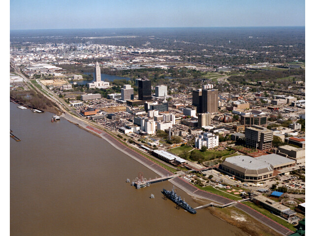
#2 Baton Rouge
The capital of Louisiana.
| Population | 219,052 |
| Coordinates | 30.4433200, -91.1874700 |
| Altitude | 14 |
| Country | United States |
End: Saint Louis Street (-91.18751, 30.443332)
Estimated Travel Time
Distance: 183 km by road
| Speed | Time |
|---|---|
| 30 mph (48.3 km/h) | 03h 46m |
| 40 mph (64.37 km/h) | 02h 50m |
| 50 mph (80.47 km/h) | 02h 16m |
| 60 mph (96.56 km/h) | 01h 53m |
| 70 mph (112.65 km/h) | 01h 37m |
| 80 mph (129 km/h) | 01h 24m |
Fuel, Round Trip and CO2
Estimated fuel cost and emissions for this route.
| Fuel | $/gal | One way | Round trip |
|---|---|---|---|
| Regular gas | $3.79 | $15.15 | $30.30 |
| Mid-grade | $4.26 | $17.04 | $34.07 |
| Premium | $4.63 | $18.50 | $37.00 |
| Diesel | $5.42 | $21.66 | $43.32 |
Assumes 8.3 L/100 km (about 28.3 MPG). CO2 is an estimate and varies by vehicle, fuel blend, traffic, and terrain.
Prices in Louisiana · Jun 27, 2026
Distance to Other Cities
Planning a road trip? See the full trip guide on Trip.ovh — stops, fuel costs, weather, and departure timing.