How far is Falcon Heights, MN from Apple Valley, MN?
Fastest route
The route from Falcon Heights, Minnesota to Apple Valley, Minnesota 55124 is approximately 21.2 miles and takes around 27 minutes via I-35E S.
Directions
- Start by heading east on Larpenteur Ave W toward Arona St.
- Make a U-turn at Arona St.
- Turn left onto MN-51 S/Snelling Ave.
- Slight right onto Ayd Mill Rd.
- Use any lane to take the ramp onto I-35E S.
- Continue on I-35E S until you reach Apple Valley.
- Take exit 92 for MN-77 S/Cedar Ave and keep left to continue on MN-77 S/Cedar Ave.
- Drive on Cedar Ave and make a U-turn at 153rd St W to reach your destination in Apple Valley, Minnesota 55124.
Tips & Suggestions
- 🚗 Plan your journey in advance to avoid traffic congestion.
- ⛽️ Make sure your vehicle has enough fuel for the journey.
- 📱 Use a navigation app or GPS device to help you navigate the route.
- 🚧 Stay alert for any road construction or detours along the way.
- 🕐 Consider the time of day and traffic conditions when estimating your travel time.
- 🚦 Observe traffic rules and signals for a safe and smooth journey.
- 🛣 Enjoy the scenic drive and landmarks along the route.
Reverse, save, or send this route
This is an easy same-day return drive. Copy the route link, send it to another device, or print a clean version before you head out.
This is an easy same-day return drive.
Flight Distance
Driving Distance
Gas Cost Calculator
Leave and Arrive Planner
Pick a departure time to see your estimated arrival and same-day return window.
Drive time stays fixed at 00h 28m.
This is a short drive, so your comfort window is wide. Traffic and current weather matter more than the clock.
You are leaving earlier than the recommended window, which gives you extra margin for breaks and traffic.
Halfway Point
A useful midpoint for breaks, coffee, or meeting in the middle.
City in Dakota County, Minnesota, United States of America
Route Weather Snapshot
Check the forecast at both ends before you head out.
Mostly Sunny
Sunny
Driving Route Map
The map below follows the saved road route between Falcon Heights and Apple Valley.
Turn-by-Turn Driving Directions
Step-by-step road directions between Falcon Heights and Apple Valley.
-
1
Start on Larpenteur Avenue West
537 ft · 18 sec · Larpenteur Avenue West
-
2
Continue on Larpenteur Avenue West
628 ft · 22 sec · Larpenteur Avenue West
-
3
Turn left onto Snelling Avenue North
3.1 mi · 7 min · Snelling Avenue North
-
4
Keep slight right to continue on Snelling Avenue
109 m · 18 sec · Snelling Avenue
-
5
Turn left onto Selby Avenue
929 ft · 37 sec · Selby Avenue
-
6
Turn slight right onto Ayd Mill Road
1.1 km · 1 min · Ayd Mill Road
-
7
Turn slight right onto Grand Avenue
1173 ft · 29 sec
-
8
Turn straight onto Ayd Mill Road
2861 ft · 1 min · Ayd Mill Road
-
9
Keep slight left to continue on Ayd Mill Road
2428 ft · 1 min · Ayd Mill Road
-
10
Merge slight left
11.1 mi · 14 min
-
11
Take the exit slight right toward MN 77: Cedar Avenue
1524 ft · 37 sec
-
12
Keep slight left to continue on MN 77 South: Cedar Avenue
1834 ft · 45 sec
-
13
Keep slight right to continue on MN 77 South: Cedar Avenue
1406 ft · 34 sec
-
14
Merge slight left onto Cedar Avenue
3.2 mi · 5 min · Cedar Avenue
-
15
Arrive at your destination
0 m · 1 sec · County Road 42
Car Route Details
A richer read on the saved driving route between Falcon Heights and Apple Valley.
Turn-heavy local drive
The route has frequent decision points for its length, so lane choice and turn timing will matter more than cruising speed.
Ayd Mill Road
Merge slight left
11.1 mi · 00h 14m
Route Summary
A quick read on whether this route feels easy, ambitious, or worth planning around.
A short regional drive
This route is short enough to handle as a quick errand, commute, or easy same-day return without much planning overhead.
Mostly Sunny leaving Falcon Heights and Sunny near Apple Valley.
Trip Questions
Direct answers travelers usually want before committing to the drive.
How long does it take to drive from Falcon Heights to Apple Valley?
The road trip is about 20.7 miles (33.3 km) and usually takes 00h 28m in normal driving conditions.
Is this a same-day trip or an overnight route?
This route is short enough to handle as a quick errand, commute, or easy same-day return without much planning overhead.
What is the halfway point on this route?
Mendota Heights is a useful midpoint, sitting about 10.3 miles from Falcon Heights and 10.4 miles from Apple Valley.
How much longer is the road route than the straight-line distance?
The direct path is about 18.1 miles (29.2 km), while the road route adds roughly 2.6 extra miles because roads do not follow the straight air line.
When is the best time to leave for this route?
A good departure window is usually 7:00 AM to 7:00 PM CDT. If you want a more comfortable same-day return, try to leave by 7:34 PM CDT.
How much will gas cost for this route?
Using about 28.3 MPG, regular gas is estimated at $2.61 one way or $5.21 round trip. Estimated CO2 is about 6.5 kg one way.
What should you check before leaving?
Before you leave, expect Mostly Sunny around Falcon Heights and Sunny near Apple Valley.
Stop Ideas Near Mendota Heights
Useful break, food, and waypoint ideas within about 15 miles of the route midpoint.

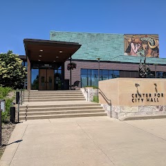
Minneapolis City Hall
City of Bloomington
Mall of America®
Transit and Meeting Points
Useful pickup, handoff, or rendezvous points close to Mendota Heights.
Saint Paul Union Depot
Red Wing station
Menomonie, WI
St. Cloud
Flight Path Map
This map shows the direct air route between Falcon Heights and Apple Valley. Straight-line distance: 18.12 mi (29.16 km).

#1 Falcon Heights
City in Ramsey County, Minnesota
| Population | 5,628 |
| Coordinates | 44.9916300, -93.1663300 |
| Altitude | 291 |
| Country | United States |

#2 Apple Valley
A city in Dakota County, Minnesota.
| Population | 54,847 |
| Coordinates | 44.7319100, -93.2177200 |
| Altitude | 291 |
| Country | United States |
End: 150th Street West (-93.21772, 44.731938)
Estimated Travel Time
Distance: 33 km by road
| Speed | Time |
|---|---|
| 30 mph (48.3 km/h) | 00h 41m |
| 40 mph (64.37 km/h) | 00h 31m |
| 50 mph (80.47 km/h) | 00h 24m |
| 60 mph (96.56 km/h) | 00h 20m |
| 70 mph (112.65 km/h) | 00h 17m |
| 80 mph (129 km/h) | 00h 15m |
Fuel, Round Trip and CO2
Estimated fuel cost and emissions for this route.
| Fuel | $/gal | One way | Round trip |
|---|---|---|---|
| Regular gas | $3.57 | $2.61 | $5.21 |
| Mid-grade | $3.92 | $2.86 | $5.72 |
| Premium | $4.39 | $3.21 | $6.41 |
| Diesel | $4.86 | $3.55 | $7.10 |
Assumes 8.3 L/100 km (about 28.3 MPG). CO2 is an estimate and varies by vehicle, fuel blend, traffic, and terrain.
Prices in Minnesota · Jun 27, 2026
Distance to Other Cities
Planning a road trip? See the full trip guide on Trip.ovh — stops, fuel costs, weather, and departure timing.