Darnestown, Maryland
Darnestown: census-designated place in Montgomery County, Maryland, United States
About
Darnestown is a CDP located in the county of Montgomery in the U.S. state of Maryland. Its population at the 2010 census was 6,773 and a population density of 148 people per km². After 1 years in 2011 city had an estimated population of 6,802 inhabitants.

Quick Facts about Darnestown
| Population | 6,802 (2011) |
| Country | United States of America |
| State | Maryland (United States) |
| County | Montgomery County |
| Phone Area Codes | 240, 301 |
| Area | 45.86 km2 |
| Latitude & Longitude | 39.1034,-77.2908 |
| Altitude | 410 feet / 125, 133, 134, 440 meters |
| Time Zone | Eastern Time Zone |
| Local time | 07:23:25 (18th July 2026) |
| Density | 148 Pop. per km² as of 2011 |
| Population growth | 0.43% (2010-2011) |
| Weather | 74℉ Smoke 7-days weather |

Geography
Darnestown is located at 39°6'12"N 77°17'27"W (39.1034400, -77.2908200).
Darnestown map
Weather
Smoke before 2am, then smoke and a slight chance of showers and thunderstorms. Mostly cloudy, with a low around 74. Southeast wind around 3 mph. Chanc...
7-Day ForecastDemographics
The population of Darnestown increased by 0.43% in 1 years.
| Year | Population | % Change | Method |
|---|---|---|---|
| 2000 | 6,378 | - | 2000 United States Census |
| 2010 | 6,773 | 5.83% | 2010 United States Census |
| 2011 | 6,802 | 0.43% | estimation process |
Best Things to Do in Darnestown
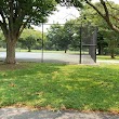
1Darnestown Local Park
14211 Darnestown Rd, Darnestown, MD 20878, United States View details
Phone: +13014952595 | Website available
People born in Darnestown (1)
American slalom canoeist Ashley Nee was born in Darnestown
Nearby Schools and Colleges
Schools and campuses linked to Darnestown, MD. Select a name to open its map and contact details.
| Code | Name | City | ZIP |
|---|---|---|---|
| 163426 | Montgomery College | Rockville (MD) | 20850 |
| 448257 | Avi Career Training | Great Falls (VA) | 22066 |
| 447971 | Hair Expressions Academy | Rockville (MD) | 20852 |
| 455026 | Omega Studios' School of Applied Recording Arts & Sciences | Rockville (MD) | 20852 |
| 484923 | Dermal Science International Aesthetics and Nail Academy | Reston (VA) | 20190 |
Nearby Transit Stations (22)
Rail and bus stations connected to Darnestown, MD. Select a station to open its map and address details.
| Code | Name | Address | Type |
|---|---|---|---|
| RKV | Rockville station | 251 Hungerford Drive at Park Rd. | RAIL |
| WAS | Washington Union Station | 50 Massachusetts Ave NE | RAIL |
| BCV | Burke Centre | 10399 Premier Court | RAIL |
| FRR | Frederick Airport, MD | 1341 Hughes Ford Road | BUS |
| FRC | Frederick, MD | 100 South East Street | RAIL |
Closest post offices linked to Darnestown.
| Post Office Name | City | ZIP |
|---|---|---|
| Kentland Post Office | Gaithersburg (MD) | 20878 |
| Diamond Farm Post Office | Gaithersburg (MD) | 20878 |
| Germantown Post Office | Germantown (MD) | 20874 |
| Boyd Post Office | Boyds (MD) | 20841 |
| Gaithersburg Post Office | Gaithersburg (MD) | 20877 |
Other cities in Montgomery County
Cities, towns, neighborhoods & other populated places in Montgomery County , MD. (more)
| City Name | Population | Title |
|---|---|---|
| Germantown | 86,395 | Census-designated place in Montgomery County, Maryland, United States |
| Silver Spring | 71,452 | A city in Montgomery County, Maryland. |
| Rockville | 69,512 | The most populous city in Montgomery County, Maryland. |
| Gaithersburg | 67,741 | The second most populous city in Montgomery County, Maryland. |
| Bethesda | 62,448 | A census-designated place (CDP) in Montgomery County, Maryland. |
| Aspen Hill | 48,759 | Census-designated place in Montgomery County, Maryland, United States |
| Potomac | 44,965 | Census-designated place in Montgomery County, Maryland, United States |
| North Bethesda | 43,828 | A census-designated place in Montgomery County, Maryland. |
| Olney | 33,844 | Unincorporated area of Montgomery County, Maryland, United States of America |
| Montgomery Village | 32,032 | Unincorporated community in Montgomery County, Maryland, United States |
| North Potomac | 24,410 | Census-designated place in Montgomery County, Maryland, United States |
| Fairland | 23,681 | Town in Oklahoma, United States |
| White Oak | 19,020 | Unincorporated area in Montgomery County, Maryland, United States |
| Takoma Park | 17,696 | City in Maryland, United States |
| Cloverly | 15,126 | Community in Montgomery County, Maryland, United States |
| Colesville | 14,647 | Unincorporated area in Montgomery County, Maryland, United States |
Distance to Other Cities
Darnestown distances to largest Maryland cities