North Bethesda, Maryland
North Bethesda: A census-designated place in Montgomery County, Maryland.
About
North Bethesda is a city located in the county of Montgomery in the U.S. state of Maryland.

Quick Facts about North Bethesda
| Population | 43,828 |
| Country | United States of America |
| State | Maryland (United States) |
| County | Montgomery County |
| Postal code | 20852, 20817, 20851, 20814 |
| Phone Area Codes | 301, 240 |
| Area | 23.03 km2 |
| Latitude & Longitude | 39.0446,-77.1189 |
| Altitude | 394 feet / 120 meters |
| Time Zone | Eastern Time Zone, UTC−05:00, UTC−04:00 |
| Local time | 14:11:06 (18th July 2026) |
| Weather | 74℉ Smoke 7-days weather |

Geography
North Bethesda is located at 39°2'40"N 77°7'8"W (39.0445500, -77.1188700). It has 3 neighbors: Bethesda, Potomac and Rockville.
North Bethesda map
Weather
Smoke before 2am, then smoke and a slight chance of showers and thunderstorms. Mostly cloudy, with a low around 74. Southeast wind around 3 mph. Chanc...
7-Day ForecastBest Things to Do in North Bethesda
1Bark Social
935 Prose St, North Bethesda, MD 20852, United States View details
Phone: +12402536060 | Website available

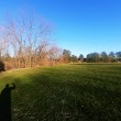
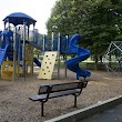
2Timberlawn Local Park
10800 Gloxinia Dr, North Bethesda, MD 20852, United States View details
Phone: +13014952595 | Website available
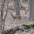
3Tilden Woods Stream Valley Park
Sulky Ln & I-270/N, North Bethesda, MD 20852, United States View details
Phone: +13014952595 | Website available
4Wall Local Park
5900 Executive Blvd, North Bethesda, MD 20852, United States View details
Phone: +13014952595 | Website available
5Josiah Henson Museum & Park
11410 Old Georgetown Rd, North Bethesda, MD 20852, United States View details
Phone: +13017658790 | Website available
Nearby Schools and Colleges
Schools and campuses linked to North Bethesda, MD. Select a name to open its map and contact details.
| Code | Name | City | ZIP |
|---|---|---|---|
| 447971 | Hair Expressions Academy | Rockville (MD) | 20852 |
Nearby Transit Stations (23)
Rail and bus stations connected to North Bethesda, MD. Select a station to open its map and address details.
| Code | Name | Address | Type |
|---|---|---|---|
| RKV | Rockville station | 251 Hungerford Drive at Park Rd. | RAIL |
| WAS | Washington Union Station | 50 Massachusetts Ave NE | RAIL |
| NCR | New Carrollton station | 4300 Garden City Drive | RAIL |
| ALX | Union Station | 110 Callahan Drive | RAIL |
| BCV | Burke Centre | 10399 Premier Court | RAIL |
Closest post offices linked to North Bethesda.
| Post Office Name | City | ZIP |
|---|---|---|
| Rockville Carrier Annex Post Office | Rockville (MD) | 20852 |
Other cities in Montgomery County
Cities, towns, neighborhoods & other populated places in Montgomery County , MD. (more)
| City Name | Population | Title |
|---|---|---|
| Germantown | 86,395 | Census-designated place in Montgomery County, Maryland, United States |
| Silver Spring | 71,452 | A city in Montgomery County, Maryland. |
| Rockville | 69,512 | The most populous city in Montgomery County, Maryland. |
| Gaithersburg | 67,741 | The second most populous city in Montgomery County, Maryland. |
| Bethesda | 62,448 | A census-designated place (CDP) in Montgomery County, Maryland. |
| Aspen Hill | 48,759 | Census-designated place in Montgomery County, Maryland, United States |
| Potomac | 44,965 | Census-designated place in Montgomery County, Maryland, United States |
| Olney | 33,844 | Unincorporated area of Montgomery County, Maryland, United States of America |
| Montgomery Village | 32,032 | Unincorporated community in Montgomery County, Maryland, United States |
| North Potomac | 24,410 | Census-designated place in Montgomery County, Maryland, United States |
| Fairland | 23,681 | Town in Oklahoma, United States |
| White Oak | 19,020 | Unincorporated area in Montgomery County, Maryland, United States |
| Takoma Park | 17,696 | City in Maryland, United States |
| Cloverly | 15,126 | Community in Montgomery County, Maryland, United States |
| Colesville | 14,647 | Unincorporated area in Montgomery County, Maryland, United States |
| Kemp Mill | 13,445 | Census-designated place in Montgomery County, Maryland, United States |
Distance to Other Cities
North Bethesda distances to largest Maryland cities