State of Uttar Pradesh (Uttar Pradesh), Uttar Pradesh
State of Uttar Pradesh: Court Case of 1975
About
State Snapshot
Uttar Pradesh at a glance
Uttar Pradesh currently has 263 quality-checked populated place pages and 38 county pages linked on MapSof.
Mapped cities & towns
263
These counts use a stricter populated-place filter so the main lists stay focused on real city and town pages.
County pages
38
Open related pagesLargest city
GhāziābādPopulation 4,681,645
Top linked places
Quick Facts about Uttar Pradesh
| State | Uttar Pradesh (India) |
| Latitude & Longitude | 27.2500,80.7500 |
| Time Zone | Asia/Kolkata |
| Local time | 14:13:23 (17th July 2026) |
Geography
Uttar Pradesh is located at 27°15'0"N 80°45'0"E (27.2500000, 80.7500000).
State of Uttar Pradesh map
The largest city of Uttar Pradesh is Kanpur with a population of 2,823,249. Other cities include, Agra population 1,430,055, Varanasi population 1,164,404, Alīgarh population 753,207 and Bareilly population 745,435. See all Uttar Pradesh cities & populated places.
Map & Images (more maps)
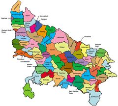
Districts Map of Uttar Pradesh
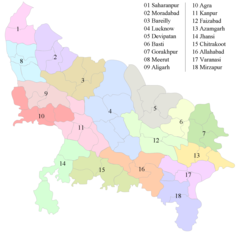
Divisions Map of Uttar Pradesh
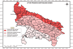
Earthquake Hazard Map of Uttar Pradesh
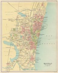
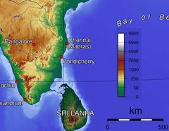
History Map of Chennai
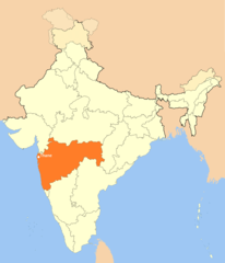
Location Map of Thane
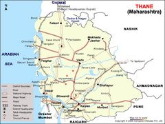
Map of Thane