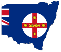
State of New South Wales, New South Wales
State of New South Wales: state of Australia
About
State Snapshot
State of New South Wales at a glance
State of New South Wales currently has 143 quality-checked populated place pages and 89 county pages linked on MapSof.
Mapped cities & towns
143
These counts use a stricter populated-place filter so the main lists stay focused on real city and town pages.
County pages
89
Open related pagesLargest city
SydneyPopulation 4,840,600
Top linked places
Quick Facts about State of New South Wales
| Population | 8,157,735 |
| Country | Australia |
| State | New South Wales (Australia) |
| Phone Area Codes | 03, 08, 02 |
| Area | 801150 km2 |
| Official name | New South Wales |
| Latitude & Longitude | -33.0000,146.0000 |
| Legislative body | Parliament of New South Wales |
| Named for | South Wales |
| Altitude | 525 feet / 160 meters |
| Capital | Sydney |
| Establishment | January 01, 1788 (238 years ago) |
| Time Zone | UTC+10:00, UTC+11:00 |
| Local time | 12:38:55 (16th July 2026) |
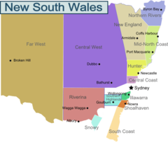
Geography
State of New South Wales is located at 33°0'0"S 146°0'0"E (-33.0000000, 146.0000000). It has 3 neighbors: State of South Australia, Australian Capital Territory and Victoria.
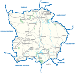
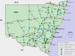
State of New South Wales map
The largest city of State of New South Wales is Newcastle with a population of 300,196. Other cities include, Wollongong population 289,236, Port Macquarie population 44,875, Dubbo population 39,863 and Coffs Harbour population 26,672. See all State of New South Wales cities & populated places.
Largest Cities in State of New South Wales (more)
Cities, Towns, Villages, Neighborhoods & Other Populated Places in State of New South Wales.
| City Name | County | Population |
|---|---|---|
| Sydney | 4,840,600 | |
| Newcastle | Newcastle | 300,196 |
| Wollongong | Wollongong | 289,236 |
| Maitland | Maitland Municipality | 67,132 |
| Cessnock | Cessnock | 55,560 |
| Tamworth | Tamworth Municipality | 47,597 |
| Port Macquarie | Port Macquarie-Hastings | 44,875 |
| Dubbo | Western Plains Regional | 39,863 |
| Orange | Orange Municipality | 38,408 |
| Bathurst | Bathurst Regional | 33,110 |
| Kempsey | Kempsey | 28,885 |
| Liverpool | Fairfield | 27,545 |
| Parramatta | Parramatta | 26,876 |
| Coffs Harbour | Coffs Harbour | 26,672 |
| Armidale | Armidale Regional | 24,504 |
| Goulburn | Goulburn Mulwaree | 22,645 |
Show more State of New South Wales cities and populated places
Official website of State of New South Wales
Official Website- Beijing
- Jakarta
- Tokyo (1984 )
- Wentworth Shire
- Marrickville Council
- City of Hawkesbury
- Snowy River Shire
- Carrathool Shire
- City of Wollongong
- City of Shoalhaven
- Municipality of Strathfield
- City of Blacktown
- Tumut Shire
- City of Hurstville
- City of Griffith
- Cootamundra Shire
- Coonamble Shire
- Gundagai Shire
- City of Blue Mountains
- City of Penrith
- City of Dubbo
- Forbes Shire
- City of Cessnock
- Boorowa Shire
- Municipality of Burwood
- City of Lake Macquarie
- Harden Shire
- Bathurst Regional Council
- Wollondilly Shire
- Cooma-Monaro Shire
- Inverell Shire
- Glen Innes Severn
- Tenterfield Shire
- Bourke Shire
- Balranald Shire
- Upper Hunter Shire
- Weddin Shire
- Brewarrina Shire
- Wyong Shire
- Wakool Shire
- Guyra Shire
- City of Ryde
- City of Lithgow
- City of Greater Taree
- Mid-Western Regional Council
- City of Randwick
- Upper Lachlan Shire
- City of Coffs Harbour
- Camden Council
- Narromine Shire
- Greater Hume Shire
- Gwydir Shire
- Gunnedah Shire
- Municipality of Lane Cove
- Clarence Valley Council
- City of Kogarah
- Gilgandra Shire
- Wingecarribee Shire
- Wellington Council
- Murrumbidgee Shire
- Hornsby Shire
- Deniliquin Council
- Tweed Shire
- Blayney Shire
- Tumbarumba Shire
- City of Holroyd
- Nambucca Valley Council
- Gloucester Shire
- Waverley Municipal Council
- Eurobodalla Shire
- Parkes Shire
- Oberon Shire
- City of Broken Hill
- Yass Valley Council
- Warringah Council
- City of Rockdale
- City of Gosford
- Murray Shire
- Bombala Shire
- Berrigan Shire
- Palerang Council
- Great Lakes Council
- Municipality of Leichhardt
- City of Lismore
- Junee Shire
- Narrabri Shire
- City of Campbelltown
- Pittwater Council
- Auburn City
- Manly Council
- The Hills Shire
- Singleton Council
- City of Willoughby
- Moree Plains Shire
- Coolamon Shire
- Municipality of Hunter's Hill
- Muswellbrook Shire
- North Sydney Council
- Ballina Shire
- Liverpool Plains Shire
- Jerilderie Shire
- City of Parramatta Council
- Municipality of Kiama
- Federation Council
- Young Shire
- Urana Shire
- Cobar Shire
- Lachlan Shire
- Dungog Shire
- City of Wagga Wagga
- City of Fairfield
- Hay Shire
- Richmond Valley Council
- Bega Valley Shire
- Narrandera Shire
- Walcha Shire
- Kempsey Shire
- Byron Shire
- Municipality of Ashfield
- Warren Shire
- Central Darling Shire
- City of Canada Bay
- Municipality of Mosman
- Sutherland Shire
- Uralla Shire
- City of Newcastle
- Bland Shire
- City of Orange
- City of Bankstown
- Cowra Shire
- City of Botany Bay
- Lockhart Shire
- Leeton Shire
- Bellingen Shire
- Conargo Shire
- Port Macquarie-Hastings Council
- Tamworth Regional Council
- Port Stephens Council
- Kyogle Council
- Cabonne Council
- City of Queanbeyan
- Temora Shire
- Ku-ring-gai Council
- Warrumbungle Shire
- Goulburn Mulwaree Council
- City of Canterbury
- Woollahra Municipality
- City of Albury
- City of Shellharbour
- Armidale Dumaresq Shire
- Bogan Shire
- City of Sydney
- City of Maitland
- Walgett Shire
- City of Liverpool
- Corowa Shire
Demographics
| Year | Population | % Change | Method |
|---|---|---|---|
| 2011 | 6,917,658 | - | census |
| 2014 | 7,500,600 | 7.77% | census |
| 2016 | 7,480,228 | -0.27% | census |
| 2020 | 8,157,735 | 8.31% | population estimation |
State of New South Wales Counties
| County Name | Population |
|---|
Show more State of New South Wales counties
Map & Images (more maps)
New South Wales Region Map
Burrinkuck City Map
Cities Map of New South Wales
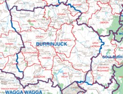
City Map Burrinjuck
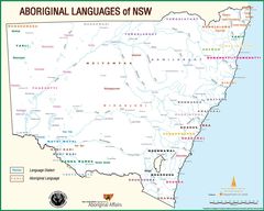
Language Map of New South Wales
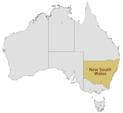
Location Map of New South Wales