State of Andhra Pradesh, Andhra Pradesh
State of Andhra Pradesh: state in India
About
State Snapshot
State of Andhra Pradesh at a glance
State of Andhra Pradesh currently has 131 quality-checked populated place pages and 10 county pages linked on MapSof.
Mapped cities & towns
131
These counts use a stricter populated-place filter so the main lists stay focused on real city and town pages.
County pages
10
Open related pagesLargest city
VisakhapatnamPopulation 1,063,178
Top linked places
Quick Facts about State of Andhra Pradesh
| Population | 49,386,799 |
| Country | India |
| State | Andhra Pradesh (India) |
| Different from | Andhra Pradesh |
| Area | 275068 km2 |
| Official name | आंध्र प्रदेश, ఆంధ్ర ప్రదేశ్, ஆந்திரப் பிரதேசம், ಆಂಧ್ರ ಪ್ರದೇಶ, ଆନ୍ଧ୍ର ପ୍ରଦେଶ |
| Latitude & Longitude | 15.8333,79.7500 |
| Legislative body | Andhra Pradesh Legislature |
| Male population | 42442146 |
| Official language | Telugu |
| Female population | 42138631 |
| Capital | Amaravati, Hyderabad |
| Establishment | November 01, 1956 (69 years ago) |
| Time Zone | UTC+05:30 |
| Local time | 00:01:13 (1st July 2026) |
Geography
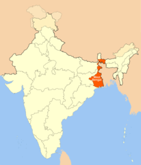
State of Andhra Pradesh is located at 15°49'60"N 79°45'0"E (15.8333300, 79.7500000). It has 3 neighbors: State of Tamil Nadu, Pondicherry and State of Chhattisgarh.
State of Andhra Pradesh map
The largest city of State of Andhra Pradesh is Vijayawada with a population of 1,048,240. Other cities include, Guntur population 647,508, Nellore population 547,621, Kākināda population 384,182 and Rājahmundry population 341,831. See all State of Andhra Pradesh cities & populated places.
Official website of State of Andhra Pradesh
Official Website- West Godavari district
- Prakasam district
- Guntur district
- Krishna district
- Visakhapatnam district
- Kurnool District
- Srikakulam district
- Sri Potti Sri Ramulu Nellore district
- Chittoor district
- Kadapa District
- Vizianagaram district
- Anantapuram district
- East Godavari district
Demographics
| Year | Population | % Change | Method |
|---|---|---|---|
| 2011 | 84,580,777 | - | census |
| 2014 | 49,386,799 | -71.26% | census |
Map & Images (more maps)
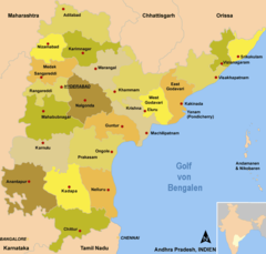
Districts Map of Andhra Pradesh
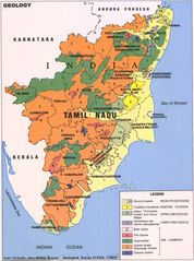
Geologic Map of Tamil Nadu
Location Map of West Bengal
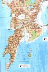
Physical Map Mumbai
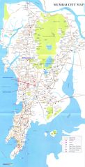
Political City Map of Mumbai
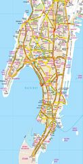
Political Map Mumbai
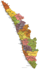
Political Map of Kerala
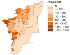
Topographic (altitude) Map Tamil Nadu
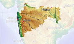
Topographic Map Maharashtra
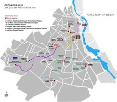
Tourism Map of Delhi
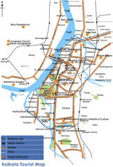
Tourist Map Kolkata