Newcastle Tourist Transport Map
Click on the Newcastle Tourist Transport Map to view it full screen. File Type: png, File size: 198434 bytes (193.78 KB), Map Dimensions: 1800px x 1188px (256 colors)
More Newcastle Static Maps
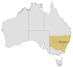
Location Map of Newcastle
1493 x 1380 - 48,595k - png
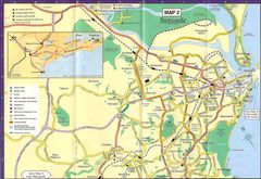
Map of Newcastle
1600 x 1103 - 326,419k - jpg
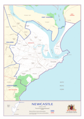
Newcastle Autralia Map
1684 x 2381 - 246,518k - gif
Newcastle Bus Map
1800 x 1672 - 227,234k - png
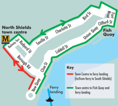
Newcastle Ferry Link Map
1000 x 899 - 91,637k - png
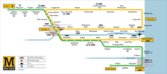
Newcastle Metro Map (subway)
1800 x 794 - 167,658k - png
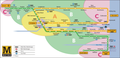
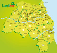
Newcastle Metro Zone Map
1599 x 782 - 234,281k - png
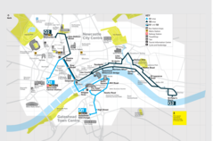
Newcastle Tourist Transport Map
1800 x 1188 - 198,434k - png
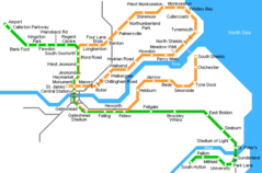
Newcastle Metro Map
650 x 429 - 9,461k - png