Newcastle, Oklahoma
Newcastle: city in Oklahoma, United States
About
Newcastle is a city located in the county of McClain in the U.S. state of Oklahoma. Its population at the 2010 census was 7,685 and a population density of 49 people per km². After 10 years in 2020 city had an estimated population of 11,347 inhabitants.
The city was created 64 years ago in 1961.

Quick Facts about Newcastle
| Population | 11,347 (2020) |
| Country | United States of America |
| State | Oklahoma (United States) |
| County | McClain County |
| Postal code | 73065 |
| Phone Area Codes | 405 |
| Area | 157.86 km2 |
| Latitude & Longitude | 35.2473,-97.5998 |
| Altitude | 1,194 feet / 364 meters |
| Establishment | January 01, 1962 (64 years ago) |
| Time Zone | America/Chicago |
| Local time | 18:48:30 (16th July 2026) |
| Density | 72 Pop. per km² as of 2020 |
| Population growth | 32.27% (2010-2020) |
| Weather | 90℉ Sunny 7-days weather |
Geography
Newcastle is located at 35°14'50"N 97°35'59"W (35.2472900, -97.5997600).
Newcastle map
Weather
Sunny, with a high near 90. South southwest wind 6 to 15 mph, with gusts as high as 20 mph.
7-Day ForecastOfficial website of Newcastle
Official WebsiteDemographics
The population of Newcastle increased by 32.27% in 10 years.
| Year | Population | % Change | Method |
|---|---|---|---|
| 2010 | 7,685 | - | census |
| 2011 | 8,018 | 4.15% | estimation process |
| 2012 | 8,292 | 3.3% | estimation process |
| 2013 | 8,671 | 4.37% | estimation process |
| 2014 | 9,132 | 5.05% | estimation process |
| 2015 | 9,405 | 2.9% | estimation process |
| 2016 | 9,613 | 2.16% | estimation process |
| 2017 | 9,928 | 3.17% | estimation process |
| 2018 | 10,284 | 3.46% | estimation process |
| 2019 | 10,655 | 3.48% | estimation process |
| 2020 | 11,347 | 6.1% | estimation process |
People born in Newcastle (2)
People born in Newcastle, including Oklahoma politician Anthony Sykes, tennis player J. D. Morgan, .
More notable people
Nearby Schools and Colleges
Schools and campuses linked to Newcastle, OK. Select a name to open its map and contact details.
| Code | Name | City | ZIP |
|---|---|---|---|
| 245953 | Mid-America Christian University | Oklahoma City (OK) | 73170-9797 |
Nearby Transit Stations (5)
Rail and bus stations connected to Newcastle, OK. Select a station to open its map and address details.
| Code | Name | Address | Type |
|---|---|---|---|
| NOR | Norman | 200 South Jones Avenue | RAIL |
| OKC | Santa Fe Depot | 100 South E.K. Gaylord Blvd. | RAIL |
| PUR | Purcell | East Main St and North Santa Fe Ave. | RAIL |
| PVL | Pauls Valley | East Paul Ave. and South Santa Fe St. | RAIL |
| GUT | Guthrie, OK | 409 West Oklahoma Ave. | RAIL |
Closest post offices linked to Newcastle.
| Post Office Name | City | ZIP |
|---|---|---|
| Newcastl Post Office | Newcastle (OK) | 73065 |
Other places with the same name (6)
- Newcastle, Washington city in King County, Washington, United States with a population of 12,905 people.
- Newcastle, Wyoming city in Weston County, Wyoming, United States with a population of 3,314 people.
- Newcastle, Maine town in Maine, United States with a population of 1,779 people.
- Newcastle, Texas city in Young County, Texas, United States with a population of 567 people.
- Newcastle, Ohio human settlement in United States of America with a population of 475 people.
- Newcastle, Nebraska village in Nebraska, United States with a population of 344 people.
Other cities in McClain County
Cities, towns, neighborhoods & other populated places in McClain County , OK.
| City Name | Population | Title |
|---|---|---|
| Blanchard | 9,114 | City in Oklahoma, USA |
| Purcell | 6,391 | City in Oklahoma |
| Goldsby | 2,536 | Town in Oklahoma |
| Dibble | 878 | Human settlement in McClain County, Oklahoma, United States of America |
| Wayne | 733 | Town in McClain County, Oklahoma |
| Washington | 601 | Town in Oklahoma |
| Cole | 599 | Human settlement in McClain County, Oklahoma, United States of America |
| Byars | 274 | Human settlement in McClain County, Oklahoma, United States of America |
| Rosedale | 73 | Town in the United States |
Distance to Other Cities
Newcastle distances to largest Oklahoma cities
- Oklahoma City
- Tulsa
- Norman
- Broken Arrow
- Edmond
- Lawton
- Moore
- Midwest City
- Stillwater
- Enid
- Owasso
- Muskogee
- Bartlesville
- Shawnee
- Yukon
- Bixby
- Ardmore
- Jenks
Map & Images (more maps)
Location Map of Newcastle
Map of Newcastle
Newcastle Autralia Map
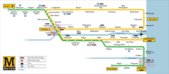
Newcastle Bus Map
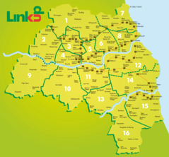
Newcastle Ferry Link Map
Newcastle Metro Map (subway)
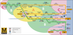
Newcastle Metro Zone Map
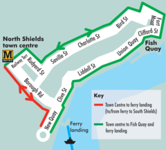
Newcastle Tourist Transport Map