
Map & Images
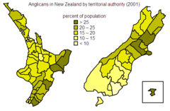
Anglicans In Nz
574 x 376 - 9,741k -
png
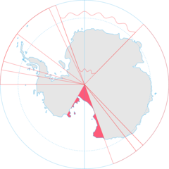
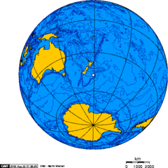
Antarctica, New Zealand Territorial Claim
920 x 920 - 33,662k -
png
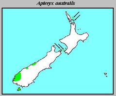
Apteryx Australis Distribution
409 x 339 - 16,498k -
jpg
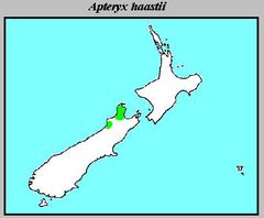
Apteryx Haastii Distribution
409 x 337 - 15,619k -
jpg
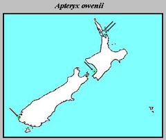
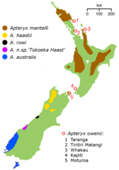
Apteryx Owenii Distribution
409 x 344 - 15,765k -
jpg
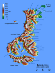
Auckland Islands Topo
950 x 1264 - 228,322k -
png
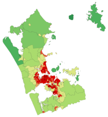
Aucklandregionpopulationdensity
781 x 848 - 33,712k -
png
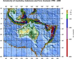
Ausseis 1
556 x 449 - 89,173k -
jpg
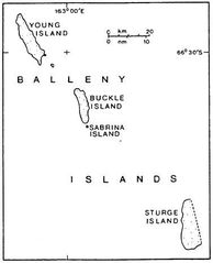
Balleny Map
377 x 465 - 17,877k -
jpg
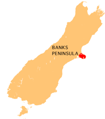
Banks Peninsula Map
440 x 497 - 9,292k -
png
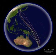
Bar Tailed Godwit Migration 1
416 x 408 - 31,685k -
jpg
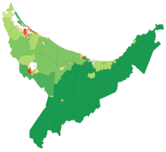
Bayofplentyregionpopulationdensity
1236 x 1135 - 31,154k -
png
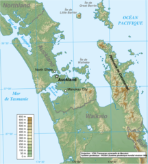
Carte Auckland Region Fr
908 x 1010 - 346,342k -
png
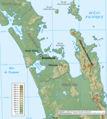
Carte Auckland Region
722 x 802 - 226,120k -
png
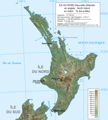
Carte Ile Du Nord Nz
823 x 911 - 171,770k -
png
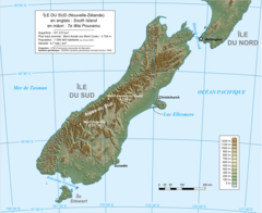
Carte Ile Du Sud Nz
1114 x 910 - 218,905k -
png
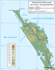
Carte Physique Northland
756 x 957 - 71,439k -
png
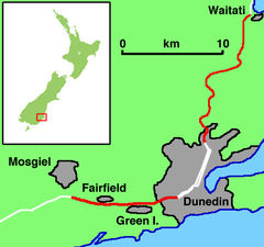
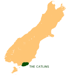
Catlinsmap
635 x 567 - 87,238k -
jpg
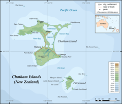
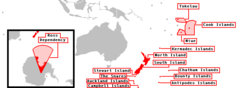
Chatham Islands Map Topo En
920 x 786 - 39,281k -
png
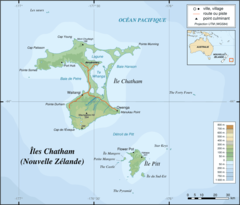
Chatham Islands Map Topo Fr
920 x 786 - 41,566k -
png
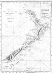
Cook Chart of New Zealand
1093 x 1508 - 307,926k -
jpg
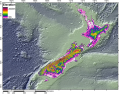
Dem Newzealand
950 x 750 - 331,931k -
png
Dnnz Motorways
482 x 452 - 69,443k -
jpg
Gisborneregionpopulationdensity
837 x 994 - 15,585k -
png
Hawkesbayregionpopulationdensity
1061 x 1250 - 31,123k -
png
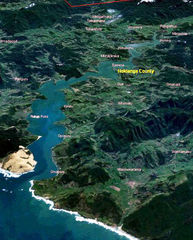
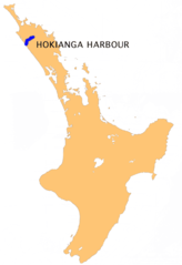
Hokianga
1152 x 784 - 131,834k -
jpg
Hokiangalitesml
510 x 634 - 290,510k -
jpg
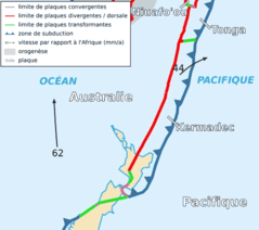
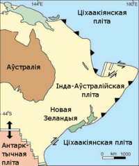
Kermadec Plate Map Fr
497 x 441 - 21,650k -
png
Locmap Tongariro National Park2
800 x 590 - 5,555k -
png
Manawatuwanganuiregionpopulationdensity
1051 x 1587 - 41,068k -
png
Map New Zealand Volcanoes
377 x 722 - 19,099k -
gif
Map of Maungatautari
865 x 759 - 206,317k -
jpg
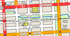
Map Showing Otepuni Gardens
603 x 310 - 26,622k -
gif
Marlborough Base Map
3000 x 3861 - 35,151k -
png
Marlboroughregionpopulationdensity
904 x 1236 - 31,351k -
png
Mitasmannelson
386 x 556 - 7,949k -
png
Mitauihu
386 x 556 - 7,941k -
png
Nz Embassies 1945
1357 x 628 - 19,884k -
png
Nz Embassies 1960
1357 x 628 - 20,620k -
png
Nz Embassies 1975
1357 x 628 - 20,780k -
png
Nz Embassies 1990
1357 x 628 - 20,807k -
png
Nz Embassies 2005
1357 x 628 - 21,738k -
png
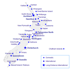
Nz Intl Network
800 x 397 - 36,819k -
jpg

Nz Locator Blank
800 x 590 - 5,295k -
png
Nz Realm of New Zealand
1357 x 617 - 20,688k -
png
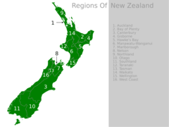
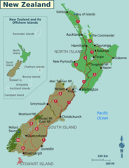
Nz Regions
920 x 690 - 25,468k -
png
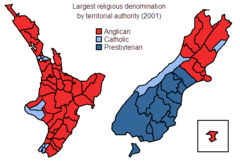
Nz Religious Denominations
551 x 376 - 9,169k -
png
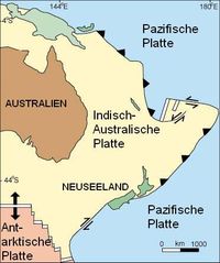
Nz Transform (belarusian)
372 x 445 - 21,447k -
png
Nz Transform (deutsch)
372 x 445 - 38,756k -
jpg
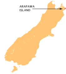
Nz Arapawa I
440 x 497 - 8,926k -
png
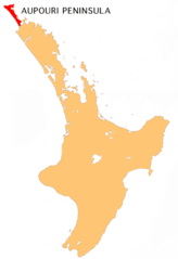
Nz Aupouri P
405 x 590 - 19,033k -
png
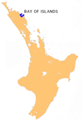
Nz Bay of Islands
405 x 590 - 19,506k -
png
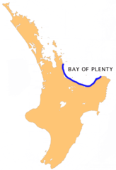
Nz Bay of Plenty
405 x 590 - 19,691k -
png
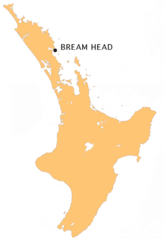
Nz Bream H
405 x 590 - 19,373k -
png
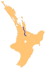
Nz Buller R
1234 x 1395 - 95,352k -
png
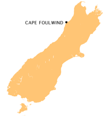
Nz C Foulwind
440 x 497 - 8,893k -
png
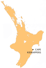
Nz C Kidnappers
405 x 590 - 19,471k -
png
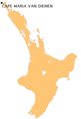
Nz C Mvdiemen
405 x 590 - 9,588k -
png
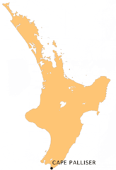
Nz C Palliser
405 x 590 - 19,419k -
png
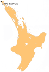
Nz C Reinga
405 x 590 - 19,425k -
png
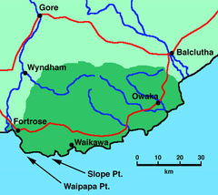
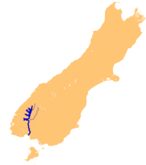
Nz Catlins
440 x 497 - 18,805k -
png
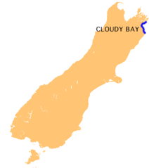
Nz Cloudy B
440 x 497 - 8,228k -
png
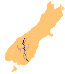
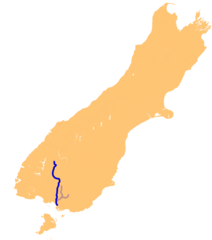
Nz Clutha R
1234 x 1395 - 95,778k -
png
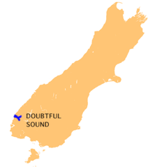
Nz Doubtful S
440 x 497 - 8,288k -
png
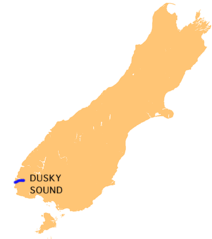
Nz Dusky S
440 x 497 - 8,493k -
png
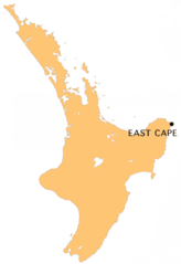
Nz East C
405 x 590 - 20,418k -
png
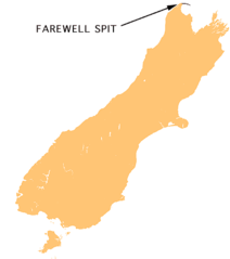
Nz Farewell S
440 x 497 - 9,454k -
png
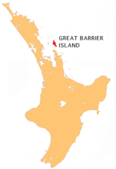
Nz Gt Barrier I
405 x 590 - 19,046k -
png
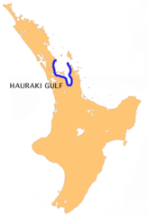
Nz Hauraki G
405 x 590 - 19,400k -
png
Nz Hauraki P
1003 x 1457 - 262,505k -
png
Nz Heretaunga P
1003 x 1457 - 262,440k -
png
Nz Hokianga Harbour
405 x 590 - 19,631k -
png
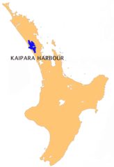
Nz Kaipara H
405 x 590 - 19,248k -
png
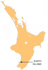
Nz Kapiti I
405 x 590 - 18,870k -
png

Nz L Chalky Island
617 x 697 - 31,785k -
png

Nz L Hawea
617 x 697 - 30,907k -
png
Nz L Manapouri
617 x 697 - 31,586k -
png
Nz L Rotorua
501 x 728 - 12,971k -
png
Nz L Te Anau
617 x 697 - 30,667k -
png
Nz L Tekapo
617 x 697 - 24,244k -
png
Nz L Wairarapa
501 x 728 - 10,774k -
png
Nz L Wakatipu
617 x 697 - 30,852k -
png
Nz L Wanaka
617 x 697 - 35,949k -
png
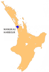
Nz Manukau H
405 x 590 - 20,737k -
png
Nz Mataura R
1234 x 1395 - 131,204k -
png
Nz Ni Plain Map
1003 x 1457 - 8,843k -
png
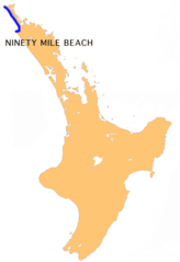
Nz Ninety Mile B
405 x 590 - 19,476k -
png
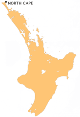
Nz North C
405 x 590 - 19,445k -
png
Nz Oreti R
1234 x 1395 - 132,988k -
png
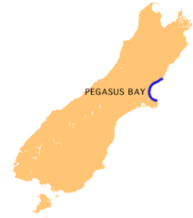
Nz Pegasus B
440 x 497 - 8,596k -
png
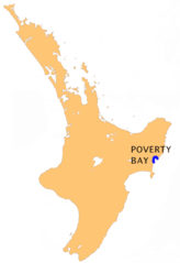
Nz Poverty B
405 x 590 - 19,600k -
png
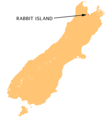
Nz Rabbit I
440 x 497 - 9,463k -
png
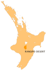
Nz Rangipo D
405 x 588 - 9,265k -
png
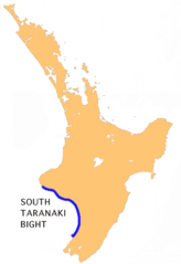
Nz S Taranaki B
405 x 590 - 19,842k -
png
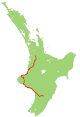
Nz Sh2 Map
1003 x 1457 - 24,370k -
png
Nz Sh3 Map
1003 x 1457 - 22,838k -
png
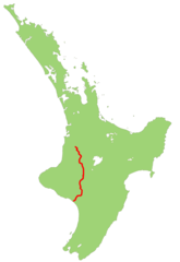
Nz Sh4 Map
1003 x 1457 - 22,497k -
png
Nz Sh5 Map
1003 x 1457 - 22,601k -
png
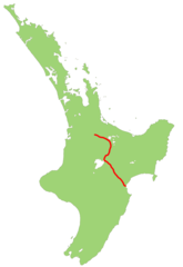
Nz Sh6 Map
1234 x 1395 - 20,901k -
png
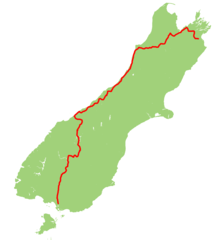
Nz Sh7 Map
1234 x 1395 - 11,907k -
png
Nz Sh8 Map
617 x 698 - 13,073k -
png
Nz Si Plain Map
1234 x 1395 - 9,255k -
png
Nz Secretary I
440 x 497 - 9,641k -
png
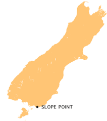
Nz Slope P
440 x 497 - 8,683k -
png
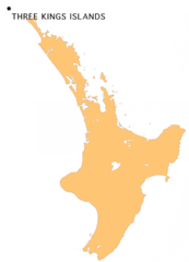
Nz Threekings
449 x 622 - 20,408k -
png

Nz Toetoes B
440 x 497 - 8,606k -
png
Nz Waiau R(south)
1234 x 1395 - 98,847k -
png
Nz Waihou R
1003 x 1457 - 58,336k -
png
Nz Waikato P
1003 x 1457 - 262,883k -
png
Nz Waikato R
1003 x 1457 - 59,995k -
png
Nz Waimakariri R
1234 x 1395 - 131,961k -
png
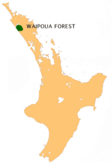
Nz Waipoua F
405 x 590 - 19,565k -
png
Nz Wairoa R(hb)
1003 x 1457 - 58,357k -
png
Nz Wairua R
1003 x 1457 - 58,074k -
png
Nz Whanganui R
1003 x 1457 - 59,316k -
png
Nz Whangaparaoa P
405 x 590 - 19,197k -
png
Nz Kiwimap Mi
824 x 1180 - 27,841k -
png
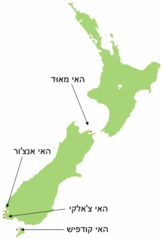
Nzoffshoreislandsmap
911 x 581 - 20,727k -
png
Nzsouthisland
259 x 309 - 12,355k -
png
Nzstewardislandareamap
911 x 579 - 18,600k -
png
Neuseeland Mit Campbell
329 x 484 - 9,852k -
png
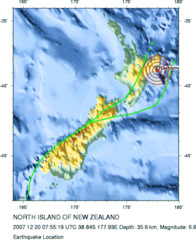
New Zealand Earthquake 2007
418 x 512 - 48,254k -
png
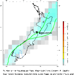
New Zealand Earthquake Density Map
479 x 484 - 33,626k -
gif
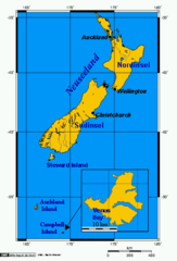
New Zealand Map
323 x 590 - 20,116k -
png
New Zealand Topographic Map
652 x 904 - 42,322k -
jpg
New Zealand Counties 1913
1800 x 2574 - 638,627k -
jpg
Newzealandairportsmap
502 x 494 - 11,891k -
png
Newzealandembassies
1357 x 628 - 27,067k -
png
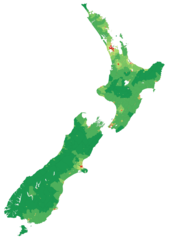
Newzealandpopulationdensity
1500 x 2124 - 141,832k -
png
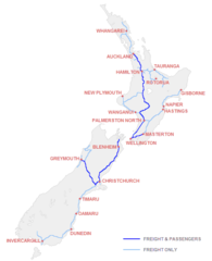
Newzealandrailnetwork
376 x 462 - 9,686k -
png
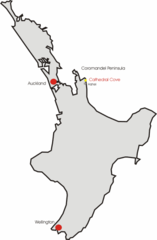
Northisland Nz Cathedral Cove
328 x 500 - 8,316k -
png
Northisland Nz East Coast Main Trunk Detail
1350 x 675 - 38,276k -
png
Northisland Nz East Coast Main Trunk
328 x 500 - 10,118k -
png
Northisland Nz Hwy43 Detail
800 x 400 - 19,408k -
png
Northisland Nz Hwy43
328 x 500 - 9,493k -
png
Northisland Nz Hwy45
328 x 500 - 9,378k -
png
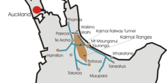
Northisland Nz Kaimai Ranges
328 x 500 - 9,836k -
png
Northisland Nz Kaipara Harbour Detail
800 x 400 - 21,153k -
png
Northisland Nz Kaipara Harbour
327 x 500 - 9,809k -
png
Northisland Nz Nimt
600 x 915 - 24,290k -
png
Northisland Nz Rangitikei River
328 x 500 - 10,899k -
png
Northisland Nz Rimutaka Range
328 x 500 - 8,906k -
png
Northisland Nz Springvale Suspension Bridge
900 x 1373 - 44,495k -
jpg
Northisland Nz Springvale Suspension Bridge 1
328 x 500 - 9,374k -
png
Northisland Nz Tararua Range
328 x 500 - 9,084k -
png
Northlandregionpopulationdensity
1208 x 1380 - 48,409k -
png
Novy Zeland
323 x 590 - 11,773k -
png
Nueva Zelanda4
330 x 707 - 9,819k -
png
Orthographic Projection Centred Over the Bounty Islands
488 x 487 - 20,597k -
png
Otagoregionpopulationdensity
1467 x 1811 - 46,377k -
png
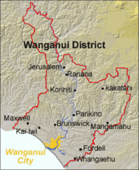
Position of Wanganui District
230 x 282 - 29,426k -
png
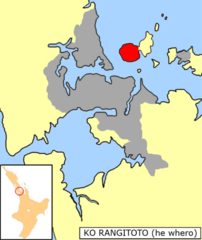
Rangitotolocnzmaori
901 x 1072 - 138,676k -
png
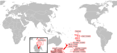
Realm of New Zealand Exclusive Economic Zones
2410 x 1178 - 78,786k -
png
Realm of New Zealand
740 x 272 - 5,737k -
png
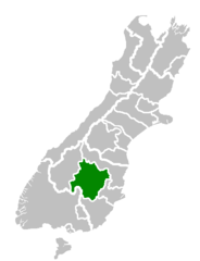
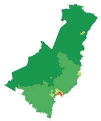
Central Otago Territorial Authority
520 x 677 - 6,374k -
png
Nz Masterton Kakapo He
633 x 922 - 15,924k -
png
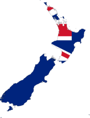
New Zealand Flag Map
2048 x 2684 - 82,722k -
png
New Zealand Regions Map
1349 x 1752 - 139,249k -
png
New Zealand New Lakes
1000 x 1182 - 169,320k -
png
New Zealand Road Map
950 x 1124 - 208,861k -
png

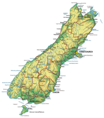
New Zealand South Island Physical
900 x 1018 - 119,247k -
jpg
New Zealand South Island Physical 1
900 x 1018 - 249,678k -
png
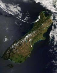
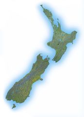
New Zealand South Island Satellite Image
2200 x 2787 - 478,874k -
jpg
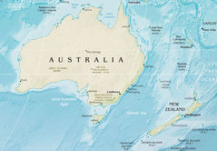
Australia And New Zealand
1435 x 997 - 319,209k -
jpg
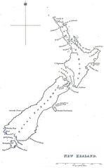
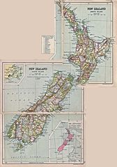
Historical Map New Zealand (1832)
1296 x 2094 - 122,557k -
jpg
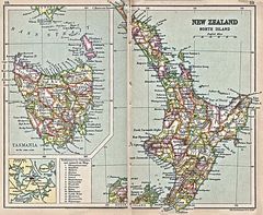
Historical Map New Zealand North Island (1913)
1400 x 1151 - 415,425k -
jpg
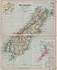
Historical Map New Zealand South Island (1913)
1143 x 1400 - 383,096k -
jpg
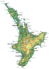
North Island Physical New Zealand
900 x 1276 - 260,890k -
jpg