Mexico, Missouri
Mexico: city in and county seat of Audrain County, Missouri
About
Mexico is a city located in the county of Audrain in the U.S. state of Missouri. Its population at the 2010 census was 11,543 and a population density of 357 people per km². After 10 years in 2020 city had an estimated population of 11,530 inhabitants.
The city was created 190 years ago in 1835.

Quick Facts about Mexico
| Population | 11,530 (2020) |
| Country | United States of America |
| State | Missouri (United States) |
| County | Audrain County |
| Postal code | 65265 |
| Phone Area Codes | 573 |
| Area | 32.33 km2 |
| Latitude & Longitude | 39.1698,-91.8830 |
| Altitude | 801 feet / 244 meters |
| Capital city | Mexico is capital of Audrain County |
| Establishment | January 01, 1836 (190 years ago) |
| Time Zone | America/Chicago |
| Local time | 03:58:43 (15th July 2026) |
| Density | 357 Pop. per km² as of 2020 |
| Population growth | -0.11% (2010-2020) |
| Weather | 90℉ Sunny 7-days weather |
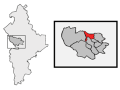
Geography
Mexico is located at 39°10'11"N 91°52'59"W (39.1697600, -91.8829500).
Mexico map
Weather
Sunny, with a high near 90. Northeast wind 0 to 6 mph.
7-Day ForecastOfficial website of Mexico
Official WebsiteDemographics
According to census records, the population of Mexico decreased by 0.11% in 10 years.
| Year | Population | % Change | Method |
|---|---|---|---|
| 2010 | 11,543 | - | census |
| 2011 | 11,539 | -0.03% | estimation process |
| 2012 | 11,493 | -0.4% | estimation process |
| 2013 | 11,443 | -0.44% | estimation process |
| 2014 | 11,601 | 1.36% | estimation process |
| 2015 | 11,560 | -0.35% | estimation process |
| 2016 | 11,580 | 0.17% | estimation process |
| 2017 | 11,503 | -0.67% | estimation process |
| 2018 | 11,523 | 0.17% | estimation process |
| 2019 | 11,517 | -0.05% | estimation process |
| 2020 | 11,530 | 0.11% | estimation process |
Services and Civic Places in Mexico
1USDA Rural Development
4617 S Clark St, Mexico, MO 65265, United States View details
Phone: +15735814177 | Website available
People born in Mexico (19)
People born in Mexico, including Mexican bicycle racer César Vaquera, basketball coach and former player Tyronn Lue, politician Xenophon Pierce Wilfley, .
More notable people
- Cookie Belcher (American professional basketball player) he was born in 25/06/1978
- Dedrick Harrington (American football player) he was born in 25/09/1983
- Dick Thoenen (American baseball player) he was born in 09/01/1944
- Howard Kindig (American football player) he was born in 22/06/1941
- Howard L. Bickley (American politician) he was born in 03/05/1871
- Jason Brookins (American football player) he was born in 05/01/1976
- Lebbeus R. Wilfley (American judge) he was born in 30/03/1866
- Martha Mears (American actress and singer (1910-1986)) she was born in 18/07/1910
- Pat Fleming (American congresswoman in Arizona) she was born in 10/03/1949
- Click Bishop (American politician) he was born in 25/07/1957
- Prim Siripipat she was born in 15/01/1981
- América Sierra she was born in 17/03/1979
- Jack Claybourne (American professional wrestler) he was born in 08/03/1910
- Clovis Swinney he was born in 17/08/1945
- Adrian Guerra (artist) he was born in 01/01/1977
- Uriel Reymund (Mexican Actor and singer) he was born in 23/09/2006
Nearby Schools and Colleges
Schools and campuses linked to Mexico, MO. Select a name to open its map and contact details.
| Code | Name | City | ZIP |
|---|---|---|---|
| 179964 | William Woods University | Fulton (MO) | 65251-2388 |
| 179946 | Westminster College | Fulton (MO) | 65251-1299 |
| 177685 | Paul Mitchell the School-Missouri Columbia | Columbia (MO) | 65202 |
| 177065 | Columbia College | Columbia (MO) | 65216 |
| 179548 | Stephens College | Columbia (MO) | 65215 |
Nearby Transit Stations (5)
Rail and bus stations connected to Mexico, MO. Select a station to open its map and address details.
| Code | Name | Address | Type |
|---|---|---|---|
| HEM | Hermann | Wharf & Gutenberg Sts. | RAIL |
| JEF | Jefferson City | 101 Jefferson Street | RAIL |
| QCY | Quincy | North 30th St. and Wisman Lane | RAIL |
| WAH | Washington | 301 West Front St. | RAIL |
| LAP | La Plata | 535 N. Owensby St. | RAIL |
Closest post offices linked to Mexico.
| Post Office Name | City | ZIP |
|---|---|---|
| Mex Post Office | Mexico (MO) | 65265 |
Other cities in Audrain County
Cities, towns, neighborhoods & other populated places in Audrain County , MO.
| City Name | Population | Title |
|---|---|---|
| Vandalia | 3,496 | City in Audrain and Ralls Counties, Missouri, USA |
| Laddonia | 498 | City in Audrain County, Missouri, United States |
| Farber | 310 | City in Audrain County, Missouri, United States |
| Martinsburg | 299 | Town in Audrain County, Missouri, United States |
| Rush Hill | 143 | Human settlement in Audrain County, Missouri, United States of America |
| Benton City | 103 | Human settlement in Audrain County, Missouri, United States of America |
| Vandiver | 69 | Human settlement in Audrain County, Missouri, United States of America |
| Champ | 13 | Unincorporated community in Missouri |
Distance to Other Cities
Mexico distances to largest Missouri cities
- Kansas City
- St. Louis
- Columbia
- Independence
- East Independence
- Lee's Summit
- Castle Point
- O'Fallon
- Saint Joseph
- Saint Charles
- Saint Peters
- Blue Springs
- Joplin
- Florissant
- Chesterfield
- Wentzville
- Jefferson City
- Cape Girardeau
Map & Images (more maps)
2006 Mexican Election Per State
2007 04l 5 Day Track
Abortionlawsmexicomap
Acatlan De Perez Figueroa Map
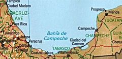
Bay of Campeche
Blank Mexico Map, No States
Caminorealadentro
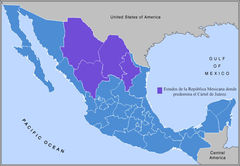
Cartel De Juarez (mapa)
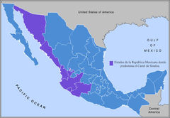
Cartel De Sinaloa (mapa)
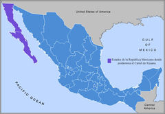
Cartel De Tijuana (mapa)
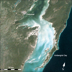
Chetumal Bay
Chihuahua Desert
Circunscripciones 2006
Circunscripciones 2006 7
Comision Map
Df Elecciones 2000
Df Elecciones 2006
Division Politica Mexico
Escobedo
Garcia