Rostock, Mecklenburg-Vorpommern
Rostock: city in Mecklenburg-Vorpommern, Germany
About
Quick Facts about Rostock
| Population | 208,886 |
| Country | Weimar Republic, German Democratic Republic, Germany, Germany, Duchy of Mecklenburg-Schwerin, German Empire, German Confederation, Soviet occupation zone (Germany) |
| State | Mecklenburg-Vorpommern (Germany) |
| County | Bous |
| Different from | Rostock District |
| Postal code | 18181, 18059, 18001 |
| Plate code | A, HRO |
| Phone Area Codes | 0381 |
| Official name | Rostock |
| Has part | Brinckmansdorf, Evershagen, Toitenwinkel, Q1486513, Kröpeliner-Tor-Vorstadt, Hinrichshagen, Warnemünde, Q977623, Dierkow, Rostock-Lichtenhagen, Südstadt, Gehlsdorf, Hansaviertel, Peez, Biestow, Hohe Düne, Torfbrücke, Q14906558, Markgrafenheide, Jürgeshof, Wiethagen, Lütten Klein, Stadtmitte, Q1333329, Schmarl |
| Latitude & Longitude | 54.0887,12.1405 |
| Male population | 102911 |
| Altitude | 46 feet / 14, 8 meters |
| Capital city | Rostock is capital of Rostock District, Rostock (district), Rostock-Land |
| Establishment | January 01, 1201 (825 years ago) |
| Time Zone | UTC+02:00, UTC+01:00 |
| Local time | 03:27:29 (26th July 2026) |
Geography
Rostock is located at 54°5'19"N 12°8'26"E (54.0887000, 12.1404900). It has 11 neighbors: Rovershagen, Roggentin, Papendorf, Monchhagen, Lambrechtshagen, Kritzmow, Gelbensande, Dummerstorf, Broderstorf, Bentwisch and Admannshagen Bargeshagen.
Rostock map
Click "full screen"  icon to open full mode. View satellite images
Official website of Rostock
Official Website- Aarhus (1964 )
- Antwerp (1963 )
- Bergen (1965 )
- Bremen (1987 )
- Dalian (1988 )
- Dunkirk (1960 )
- Gothenburg Municipality (1965 )
- Guldborgsund Municipality (2014 )
- Raleigh (2001 )
- Riga (1961 )
- Rijeka (1966 )
- Szczecin (1957 )
- Turku (1959 )
- Varna (1966 )
Demographics
| Year | Population | % Change | Method |
|---|---|---|---|
| 1950 | 133,109 | - | census |
| 1960 | 158,630 | 16.09% | t2113780388 |
| 1970 | 198,636 | 20.14% | census |
| 1980 | 232,506 | 14.57% | t2113780389 |
| 1981 | 236,011 | 1.49% | census |
| 1990 | 248,088 | 4.87% | t2113780394 |
| 2000 | 200,506 | -23.73% | t2113780392 |
| 2010 | 208,886 | 4.01% | 105975 |
| 2011 | 204,260 | -2.26% | t2113780396 |
| 2012 | 202,887 | -0.68% | t2113780390 |
| 2013 | 203,431 | 0.27% | t2113780395 |
| 2015 | 206,011 | 1.25% | t2113780393 |
| 2016 | 207,513 | 0.72% | project management estimation |
| 2017 | 208,409 | 0.43% | census |
| 2019 | 208,886 | 0.23% | statistical updating |
RLG, Roshhok, Roshtok, Rostak, Rostochium, Rostok, Rostoka, Rostokas, Roztok, loseutokeu, luo si tuo ke, rosutokku, rwstwk, rwstwq, rxs thxkh, Ρόστοκ, Ростак, Росток, Рошток, Рощок, רוסטוק, روستوك, روستوک, روسٹاک, รอสทอค, როსტოკი, ロストック, 罗斯托克, 로스토크
Map & Images (more maps)
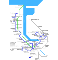
Rostock Metro Map
750 x 765
- 13,448k -
png