Rodrigues, Rodrigues
Rodrigues:
About
Quick Facts about Rodrigues
| State | Rodrigues (Mauritius) |
| Latitude & Longitude | -19.7010,63.4160 |
| Time Zone | Indian/Mauritius |
| Local time | 22:03:41 (10th June 2026) |
Geography
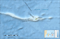
Rodrigues is located at 19°42'4"S 63°24'58"E (-19.7010000, 63.4160000).
Rodrigues map
Click "full screen"  icon to open full mode. View satellite images
Ile Rodrigues, Île Rodrigues
Map & Images (more maps)
Rodrigues Island Bathymetric Environment Map French
2000 x 1321
- 271,050k -
png
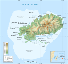
Rodrigues Island Topographic Map French
1700 x 1600
- 242,336k -
png