Regione Autonoma Valle d Aosta (Regione Autonoma Valle d'Aosta), Aosta Valley
Regione Autonoma Valle d Aosta:
About
State Snapshot
Regione Autonoma Valle d'Aosta at a glance
Regione Autonoma Valle d'Aosta currently has 24 quality-checked populated place pages and 1 county pages linked on MapSof.
Mapped cities & towns
24
These counts use a stricter populated-place filter so the main lists stay focused on real city and town pages.
County pages
1
Open related pagesLargest city
ChatillonPopulation 37,355
Top linked places
Quick Facts about Regione Autonoma Valle d'Aosta
| State | Aosta Valley (Italy) |
| Latitude & Longitude | 45.7500,7.2500 |
| Time Zone | Europe/Rome |
| Local time | 21:06:16 (10th June 2026) |
Geography
Regione Autonoma Valle d'Aosta is located at 45°45'0"N 7°15'0"E (45.7500000, 7.2500000).
Regione Autonoma Valle d Aosta map
Click "full screen"  icon to open full mode. View satellite images
Aosta Valley, Aostadalen, Aostatal, Region Autonome Vallee d'Aoste, Region del Valle de Aosta, Regione Autonoma Val d'Aosta, Región del Valle de Aosta, Région Autonome Vallée d'Aoste, Vall d'Aosta, Valle d'Aosta, Valle de Aosta, Valle di Aosta, Valle d’Aosta, Vallee d'Aoste, Vallée d'Aoste, balledaoseuta ju, 발레다오스타 주
Map & Images (more maps)
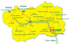
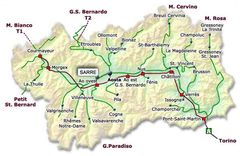
Aosta Valley Map
700 x 431
- 52,299k -
png
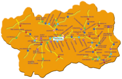
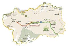
Aosta Valley Map 2
1141 x 735
- 179,364k -
png
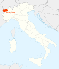
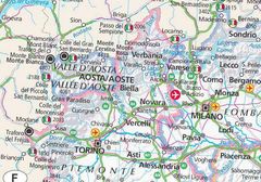
Location of Aosta Valley Map
1338 x 1548
- 99,179k -
png
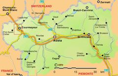
Map of Aosta Valley
600 x 390
- 49,387k -
jpg
Map of Aosta Valley 2
619 x 403
- 56,778k -
jpg
Map of Aosta Valley 3
690 x 473
- 50,851k -
jpg
Map of Aosta Valley 4
764 x 534
- 162,028k -
jpg
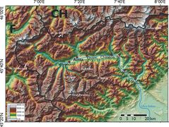
Physical Map Aosta Valley
2000 x 1505
- 629,343k -
jpg