Fort Salonga, New York
Fort Salonga: census-designated place in Suffolk County, New York
About
Fort Salonga is a CDP located in the county of Suffolk in the U.S. state of New York.

Quick Facts about Fort Salonga
| Population | 10,008 |
| Country | United States of America |
| State | New York (United States) |
| County | Suffolk County |
| Postal code | 11768 |
| Area | 25.69 km2 |
| Latitude & Longitude | 40.9126,-73.3010 |
| Altitude | 33 feet / 10 meters |
| Time Zone | America/New_York |
| Local time | 11:54:54 (24th July 2026) |
| Weather | 83℉ Sunny 7-days weather |

Geography
Fort Salonga is located at 40°54'45"N 73°18'3"W (40.9126000, -73.3009500).
Fort Salonga map
Weather
Sunny. High near 83, with temperatures falling to around 81 in the afternoon. East wind 2 to 9 mph.
7-Day ForecastBest Things to Do in Fort Salonga
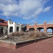
1Crab Meadow Beach
Waterview St W, Fort Salonga, NY 11768, United States View details
Phone: +16312617574 | Website available
2Meadowlark Park
Fort Salonga, NY 11768, United States View details
Website available
Nearby Schools and Colleges
Schools and campuses linked to Fort Salonga, NY. Select a name to open its map and contact details.
| Code | Name | City | ZIP |
|---|---|---|---|
| 420468 | Western Suffolk BOCES | Northport (NY) | 11768 |
Nearby Transit Stations (19)
Rail and bus stations connected to Fort Salonga, NY. Select a station to open its map and address details.
| Code | Name | Address | Type |
|---|---|---|---|
| STM | Stamford Transportation Center | Washington Blvd and South State St. | RAIL |
| BRP | Bridgeport | 525 Water St. | RAIL |
| NRO | New Rochelle station | 1 Railroad Plaza | RAIL |
| YNY | Yonkers station | 5 Buena Vista Ave. | RAIL |
| NHV | Union Station | 50 Union Avenue | RAIL |
Closest post offices linked to Fort Salonga.
| Post Office Name | City | ZIP |
|---|---|---|
| Northpor Post Office | Northport (NY) | 11768 |
Other cities in Suffolk County
Cities, towns, neighborhoods & other populated places in Suffolk County , NY. (more)
| City Name | Population | Title |
|---|---|---|
| Brookhaven | 479,883 | This town in Suffolk County, New York, is the most populous in the state. |
| Islip | 322,328 | This Long Island community is situated on the south shore of Suffolk County, New York, at an elevation of 13 feet. |
| Babylon | 218,223 | A town in Suffolk County, New York. |
| Huntington | 200,102 | Town in Suffolk County, New York, United States |
| Smithtown | 110,876 | Census-designated place in Suffolk County, New York |
| Brentwood | 60,664 | Census-designated place in Suffolk County, New York |
| Southampton | 58,549 | Town in Suffolk County, New York, partly on the South Fork of Long Island, USA |
| West Babylon | 43,213 | Census-designated place in Suffolk County, New York |
| Coram | 39,113 | Census-designated place in Suffolk County, New York |
| Commack | 36,124 | Census-designated place in Suffolk County, New York |
| Central Islip | 34,450 | Census-designated place in Suffolk County, New York |
| Riverhead | 33,434 | Town in New York |
| Huntington Station | 33,029 | Census-designated place in Suffolk County, New York |
| Centereach | 31,578 | Census-designated place in Suffolk County, New York |
| West Islip | 28,335 | Census-designated place in Suffolk County, New York |
| Shirley | 27,854 | Census-designated place in New York, USA |
Distance to Other Cities
Fort Salonga distances to largest New York cities