Colesville, Maryland
Colesville: unincorporated area in Montgomery County, Maryland, United States
About
Colesville is a city located in the county of Montgomery in the U.S. state of Maryland.

Quick Facts about Colesville
| Population | 14,647 |
| Country | United States of America |
| State | Maryland (United States) |
| County | Montgomery County |
| Phone Area Codes | 240, 301 |
| Area | 13.29 km2 |
| Latitude & Longitude | 39.0757,-77.0019 |
| Altitude | 436 feet / 133 meters |
| Time Zone | Eastern Time Zone |
| Local time | 12:33:32 (24th July 2026) |
| Weather | 61℉ Clear 7-days weather |

Geography
Colesville is located at 39°4'32"N 77°0'7"W (39.0756600, -77.0019200).
Colesville map
Weather
Clear, with a low around 61. East wind around 2 mph.
7-Day ForecastBest Things to Do in Colesville
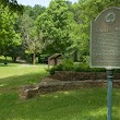
1Northwest Branch Recreational Park
16109 Llewellyn Manor Way, Colesville, MD 20905, United States View details
Website available

2Valley Mill Special Park
1620 E Randolph Rd, Colesville, MD 20904, United States View details
Phone: +13014952595 | Website available
3Maydale Nature Classroom
1638 Maydale Dr, Colesville, MD 20905, United States View details
Phone: +13019621496 | Website available

4Colesville Manor Neighborhood Park
13751 Notley Rd, Colesville, MD 20904, United States View details
Phone: +13014952595 | Website available

5Colesville Local Park
610 Hobbs Dr, Colesville, MD 20904, United States View details
Phone: +13014952595 | Website available

People born in Colesville (1)
Banker and railroad executive (1776-1861) Philip E. Thomas was born in Colesville
Nearby Schools and Colleges
Schools and campuses linked to Colesville, MD. Select a name to open its map and contact details.
| Code | Name | City | ZIP |
|---|---|---|---|
| 434937 | Yeshiva College of the Nations Capital | Silver Spring (MD) | 20902 |
Nearby Transit Stations (22)
Rail and bus stations connected to Colesville, MD. Select a station to open its map and address details.
| Code | Name | Address | Type |
|---|---|---|---|
| RKV | Rockville station | 251 Hungerford Drive at Park Rd. | RAIL |
| NCR | New Carrollton station | 4300 Garden City Drive | RAIL |
| WAS | Washington Union Station | 50 Massachusetts Ave NE | RAIL |
| BWI | BWI Rail Station | 7 Amtrak Way | RAIL |
| ALX | Union Station | 110 Callahan Drive | RAIL |
Closest post offices linked to Colesville.
| Post Office Name | City | ZIP |
|---|---|---|
| Colesvill Post Office | Silver Spring (MD) | 20904 |
Other cities in Montgomery County
Cities, towns, neighborhoods & other populated places in Montgomery County , MD. (more)
| City Name | Population | Title |
|---|---|---|
| Germantown | 86,395 | Census-designated place in Montgomery County, Maryland, United States |
| Silver Spring | 71,452 | A city in Montgomery County, Maryland. |
| Rockville | 69,512 | The most populous city in Montgomery County, Maryland. |
| Gaithersburg | 67,741 | The second most populous city in Montgomery County, Maryland. |
| Bethesda | 62,448 | A census-designated place (CDP) in Montgomery County, Maryland. |
| Aspen Hill | 48,759 | Census-designated place in Montgomery County, Maryland, United States |
| Potomac | 44,965 | Census-designated place in Montgomery County, Maryland, United States |
| North Bethesda | 43,828 | A census-designated place in Montgomery County, Maryland. |
| Olney | 33,844 | Unincorporated area of Montgomery County, Maryland, United States of America |
| Montgomery Village | 32,032 | Unincorporated community in Montgomery County, Maryland, United States |
| North Potomac | 24,410 | Census-designated place in Montgomery County, Maryland, United States |
| Fairland | 23,681 | Town in Oklahoma, United States |
| White Oak | 19,020 | Unincorporated area in Montgomery County, Maryland, United States |
| Takoma Park | 17,696 | City in Maryland, United States |
| Cloverly | 15,126 | Community in Montgomery County, Maryland, United States |
| Kemp Mill | 13,445 | Census-designated place in Montgomery County, Maryland, United States |
Distance to Other Cities
Colesville distances to largest Maryland cities